100 Victorian Waterfalls Accessible by a Track

We've put together a list of more than 100 waterfalls in Victoria which are accessible by a track. A summary of each waterfall includes a description of the type and size of the waterfall, distance from Melbourne, best time of the year to visit, vehicle access (gravel or sealed surface, 2WD or 4WD requirements), how to access the falls including walking distance from a carpark and facilities near the falls such as toilets, picnic tables, water taps and BBQs.
The most spectacular waterfalls have been marked with stars and there is a map at the end of the list showing the location of each waterfall. Click on the links for each waterfall to get more information including directions to the waterfall and photos.
Map of Waterfall Locations:
More than 100 accessible waterfalls are shown on the map below with links to detailed information about each waterfall.
Melbourne Waterfalls
Dights Falls (Abbotsford)
Description: These are the only falls in inner Melbourne and they are not exactly spectacular, only being about two metres high.
Distance from Melbourne: 6 km
Best time to Visit: Any time of the year
Vehicle Access: 2WD sealed
Access to Falls: There are a number of vantage points to view the falls on the northern side of the river including a viewing platform beside the falls and the walking trail on the southern side of the river. It is less than 200m from the carpark to the falls. There is a nice 4km return walk following the Yarra River from Kane's Bridge all the way to Dights Falls through Yarra Bend Park.
Facilities: Toilets, sheltered areas, seating, picnic tables, drinking fountains and carpark.
Kings Falls (Main Ridge)
Description: A creek runs down a steep granite face surrounded by a lot of vegetation.
Distance from Melbourne: 91 km
Best time to Visit: In dry weather the creek is just a trickle, and after a downpour its flow increases for a short time.
Vehicle Access: 2WD sealed
Access to Falls: A circuit walk taking in the falls is only about 1km long but you can easily extend the walk. There is a lookout which provides a view of the falls area which is heavily vegetated.
Facilities: None at the falls.
La La Falls (Warburton)
Description: Smallish waterfall where the water zig-zags down the rock face and then flows through arches in a stone wall which forms part of the viewing platform.
Distance from Melbourne: 80 km
Best time to Visit: There should be some water flow throughout the year.
Vehicle Access: 2WD sealed
Access to Falls: 1.6km well formed track to the falls which passes through areas of tree ferns and tall Mountain Ash trees.
Facilities: There is a picnic area at the start of the track.
Masons Falls (Kinglake West)
Description: The falls flow down a big hill in a series of cascades. The falls are viewed from a viewing platform and it is not possible to walk to the base or top of the falls.
Distance from Melbourne: 81 km
Best time to Visit: The falls generally flow throughout the year and are most spectacular after heavy rain.
Vehicle Access: 2WD sealed
Access to Falls: 700m track to a viewing platform.
Facilities: Masons Falls Picnic Area has gas barbecues, tables, shelter and toilets.
Wombelano Falls (Kinglake)
Description: Falls cascade down a rock face and disappear into the vegetation below.
Distance from Melbourne: 86 km
Best time to Visit: Best viewed after rain.
Vehicle Access: 2WD gravel
Access to Falls: A 1.5km circuit walking track winds through forest with big old growth trees and leads to the falls viewing platform in Kinglake National Park.
Facilities: Carpark
Olinda Falls (Olinda)
Description: Small series of falls along Olinda Creek.
Distance from Melbourne: 50 km
Best time to Visit: The falls are best seen after some rain.
Vehicle Access: 2WD sealed
Access to Falls: There are two viewing platforms. The upper platform is a 350m easy walk from the car park. The Lower Falls is a further 140m downstream with 52 steps. Swimming is not allowed although it is possible to sit in the water at the base of the Lower falls.
Facilities: At the picnic area there is a table and toilets.
Sherbrooke Falls (Sherbrooke)
Description: Fairly unspectacular falls where water flows down a gully which a wooden bridge crosses.
Distance from Melbourne: 44 km
Best time to Visit: The falls are most inspiring after rain when the swollen Sherbrooke Creek rushes over the rocks.
Vehicle Access: 2WD sealed
Access to Falls: Tracks leading from Sherbrooke and O'Donohue Picnic Grounds provide the easiest walk to the falls through the attractive landscape of tall Mountain Ash and tree ferns. The distance to the falls is about 1.2km.
Facilities: The picnic areas have tables, BBQ, water tap and toilets (O'Donohue Picnic Ground).
Tea Tree Falls / Quarry Falls/ Yallerong Falls (Flinders)
Description: The falls have an overall height of 10.7m with two main tiers.
Distance from Melbourne: 105 km
Best time to Visit: The falls are seasonal and only run after rain.
Vehicle Access: 2WD sealed
Access to Falls: The falls are located at Cairns Bay in the Mornington Peninsula National Park. The top tier of the falls was created due to a quarry that was on Tea Tree Creek but the bottom tier is a natural waterfall. Walk down the track from the car park for 400m and you will find the upper falls on the northern wall. Continue along the track for a further 400m to near the beach where the lower tier is located.
Facilities: None
Central Victoria Waterfalls
Buckley Falls (Geelong)
Description: A rock cascade in the Barwon River at Highton. The falls are only 2m high but they are the only falls in Geelong.
Distance from Melbourne: 84 km
Best time to Visit: Best after rain but can be visited at any time of the year.
Vehicle Access: 2WD sealed
Access to Falls: There are three cascades along this part of the river - one upstream at Baums Weir, one at the main Buckleys Falls and another opposite the former paper mill. Along Buckley Falls Road, high above the river, there is a lookout / viewing platform and another viewing platform at the falls reached by a set of stairs. Depending on the water level, there are often opportunities for some rock hopping.
Facilities: There are some car parks near the falls, one with a picnic area. There are no toilets. Dogs must be on-leash.
Currawong Falls (Aireys Inlet)
Description: Small falls on Distillery Creek which drop into a tree fern lined gully.
Distance from Melbourne: 131 km
Best time to Visit: ??
Vehicle Access: 2WD gravel
Access to Falls: The falls can be visited on a strenuous 10.2km loop walk (about 4 hour return) which also passes through Ferny Gully Cascades. The distance to reach Currawong Falls is 4.5km.
Facilities: The walk starts and ends at Distillery Creek picnic ground which has toilets, fireplace and a picnic table.
Lal Lal Falls (Lal Lal)
Description: 30m high falls into a big gully.
Distance from Melbourne: 115 km
Best time to Visit: Best after heavy rain. During prolonged dry periods the falls may not be flowing.
Vehicle Access: 2WD sealed
Access to Falls: 200m walk to a viewing platform which has a long distance view of the falls. The path which leads to the base of falls is closed.
Facilities: Large picnic area with rotunda, toilets, BBQs and a playground. Moorabool Falls are located in the same reserve.
Moorabool Falls (Lal Lal)
Description: A single 27m drop over a basalt wall.
Distance from Melbourne: 115 km
Best time to Visit: Best after heavy rain. During prolonged dry periods the falls may not be flowing.
Vehicle Access: 2WD sealed
Access to Falls: 5.6 km return walk to the falls from the road.
Facilities: Close by to the start of the walk is a large picnic area with rotunda, toilets, BBQs and a playground. Lal Lal Falls are located in the same reserve.
Loddon Falls (Glenlyon)
Description: The Loddon River drops dramatically over a wall of huge hexagonal basalt columns into a pool below before continuing on through the spectacular rocky gorge. There is a pool beneath the falls.
Distance from Melbourne: 101 km
Best time to Visit: After heavy rain. There is just a trickle or no flow during dry periods.
Vehicle Access: 2WD gravel
Access to Falls: The waterfall is only about a five minute walk from the car park at the end of Sewells Road. Either view the falls from the top of the cliff or scramble down to be level with the bottom of the falls.
Facilities: None
Sailors Falls (Sailors Falls)
Description: A number of streams plummet down the side of a cliff.
Distance from Melbourne: 112 km
Best time to Visit: Best after heavy rains since the falls are dry for a significant part of the year.
Vehicle Access: 2WD sealed
Access to Falls: The falls can be viewed from the road above or there is a 100m steep walk down to the falls viewpoint.
Facilities: Above the falls is an area with two shelters (one table in each shelter), unshaded table, toilets and water tap with mineral water.
Stanley Park Falls (Turitable Falls) (Mount Macedon)
Description: Waterfall, cascades down a rocky ledge into a dense bush gully.
Distance from Melbourne: 65 km
Best time to Visit: After periods of rain. May not flow during drier periods.
Vehicle Access: 2WD sealed
Access to Falls: Located in a park at Mount Macedon. A wooden viewing platform overlooks the top of the falls and there is a stone path that leads to some stairs down to the fern gully for those seeking a better view.
Facilities: The park has a playground, toilets, unshaded tables, water tap and shelter with BBQs and seats.
The Blowhole (Hepburn)
Description: An artificial diversion tunnel on Sailors Creek which was built by gold miners around the early 1870s. Water spurts out over a 5m high rock face to a pool below.
Distance from Melbourne: 118 km
Best time to Visit: During summer there is generally no flow, so the best time to visit in is winter / spring or after heavy rain.
Vehicle Access: 2WD gravel
Access to Falls: From the car park it is a 100 m walk to the viewing platform.
Facilities: None. It is possible to swim here in the pool below the tunnel when the conditions are suitable i.e. a gentle flow of water is running through the tunnel. Dogs are allowed but must be on a leash
Trentham Falls (Trentham)

Description: One of the longest single drop waterfalls in Victoria, plunging some 32 metres over basalt columns.
Distance from Melbourne: 94 km
Best time to Visit: Best viewed after rain. It can be dry during the drier months.
Vehicle Access: 2WD sealed
Access to Falls: It is only about 100m from the car park to the falls viewing area. Due to the danger of falling rocks from the unstable cliffs, you are not permitted to go down the path to the base of the falls.
Facilities: The parking area has a few unshaded picnic tables.
Wombat Falls (Daylesford)
Description: The falls on Wombat Creek are located just below the weir wall of Jubilee Lake. The falls have a height of 4m plus a 5m high weir.
Distance from Melbourne: 112 km
Best time to Visit: The falls are seasonal.
Vehicle Access: 2WD sealed
Access to Falls: Jubilee Lake is close to the town of Daylesford. There is a short, easy, 50m track to the top of the falls but to get to the base requires a 600m off-track with thick blackberries to negotiate.
Facilities: There is a picnic area, walking trails, nearby mineral spring, kiosk, toilets and BBQs.
Grampians Waterfalls
Beehive Falls (Roses Gap)
Description: Waterfall drops 25 metres into sheltered rock pools surrounded by ferns.
Distance from Melbourne: 267 km
Best time to Visit: Best after rain. Visit in spring when it is often surrounded by pink and white Grampians Thryptomene flowers.
Vehicle Access: 2WD gravel
Access to Falls: A gently undulating walking track follows Mud Hut Creek upstream, to a series of rock steps and on to Beehives Falls. The return walk takes about 1.5 hours.
Facilities: Carpark
Broken Falls (Zumsteins)
Description: The MacKenzie River cascades in a wide dissipated waterfall just upstream from MacKenzie Falls.
Distance from Melbourne: 270 km
Best time to Visit: There is a flow during the whole year.
Vehicle Access: 2WD sealed
Access to Falls: To reach the falls, follow the 500m track through open stringybark forest from the MacKenzie Falls car park. The cantilevered lookout on the edge of the gorge offers sweeping views. The falls are also named Scattered Falls. Broken Falls are located upstream from MacKenzie Falls and Broken Falls.
Facilities: There is a picnic area beside the car park with toilets. The closest campground is Smiths Mill compound, which is 1.1 km away.
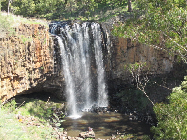
MacKenzie Falls (Zumsteins)
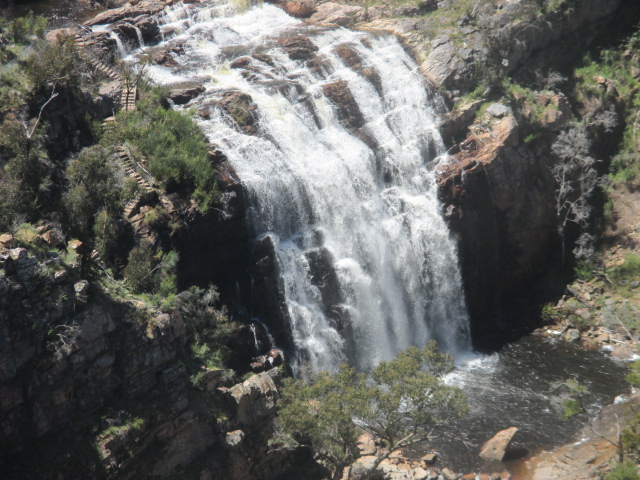
Description: An iconic impressive waterfall with water cascading over huge cliffs into a deep pool.
Distance from Melbourne: 270 km
Best time to Visit: The falls flow all year.
Vehicle Access: 2WD sealed
Access to Falls: There are two viewpoints, either walk to the base of the falls via a 750m steep trail or 1km to a viewing lookout at the Bluff which offers great views of the falls. Swimming is not permitted in the pool at the base of the falls due to the danger.
Facilities: There is a picnic area beside the car park with toilets. The closest campground is Smiths Mill compound, which is 1.1 km away.
Fish Falls (Zumsteins)
Description: Water cascades 60 metres over terraced rocks into a pool below.
Distance from Melbourne: 274 km
Best time to Visit: Water flows year-round, but the waterfall is best viewed after rains when there is a heavier flow and during spring for wildflowers.
Vehicle Access: 2WD sealed
Access to Falls: Fish Falls are located downstream from MacKenzie Falls and Broken Falls. The 4.6km return moderate-grade walk (water/rock crossings, slippery track surfaces) starts at Zumsteins Picnic Area. Alternatively, start at the MacKenzie Falls car park and follow the track downstream along the MacKenzie River until you reach Fish Falls. The difficulty level is moderate (section of very steep steps).
Facilities: None at the falls.
Burrong Falls (Zumsteins)
Description: The 13m high cascade falls are a series of ledges, varying in height from 1 to 5 metres.
Distance from Melbourne: 276 km
Best time to Visit: The best time to visit is winter or after decent rainfall because the falls may be dry during the warmest months.
Vehicle Access: 2WD gravel
Access to Falls: There is a 300m long walking track leading from the car park with the last section being a difficult scramble.
Facilities: Burrong Falls carpark has a picnic table.
Clematis Falls (Halls Gap)
Description: Water flows down sloping cliff walls.
Distance from Melbourne: 252 km
Best time to Visit: A seasonal waterfall and is best viewed after rain. The flow of water varies significantly and during the winter months between April and August are best period to observe higher flows. In spring there are many variety of wildflowers.
Vehicle Access: 2WD sealed
Access to Falls: An easy 1.2km stroll from Halls Gap's recreation oval.
Facilities: Halls Gap township.
Splitters Falls (Halls Gap)
Description: Series of cascades down a stepped gully.
Distance from Melbourne: 252 km
Best time to Visit: A seasonal waterfall and is best viewed in spring when wildflowers dot the landscape. Splitters Falls may be dry during the summer period.
Vehicle Access: 2WD sealed
Access to Falls: 2.3km route from Halls Gap which passes the delightful rock pools of Venus Baths. Alternatively, the easiest and shortest walk is from Wonderland carpark. This is a 700m one way easy/moderate walk.
Facilities: Halls Gap township.
Bridal Veil Falls (Halls Gap)
Description: The falls cascade down a rock wall into a shallow pond below.
Distance from Melbourne: 256 km
Best time to Visit: A seasonal waterfall which can be viewed after heavy rainfall.
Vehicle Access: 2WD sealed
Access to Falls: It is located on the track to the Pinnacle which starts at the Wonderland carpark. It is a 2.8km return moderate/hard walk to the falls which passes through the Grand Canyon and goes past the Cool Chamber. The track passes beneath the waterfall where there is a shallow pond. It is possible to get behind the waterfall as it runs down the rocks.
Facilities: None
Turret Falls (Halls Gap)
Description: Creek passes through a series of rockpools before dropping into the gorge below.
Distance from Melbourne: 256 km
Best time to Visit: The falls are best viewed in winter when the flow is more reliable and during late winter and spring there are wonderful wildflower displays.
Vehicle Access: 2WD sealed
Access to Falls: 1.2km walk which starts from the Wonderland car park. Some sections run beside steep cliffs and care needs to be taken with children. The path reaches the top of the falls. There is a track down to the bottom side of the gorge with good views of the falls and the opportunity with some scrambling to reach the bottom of the falls.
Facilities: None
Silverband Falls (Bellfield)
Description: A narrow band of water that tumbles down the rock face. Watch the water 'disappear' into the rocks at the base, re-emerging some 50 metres further downstream.
Distance from Melbourne: 261 km
Best time to Visit: A seasonal waterfall and is best viewed during the winter months and after rain.
Vehicle Access: 2WD gravel
Access to Falls: From the Silverband Falls carpark, walk 700m through shady, ferny forest to the falls.
Facilities: None
North Central Victoria Waterfalls
Coliban Cascades (Metcalfe)
Description: A series of rock pools where the Coliban River flows and cascades through large granite boulders, outcrops, crevices and caverns. You can walk around the area and explore the pools and flowing water.
Distance from Melbourne: 108 km
Best time to Visit: The area is a popular spot for splashing in the pools, swimming and picnics, especially during the warmer months.
Vehicle Access: 2WD gravel
Access to Falls: Only 100m from the road.
Facilities: There are some picnic tables and a parking area.
Cora Lynn Falls (Marysville)
Description: A cascading style waterfall that can be viewed from stairs running beside the falls or from the bottom of the falls.
Distance from Melbourne: 114 km
Best time to Visit: Any time of the year.
Vehicle Access: 2WD sealed
Access to Falls: 500m casual walk along the Cumberland walking track where you can also see Cumberland Falls.
Facilities: None
Cumberland Falls (Marysville)
Description: At Cumberland Falls there is a seat and panoramic views of the falls from a viewing platform. It is not possible to get close to the falls.
Distance from Melbourne: 114 km
Best time to Visit: Any time of the year.
Vehicle Access: 2WD sealed
Access to Falls: 650m walk along the Cumberland walking track where you can also see Cora Lynn Falls.
Facilities: None
Phantom Falls (Marysville)
Description: A smaller cascade style waterfall. Only a small section of the larger 35m drop is visible due to the profusion of tree ferns and vegetation in the gully where the creek flows.
Distance from Melbourne: 109 km
Best time to Visit: The falls have water throughout the year.
Vehicle Access: 2WD gravel
Access to Falls: The 400m uphill path to the falls meanders through lush bush with plenty of tree ferns and passes over two lovely bridges. There are about 115 steps on the path and the waterfall has a viewing platform and seat. Lady Talbot Drive continues onto Keppel Falls (2WD road) and then Taggerty Cascades and The Beeches but this is a rough road with 4WD access only.
Facilities: None
Keppel Falls (Marysville)
Description: One of the larger and more spectacular cascading waterfalls in the district.
Distance from Melbourne: 109 km
Best time to Visit: The falls are particularly impressive in spring, following snow melt and rain but do have water throughout the year.
Vehicle Access: 2WD gravel
Access to Falls: 1km walk to the falls. Lady Talbot Drive continues onto Taggerty Cascades and The Beeches but this is a rough road with 4WD access only.
Facilities: None
Taggerty Cascades (Marysville)
Description: The water cascades over boulders. There is an upper and lower part of the cascades.
Distance from Melbourne: 109 km
Best time to Visit: ??
Vehicle Access: 4WD gravel
Access to Falls: Lady Talbot Drive passes Phantom Falls and Keppel Falls (2WD access) and continues onto Taggerty Cascades and The Beeches but this section is a rough road with 4WD access only. The walk to the falls from the carpark is only about 150m.
Facilities: There is a carpark, picnic tables and seats.
Murrindindi Cascades (Murrindindi)
Description: Series of spectacular cascades where the Murrindindi River drops steeply over granite boulders.
Distance from Melbourne: 108 km
Best time to Visit: Any time of the year
Vehicle Access: 2WD gravel
Access to Falls: 300m walk from the carpark.
Facilities: The cascades are located at the Murrindindi Cascades Visitor Area.
Rubicon Falls (Rubicon)
Description: 40m high waterfall
Distance from Melbourne: 135 km
Best time to Visit: The Falls are best after heavy rain, as a portion of water is constantly diverted from the Falls Dam located above the Falls to the Power Station below the Falls.
Vehicle Access: 4WD gravel track. There are seasonal road closures (track is closed between June and November) but you can access the Falls in winter by parking at the Rubicon Power Station and walking the track to the falls (60 minutes each way).
Access to Falls: Viewing is restricted to the elevated roadside due to the harsh inaccessible terrain.
Facilities: None
Snobs Creek Falls (Eildon)
Description: The impressive falls drop more than 100 metres over a series of rocky outcrops.
Distance from Melbourne: 141 km
Best time to Visit: Any time of the year.
Vehicle Access: 2WD gravel
Access to Falls: From the car park there is a 25m walk with concrete steps down to a viewing platform overlooking the falls. A 100m path with steps leads down to a another lookout platform perched out into space with great views of the water cascading down the rock face.
Facilities: None
Steavenson Falls (Marysville)
Description: One of the tallest waterfalls in Victoria, with 5 cascades, a total descent of 122 metres, the last having a clear drop of more than 21 metres.
Distance from Melbourne: 102 km
Best time to Visit: Any time of the year.
Vehicle Access: 2WD sealed
Access to Falls: The falls can be viewed from two lower viewing platforms, one on each side of the Steavenson River. A further viewing platform is found at the top of the falls, which requires a 200m minute walk up a medium grade walking track.
Facilities: The falls are illuminated by floodlights at night. There are toilets at the carpark.
Strath Creek Falls (Strath Creek )
Description: The falls cascade over 50 metres over a rock face and into the gully below.
Distance from Melbourne: 96 km
Best time to Visit: The falls are best viewed after heavy rain.
Vehicle Access: 2WD gravel
Access to Falls: 500 walk to the falls from the carpark.
Facilities: Picnic tables near the carpark.
Turpin Falls (Langley)
Description: Water flows over a 25m tall rock wall into a large, deep pool.
Distance from Melbourne: 103 km
Best time to Visit: Best after heavy rain. During drier periods there won't be any flow over the rock wall. Swimming in the waterhole is available year round.
Vehicle Access: 2WD gravel
Access to Falls: There is a lookout near the carpark with scenic views of the falls. There is a 50m steep track down to the pool which provides a cold and deep waterhole for swimming.
Facilities: None
Wilhelmina Falls (Murrindindi)
Description: Falls drop 75 metres down a steep granite rock face.
Distance from Melbourne: 100 km
Best time to Visit: The falls flow all year round.
Vehicle Access: 2WD gravel
Access to Falls: 1600m medium grade walk to the falls from Water Gauge Day Visitor Area. There are a number of viewing platforms. There is alternative access to the top of the falls from Jackson's Road / SEC carpark via a 300m walk.
Facilities: There are drop toilets, fire pits and covered picnic area at the Visitor Area.
North East Victoria Waterfalls
Back Creek Falls (Bridge Creek)
Description: A gently cascading waterfall.
Distance from Melbourne: 212 km
Best time to Visit: ??
Vehicle Access: 2WD gravel
Access to Falls: 1.5km walk to the top of the falls.
Facilities: None
Barrys Falls (Eldorado)
Description: Lovely waterfall down the side of a wall hidden in the forest near the Historic Gold mining town of Eldorado.
Distance from Melbourne: 283 km
Best time to Visit: The falls are most spectacular during late winter and early spring when there is still plenty of water runoff from the hills.
Vehicle Access: 2WD gravel. The last 400m of track to drive in could be difficult in a standard 2WD so it may be best to walk this section if you don't have AWL/4WD.
Access to Falls: 300m walk to the falls from a carpark.
Facilities: None
Beechworth Cascades (Beechworth)
Description: A series of small waterfalls where Spring Creek drops down into the valley.
Distance from Melbourne: 287 km
Best time to Visit: Especially spectacular after rain.
Vehicle Access: 2WD gravel
Access to Falls: 2km direct walk or viewed as part of the Beechworth Gorge Walk which is a 7.2km circuit walk.
Facilities: None
Bindaree Falls (Mount Buller)
Description: A spectacular 20m column of water plummets down a rocky cliff.
Distance from Melbourne: 255 km
Best time to Visit: Year round flow, even in drought conditions.
Vehicle Access: 4WD gravel. Access by vehicle is not possible from June to November due to seasonal track closures in the High Country.
Access to Falls: 400m track to falls. A wooden viewing platform passes behind the falls allowing you to enjoy the curtain of water cascading from the rocks above.
Facilities: None
Cudgewa Bluff Falls (Lower) (Cudgewa)
Description: Water cascades off the park plateau, over the Cudgewa Bluff and into a tranquil grotto below.
Distance from Melbourne: 456 km
Best time to Visit: Best during wetter periods. Contact the Corryong Visitor Information Centre to check if the falls are flowing.
Vehicle Access: 2WD gravel
Access to Falls: 250m walk from the car park to the falls. The falls can be viewed from various vantage points - from the top, at car park level or from its base.
Facilities: None near the falls.
Carmichael Falls (Dinner Plain)
Description: The falls drop 25 metres over basalt cliffs.
Distance from Melbourne: 388 km
Best time to Visit: ??
Vehicle Access: 4WD gravel
Access to Falls: A 1km hike down to a viewing platform. There is a difficult scramble down to the base of the waterfall along an unmarked route.
Facilities: None
Eurobin Falls (Lower) (Mount Buffalo)
Description: Water flows down a big sloping wall.
Distance from Melbourne: 325 km
Best time to Visit: Outside the winter period.
Vehicle Access: 2WD sealed
Access to Falls: 500m track to Lower Eurobin Falls which passes Ladies Bath Falls. The track continues for another 250m to Upper Eurobin Falls.
Facilities: There is a picnic ground close to the park entrance with tables but no toilets.
Eurobin Falls (Upper) (Mount Buffalo)
Description: Water flows down a big vertical wall.
Distance from Melbourne: 325 km
Best time to Visit: Outside the winter period.
Vehicle Access: 2WD sealed
Access to Falls: 750m track to Upper Eurobin Falls which passes Ladies Bath Falls and Lower Eurobin Falls.
Facilities: There is a picnic ground close to the park entrance with tables but no toilets.
Fainter Falls (Bogong Village)
Description: Series of cascades.
Distance from Melbourne: 372 km
Best time to Visit: The falls flow for the whole year.
Vehicle Access: 2WD gravel
Access to Falls: A 1.5km walk on a well formed track to a lookout. For the more adventurous, a short (200m) but steep section of track takes you to a lookout below the falls.
Facilities: None near the falls.
Gooram Falls (Gooram)
Description: Water cascades over a series of rocks.
Distance from Melbourne: 173 km
Best time to Visit: A beautiful place to visit for a swim and picnic during summer.
Vehicle Access: 2WD gravel
Access to Falls: Easy access from the picnic areas.
Facilities: There are two picnic areas, one at the top and one approximately 200m downstream. Picnic tables, fireplaces and toilets are available at the Gooram Falls Day Visitor Area.
Granya Falls (Granya)
Description: Water spills into a rocky gully at the bottom of the mountain.
Distance from Melbourne: 375 km
Best time to Visit: The falls are best visited in winter and spring to guarantee a water flow. Spring also sees diverse wildflower displays.
Vehicle Access: 2WD gravel
Access to Falls: 1.4km return walk from the visitor area.
Facilities: Cotton Tree campground has information signage, free camping, picnic table, fire pit and long drop toilet.
Indigo Falls (Yackandandah)
Description: Multi-tiered waterfall in lush bush.
Distance from Melbourne: 305 km
Best time to Visit: The falls are best visited in winter and spring to guarantee a water flow.
Vehicle Access: 2WD bumpy gravel road
Access to Falls: 100m walk from the visitor area.
Facilities: None
Ladies Bath Falls (Mount Buffalo)
Description: A 5m cascade down a wall into a pool below.
Distance from Melbourne: 325 km
Best time to Visit: Any time of the year. There is a perfectly clear pool of water formed at the bottom where it is safe to paddle / have a dip during hot weather.
Vehicle Access: 2WD sealed
Access to Falls: 400m track to Ladies Bath Falls. The track continues for another 350m to Lower and Upper Eurobin Falls.
Facilities: There is a picnic ground close to the park entrance with tables but no toilets.
Paradise Falls and Little Paradise Falls (Cheshunt)
Description: The falls cascade an uninterrupted 31 metres over a cliff edge.
Distance from Melbourne: 287 km
Best time to Visit: Best viewed in spring, early summer or after rain.
Vehicle Access: 2WD gravel
Access to Falls: 500m walk on a well made stepped track to the viewing platform. The track then leads down further to underneath the falls. You can walk under the cliff face behind these falls.
Facilities: Toilet and picnic facilities are available.
Pine Gully Falls (Mount Bruno)
Description: Water flows down a rocky gully.
Distance from Melbourne: 255 km
Best time to Visit: Seasonal falls which flow after rain.
Vehicle Access: 2WD gravel
Access to Falls: The falls are accessed by a 2km loop walk which is steep and rocky in places and brings you to the viewing platform at the top of the falls.
Facilities: At Pine Gully Picnic Area there are picnic tables, barbecue facilities and pit toilets.
Salisbury Falls (Wangaratta South)
Description: Cascades spill down the escarpment in a series of drops.
Distance from Melbourne: 255 km
Best time to Visit: Only flows after heavy rain
Vehicle Access: 2WD gravel
Access to Falls: 800m easy walk
Facilities: None
Jubilee Falls / Briens Gorge Falls (Wangandary)
Description: Water flows over rocks for approximately 25-30 metres. The water disappears at the base of the falls seemingly into the ground, resurfacing in nearby springs.
Distance from Melbourne: 260 km
Best time to Visit: Only flows after heavy rain
Vehicle Access: 2WD gravel
Access to Falls: 500m walk from the Briens Gorge Reserve carpark.
Facilities: Picnic tables and open fire barbeques at the Briens Gorge Reserve.
Lower Rollasons Falls (Mount Buffalo)
Description: Buffalo Creek flows down a steep corner and then cascades into a lovely pool.
Distance from Melbourne: 330 km
Best time to Visit: The creek flows all year round.
Vehicle Access: 2WD sealed
Access to Falls: 1.9km walk to the Lower Falls from the Rollasons Falls Picnic Area. It is a short walk to the Upper Falls.
Facilities: There are tables, toilets and fireplaces at the Rollasons Falls Picnic Area.
Upper Rollasons Falls (Mount Buffalo)
Description: The creek flows down a gully.
Distance from Melbourne: 330 km
Best time to Visit: The creek flows all year round.
Vehicle Access: 2WD sealed
Access to Falls: 2.0km walk to the Upper Falls from the Rollasons Falls Picnic Area. There are obstructed views of the falls from side-on and below. It is a short walk to the Lower Falls which has a rock pool.
Facilities: There are tables, toilets and fireplaces at the Rollasons Falls Picnic Area.
Wild Dog Creek Falls (Bridge Creek)
Description: Wild Dog Creek cascades down a big gully.
Distance from Melbourne: 243 km
Best time to Visit: ??
Vehicle Access: 2WD gravel
Access to Falls: The walk from the car park to the falls passes the Wild Dog Falls campground after 800m and then becomes much steeper with lots of steps until it reaches a lookout at the top of the falls after 1.5km.
Facilities: There are picnic tables, fireplaces and toilets at the Wild Dog Falls campground.
Woolshed Falls (Beechworth)
Description: The water flows through a series of cascades and rock pools before a sharp fall into the valley below.
Distance from Melbourne: 292 km
Best time to Visit: ??
Vehicle Access: 2WD gravel
Access to Falls: As you enter the Woolshed Falls carpark there is a observation deck on the top left side offering great views of the falls and the valley below. You can also walk down to the top of the waterfall area where it is great fun scrambling over the rocks and small ledges and sitting in the rock pools (in summer) but you have to be very careful not to slip and be swept down to the top of the waterfall, especially when it is wet and the rocks are slippery. More than 8000 miners and diggers once worked the banks of the river here being one of the richest goldfields in Victoria.
Facilities: The car park area has a BBQ, tables and toilets.
Otways Waterfalls
Annes Cascade (Lavers Hill)
Description: A 3m high, single tier waterfall on the Johanna River set in a cool temperate rainforest.
Distance from Melbourne: 212 km
Best time to Visit: This is one of the wettest places in the state with an annual rainfall of over 2000mm and there should be a flow anytime during the year. The most unusual inhabitants of the area are the glow worms, which can be seen at night along the walking tracks.
Vehicle Access: 2WD gravel
Access to Falls: A 1.5km loop walk passes Anne's Cascade and the Big Tree, a huge old Otway Messmate.
Facilities: The area has picnic tables, a gas barbecue and toilets.
Carisbrook Falls (Wongarra)
Description: This is one of the highest falls in the Otway Ranges, but rather than a vertical drop, the water rushes down a diagonal rock face.
Distance from Melbourne: 170 km
Best time to Visit: The falls are best seen after heavy rain since they aren't as impressive in the drier months of the year.
Vehicle Access: 2WD gravel
Access to Falls: 300m uphill walking track from the carpark with a viewing area which provides views of the falls. The viewing platform is a fair way back and there is a distant and slightly obscured views of the falls. The base of the falls are not able to be safely accessed.
Facilities: None
Cora Lynn Cascades (Lorne)
Description: A succession of cascades rather than a waterfall on the creek. There are 6 tiers with a total height of 27m but it is only the 5th tier which is easily accessible.
Distance from Melbourne: 147 km
Best time to Visit: ??
Vehicle Access: 2WD gravel
Access to Falls: There are a number of routes to the falls. From Blanket Leaf Picnic Area there is a 2.1km walk to the cascades. From the Cora Lynn carpark it is a 3.5km walk to the cascades. Alternatively, from Erskine Falls follow the Lemonade Creek Track to the cascades.
Facilities: None
Cumberland Falls (Lorne)
Description: The falls are quite small (about 7m tall) but it is a pretty area and you can swim here.
Distance from Melbourne: 147 km
Best time to Visit: The river crossings mean that the falls are only accessible during dry weather. In summer, Jebb's Pool (along the route to the falls) is a really nice place to swim and the cascades above the pool can be used as a natural waterslide.
Vehicle Access: 2WD gravel
Access to Falls: The walk to the falls is 3km. It is an easy walk to Jebb's Pool but beyond that to Cumberland Falls there are numerous river crossings and some scrambling over rocks. There are several low river crossings on the Cumberland River that should not be attempted at high river levels which would be dangerous.
Facilities: The starting point for the walk is Cumberland River Holiday Park. At the visitor car park there are picnic tables but no toilets.
Erskine Falls (Lorne)
Description: The spectacular falls cascade over one of the highest drops in the Otways.
Distance from Melbourne: 151 km
Best time to Visit: Any time of the year.
Vehicle Access: 2WD sealed
Access to Falls: 200m walk to a viewing point above the falls. A walking track about 250 steps down which is steep in places, leads to the base of the falls.
Facilities: None
Straw Falls (Lorne)
Description: Cascading falls
Distance from Melbourne: 151 km
Best time to Visit: The amount of water coming over Straw Falls can vary greatly depending on recent rainfall which presents the predicament of Straw Falls - to see it flowing well it needs to have rained a bit, which means the river will be harder (and more dangerous) to cross in order to get to the falls.
Vehicle Access: 2WD gravel
Access to Falls: Straw Falls is 400m down from Erskine Falls. There is one river crossing on the way to the falls. Don't try to cross if the river is flowing too hard.
Facilities: None
Henderson Falls (Lorne)
Description: 10m tall waterfall within a fern gully.
Distance from Melbourne: 168 km
Best time to Visit: Any time of the year.
Vehicle Access: 2WD gravel
Access to Falls: From the Sheoak Picnic Area it is a 1.5km walk to Henderson Falls which passes Won Wondah Falls after 1.0 km. From the Sheoak Picnic Area there is a 9km loop walk which takes in Henderson Falls, Won Wondah Falls and Phantom Falls. There are also walks to Lower Kalimna Falls (3.0 km) and Upper Kalimna Falls (4.2 km).
Facilities: The Sheoak Picnic Area has a carpark, toilets and BBQs.
Lower Kalimna Falls (Lorne)
Description: The falls plunge over an undercut rock ledge into a tranquil fern-fringed pool.
Distance from Melbourne: 168 km
Best time to Visit: Any time of the year.
Vehicle Access: 2WD gravel
Access to Falls: From the Sheoak Picnic Area it is a 3.0km walk to Lower Kalimna Falls. Continue on for another 1.2km to get to Upper Kalimna Falls. From the Sheoak Picnic Area there is also a 9km loop walk which takes in Henderson Falls, Won Wondah Falls and Phantom Falls.
Facilities: The Sheoak Picnic Area has a carpark, toilets and BBQs.
Upper Kalimna Falls (Lorne)
Description: Dense tree ferns frame the 15-metre falls as they cascade down the steep rock face onto mossy boulders below.
Distance from Melbourne: 168 km
Best time to Visit: Any time of the year.
Vehicle Access: 2WD gravel
Access to Falls: From the Sheoak Picnic Area it is a 4.2km to get to Upper Kalimna Falls. The track passes Lower Kalimna Falls after 3.0km. From the Sheoak Picnic Area there is also a 9km loop walk which takes in Henderson Falls, Won Wondah Falls and Phantom Falls.
Facilities: The Sheoak Picnic Area has a carpark, toilets and BBQs.
Phantom Falls (Lorne)
Description: A 15m high waterfall on the St George River.
Distance from Melbourne: 168 km
Best time to Visit: Any time of the year.
Vehicle Access: 2WD gravel
Access to Falls: The usual way of getting to the falls is from the Sheoak Picnic Area via Won Wondah Falls, Henderson Falls and the Canyon. This is 3.7km one way. There are also walks to Lower Kalimna Falls (3.0 km) and Upper Kalimna Falls (4.2 km) from the Sheoak Picnic Area.
Facilities: The Sheoak Picnic Area has a carpark, toilets and BBQs.
Sabine Falls (Mount Sabine)
Description: The tallest waterfall complex in the Otways, consisting of three waterfalls, plunging down a 130 metre escarpment.
Distance from Melbourne: 177 km
Best time to Visit: ??
Vehicle Access: 2WD gravel
Access to Falls: The 3.6km walk to the falls passes through lush rainforest with sections of steep terrain, creek crossings and an old mill site. You can see and hear the waterfall, but it is not possible to get close to the waterfall which is a few hundred metres across a thick valley.
Facilities: There are picnic tables at the Sabine Falls picnic area.
Sheoak Falls (Lorne)
Description: The waters of Sheoak Creek cascade 15m down a sheer rock face into a pool surrounded by trees and ferns.
Distance from Melbourne: 146 km
Best time to Visit: The best time to visit is winter/spring or after rainfall since the falls can dry up in summer and autumn in dry years. Visit from spring to autumn for the chance to spy nesting birds at Swallow Cave (200 metres further on from the falls).
Vehicle Access: 2WD gravel
Access to Falls: 600m walk with a moderate grade including some steep sections, which starts and finishes at Sheoak Falls Car Park along the Great Ocean Road.
Facilities: None
Stevensons Falls (Barramunga)
Description: Cascading waterfall along the Gellibrand River
Distance from Melbourne: 170 km
Best time to Visit: Falls are likely to be flowing at all times of the year.
Vehicle Access: 2WD gravel
Access to Falls: 500m walk with easy grade from the day picnic area. There is an elevated viewing platform.
Facilities: There are tables, toilets and camping facilities.
Triplet Falls (Beech Forest)
Description: An iconic waterfall in the Great Otway National Park which has three distinct and impressive cascades flowing through shady rainforests and glades of mossy tree ferns.
Distance from Melbourne: 200 km
Best time to Visit: Any time of the year.
Vehicle Access: 2WD gravel
Access to Falls: There is a 2km loop walk from the car park with steep steps. There are platforms which provide spectacular views of Triplet Falls' lower and upper cascades. Little Aire Falls is also reached from this carpark.
Facilities: A small picnic area is also available for visitors.
Little Aire Falls (Beech Forest)
Description: Water flows down a large rock surface.
Distance from Melbourne: 200 km
Best time to Visit: Any time of the year.
Vehicle Access: 2WD gravel
Access to Falls: This track leads off the Triplet Falls track and passes through spectacular rainforest along an old logging winch line. The track has about 360 steps as well as a lot of steeper sections. There is no access to the base of the falls but there is a viewing platform some distance away. The distance from the same car park which is used to access Triplet Falls is 4.5km return.
Facilities: A small picnic area is also available for visitors.
Beauchamp Falls (Beech Forest)
Description: Beauchamp Falls is set in a lovely setting.
Distance from Melbourne: 201 km
Best time to Visit: Any time of the year.
Vehicle Access: 2WD gravel
Access to Falls: 2km from the car park to the falls on a very well made and maintained track.
Facilities: There is a carpark, toilets, wood BBQ and tables.
Hopetoun Falls (Beech Forest)
Description: The falls plummet 30 metres into the Aire River.
Distance from Melbourne: 203 km
Best time to Visit: Any time of the year.
Vehicle Access: 2WD gravel
Access to Falls: Take in the view from the upper platform which is next to the car park or descend some 200 stairs leading through glades of tree ferns to the base of the falls.
Facilities: Carpark
Won Wondah Falls (Lorne)
Description: A small waterfall.
Distance from Melbourne: 168 km
Best time to Visit: Any time of the year.
Vehicle Access: 2WD gravel
Access to Falls: From the Sheoak Picnic Area it is a 1.0km walk to Won Wondah Falls. The track continues for another 0.5km to Henderson Falls. From the Sheoak Picnic Area there is a 9km loop walk which takes in Henderson Falls, Won Wondah Falls and Phantom Falls. There are also walks to Lower Kalimna Falls (3.0 km) and Upper Kalimna Falls (4.2 km).
Facilities: The Sheoak Picnic Area has a carpark, toilets and BBQs.
South West Victoria Waterfalls
Avoca Falls (Percydale)
Description: Water flows down a rocky gully.
Distance from Melbourne: 193 km
Best time to Visit: A seasonal waterfall which flows in the winter months only or after heavy rainfall.
Vehicle Access: 2WD gravel
Access to Falls: 500m walk from the Waterfalls Picnic Area and Campground.
Facilities: The campground has picnic tables, wood fire barbecues, fire pits and toilets.
Ferntree Falls (Raglan)
Description: The falls cascade down among huge ferns and moss covered rocks.
Distance from Melbourne: 184 km
Best time to Visit: ??
Vehicle Access: 2WD gravel
Access to Falls: Easy 250m walk from the picnic ground.
Facilities: The Ferntree visitor area and picnic ground has picnic tables, fire pits, wood fire barbecues, toilets and a small hut with seating and fireplace.
Hopkins Falls (Wangoom)
Description: The Hopkins River plunges down a rocky escarpment with a very wide flow.
Distance from Melbourne: 242 km
Best time to Visit: The falls are most spectacular in winter and spring when rainfall is usually at its peak. In summer the water flows over the falls at a much slower pace.
Vehicle Access: 2WD sealed
Access to Falls: The falls are very close to the carpark. There are two viewing platforms above the falls with a number of information boards. The base viewing area is a 105m walk on a gravel path with steps.
Facilities: Adjacent to the falls there are gas BBQs, picnic tables and toilets.
Kalymna Falls (Pomonal)
Description: Water runs down a large steep wall
Distance from Melbourne: 239 km
Best time to Visit: The falls are best after rain or during the winter months.
Vehicle Access: 2WD gravel
Access to Falls: 1.6km walk to falls
Facilities: None
Urquharts Falls (Apollo Bay)
Description: Tall falls cascading down a cliff.
Distance from Melbourne: 119 km
Best time to Visit: Flows after reasonable rainfall.
Vehicle Access: 2WD sealed
Access to Falls: There is no access to this waterfall as it is located on private property but it can be viewed from the road.
Facilities: None. There is no dedicated car park for the falls and if you want to take photos, then you'll need to park your car on a side of the road.
Western Victoria Waterfalls
Nigretta Falls (Wannon)
Description: A multi-channel cascade of smaller drops with water tumbling over the rocks.
Distance from Melbourne: 322 km
Best time to Visit: The amount of water varies with the time of year. The best time to view the falls is between June and October.
Vehicle Access: 2WD sealed
Access to Falls: Next to a carpark. At the top there are two observation decks with views of the falls and access to the base of the falls. Located near Wannon Falls.
Facilities: Unshaded table, shelter with table and BBQ and toilets.
Wannon Falls (Wannon)
Description: A 30 metre single plunge into a deep pool below.
Distance from Melbourne: 324 km
Best time to Visit: The amount of water varies with the time of year. The best time to view the falls is between June and October.
Vehicle Access: 2WD sealed
Access to Falls: Located next to a carpark with an observation deck for the falls.
Facilities: Rotunda with information boards, toilets, shelter with table and BBQ plus unshaded tables. Located near Nigretta Falls.
West & South Gippsland Waterfalls
Agnes Falls (Hazel Park)
Description: The Agnes River cascades over rocks into a deep picturesque gorge. At 59m, Agnes Falls are the highest single span falls in Victoria.
Distance from Melbourne: 196 km
Best time to Visit: Most impressive after rain.
Vehicle Access: 2WD gravel
Access to Falls: A 200m walking track leads from the car park to a viewing area overlooking the falls.
Facilities: Picnic tables
Amphitheatre Falls (Noojee)
Description: Water runs down the face of a big rock. The falls are less than 5m high.
Distance from Melbourne: 150 km
Best time to Visit: Any time of the year.
Vehicle Access: 2WD gravel
Access to Falls: Amphitheatre Falls and Toorongo Falls can be seen as part of a 2.2km loop walk or 700m direct walk to these falls. There is an observation platform above the water to give a good view of the waterfall.
Facilities: Picnic tables and toilets.
Beachcomber Falls (Smiths Beach, Phillip Island)
Description: Single tier, cascade falls.
Distance from Melbourne: 136 km
Best time to Visit: The falls are ephemeral in nature which means that they only run after rainfall and then stop running after a period of time.
Vehicle Access: 2WD sealed
Access to Falls: 100m walk from the carpark. The falls are not marked on maps and are located at the back of the beach.
Facilities: None
Hilda Falls (Loch)
Description: A small waterfall cascading down a slope
Distance from Melbourne: 110 km
Best time to Visit: During wetter periods of the year
Vehicle Access: 2WD sealed
Access to Falls: The falls are located 2.3km up the rail trail from Loch Village.
Facilities: None
Lawson Falls (Gentle Annie)
Description: 10m cascade waterfall which can be difficult to see due to overgrown vegetation.
Distance from Melbourne: 106 km
Best time to Visit: ??
Vehicle Access: 2WD gravel but 4WD preferred.
Access to Falls: 4.9km hard return walk from the Lawson Falls Picnic Ground or 200m walk from Forest Road which only has parking for a few vehicles.
Facilities: Lawson Falls Picnic Ground has some picnic tables, toilets, wood fire BBQ (BYO firewood). The water is untreated and should not be drunk. There are no facilities at the falls.
Minnehaha Falls (Hiawatha)
Description: The Albert River drops down a near vertical rock face about 5m into a pool below.
Distance from Melbourne: 245 km
Best time to Visit: The water generally flows all year round. A popular spot on warm weekends with people sliding down the waterfall into the pool below.
Vehicle Access: 2WD gravel
Access to Falls: The falls are next to the campground.
Facilities: A site for camping (free, unpowered sites with fire pits and toilets).
Morwell River Falls (Grand Ridge)
Description: A set of waterfalls / cascades
Distance from Melbourne: 184 km
Best time to Visit: ??
Vehicle Access: 2WD gravel
Access to Falls: Close to the road.
Facilities: None
Narracan Falls (Narracan)
Description: 8m tall falls
Distance from Melbourne: 138 km
Best time to Visit: ??
Vehicle Access: 2WD sealed
Access to Falls: 50m walking path leads to the base of the falls from the car park.
Facilities: There is car parking as well as picnic tables and open fireplaces in the reserve. There are no bins or toilets. Dogs are permitted.
Ship Rock Falls (Hoddles Creek)
Description: Water from the McCrae Creek tumbles over the weathered slabs of granite. Also named Beenak or McCrae Creek Falls.
Distance from Melbourne: 78 km
Best time to Visit: ??
Vehicle Access: 2WD gravel
Access to Falls: Easy 150m walk from the Ship Rock picnic area to the falls. There is a viewing platform at the falls where you can get a partial view of the falls. Many people take the difficult track down to the creek to get a closer look.
Facilities: At the picnic area is a car park, picnic tables, fire pit and toilets.
Cyathea Falls (Tarra Valley)
Description: 10m high cascades down a cliff.
Distance from Melbourne: 198 km
Best time to Visit: ??
Vehicle Access: 2WD sealed. Roads throughout the area are narrow and winding.
Access to Falls: 1.4km return Tarra Valley Rainforest Walk to the falls. Ancient myrtle beech along the trail creates a protective canopy above an understorey of tree ferns, lichens and moss.
Facilities: The Tarra Valley picnic area at the start of the walk has tables, toilets and picnic shelters. The Visitor Information Centre is 8km away. Close to Tarra Falls.
Tarra Falls (Tarra Valley)
Description: The falls sprawl down a rock slope.
Distance from Melbourne: 198 km
Best time to Visit: ??
Vehicle Access: 2WD sealed. Roads throughout the area are narrow and winding.
Access to Falls: Steps lead down from the road to a view point of the falls from the side.
Facilities: The Tarra Valley picnic area at the start of the walk has tables, toilets and picnic shelters. The Visitor Information Centre is 8km away. Close to Cyathea Falls.
Toorongo Falls (Noojee)
Description: Multiple streams running down a 20m high cliff.
Distance from Melbourne: 150 km
Best time to Visit: Any time of the year.
Vehicle Access: 2WD gravel
Access to Falls: Amphitheatre Falls and Toorongo Falls can be seen as part of a 2.2km loop walk or 750m direct walk to these falls. There is a viewing platform for the upper part of the waterfall.
Facilities: Picnic tables and toilets.
Turtons Creek Falls (Turtons Creek)
Description: Series of cascades set in a spectacular wet forest.
Distance from Melbourne: 177 km
Best time to Visit: ??
Vehicle Access: 2WD gravel
Access to Falls: A 0.9km walk to along a well defined gravel track to the falls. For the more adventurous, there is a 3km difficult return walk with some indistinct trails which passes Turtons Creek Falls and also Turtons Creek Little Falls.
Facilities: There is a campground situated on the banks of the creek under shady mountain ash.
East Gippsland Waterfalls
Basin Creek Falls (Buchan)
Description: Water cascades down a cliff in a number of places. The water flows down the rock face and it is possible to stand underneath the water.
Distance from Melbourne: 365 km
Best time to Visit: The falls may be dry or running slowly if there has not been recent rain.
Vehicle Access: 2WD gravel. The gravel road to the falls is very narrow with steep cliffs and it can be a scary situation when you have to get close to the edge when there is an on-coming car.
Access to Falls: Difficult, narrow and steep walk to the bottom of the falls. The return trip is about one hour.
Facilities: Small clearing with room to park a couple of cars and a picnic table.
W Tree Falls (Buchan)
Description: Two tiered falls which are about 20m high.
Distance from Melbourne: 374 km
Best time to Visit: Best during wet periods or after heavy rain.
Vehicle Access: 2WD gravel
Access to Falls: A short track leads to above the falls.
Facilities: None
Deadcock Den Falls (Iguana Creek)
Description: A natural amphitheatre where Woolshed Creek cascades over a series of platforms and then into a pool.
Distance from Melbourne: 275 km
Best time to Visit: During wetter part of year or after rain.
Vehicle Access: 2WD gravel
Access to Falls: 1.5km direct from picnic ground or 5km circuit walk which also has access to Den Of Nargun Falls.
Facilities: Picnic area with toilets, picnic tables, gas barbecue and fire places.
Den Of Nargun Falls (Iguana Creek)
Description: Cascading falls over a den. Tradition has it the Nargun lives there; a fierce being, half human and half stone. The Gunai/Kurnai people ask you to respect this special place by not entering the cave behind the waterfall.
Distance from Melbourne: 275 km
Best time to Visit: During wetter part of year or after rain.
Vehicle Access: 2WD gravel
Access to Falls: 1.5km direct from picnic ground or 5km circuit walk which also has access to Deadcock Den Falls.
Facilities: Picnic area with toilets, picnic tables, gas barbecue and fire places.
Genoa Falls (Genoa)
Description: The falls drop down in a series of small sections around 1-2 metres in height.
Distance from Melbourne: 488 km
Best time to Visit: Best viewed during wet periods or after heavy rain.
Vehicle Access: 2WD gravel
Access to Falls: 200m walk from the carpark.
Facilities: None
Little River Falls (Wulgulmerang East)
Description: Extensive area of cascades down a slope.
Distance from Melbourne: 417 km
Best time to Visit:
Vehicle Access: 2WD gravel (5km of rough road)
Access to Falls: 600m walking path, with a short steep set of stairs, to the top of the falls with a viewing platform.
Facilities: Some picnic tables.
Raymond Creek Falls (Yalmy)
Description: The falls plunge 20 metres onto jagged rocks below and then flows into a deep, clear pool.
Distance from Melbourne: 410 km
Best time to Visit: Any time of the year. For summer, there is a large swimming hole at the base of the falls and some smaller swimming holes at the top of the falls.
Vehicle Access: 2WD gravel
Access to Falls: The top of the falls are reached by a 500m walk from the Raymond Creek Falls picnic area. It is another 300m to get to the bottom of the falls via 135 steps.
Facilities: The camping ground is free with toilets, picnic tables and open fire BBQs. Visitors need to bring their own water as none is available on site.
Youngs Creek Falls (Orbost)
Description: Creek plunges over a rock face to plunge into a large pool 13 metres below.
Distance from Melbourne: 384 km
Best time to Visit: Flows are likely to be greatest in winter through to late spring. Can be just a trickle during the summer period.
Vehicle Access: 2WD gravel
Access to Falls: 300m track to falls.
Facilities: There is a viewing platform at the top of the falls. The picnic area has toilets, picnic tables, wood fire pits and car park. Dogs are permitted.
Books on Victorian Waterfalls
I have personally purchased these books and highly recommend them for people who love waterfalls and the adventure of finding them. The amount of effort involved in creating these books is immense. Note: I don't receive any commission from sales of these books.
- "Melbourne's Waterfalls - 314 Waterfalls within 100km of Melbourne" by Travis Easton. Buy here ($99.95 for a three book set). These books rate the difficulty of getting to each waterfall and provide very good directions on how to get to each one. However, many of these waterfalls are extremely difficult to get to and require the skills of a hardened adventurer.
- "Waterfalls of the Otway Ranges" by Anthony Car. Buy here ($55) This book is not intended as a guide book but does give longitude and latitude of each waterfall but no directions on how to get there. Waterfalls are colour coded as green (family friendly), blue (not very accessible) or red (inaccessible),
- "250 Victorian Waterfalls" by by Ray Barber and Ian Wacey. This book is no longer in print but there is a Kindle edition for $34.90. Buy here
- "Waterfalls of South Gippsland" by Travis Easton. Buy here ($70). Seventeen years in the making, this 400 page book documents 200 waterfalls and another 34 water features of interest. 30% of the waterfalls have some sort of track to them while the remainder are off track.
Thanks for the help by Anthony Car in compiling this list.
Web Links
→ 50 Best Waterfalls in Melbourne and Victoria for Families
→ Victorian Waterfalls With Wheelchair Access
→ Walks and Waterfalls Around Lorne


")