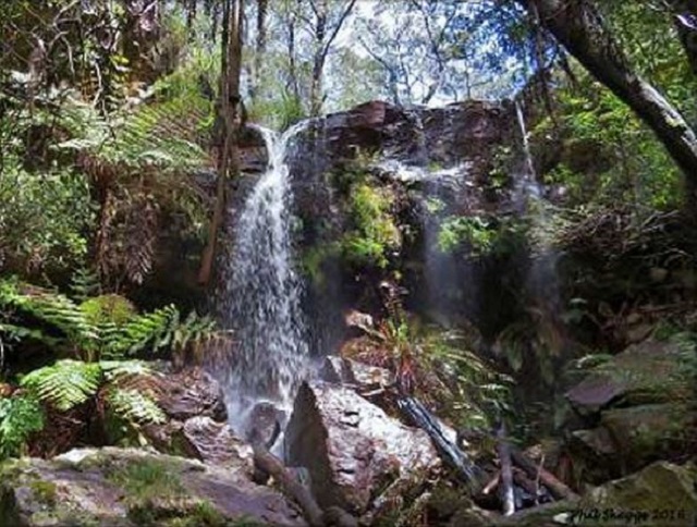
Aireys Inlet - Currawong Falls


Currawong Falls can be visited on a 10.2km loop walk (about 4 hour return) which also passes through Ferny Gully Cascades. The distance to reach Currawong Falls is 4.5km.
This strenuous walk reveals a fascinating range of habitats, high ridges and steep-sided gorges with panoramic views to Aireys Inlet township and Split Point Lighthouse.
The start point for the walk is the Distillery Creek Picnic area (115 Bambra Road, Aireys Inlet). The area has toilets, fireplace and a picnic table. Turn north from the Great Ocean Road onto Bambra Road and then continue for about 2.4km to the picnic area. Note that Bambra Road turns sharp left when it joins Distillery Creek Road just before Distillery Creek Picnic Area.
The second (upper) picnic area has a short walk leading to a bird hide that looks over the Distillery Creek Wetlands
Currawong Falls is located on Distillery Creek but is dry most of the time. To see the falls running you need to visit after a decent amount of rain.
Loop Walk Description - Taking the Currawong Falls track out of the Distillery Creek Picnic area, you start a slow climb that follows the contours of the East side of the Ironbark Gorge. Along the way you can see the results of wild bush fires that have swept through this area. A good first stop on this walk is the cliff tops of the Ironbark Gorge. The view is quite spectacular with 25-30m drops into the gorge. Leaving the rock platform you start to climb again, this time to the east and its along this part of the walk that the big panoramic views back to Aireys Inlet appear, The top of the walk is Trig Point and its here that you cross over Loves track and start to descend across Heathlands and into the gullies heading towards the Currawong Falls. The big view here is back towards Anglesea and Mount Ingoldsby.
Winding through some gullies you find yourself walking along Distillery Creek, crossing a small bridge and up the other side the Currawong Falls come into view. Following Distillery Creek you descend down back towards the Distillery Creek picnic ground, picking up the Nature Trail, along the board walk and through a gum forest which has a small Koala population living in it.
There are a number of other walks from the picnic ground.
The Nature Trail (1.5 km circuit) - This is a short, self-guided nature trail showing a diversity of plant life. The trail takes you through a range of vegetation communities, and returns along the edge of Distillery Creek. Distillery Creek is named after an illicit distillery that operated here in the late 1880s. It is a tributary of the larger Painkalac Creek. Large crops of barley were grown along the fertile flats of Painkalac Creek to supply the distillery the pure water was obtained from a well at the foot of a small waterfall on Distillery Creek.
The Ironbark Gorge Track (2.2 km circuit, 1.5 hrs return) passes through stands of ironbark and sandy heathland, and rewards with a panoramic view of the surrounding area.
Track to Moggs Creek Picnic Area (7.5 km one way, 2.5 hrs) is a strenuous walk through the ironbarks and other eucalypts behind Aireys Inlet. It then passes Painkalac Dam before continuing to Moggs Creek along a fire break track.
Location
115 Bambra Road, Aireys Inlet VIC 3231 Aireys Inlet 3231 View Map
Web Links
→ Ironbark Gorge & Currawong Falls, Great Otway National Park (Goin Feral One Day At A Time)
→ Distillery Creek Nature Trail (Parks Victoria)
→ Currawong Falls Circuit Walk (Way & Farer)
→ Currawong Falls Walk (Friends of Eastern Otways)


