Guide to the Best National, Regional, Historic and Coastal Parks to Visit in Melbourne and Victoria

The Melbourne area and country regions of Victoria have many wonderful parks which combine iconic Australian flora and fauna with recreational activities such as walking, picnicking, camping, swimming, boating, canoeing, fishing, four wheel driving and horseriding. Whether it's a relaxing location along a river or beach, the exciting mountainous spine of the state's north east or a bush setting close to Melbourne, our guide will inspire you with ideas.
Around Melbourne
Arthurs Seat State Park (Dromana)
Size: 572ha
Distance from Melbourne CBD: 88km
Activities: Day trip, walking tracks, self guided walks, lookout
Facilities: Information, toilets, picnic shelter, BBQ
Arthurs Seat's popular lookout, reached by car or foot, offers stunning views of Port Phillip Bay. On a clear day the view extends as far as the city skyline, the You Yangs, and Mount Macedon. Set within the park is the Seawinds Gardens. With its indigenous and exotic formal gardens dotted with the sculptures of William Ricketts, it is the perfect place for a picnic.
Albert Park (Albert Park)
Size: 225ha
Distance from Melbourne CBD: 3km
Activities: Walking tracks, canoeing, sailing, cycling
Facilities: Information, toilets, picnic shelter, BBQ, playground, kiosk
Dogs: Dogs are permitted on leash. There are some dog off-leash areas.
Only 3km from the heart of the city, Albert Park is popular for a range of activities including walking, cycling, sailing and rowing. Apart from the lake itself, other attractions include sporting facilities, ovals, playgrounds, restaurants and a 5km walking and running track. Sporting facilities include a golf driving range, gymnasium and the Melbourne Sports and Aquatic Centre. Enjoy a barbecue or picnic with the family, hire a boat or walk, cycle or jog around the track, past green lawns and playing fields. See the swans and colourful sailboats on the lake and the magnificent views of the city skyline.
Braeside Park (Braeside)
Size: 312ha
Distance from Melbourne CBD: 31km
Activities: Walking tracks, cycling
Facilities: Information, toilets, picnic shelter, BBQ, playground
Explore Braeside on a network of tracks ideal for family walks and rides. Keen birdwatchers could spot over 100 species of birds, and children will enjoy the adventure playground.
Karkarook Park (Heatherton)
Size: 40ha
Distance from Melbourne CBD: 21km
Activities: Walking tracks, canoeing, fishing, sailing, cycling, lookout
Facilities: Information, toilets, picnic tables, BBQ, playground
Dogs: Dogs are permitted on leash.
Karkarook boasts an off-lead dog area, wetlands, trails, playground, picnic areas and a 15ha lake with a bird hide, viewing platforms and fishing.
NB: Boats must not be any longer than five metres.
Brimbank Park (Keilor)
Size: 409ha
Distance from Melbourne CBD: 20km
Activities: Walking tracks, self guided walk, canoeing, fishing, cycling, lookout
Facilities: Information, toilets, picnic shelter, BBQ, playground, kiosk
Featuring native grasslands, plains and Red Gums along the Maribyrnong River, Brimbank bustles with activity at the weekend - cyclists and joggers enjoying the 4km river circuit, bocce players bowling on the grass and canoeists paddling along the river.
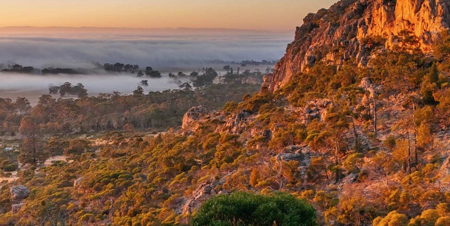
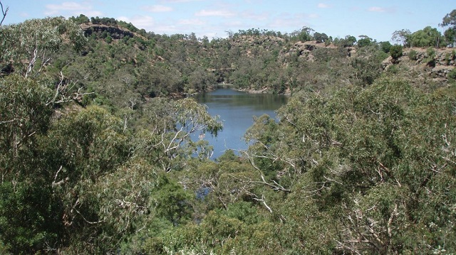
Brisbane Ranges National Park (Steiglitz)
Size: 8,818ha
Distance from Melbourne CBD: 91km
Activities: Day trip, walking tracks, self guided walk, lookout, camping
Facilities: Information, toilets, picnic shelter, fireplace, BBQ
The Brisbane Ranges, popular for bushwalking, picnics, scenic drives and camping, support many spring wildflowers and native wildlife. Explore Anakie Gorge and the Lower Stoney Creek Reservoir. Discover the gold rush history of the adjoining Steiglitz Historic Park, including a display in the old Steiglitz Court House and a self-guided walk.
Bunyip State Park (Gembrook)
Size: 16,600ha
Distance from Melbourne CBD: 82km
Activities: Day trip, walking tracks, 4WD, horseriding, lookout, cycling, camping
Facilities: Information, toilets, picnic tables, fireplace
This extensive forested area near Gembrook contains relics from logging days with the timber tramways. It is popular for scenic drives, walks and four wheel driving.
Cardinia Reservoir Park (Narre Warren East)
Size: 153ha
Distance from Melbourne CBD: 48km
Activities: Day trip, walking tracks, canoeing, sailing, cycling
Facilities: Information, toilets, picnic shelter, fireplace, BBQ, playground
Dogs: Dogs are permitted on leash.
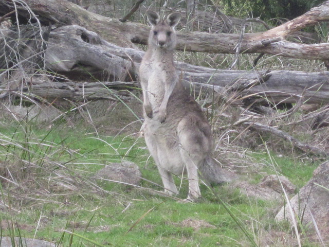
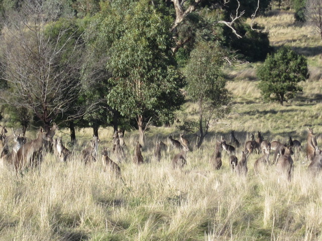
Set by the expansive waters of Cardinia Reservoir, this is the perfect setting for a picnic, barbecue or stroll. Walk across the dam wall, enjoy panoramic views from the lookouts or spot a kangaroo.
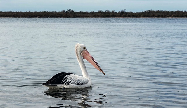
Coolart Wetlands and Homestead (Somers)
Size: 87ha
Distance from Melbourne CBD: 85km
Activities: Day trip, walking tracks, self guided walk, lookout
Facilities: Information, toilets, picnic shelter, BBQ
Famous for its breeding colony of Australian White Ibis, Coolart is a harmonious blending of nature and human settlement. The historic mansion, built in 1896, is set in a delightful garden with wetlands, woodlands and pasture nearby. Walking tracks take you to the beach, lagoon and wetlands, with excellent bird hides.
Dandenong Ranges Gardens
Tucked into the hillsides and just a short drive east of Melbourne lie the great gardens of the Dandenongs. These picturesque gardens have breathtaking views of the Warburton Ranges and are framed by Mountain Ash trees. Seasonal changes ensure they are an all-year-round delight.
Distance from Melbourne CBD: About 50km
Alfred Nicholas Gardens (Sherbrooke)
Size: 13ha
Activities: Walking tracks
Facilities: Toilets, picnic table
Dogs: Dogs are permitted on leash.
George Tindale Memorial Garden (Sherbrooke)
Size: 2.4ha
Activities: Walking tracks
Facilities: Toilets, picnic table
Dogs: Dogs are permitted on leash.
Mount Dandenong Arboretum (Mount Dandenong)
Size: 16ha
Activities: Walking tracks, Lookout
Facilities: Toilets, picnic shelter
Dogs: Dogs are permitted on leash.
National Rhododendron Gardens (Olinda)
Size: 43ha
Activities: Walking tracks, lookout
Facilities: Information, toilets, picnic tables, kiosk
Pirianda Garden (Olinda)
Size: 11ha
Activities: Walking tracks
Facilities: Toilets, picnic tables
Dogs: Dogs are permitted on leash.
RJ Hamer Arboretum (Olinda)
Size: 120ha
Activities: Walking tracks, lookout, cycling
Facilities: Toilets, picnic shelter, BBQ
Dogs: Dogs are permitted on leash.
Dandenong Ranges National Park
Size: 3,540ha
Distance from Melbourne CBD: About 45km
Protecting the tall forests of the Dandenongs, this park is well known for its spectacular Mountain Ash trees and lush fern gullies, and is ideal for relaxing picnics and tranquil forest walks. The cool mountain elevation affords spectacular panoramic views. There is abundant native birdlife, including crimson Rosellas, kookaburras and the Superb Lyrebird. Explore the forest on a range of walks, or enjoy a picnic at the Fern Tree Gully Picnic Ground, One Tree Hill or in Sherbrooke Forest. Nearby coffee shops, restaurants, craft and antique shops, as well as gardens and the historic Puffing Billy train make for a pleasant day out. The park can be reached by public transport from Melbourne.
French Island National Park
Size: 11,100ha
Distance from Melbourne CBD: 70km
Activities: Day trip, walking tracks, fishing, cycling, camping
Facilities: Information, toilets, picnic tables
A quiet wilderness haven for nature lovers, French Island has a large koala population and many birds. Access is by passenger ferry from Stony Point. Visitors' cars are not permitted on the island, so travel is by foot, bicycle or guided tour. Camping sites must be pre-booked.
Greenvale Reservoir Park (Greenvale)
Size: 53ha
Distance from Melbourne CBD: 27km
Activities: Day trip, walking tracks, fishing, cycling
Facilities: Information, toilets, picnic tables, playground
Dogs: Dogs are permitted on leash.
The grassy slopes of this park are popular with large groups for picnics and games. Trails wind through the park, offering glimpses of native birdlife and views across the water.
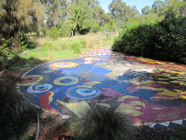
Herring Island Environmental Sculpture Park (South Yarra)
Size: 2.8ha
Distance from Melbourne CBD: 5km
Activities: Walking tracks, fishing, outdoor sculptures
Facilities: Information, toilets, picnic shelter, BBQ
Accessible only by boat, Herring Island in the Yarra River is just 3km from the city. The park is a haven for nature and art lovers alike. Environmental sculptures made from natural materials reflect the island's tranquil setting. A punt operates periodically from Como Landing during summer.
Jells Park and surrounds
Distance from Melbourne CBD: 27km
Jells Park and surrounds are ideal for picnickers, walkers, joggers and cyclists, with wide open spaces and a network of sealed trails. The 11.5ha lake at Jells Park is popular with birdwatchers and anglers. At Koomba Park you can walk, cycle or jog along creekside and woodland trails, observing the waterbirds through the wetlands. Relax with the family on the rolling lawns of Nortons Park, then walk to Shepherds Bush, a natural sanctuary for birds, with tracks and boardwalks through bushland and billabongs.
Jells Park (Wheelers Hill)
Size: 129ha
Activities: Walking tracks, fishing, cycling
Facilities: Information, toilets, picnic shelter, BBQ, playground, kiosk
Dogs: Dogs are permitted on leash.
Koomba Park (Wantirna)
Size: 33ha
Activities: Walking tracks, cycling
Facilities: Information
Dogs: Dogs are permitted on leash.
Nortons Park (Wantirna South)
Size: 35ha
Activities: Walking tracks, cycling
Facilities: Information, toilets, picnic shelter, BBQ
Dogs: Dogs are permitted on leash.
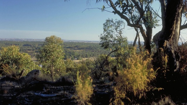
Kinglake National Park (Kinglake)
Size: 22,360ha
Distance from Melbourne CBD: 71km
Activities: Day trip, walking tracks, self guided walk, lookout, horseriding, camping, caravan camping
Facilities: Toilets, picnic shelter, BBQ
Only 65km north of Melbourne, Kinglake National Park lies on the slopes of the Great Dividing Range, offering dramatic views of the Melbourne skyline, Port Phillip Bay, the Yarra Valley and across to the You Yangs.
Kurth Kiln Regional Park (Gembrook)
Size: 3500ha
Distance from Melbourne CBD: 77km
Activities: Day trip, walking tracks, 4WD, horseriding, lookout, cycling, camping
Facilities: Information, toilets, picnic tables, fireplace
Located a short distance from Melbourne, the park is mostly known for its kiln used during the Second World War to make charcoal for gas producer units fitted to motor cars. The park contains a range of forest types and is popular for picnicking, camping, walking and horse riding.
Langwarrin Flora and Fauna Reserve (Langwarrin)
Size: 214ha
Distance from Melbourne CBD: 57km
Activities: Walking tracks, cycling
Facilities: Information, picnic shelter
Langwarrin's coastal heathland and woodland is an island of relatively undisturbed natural bushland ideal for quiet recreation activities such as walking, nature study and photography.
Lerderderg State Park (Darley)
Size: 14,250ha
Distance from Melbourne CBD: 64km
Activities: Day trip, walking tracks, swimming, fishing, 4WD, lookout, camping
Facilities: Information, toilets, picnic shelter, fireplace, BBQ
Dogs: Dogs are permitted on leash.
The park features a deep rugged gorge cut by the Lerderderg River and a wide variety of vegetation, from fern gullies to dry open forest, as well as interesting relics of early gold mining. Walks, picnics and camping are popular.
Churchill National Park (Endeavour Hills)
Size: 271ha
Distance from Melbourne CBD: 35km
Activities: Walking tracks, cycling
Facilities: Information, toilets, picnic shelter, BBQ
The Churchill National Park is a pleasant setting for picnics and a variety of walks.
Dandenong Police Paddocks Reserve Reserve (Endeavour Hills)
Size: 499ha
Distance from Melbourne CBD: 33km
Activities: Walking tracks, cycling
Facilities: Information, toilets, picnic shelter, BBQ, playground
Dogs: Dogs are permitted on leash.
Dandenong Police Paddocks offers a picnic area, walking tracks and information about the area's heritage.
Lysterfield Park (Lysterfield)
Size: 1,397ha
Distance from Melbourne CBD: 43km
Activities: Day trip, walking tracks, swimming, canoeing, sailing, horseriding, cycling
Facilities: Information, toilets, picnic tables, BBQ
Lysterfield Park is ideal for walking, barbecues, sailing, canoeing and swimming. Cyclists can tackle the State Mountain Bike Course or enjoy the network of mountain bike trails catering for riders of all ages and abilities.
Macedon Regional Park (Mount Macedon)
Size: 2,165ha
Distance from Melbourne CBD: 71km
Activities: Day trip, walking tracks, horseriding, lookout
Facilities: Information, toilets, picnic shelter, BBQ, kiosk
Dogs: Dogs are permitted on leash
Picnic in delightful natural surroundings or take afternoon tea in the tea rooms, and enjoy panoramic views from the summit of Mount Macedon with its famous cross.
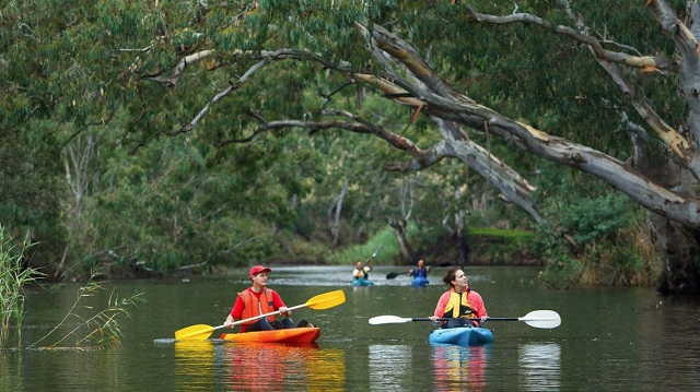
Maribyrnong River
Flowing through Melbourne's north-western suburbs, the Maribyrnong River is a Melbourne gem. Popular for canoeing, boating, fishing and picnicking, the shared walking/cycling Maribyrnong River Trail runs from Brimbank Park through to Williamstown.
Maroondah Reservoir Park (Healesville)
Size: 40ha
Distance from Melbourne CBD: 68km
Activities: Day trip, walking tracks, self guided walk, canoeing, sailing, cycling
Facilities: Information, toilets, picnic shelter, fireplace, BBQ, playground
Dogs: Dogs are permitted on leash
Maroondah features gardens with stands of native and exotic trees, native animals and birds and walking tracks. Its playground, lawns and cool summer shade make it a popular picnic destination in warmer months.
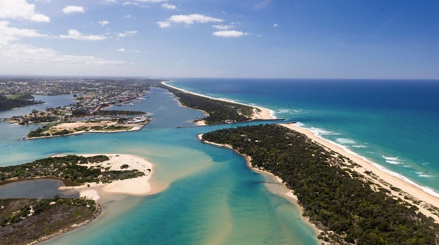
Mornington Peninsula National Park (Rye)
This narrow strip of coast and bushland is a wonderful blend of natural scenery and fascinating historic features. The park is popular for bushwalking, swimming, picnics and nature study, as well as surfing at ocean beaches like Portsea, Sorrento and Gunnamatta. The Greens Bush area of the park is the largest remnant of bushland on the Peninsula and a great place for wildlife watching. Historic sites include the Collins Settlement Historic Site near Sorrento which was the first official European settlement in Victoria and the Cape Schanck Lightstation, built in 1859, which is open for tours and accommodation (fees apply to the lightstation).
Distance from Melbourne CBD: 105km
Activities: Day trip, walking tracks, self guided walk, swimming, fishing, horseriding, lookout, cycling
Facilities: Information, toilets, picnic shelter, BBQ, kiosk
Organ Pipes National Park (Keilor North)
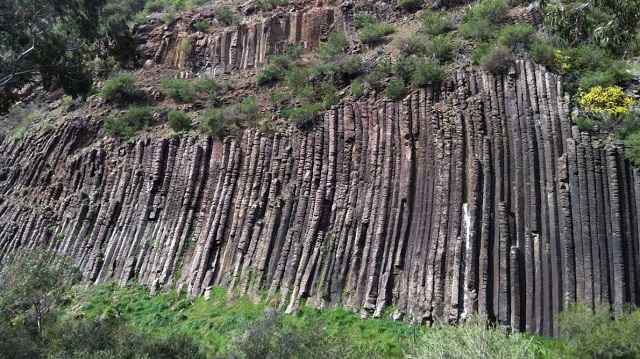
Size: 121ha
Distance from Melbourne CBD: 27km
Activities: Day trip, walking tracks, self guided walk, lookout
Facilities: Information, toilets, picnic tables
The Organ Pipes, a spectacular wall of 20m high basalt columns, is the centrepiece of this park, but it is also one of Australia's best examples of vegetation restoration. Enjoy a picnic, a walk and the spring wattle blossom.
Pipemakers Park (Maribyrnong)
Size: 19.3ha
Distance from Melbourne CBD: 8km
Activities: Walking tracks, canoeing, cycling
Facilities: Information, toilets, picnic shelter, BBQ
Dogs: Dogs are permitted on leash
Set beside the Maribyrnong River, Pipemakers is a transformed industrial site. Visit the Living Museum of the West in a historic meatworks and pipe factory, and explore the History of the Land Trail.
Plenty Gorge Park (South Morang)
Size: 1,350ha
Distance from Melbourne CBD: 25km
Activities: Walking tracks, lookout
Facilities: Information, toilets, picnic shelter, BBQ, playground
With views of the Plenty River, a backdrop of the wooded Plenty Gorge and the historic Le Page Homestead, the Hawkstowe Picnic Area is the perfect spot for a quiet get together that the whole family will enjoy. Visitors to Yarrambat can enjoy views of the Kinglake Ranges and the Plenty River valley.
Point Cook Coastal Park (Point Cook)
Size: 500ha
Distance from Melbourne CBD: 28km
Activities: Walking tracks, swimming, canoeing, sailing, fishing
Facilities: Information, toilets, picnic shelter, BBQ, playground
Point Cook, adjoining the Point Cooke Marine Sanctuary, features abundant birdlife, a historic bluestone homestead and intertidal sandbanks. It is popular with birdwatchers, nature lovers and family groups. At nearby Cheetham Wetlands, see migratory waterbirds and enjoy the views from the Tower.
Point Nepean National Park (Rosebud)
Size: 55ha
Distance from Melbourne CBD: 112km
Activities: Walking tracks, self guided walk, lookout, cycling
Facilities: Information, toilets, picnic shelter, kiosk
Point Nepean played an important role in shaping the early settlement, quarantine and defence of Victoria. Located at the tip of the Mornington Peninsula, the park offers outstanding coastal scenery and panoramic views of Bass Strait, the Rip and Port Phillip Bay. Visitors can explore military forts and tunnels, discover the historic Quarantine Station, view the memorial where Prime Minister Harold Holt went missing and enjoy the coastal scenery by foot or bicycle.
Ricketts Point Marine Sanctuary (Beaumaris)
Size 115ha
Distance from Melbourne CBD: 23km
With its rockpools close to shore, Ricketts Point is the perfect place to introduce kids to the wonder of Victoria's underwater marine life. Sandstone platforms are home to an array of marine creatures and are excellent for rockpool exploration. During summer, the beach is patrolled by the life saving club, making it a great option for a summer family outing.
Serendip Sanctuary (Lara)
Size: 250ha
Distance from Melbourne CBD: 59km
Activities: Day trip, walking tracks, self guided walk
Facilities: Information, toilets, picnic shelter, fireplace
Discreet bird hides at Serendip are specifically designed to allow you to view the prolific bird life at close range. Birds can often be seen preening, feeding, incubating eggs and caring for their young.
Silvan Reservoir Park (Olinda)
Size: 15ha
Distance from Melbourne CBD: 52km
Activities: Day trip, walking tracks, lookout
Facilities: Information, toilets, picnic shelter, picnic tables, fireplace, BBQ, playground
Dogs: Dogs are permitted on leash
The lower section of this pleasant park in the foothills of the Dandenongs is ideal for a family picnic, with its rolling lawns, barbecues and walking tracks. The higher level, set in eucalypt forest, has views over the reservoir.
Sugarloaf Reservoir Park (Christmas Hills)
Size:30ha
Distance from Melbourne CBD: 46km
Activities: Day trip, walking tracks, fishing
Facilities: Information, toilets, picnic shelter, BBQ
Nestled in the Christmas Hills, Sugarloaf is a tranquil setting for a picnic or a stroll near the reservoir shores, offering wonderful views across the water. For the more energetic, there is a 15km walk that circumnavigates the reservoir.
Upper Yarra Reservoir Park (Reefton)
Size: 50ha
Distance from Melbourne CBD: 101km
Activities: Day trip, walking tracks, lookout, cycling, camping
Facilities: Information, toilets, picnic tables, fireplace, BBQ
Dogs: Dogs are permitted on leash
Framed by forested mountains, Upper Yarra Reservoir Park has gardens, scenic lookouts, picnic grounds and a camping area surrounded by bushland. It's a great place for an introduction to family camping, with hot showers and shelter as well as good short walks, such as the Fern Gully Nature Trail.
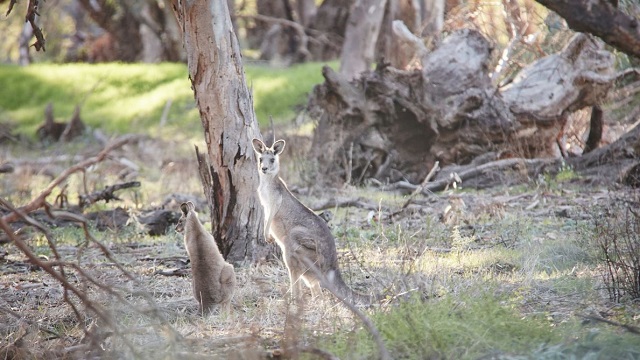
Warrandyte State Park (Warrandyte)
Size: 620ha
Distance from Melbourne CBD: 28km
Activities: Day trip, walking tracks, self guided walk, canoeing, fishing, horseriding, lookout, cycling
Facilities: Information, toilets, picnic shelter, fireplace
This pleasant bushland park along the Yarra River is home to kangaroos, koalas, wildflowers and birds. The site of Victoria's first official gold discovery, it is dotted with relics of gold mining era, particularly around Fourth Hill and Pound Bend. Jumping Creek, Mount Lofty and Pound Bend are popular for picnics, walks, canoeing and nature studies.
Wattle Park (Burwood)
Size: 55ha
Distance from Melbourne CBD: 17km
Activities: Walking tracks
Facilities: Information, toilets, picnic shelter, BBQ, playground, kiosk
Dogs: Dogs are permitted on leash
Wattle Park features historic buildings, huge gum trees, wattles, seasonal wildflowers and ponds. The historic Chalet, popular for functions, is set among exotic trees and sweeping lawns. The tennis courts and public nine-hole golf course are great places to enjoy some friendly competition.
Werribee Gorge State Park (Pentland Hills)
Size: 575ha
Distance from Melbourne CBD: 67km
Activities: Day trip, walking tracks, rock climbing, lookout
Facilities: Information, toilets, picnic tables, fireplace
Werribee Gorge has a rugged natural beauty, offering spectacular views and great opportunities for bushwalking and rock climbing.
Werribee Park (Werribee)
Size: 140ha
Distance from Melbourne CBD: 35km
Activities: Walking tracks
Facilities: Information, toilets, picnic shelter, BBQ, kiosk
This Italianate tower-mansion built in the 1870s is the remnant of a family pastoral empire and a style of grand living that flourished briefly in Australia. Experience the elegance of the mansion, with its ornate crystal chandeliers, giant gilt-framed mirrors and imposing main staircase with the help of guides and an audio tour. Much of the building is open to visitors, including the ground floor reception rooms, main bedrooms, billiard room and part of the kitchen.
Wander around the original bluestone farm buildings and formal gardens, which include a parterre garden with a geometric pattern of flowerbeds, as well as a man-made lake and grotto. The adjoining Victoria State Rose Garden displays over 4,500 roses, and is particularly spectacular from November to May.
Werribee River Park (Werribee)
Size: 230ha
Distance from Melbourne CBD: 41km
Activities: Walking tracks, canoeing, fishing, cycling
Facilities: Picnic tables
Dogs: Dogs are permitted on leash
Meandering along the river, this park features wetlands, coastal saltmarsh and views of dramatic escarpments.
Westerfolds Park
Distance from Melbourne CBD: 20km
Visitors to Westerfolds can relax with a picnic, or the more energetic can rollerblade, cycle, run or canoe. Enjoy a picnic at Banksia, explore the Heritage Trail, or discover the adventure playground at nearby Birrarrung. See the landscapes made famous by the Heidelberg School of artists at Yarra Flats, Cycle or walk the Main Yarra Trail, along the riverside boardwalk to the Manna Gums of Candlebark Park. For campers who don't want to venture far from the city, enjoy a weekend by the Yarra River at Longridge Camp (bookings required).
Banksia Park (Bulleen)
Size: 23ha
Activities: Walking tracks, cycling
Facilities: Information, toilets, picnic shelter, fireplace, playground
Dogs: Dogs are permitted on leash
Birrarrung Park (Templestowe Lower)
Size: 33ha
Activities: Walking tracks, cycling
Facilities: Information, toilets, picnic shelter, fireplace, playground
Dogs: Dogs are permitted on leash
Westerfolds Park (Templestowe)
Size: 123ha
Activities: Day trip, walking tracks, canoeing, cycling
Facilities: Information, toilets, picnic shelter, fireplace, BBQ, playground, kiosk
Dogs: Dogs are permitted on leash
Yarra Flats Park (Heidelberg)
Size: 85ha
Activities: Walking tracks, cycling
Facilities: Information, toilets, picnic shelter
Dogs: Dogs are permitted on leash
Westgate Park (Port Melbourne)
Size: 28ha
Distance from Melbourne CBD: 7km
Activities: Walking tracks, self guided walk, cycling
Facilities: Information, toilets, picnic shelter, BBQ
Dogs: Dogs are permitted on leash
Beneath the spans of the West Gate Bridge, this park features fresh water and saltwater lakes rich in birdlife. It is ideal for some lunchtime respite, a city bicycle tour, or a stop off on a trip to Geelong and beyond.
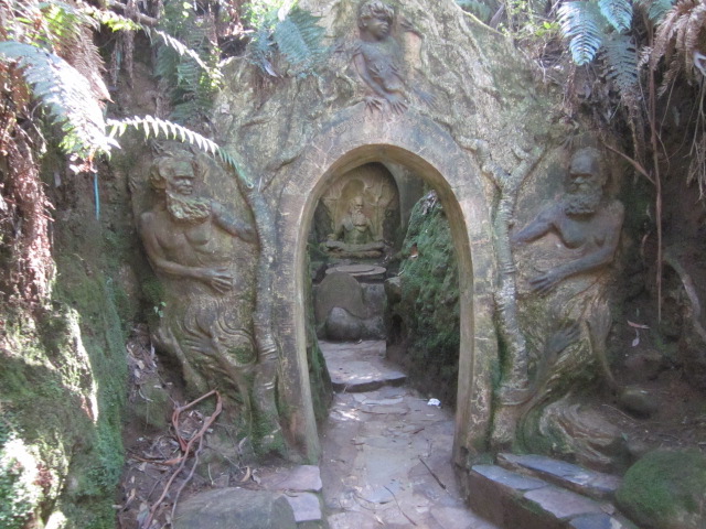
William Ricketts Sanctuary (Mount Dandenong)
Size: 11 ha
Distance from Melbourne CBD: 50km
Activities: Walking tracks
Facilities: Information, toilets
This sanctuary is a place of spiritual renewal where visitors can discover the vision and passion that lives in William Ricketts' art. As you wander along the pathways, delight in mystical sculptures half hidden among the ferns and towering Mountain Ash trees.
Woodlands Historic Park (Greenvale)
Size: 700ha
Distance from Melbourne CBD: 28km
Activities: Day trip, walking tracks, horseriding, lookout, cycling
Facilities: Information, toilets, picnic tables, BBQ
Dogs: Dogs are permitted on leash
Woodlands provides a fascinating glimpse of the landscapes and wildlife seen by European settlers in the 1840s. The park has a 150-year-old homestead, Indigenous canoe trees, native woodland and grassland. Plan a picnic, walk or bike ride.
Yan Yean Reservoir Park (Yan Yean)
Size: 12ha
Distance from Melbourne CBD: 36km
Activities: Walking tracks
Facilities: Information, toilets, picnic shelter, BBQ, playground
Dogs: Dogs are permitted on leash
Yan Yean Reservoir Park provides visitors with peaceful picnic areas, a variety of walking tracks and breathtaking views of Melbourne's oldest water storage site.
Yarra Bend Park (Fairfield)
Size: 260ha
Distance from Melbourne CBD: 8km
Activities: Walking tracks, self guided walk, canoeing, fishing, lookout, cycling
Facilities: Information, toilets, picnic shelter, BBQ, playground, kiosk
Dogs: Dogs are permitted on leash
This park is the largest area of natural bushland near the heart of Melbourne, and has steep river escarpments, open woodlands, playing fields and golf courses. Explore the park by foot or by bike or go boating on the river and enjoy superb views of the city skyline. Pleasant picnic areas, barbecues, rotundas and playgrounds make it popular with families. Meals, refreshments and boat hire are available at venues within the park.
Melbourne's Grey-headed Flying-fox colony resides within the park. Visit the Bellbird Picnic Area at dusk when thousands of flying-foxes take to the sky in search of food.
Yarra Ranges National Park (Warburton)
Size: 76,003ha
Distance from Melbourne CBD: 123km
Activities: Day trip, walking tracks, skiing, lookout
Facilities: Information, toilets, picnic shelter, fireplace
Cradling the Yarra River headwaters and much of Melbourne's water catchment, the park features majestic Mountain Ash trees. Discover just how tall these trees are by looking through the clinometer to measure their height at Cambarville Historic Area. Visit the Rainforest Gallery with its spectacular observation platform and rainforest walkway on the southern slopes of Mount Donna Buang. Enjoy cross-country skiing and tobogganing at Lake Mountain. Drive the famous Black Spur between Healesville and Narbethong, continue through to Marysville stopping along Lady Talbot Drive to walk through ancient rainforests at the Beeches and view the waterfalls at Keppel and Phantom Falls. Note: Much of the catchment area is not open to the public.
Yarra River
Activities: Walking tracks, boating, canoeing, fishing, cycling
Facilities: Information, picnic shelter, BBQ
The Yarra River is a Melbourne icon and the focus for many of Melbourne's cultural events. Board one of the many river craft at Docklands, Southgate or Princes Wharf to visit attractions such as the Royal Botanic Gardens and Herring Island Environmental Sculpture Park.
The Yarra is a picturesque setting for recreation, with barbecue and picnic facilities, fishing platforms and jetties dotted along its banks. Try walking or cycling further upstream on the Main Yarra Trail as it follows the course of the river for 33km, passing parks, historic landmarks and bushland on its winding way to the scenic Yarra Valley.
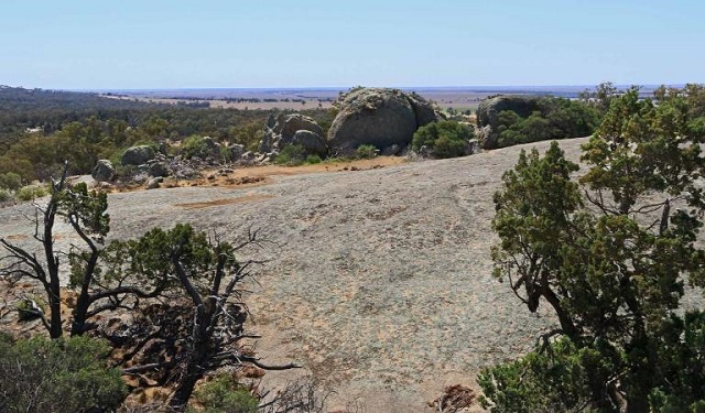
You Yangs Regional Park (Lara)
Size: 2,025ha
Distance from Melbourne CBD: 59km
Activities: Day trip, walking tracks, lookout, horseriding, cycling
Facilities: Information, toilets, picnic shelter, fireplace
Dogs: Dogs are permitted on leash
The distinctive granite peaks of the You Yangs rise from the flat volcanic plains between Melbourne and Geelong. The park is popular for its magnificent views, birdlife and opportunities for walks, picnics and mountain bike riding.
Central Region
Hepburn Regional Park
Size: 2,900ha
Location: 5km from Daylesford / 110km from Melbourne
Activities: Day trip, walking tracks, lookout, camping
Facilities: Information, toilets, picnic tables, fireplace
Dogs: Dogs are permitted on-leash
The park is located around the famous mineral springs townships of Daylesford, Hepburn and Hepburn Springs. Here you will find natural mineral springs and relics of the gold mining era, all set in delightful bush surroundings.
Andersons Mill
Size: 12ha
Location: 22km from Daylesford / 128km from Melbourne
Activities: Walking tracks
Facilities: Information, toilets, picnic tables
Dogs: Dogs permitted on-leash.
Set in picturesque surrounds on the banks of Birch Creek at Smeaton, Andersons Mill is one of the most impressive relics of the Gold Rushes. Standing today much as it was 150 years ago, the five-storey bluestone flourmill and its magnificent iron water wheel are still in place. Andersons Mill is open on the first Sunday of each month. The grounds of the Mill can be enjoyed at all other times.
Creswick Regional Park
Size: 2,500ha
Location: 20km from Daylesford / 120km from Melbourne
Activities: Walking tracks, canoeing, cycling, camping
Facilities: Toilets, picnic shelter, fireplace, BBQ
Dogs: Dogs are permitted on-leash
Located between Ballarat and Daylesford, explore the park on a variety of walks, picnic by tranquil St Georges Lake or relax in peaceful surroundings.
Other parks and reserves in the Central region worth a visit are:
- Anglesea Heath, near Anglesea
- Moorabool Reservoir Park, near Ballarat
- Gong Gong Reservoir Park, near Ballarat
- Kirks Reservoir Park, near Ballarat
- Enfield State Park, near Ballarat
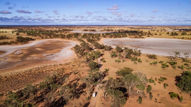
Wimmera Region
Little Desert National Park
Size: 132,000ha
Location: 8km from Dimboola / 375km from Melbourne
Activities: Walking tracks, self guided walk, swimming, canoeing, fishing, 4WD, lookout, camping, caravan camping
Facilities: Information, toilets, picnic shelter, fireplace
Little Desert is full of life - native birds are abundant and colourful wildflowers bloom in spring. Camp beside the Wimmera River, and enjoy bushwalks, birdwatching or four-wheel driving.
Grampians National Park
Size: 168,000ha
Location: 26km from Stawell / 260km from Melbourne / 460km from Adelaide
Activities: Walking tracks, self guided walk, canoeing, fishing, 4WD, lookout, camping, caravan camping
Facilities: Information, toilets, picnic shelter, fireplace, BBQ, boat ramp, kiosk
Rising abruptly from the surrounding Western Plains, the Grampians (Gariwerd) is a series of rugged sandstone mountain ranges and forests rich in wildlife. One of Victoria's most popular holiday destinations, the park is a great venue for camping, climbing, scenic drives, bushwalks and nature study. A network of walking tracks throughout the park allows you to explore cascading waterfalls, brilliant spring wildflower displays, and panoramic views from lookouts.
The area has a rich Aboriginal heritage and a number of important rock art sites. For more information visit Brambuk - the National Park and Cultural Centre near Halls Gap.
Mount Arapiles-Tooan State Park
Size: 5,061ha
Location: 33km from Horsham / 320km from Melbourne
Activities: Walking tracks, lookout, camping
Facilities: Information, toilets, picnic shelter, fireplace
Widely regarded as the top rock-climbing spot in Australia, more than 2000 routes have been developed on the many cliffs, crags and pinnacles presenting variety and challenge to climbers of all levels of experienced.
St Arnaud Range National Park
Size: 13,900ha
Location: 35km from St Arnaud / 200km from Melbourne
Activities: Walking tracks, cycling, camping, caravan camping
Facilities: Information, toilets, picnic tables, fireplace
St Arnaud Range National Park features mainly steep, forested terrain and is an ideal place to experience what the forests of central Victoria were like before the gold rushes. The rocky ridge tops in the park offer fine views for bushwalkers and four wheel drive tourers, and there are ample opportunities for hiking in the steep and rugged terrain. The Upper Teddington Reservoir is a peaceful place for picnics and camping.
Other parks and reserves in the Wimmera region worth a visit are:
- Big Desert Wilderness Park, near Murrayville
- Kara Kara National Park, near St Arnaud
- Black Range State Park, near Grampians National Park
Northern Country Region
Barmah National Park
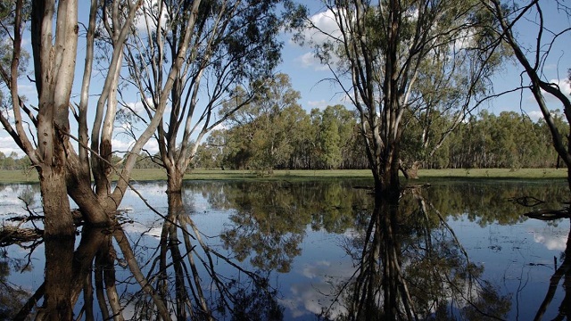
Size: 28,505ha
Location: 40km from Echuca / 280km from Melbourne
Activities: Walking tracks, swimming, canoeing, fishing, horseriding, camping
Facilities: Information, toilets, picnic tables, fireplace, boat ramp
On the Murray River flood plain north of Nathalia, Barmah National Park, together with neighbouring Millewa Forest in New South Wales is home to the world's largest forest of River Red Gums. Enjoy walks, canoeing and birdwatching, and discover the park's Aboriginal heritage.
Kooyoora State Park
Size: 11,350ha
Location: 20km from Inglewood / 220km from Melbourne
Activities: Walking tracks, horseriding, lookout, camping, caravan camping
Facilities: Information, toilets, picnic tables, picnic shelter, fireplace
Dogs: Dogs are permitted on-leash
With magnificent views and a rich variety of plants and animals, Kooryoora State Park is an ideal place for picnics, sightseeing, rock climbing, orienteering and nature study. Visit the Melville Caves, huge granite boulders thought to have once been used as a hideout for the bushranger 'Captain Melville'.
Greater Bendigo National Park
Size: 17,020ha
Location: 8km from Bendigo // 188km from Melbourne
Activities: Walking tracks, horseriding, lookout, camping
Facilities: Information, toilets, picnic shelter, fireplace
Dogs: Dogs are permitted on-leash
The park protects some of the highest quality Box-Ironbark forest in north-central Victoria, along with Mallee and grassy woodlands. It is an ideal spot for nature study, bird watching, walking, picnics, horse riding and camping. The best time to visit is between August and October when the colourful wildflowers are abundant. The 60km Bendigo Bushland Trail goes through part of the park, and the Great Dividing Trail begins here, linking Bendigo, Castlemaine and Ballarat.
Kerang Regional Park
Size: 370ha
Location: 10km from Kerang / 280km from Melbourne
Activities: Walking tracks, canoeing, fishing
Facilities: None
Dogs: Dogs are permitted on-leash
The park's wetlands provide important habitat for waterbirds, making bird watching a rewarding activity. The park is also popular for bushwalking and dog walking.
Shepparton Regional Park
Size: 2,800ha
Location: 190km from Melbourne
Activities: Day trip, walking tracks, swimming, canoeing, fishing, horseriding, cycling, camping, caravan camping
Facilities: Picnic tables, boat ramp
Dogs: Dogs are permitted on-leash
This park provides access to the Goulburn River - a good spot for fishing and water sports. It's also a great park to take the dog for a walk or on a camping holiday.
Terrick Terrick National Park
Size: 5,925ha
Location: 65km from Bendigo / 225km from Melbourne
Activities: Walking tracks, lookout, camping
Facilities: Information, toilets, picnic tables
Home to a number of threatened species, this park's granite peaks contrast with areas of native grasslands. It is an ideal park for a scenic drive, bushwalk or picnic.
Gunbower National Park
Size: 9,330ha
Location: 80km from Echuca / 315km from Melbourne
Activities: Walking tracks, swimming, canoeing, fishing, horseriding, camping, caravan camping
Facilities: Boat ramp
The wetlands and billabongs of the Gunbower forest are internationally recognised for their spectacular bird and plant life. With a backdrop of majestic River Red Gums, this is a great park for bush camping, fishing and relaxing on the bends of the Murray River.
Other parks and reserves in the Northern Country region worth a visit are:
- Broken-Boosey State Park, near Numurkah
- Lower Goulburn National Park, near Nathalia
North Central Region
Castlemaine Diggings National Heritage Park
Size: 7,500ha
Location: 5km from Castlemaine / 120km from Melbourne
Activities: Walking tracks, self guided walk, cycling
Facilities: Information, toilets, picnic tables, fireplace
From the remains of house sites and puddling machines, to the gold mines and gullies that yielded up fortunes, Australia's first National Heritage Park harbours fascinating tales of a golden past and retains much of its gold-rush character. Spring wildflowers, scenic drives, bushwalking, cycling, guided tours and gold fossicking are some of the highlights. Nearby Malden Historic Reserve also protects many interesting relics from the gold era.
Heathcote-Graytown National Park
Size: 12,700ha
Location: 5km from Heathcote / 150km from Melbourne
Activities: Walking tracks, horseriding
Facilities: Toilets, picnic tables, BBQ
Easily accessible by road, the Heathcote-Graytown National Park is a great place for bushwalks. Mount Ida and Viewing Rock provide views of Heathcote and surrounding areas. If an overnight stay is more your style, pitch a tent at the Dargile picnic ground and wake up to a choir of birds, The park also has a rich history to explore with relics from the gold rush and war era at Graytown.
Paddys Ranges State Park
Size: 2,010ha
Location: 3km from Maryborough / 170km from Melbourne
Activities: Walking tracks, camping
Facilities: Information, toilets, picnic tables, fireplace
Well known for its wildflowers in springtime, the Paddys Ranges State Park is home to 30 types of orchids and more than 140 native bird species like the rare Painted Honeyeaters and Swift Parrots. Relics of the goldmining era are scattered throughout the park. Visitors can retrace the steps of 'Paddy', a miner who reputedly roamed the area in the 1800s. Bushwalking, camping and picnicking are popular activities.
Mount Buangor State Park
Size: 2,400ha
Location: 30km from Ararat / 180km from Melbourne
Activities: Walking tracks, 4WD, horseriding, lookout, camping
Facilities: Information, toilets, picnic tables, fireplace
The park takes in eucalypt forests, creek flats, granite peaks and steep escarpments. Enjoy picnics and walks among magnificent tree ferns, experience the 21km moderate two-day forest walk (Beeripmo Walk), and take in the views from a number of scenic lookouts.
Cathedral Range State Park
Size: 3,577ha
Location: 60km from Healesville / 120km from Melbourne
Activities: Day trip, walking tracks, fishing, lookout, camping
Facilities: Information, toilets, picnic tables, fireplace, BBQ
Rising to the east of the Maroondah Highway, Cathedral Range is a spectacular rugged ridge of hard sandstone. The park is an ideal spot for bushwalking, rock climbing, fishing and camping. Visit the newly completed visitor area at Sugarloaf Saddle for a picnic and to take in the sights of the Cathedral Range.
Langi Ghiran State Park
Size: 2,695ha
Location: 14km from Ararat / 195km from Melbourne
Activities: Walking tracks, camping
Facilities: Information, toilets, picnic tables, fireplace
Lar-ne-jeering (Langi Ghiran) is a Djab Wurrung word for the Yellow-tailed Black Cockatoo, sometimes seen in the forest below the park's rugged granite peaks. In the west, a gently sloping plain supports an open woodland, rich in wildflowers.
Other parks and reserves in the North Central region worth a visit are:
- Mount Alexander Regional Park, near Harcourt
North East Region
Alpine National Park
Size: 646,000ha
Location: 350-450km from Melbourne
Activities: Walking tracks, swimming, boat ramp, canoeing, fishing, 4WD, horseriding, skiing, lookout, camping
Facilities: Information, toilets, picnic tables, fireplace
The Alpine National Park stretches from central Gippsland all the way to the NSW border where it adjoins Kosciuszko National Park. Within the park are some of Australia's most stunning alpine landscapes, including mountain peaks, escarpments and grassy high plains.
There are plenty of opportunities for bushwalking, from hikes to plunging waterfalls or the summits of Victoria's highest peaks - Mount Feathertop, Mount Bogong and Mount Howitt - to the network of tracks among the Snow Gums, summer wildflowers and historic mountain huts of the Bogong High Plains.
Other activities include cross-country skiing (with downhill skiing at adjoining resorts), camping, canoeing, cycling, four wheel driving and horse riding in the warmer seasons. This park and Mount Buffalo are part of the National Heritage listed Australian Alps national parks. Access points include Mitta Mitta, Mount Beauty, Bright, Mansfield, Heyfield, Dargo and Omeo. Deer hunting is permitted in some sections of this park.
Chiltern-Mount Pilot National Park
Size: 21,565ha
Location: 45km from Wangaratta / 300km from Melbourne
Activities: Walking tracks, self-guided walk, cycling, horseriding, lookout, camping
Facilities: Information, toilets, picnic tables, fireplace
Home to a variety of animals and rare plants, this park features Aboriginal and gold era sites. Visit scenic Woolshed Falls, take a self-guided tour, or enjoy a picnic, bike ride or bushwalk.
Beechworth Historic Park
Size: 1,080ha
Location: 2km from Beechworth / 270km from Melbourne
Activities: Walking tracks, self-guided walk, lookout
Facilities: Information, picnic tables
Adjoining the popular township of Beechworth, the park contains a number of significant goldmining sites. The tranquil beauty of eucalyptus and native cypress pine forests, winding creeks, steep gullies and rugged granite outcrops can be enjoyed for their own sake but they also paint a picture as the setting for the labours of the diggers.
Lake Eildon National Park
Size: 24,000ha
Location: 17km from Alexandra / 145km from Melbourne
Activities: Walking tracks, self guided walk, swimming, canoeing, fishing, 4WD, lookout, camping, caravan camping
Facilities: Information, toilets, picnic shelter, fireplace, boat ramp
Lake Eildon is popular for camping, boating, water-skiing, bushwalking and fishing. The park surrounds most of the lake with open bush in the north and tall forest in the south and east.
Mount Buffalo National Park
Size: 31,000ha
Location: 27km from Bright / 320km from Melbourne
Activities: Walking tracks, self guided walk, swimming, canoeing, skiing, lookout, camping
Facilities: Information, toilets, picnic shelter, fireplace
Established in 1898, Mount Buffalo is an all-seasons playground. The majestic plateau, dominated by massive granite outcrops, has over 90km of walking tracks, panoramic scenery, waterfalls and scope for adventurous pursuits such as rock climbing and hang-gliding.
Burrowa-Pine Mountain National Park
Size: 18 400ha
Location: 25km from Corryong / 430km from Melbourne
Activities: Walking tracks, 4WD, camping
Facilities: Information, toilets, picnic tables, fireplace
This park in the far north-east features massive granite outcrops, spectacular cascades, unusual vegetation and terrain rugged enough to challenge the keenest adventurer. Near Cudgewa Bluff Falls there are camping and picnic facilities.
Howqua Hills Historic Area
Size: 1,300ha
Location: 27km from Mansfield / 222km from Melbourne
Activities: Walking tracks, canoeing, fishing, 4WD, horseriding, camping
Facilities: Information, toilets
Dogs: Dogs permitted on lead.
This old gold mining area on the Howqua River is set in a beautiful, secluded valley, once busy with gold miners but now popular for camping, picnics, walking and four wheel driving.
Warby-Ovens National Park
Size: 14,655ha
Location: 18km from Wangaratta / 270km from Melbourne
Activities: Walking tracks, canoeing, boating, fishing, cycling, lookout, camping
Facilities: Information, toilets, picnic shelter, fireplace
North of Wangaratta, the Warby-Ovens National Park provides a tranquil setting for a holiday. Enjoy scenic views of the Ovens Valley and Victorian Alps from a network of tracks for bushwalking and bike riding. The granitic hills and woodlands of the Warby Ranges dramatically contrast the black trunks of the Mugga Ironbarks in the Killawarra Forest to the north which is popular for bird watching. Soak in the sights and sounds of the Red Gums Forests as you fish, or go canoeing through the maze of channels and wetlands in the lower reaches of the Ovens River. Nature enthusiasts, bushwalkers, campers and picnickers will enjoy this park, particularly in spring when the wildflowers are in bloom.
Other parks and reserves in the North East region worth a visit are:
- Reef Hills State Park, near Benalla
- Mount Samaria State Park, near Mansfield
- Cobram Regional Park, near Cobram
- Upper Goulburn Historic Area, near Jamieson
- Mount Granya State Park, near Tallangatta
- Mount Lawson State Park, near Tallangatta
South West Region
Bay of Islands Coastal Park
Size: 950ha
Location: 34km from Port Campbell / 240km from Melbourne
Activities: Walking tracks, self guided walk, fishing, lookout
Facilities: Information, toilets, picnic tables, boat ramp
Stretching 32km from near Warrnambool to Peterborough, this coastal reserve has outstanding ocean views and geological features. Sheer cliffs and rock stacks dominate the bays, and heathlands display colourful spring wildflowers. Beaches are accessible at some points.
Cape Nelson State Park
Size: 210ha
Location: 11km from Portland / 367km from Melbourne
Activities: Walking tracks, lookout
Facilities: Information, toilets, picnic tables, fireplace
Spectacular coastal cliffs, diverse vegetation, abundant bird life and walks are some of the attractions in this park. The romantic Cape Nelson Lightstation is available for tours and accommodation.
Cobbohoonee National Park and Forest Park
Size: 18,510ha
Location: 26km to Heywood / 38km from Portland / 366km from Melbourne
Activities: Walking tracks, horseriding, cycling, camping
Facilities: Toilets, picnic tables, fireplace, BBQ
Cobboboonee National Park and the adjoining Forest Park showcase lowland forest and heathland on the doorstep of Portland and Heywood in far southwest Victoria. The Great South West Walk traverses this park, and you can join the track here to explore the ferny gullies around the headwaters of the Surry and Fitzroy rivers.
Discovery Bay Coastal Park
Size: 10,615ha
Location: 20km from Portland / 387km from Melbourne
Activities: Walking tracks, swimming, sailing, fishing, 4WD, horseriding, lookout, camping
Facilities: Information, toilets, picnic tables, fireplace, boat ramp
This remote coastal park protects 55km of ocean beach. Inland, the park encompasses high coastal cliffs, huge rolling sand dunes and freshwater lakes and swamps. Coastal vegetation and wildlife thrive. Enjoy remote camping and walks.
Great Otway National Park
Size: 102,000ha
Location: Great Ocean Road / 205km from Melbourne
Activities: Walking tracks, swimming, fishing, 4WD, horseriding, lookout, camping
Facilities: Information, toilets, picnic tables, fireplace, BBQ
Following the path of the Great Ocean Road, the Great Otway National Park stretches from Torquay through to Princetown and up through the Otways hinterland towards Colac. The park features rugged coastlines, sandy beaches, rock platforms and windswept heathland. Away from the coast, the park features tall forests, ferny gullies, magnificent waterfalls and tranquil lakes.
Picnic and camping areas are within easy reach of the Great Ocean Road and Otways hinterland regions. Enjoy the short Maits Rest Rainforest Walk and take a guided tour or stay overnight at the Cape Otway Lightstation. Experience all, or part of, the Great Ocean Walk which stretches over 100km from Apollo Bay to Glenample. Venture inland to the heart of the Otway Ranges and visit waterfalls like Triplet or Erskine Falls, or try your luck spotting a platypus at Lake Elizabeth, Visit the 'jewel of the Otways', the rainforest paradise known as Melba Gully. Here, the Madsens Track Nature Walk features lush tree ferns, Myrtle Beech and tall eucalypts. (Entrance fees apply at the Cape Otway Lightstation)
Lower Glenelg National Park
Size: 27,300ha
Location: 60km from Portland / 450km from Melbourne
Activities: Walking tracks, self guided walk, swimming, canoeing, sailing, fishing, lookout, camping, caravan camping
Facilities: Information, toilets, picnic tables, fireplace, boat ramp, cabins
There are great places for fishing, canoeing, camping and picknicking along the Glenelg River. Explore Lower Glenelg and Discovery Bay on the 250km Great South West Walk, linking Portland and Nelson via the river and coast. Another highlight is the Princess Margaret Rose Cave, where you can join a guided tour of amazing limestone formations.
Budj Bim National Park
Size: 8,378ha
Location: 45km from Hamilton / 330km from Melbourne
Activities: Walking tracks, self guided walk, lookout, camping, caravan camping
Facilities: Information, toilets, picnic shelter, fireplace
Mount Eccles (Budj Bim) is a long dormant volcano. The park's tranquil crater lake and pleasant bushland surrounds make it perfect for picnicking, camping and bushwalking. Nature trails follow the old crater rim.
Mount Richmond National Park
Size: 1,733ha
Location: 32km from Portland / 388km from Melbourne
Activities: Walking tracks, self guided walk
Facilities: Information, toilets, picnic tables, fireplace
A long-extinct volcano now covered by sand, Mount Richmond is particularly attractive in spring when wildflowers are in bloom. Bushwalkers, picnickers and nature enthusiasts will enjoy exploring this park.
Port Campbell National Park
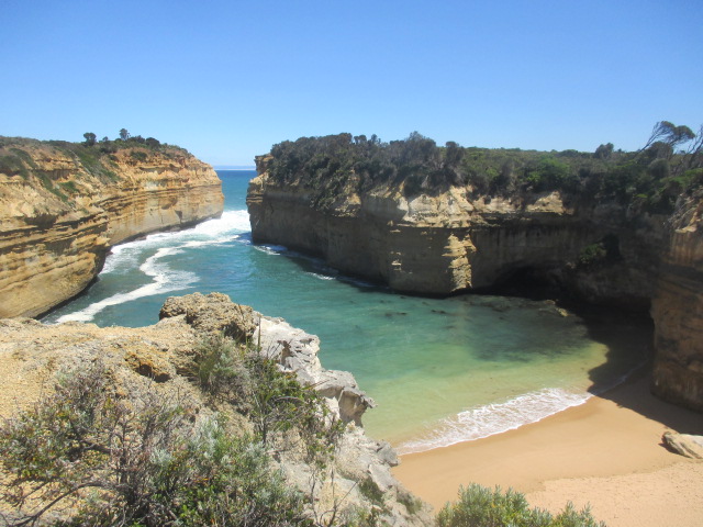
Size: 1,750ha
Location: Great Ocean Road / 250km from Melbourne
Activities: Walking tracks, self guided walk, swimming, fishing, lookout
Facilities: Information, toilets, picnic tables, fireplace, kiosk, boat ramp
World famous for its extraordinary collection of wave-sculpted rock formations and the Twelve Apostles, other highlights include Loch Ard Gorge - site of a 19th century shipwreck 'Loch Ard', as well as the Island Archway and London Bridge. The Island Archway collapsed in 2009, highlighting the fragile and ever-changing nature of Victoria's coastline. Discover the heritage of the Shipwreck Coast on short walks such as the Port Campbell Discovery Walk. For refreshments visit the kiosk at the Twelve Apostles Visitor Centre.
Tower Hill Reserve
Size: 614ha
Location: 15km from Warrnambool / 275km from Melbourne
Activities: Walking tracks, self guided walk, lookout
Facilities: Information, toilets, picnic tables, BBQ
Explore this massive volcanic feature by taking one of the five self-guided walks. Each has a different theme. Enjoy a picnic, spot some wildlife and learn about the Aboriginal heritage of the area at the Worn Gundidj Visitor Centre.
Other parks and reserves in the South West region worth a visit are:
- Ararat Hills Regional Park, near Ararat
- Mount Napier State Park, near Hamilton
- Dergholm State Park, near Edenhope
West & South Gippsland Region
Walhalla Historic Area
Size: 2570ha
Location: 50km from Moe / 184km from Melbourne
Activities: Walking tracks, canoeing, fishing, 4WD, camping
Facilities: Information, toilets, picnic shelter, fireplace
One of Victoria's richest gold-producing areas in the 19th century, Walhalla lives on as a remote and picturesque mountain township with relics of the gold era, such as tramways that now form the walking tracks around the town. Walhalla is also the start of the 650km Australian Alps Walking Track to Canberra.
Wilsons Promontory National Park
Size: 50,460ha
Location: 60km from Leongatha / 200km from Melbourne
Activities: Walking tracks, swimming, boating, canoeing, fishing, camping, caravan camping
Facilities: Information, toilets, picnic shelter, BBQ, kiosk, cabins
The southernmost tip of mainland Australia, 'The Prom', as Wilsons Promontory is affectionately known, is one of Victoria's most-loved places.
The waters surrounding the Prom are protected by Wilsons Promontory Marine National Park and Wilsons Promontory Marine Park. From short walks to day walks, pristine beaches to temperate rainforest, sweeping coastlines to granite mountains, towering sand dunes to lookouts offering spectacular panoramic views, the Prom has it all.
Baw Baw National Park
Size: 13,300ha
Location: 50km from Moe / 180km from Melbourne
Activities: Walking tracks, self-guided walk, canoeing, 4WD, skiing, lookout, camping
Facilities: Information, toilets, picnic tables, fireplace
Spectacular summer wildflower displays and snowy woodlands in winter highlight the changing beauty of Baw Baw National Park. Gnarled Snow Gums and alpine heaths stretch across Baw Baw Plateau, while majestic tall forests grow within the surrounding river valleys. Whether shooting the rapids on the Thompson River or skiing a cross-country trail, at Baw Baw National Park you'll find a wealth of natural experiences. Approach from Erica or Noojee.
Cape Liptrap Coastal Park
Size: 4,225ha
Location: 45km from Leongatha / 180km from Melbourne
Activities: Walking tracks, swimming, fishing, lookout, camping
Facilities: Information, toilets, picnic tables
The cape is a peninsula formed by the Noddle Range running out to sea. Steep cliffs are flanked by rocky platforms, coastal dunes and long beaches. Visit the Cape Liptrap Lighthouse and historic lime kilns at Walkerville.
State Coal Mine Historic Reserve
Location: 3km from Wonthaggi / 130km from Melbourne
Activities: Historic mine tour
Facilities: Information, toilets, picnic shelter, BBQ
Discover what it was like to work in the deep shafts and tunnels of a black coal mine. Explore the museum, lamp room, historic displays and enjoy an audio-visual presentation. A visit to the State Coal Mine at Wonthaggi is a fascinating journey back to the difficult working conditions of mining days past.
Tarra Bulga National Park
Size: 2,015ha
Location: 34km from Traralgon / 190km from Melbourne
Activities: Walking tracks, self guided walk, lookout
Facilities: Information, toilets, picnic shelter, BBQ
Giant Mountain Ash and pockets of cool temperate rainforest are as rewarding as the grand scenic views in this park, which feature waterfalls and a graceful suspension bridge over a fern-filled gully. As you walk along the quiet tracks through the park, you may see or hear a lyrebird. Enjoy a picnic at the Tarra Valley Day visitor area.
Morwell National Park
Size: 410ha
Location: 16km from Morwell / 175km from Melbourne
Activities: Walking tracks, self guided walk
Facilities: Information, picnic tables, fireplace
This small park protects the steep forested north-facing ridges of the Strzelecki Ranges. The creeks, blackwoods and tree ferns create cool, refreshing retreats for bushwalking and picnicking.
In summer, wildflowers are plentiful and the park is a cool retreat from the heat of the lowlands. Enjoy picnics and canoeing at Lake Catani, superb 360 degree views from the summit of the Horn and the delightful Gorge Heritage Walk. Camping is available at Lake Catani during summer. In winter, the park is popular for cross-country skiing and snow play.
Other parks and reserves in the West & South Gippsland region worth a visit are:
- Holey Plains State Park, near Rosedale
- Mount Worth State Park, near Warragul
- Tarago Reservoir Park, near Warragul
- Tyers Regional Park, near Moe
- Moondarra State Park, near Moe
East Gippsland Region
Buchan Caves Reserve
Size: 260ha
Location: 78km from Bairnsdale / 360km from Melbourne
Activities: Walking tracks, self guided walk, swimming, lookout, camping
Facilities: Information, toilets, picnic shelter, fireplace, BBQ, kiosk, cabins
Near the township of Buchan lies a honeycomb of caves full of spectacular limestone formations. Visit an underground world of colour and enchantment, and marvel at Fairy Cave's elaborate stalactites and stalagmites and the calcite-rimmed pools of Royal Cave. Guided tours are conducted daily (except Christmas Day). Above ground, wildlife is abundant. The reserve, landscaped with European and native trees, is popular for camping, with cabins and Wilderness Retreats also available. Walk the Spring Creek Track or swim in the pool fed by a natural spring (cave tour fees apply).
Cape Conran Coastal Park
Size: 11,700ha
Location: 30km from Orbost / 415km from Melbourne
Activities: Walking tracks, self-guided walk, canoeing, swimming, fishing, 4WD, lookout, camping
Facilities: Information, toilets, picnic shelter, fireplace, BBQ, boat ramp, cabins
Dogs: Dogs permitted on lead.
In this delightful coastal park are heathlands, wild ocean beaches and banksia woodlands brimming with nectar-feeding birds. The heathlands burst into bloom each spring, and the temperate, clear waters support a wealth of colourful marine plants and animals. Seals and whales may be seen offshore at times. Cabins, Wilderness Retreats and campsites are available.
Croajingolong National Park
Size: 87, 500ha
Location: 6km from Mallacoota / 500km from Melbourne
Activities: Walking tracks, swimming, boating, canoeing, sailing, fishing, 4WD, lookout, camping
Facilities: Information, toilets, picnic tables, fireplace
Named after the Aboriginal people of the area, Croajingolong follows the far-eastern coastline of Victoria for 100km, and features eucalypt forest, rainforest and heathland protecting many threatened species. Secluded coastal camping areas are a perfect base for beach walks, birdwatching, boating and fishing. Relax in a boat on the Mallacoota Lakes, climb Genoa Peak for panoramic views along the coast or visit the massive sand dunes at Thurra River.
Point Hicks Lightstation, set deep within the park, is an imposing concrete tower completed in 1890. While Gabo Island Lightstation, built of distinctive pink granite, can be reached by air or sea. Both lightstations offer tours and accommodation.
Errinundra National Park
Size: 39,870ha
Location: 90km from Orbost / 463km from Melbourne
Activities: Walking tracks, self guided walk, fishing, lookout, camping
Facilities: Information, toilets, shelter, fireplace
The Errinundra plateau contains ancient eucalypt forests and the state's largest remaining stand of cool temperate rainforest. Generally accessible only in the drier months, the park has a self-guided walk through the heart of the rainforest at Errinundra Saddle.
The Lakes National Park
Size: 2,390ha
Location: 63km from Sale / 300km from Melbourne
Activities: Walking tracks, self guided walk, swimming, boating, canoeing, sailing, fishing, camping, caravan camping
Facilities: Information, toilets, picnic shelter, fireplace
The Lakes National Park is a peaceful bushland retreat in the Gippsland Lakes. Fringed by Lake Victoria and Lake Reeve, it is an excellent spot for camping, walking, swimming and boat-based picnics.
Nyerimilang Heritage Park
Size: 200ha
Location: 10km from Lakes Entrance / 340km from Melbourne
Activities: Walking tracks, self guided walk, lookout
Facilities: Information, toilets, picnic shelter, kiosk
Nyerimilang Homestead is set among semi-formal gardens on a cliff top above the beautiful Gippsland Lakes. Perfect picnic spots are surrounded by gardens. Scenic walks meander along bush and farm tracks, past Kurrajong trees, wetland areas and through the East Gippsland Indigenous Plant Garden.
Snowy River National Park
Size: 114,505ha
Location: 10km from Buchan / 390km from Melbourne
Activities: Walking tracks, self guided walk, swimming, canoeing, fishing, 4WD, horseriding, lookout, camping
Facilities: Information, toilets, picnic tables, fireplace
The Snowy River is renowned for canoeing and rafting, and this remote park is ideal for those who appreciate magnificent forests, rugged gorges and wild landscapes. McKillops Bridge is one of the few places with conventional vehicle access to the Snowy River. The Tulloch Ard Gorge lookout offers spectacular views of Snowy River country and the Tulloch Ard Gorge.
Mitchell River National Park
Size: 14,200ha
Location: 38km from Bairnsdale / 300km from Melbourne
Activities: Walking tracks, canoeing, fishing, 4WD, lookout, camping, caravan camping
Facilities: Information, toilets, picnic shelter, fireplace
The park features a rugged river gorge, stands of temperate rainforests and the Den of Nargun, home of a mythical Aboriginal creature. The river is great for white-water canoeing and rafting.
Gippsland Lakes Coastal Park
Size: 17,584ha
Location: 55km from Sale / 265km from Melbourne
Activities: Walking tracks, swimming, canoeing, sailing, fishing, camping, caravan camping
Facilities: Information, toilets, picnic shelter, fireplace, boat ramp,
The park takes in most of the Ninety Mile Beach between Seaspray and Lakes Entrance, and much of the shoreline of the lakes, where it provides a haven for waterbirds and fish. Camping, walks, picnics, boating and fishing are popular.
Other parks and reserves in the East Gippsland region worth a visit are:
- Alfred National Park, near Cann River
- Lind National Park, near Cann River
- Coopracambra National Park, near Cann River
- Cassilis Historic Area, near Omeo
- Oriental Claims Historic Reserve, near Omeo
- Lake Tyers Forest Park, near Lakes Entrance
Mallee Region
Hattah-Kulkyne National Park
Size: 49,975ha
Location: 35km from Mildura / 490km from Melbourne / 430km from Adelaide
Activities: Walking tracks, self guided walk, swimming, canoeing, fishing, 4WD, lookout, cycling, camping, caravan camping
Facilities: Information, toilets, picnic shelter, fireplace
Just off the Calder Highway, Hattah-Kulkyne features Mallee and woodland country, magnificent River Red Gums and freshwater lakes. Camping, walking, bike riding and canoeing are popular here and in the adjoining Murray-Kulkyne Park.
Murray-Sunset National Park
Size: 664,810ha
Location: 100km from Mildura / 550km from Melbourne / 400km from Adelaide
Activities: Walking tracks, self guided walk, 4WD, lookout, cycling, camping
Facilities: Information, toilets, picnic tables, picnic shelter, fireplace
Explore Victoria's very own outback by four wheel drive, taking a bushwalk, going camping or perhaps all three. The park - now Victoria's largest - includes part of the Murray River floodplain as well as extensive sand dunes further south. It is home to abundant wildlife and beautiful spring wildflowers.
Kings Billabong Wildlife Reserve
Size: 2,195ha
Location: 9km from Mildura / 538km from Melbourne
Activities: Walking tracks, swimming, boating, fishing, camping, caravan camping
Facilities: None
Dogs: Dogs are permitted on-leash
Many of the tracks in this park lead to perfect shady sites along the Murray. It is a great place for camping. Once camp has been set up, the days can be spent canoeing, kayaking, fishing or bushwalking.
Nyah-Vinifera Park
Size: 1,370ha
Location: 25km from Swan Hill / 325km from Melbourne
Activities: Walking tracks, fishing, 4WD, camping
Facilities: None
Dogs: Dogs are permitted on-leash
Nyah-Vinifera Park, near Swan Hill, protects forests along the Murray River and smaller areas of woodland. It is a popular park for camping, fishing, four wheel driving and walking.
Wyperfeld National Park
Size: 358,800ha
Location: 30km north of Rainbow / 450km from Melbourne
Activities: Walking tracks, self guided walk, 4WD, cycling, camping, caravan camping
Facilities: Information, toilets, picnic shelter, fireplace
Wyperfeld is home for many dry-country birds, mammals and reptiles. Stands of stately River Red Gum are inviting for birdwatching and photography, and there are extensive areas of Mallee eucalypts and heathlands on rolling sand dunes. Camping, walking and four wheel driving are popular.
Other parks and reserves in the Mallee region worth a visit are:
- Lake Albacutya Park and Lake Hindmarsh Lake Reserve, near Rainbow
- Green Lake Regional Park, near Sea Lake
- Leaghur State Park, near Kerang
Note: Some photos from Parks Victoria
Web Links
→ The Best Waterfalls in Melbourne and Victoria for Family Visits


")