The Best Waterway Walks in Melbourne

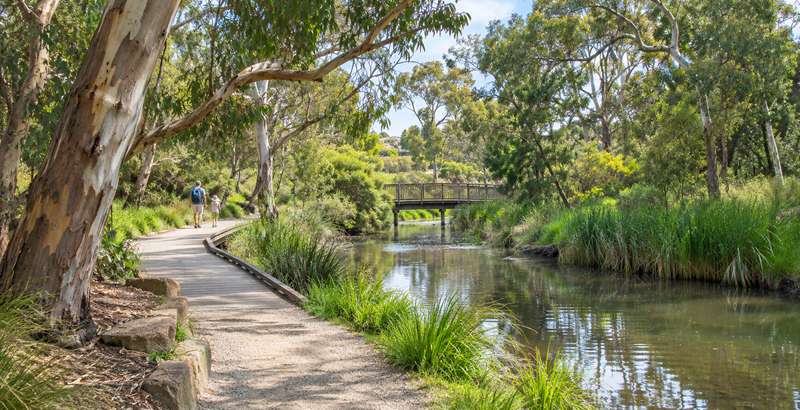
Explore some of Melbourne's loveliest rivers, creeks and wetlands on foot. From short boardwalks through bird-filled wetlands to long shared trails beside winding rivers, these walks offer families a chance to discover nature close to home. Look out for river red gums, waterfalls, footbridges, waterbirds, picnic spots and playgrounds along the way.
The walks below are grouped by waterway and include distance, dog access and facilities to help you choose. Many longer trails can be enjoyed in shorter sections. Distances are approximate; check the linked Melbourne Playgrounds listing for route maps and more information. After heavy rain, creek paths can flood or become muddy, and some routes are shared with cyclists.
Darebin Creek
The Darebin Creek is an important northern tributary of the Yarra River and has its headwaters located near Woodstock to the north of Melbourne. The creek flows predominantly south for approximately 50 kilometres until it meets the Yarra River at Alphington. The lower reach of the creek also runs through a regionally significant section of urban parkland, the Darebin Parklands.
Darebin Creek Trail Walk
Location: Alphington to Bundoora
Distance: 9 km end to end which is public transport-accessible
Dogs: Dogs must be kept on a leash at all times unless in a designated off-leash dog park.
Facilities: Toilets are available at Darebin Parklands near the environment centre at Separation Street. Northland is close to the trail if you need to make a detour for the amenities. At the end of this walk, Summerhill Shopping Centre has public toilets.
A terrific hike along Darebin Creek through Darebin Parklands and urban bush settings. This walk is public transport accessible, starting at Alphington Station and finishing at the 86 tram on Plenty Road, Bundoora.
Darebin Creek Walk from Darebin Parklands to the Yarra River
Location: Alphington
Distance: 5 km return
Dogs: Dogs must be on-leash at all times on the walk. There are dog off-lead areas at Darebin Parklands, Sparks Reserve and Willsmere Park.
Facilities: Toilets and drinking water are available at both ends of this walk.
This walk follows the Darebin Creek Trail from the urban bushland oasis of Darebin Parklands, through a series of reserves before reaching the confluence of the Yarra River.
Darebin Creek and Findons Creek Loop
Location: Epping
Distance: 5 km loop
Dogs: Dogs are permitted on leash.
Facilities: There are no public toilet facilities on this walk.
This walk takes in a picturesque section of Darebin Creek in Epping and then follows Findon Creek to create an interesting and varied loop.
Merri Creek
Merri Creek winds through Melbourne's northern suburbs, linking bushland pockets, community gardens and popular parklands with the Yarra River.
Merri Creek Trail (Clifton Hill - Fawkner)
Location: Clifton Hill to Fawkner
Distance: 21 km one-way; shorter sections can be enjoyed from numerous access points
Dogs: Check local signs for dog restrictions along the shared trail.
Facilities: Playgrounds, park seating and access to public transport at several points along the route.
Follow a changing creek landscape past parks, bushland and community attractions. Highlights include Dights Falls at the Yarra River confluence, CERES, Coburg Lake Reserve and Quarries Park. The trail is shared with cyclists.
Edgars Creek
The walking trail around Edwardes Lake continues beside Edgars Creek through restored wetlands and peaceful parkland.
Edwardes Lake and Edgars Creek Wetlands Walk
Location: Reservoir
Distance: 3.5 km loop
Dogs: Keep dogs on a leash on the walk. Edwardes Lake Park Fenced Dog Park is at the corner of Leamington Street and Seaver Grove.
Facilities: Toilets, tables, BBQs and water tap at Edwardes Lake Park.
This walk takes a circuit around the beautifully kept parklands of Edwardes Lake, then onto Edgars Creek wetlands.
Malcolm Creek
Malcolm Creek Wetlands
Location: Craigieburn
Distance: 5.4 km loop
Dogs: Dogs are allowed on leash.
Facilities: This walk starts at Centennial Park Drive which has accessible toilets, drinking water and a small playground.
Malcolm Creek and its linear parklands provide a wonderful green corridor through Craigieburn. Highlights of this walk include ancient River Redgums, boardwalks, tranquil scenery and a tribute and marker for the Stolen Generations.
Malcolm Creek Golden Sun Moth
Location: Craigieburn
Distance: 1.7 km
Dogs: Dogs are allowed on-leash.
Facilities: At the Golden Sun Moth playground there are toilets, tables, BBQs and water tap.
Golden Sun Moth Walk has two playgrounds, Malcolm Creek wetlands and important habitat for the threatened moth species.
Jacksons Creek
The Nook Jacksons Creek
Location: Sunbury
Distance: 3 km return
Dogs: The Nook has a dog off-leash area but some of the walk is a dog on-leash area.
Facilities: Accessible public toilets, BBQs and a water tap are located at the start of the walk.
Jacksons Creek waterhole, also known as the Nook, is a very picturesque spot located on a bend in Jacksons Creek. The surrounding parkland and walking paths are great to explore.
Organ Pipes National Park
Location: Keilor North
Distance: Total of 3.2 km combining multiple short walks
Dogs: Dogs and other pets are not permitted.
Facilities: Picnic tables and toilets are provided. Water is only available at the Visitor Centre area
A short walk along Jacksons Creek in a small national park named after the volcanic rock formations that resemble organ pipes. The creek is a lovely shady place to walk and explore.
Moonee Ponds Creek
Woodlands Historic Park and Moonee Ponds Creek
Location: Greenvale
Distance: 3.8 km loop walk
Dogs: Dogs are allowed but must be on leash at all times to protect the wildlife.
Facilities: Toilets and drinking water at Somerton Road Picnic Area.
Stretch your legs in bushland at Woodlands Historic Park. This walk has kangaroos, abundant birdlife and ancient River Red Gums along the upper reaches of Moonee Ponds Creek.
Moonee Ponds Creek Walking Trail
Location: Strathmore Heights - Strathmore
Distance: 3.5 km one-way. It is possible to return on public transport.
Dogs: Dogs are permitted on leash.
Facilities: There is a playground, water tap, BBQs, tables and toilets in Boeing Reserve and a playground at Lebanon Reserve.
A walk along a lovely, semi-natural section of the Moonee Ponds Creek Trail winding through undulating landscapes and varied native vegetation.
Westbreen Creek
Westbreen Creek Loop
Location: Pascoe Vale
Distance: 2.2 km loop
Dogs: Keep dogs on a leash during the walk. Dogs can enjoy an off-leash run in the K W Joyce Reserve Dog Off Leash Area
Facilities: Accessible public toilets are located at the start of the walk. Barbeques, seating and drinking water are available close to the wetlands.
Pascoe Vale has a lovely slice of bushland along the Westbreen Creek corridor. It's a great place for a tranquil walk in nature.
Taylors Creek
Taylors Creek Lakeside Loop
Location: Taylors Lakes
Distance: 3.4 km loop
Dogs: Dogs are permitted on leash
Facilities: playground, outdoor gym, Ninja course, tables, toilets, BBQs and water tap.
This is a great circuit around the scenic lakes and wetlands of Taylors Creek. Popular with families, joggers and people enjoying picnics and time outdoors.
Maribyrnong River
Maribyrnong River Loop (Aberfeldie)
Location: Moonee Ponds, Aberfeldie and Maribyrnong
Distance: 4.1 km loop
Dogs: Dogs on-leash with two parks for dogs to run free at Chifley Drive Reserve Dog Off Leash Area and/or Aberfeldie Park Dog Off Leash Area.
Facilities: Toilets, water taps and seating.
A popular 4 km circuit around the Maribyrnong River which passes through a number of parks with playgrounds.
Pipemakers Park and Maribyrnong River Loop
Location: Maribyrnong
Distance: 4.1 km loop
Dogs: Dogs permitted on-leash
Facilities: playground, toilets, tables and water tap located at Pipemakers Park.
An easy walk which takes you along the Maribyrnong river, around a small lake and new wetlands, finishing among the wonderful gardens of Pipemakers Park.
Kororoit Creek
Kororoit Creek Trail
Location: Albion to Sunshine West
Distance: 5 km one-way, 10 km return
Dogs: Dogs are permitted on leash.
Facilities: Selwyn Park has a good playground, Ninja Warrior Course, outdoor gym, shelter with table, BBQs, unshaded tables and seats and water tap and Buckingham Reserve has a playground, toilets and drinking water.
A walk along Kororoit Creek which has highlights including extensive revegetation of local flora, basalt outcrops and boulders, and birdlife.
Laverton Creek
Truganina Park Trail and Laverton Creek Spit
Location: Altona
Distance: 4 km loop
Dogs: Dogs are permitted on-leash. There is an off-leash area for dogs at Doug Grant Reserve.
Facilities: Drinking water is available at Apex Park and the 100 Steps to Federation carpark. Public toilets can be found at Apex Park or at Andrew Park Drive, opposite the sports centre.
Truganina Park is a bird watcher's paradise and a great place to walk through coastal parkland. This trail starts and finishes at the Altona Foreshore, crosses Laverton Creek and loops around Truganina Park.
Truganina Park Altona Skipper Butterfly Loop
Location: Altona Meadows
Distance: 2.3 km loop
Dogs: Dogs are permitted on leash.
Facilities: Drinking water is available at the starting point of the walk. Public toilets are located near the sports centre at Andrew Park Drive.
Walk up the "100 Steps to Federation" hill for the best views in the west. On a clear day, you can see the CBD, ships on Port Phillip Bay, Cheetham Wetlands and the You Yangs in the distance. This circuit walk on the Truganina Park Trail takes in habitats for endangered species including the Swift Parrot and Altona Skipper Butterfly.
Lollypop Creek
Lollypop Creek Trail
Location: Wyndham Vale
Distance: 4.4 km loop
Dogs: Dogs are permitted on leash.
Facilities: Toilets are available at Wyndham Vale Reserve
A series of elevated boardwalks open this walk allowing you to get up close to the rehabilitated wetlands. The Lollypop Creek Trail leads to the spectacular and serene Tucker's Waterhole.
Skeleton Creek
Skeleton Creek Grasslands to Wetlands
Location: Altona Meadows
Distance: 7 km loop
Dogs: Dogs are permitted on leash.
Facilities: There are no public toilets on this walk. Drinking water is available north of the Lan Ave pedestrian bridge.
A lovely loop walk on the Skeleton Creek Trail from Emu-Foot Grassland, a reserve of significant local flora, to Cheetham Wetlands, a haven for shore birds and water birds.
Skeleton Creek Waterholes Walk
Location: Truganina and Tarneit
Distance: 5 km loop
Dogs: Dogs are permitted on leash.
Facilities: Toilets are available at Mahbeers Talliver Park.
A varied and interesting wander along Skeleton Waterholes Creek and Tarneit Creek. With wide-open space and wetland habitats, this walk is excellent for connecting to nature in Melbourne's west.
Creeks and Wetlands Walk between Altona Meadows and Williamstown
Location: Altona Meadows - Williamstown
Distance: 21.6 km
Dogs: Dogs must be on-leash on all sections of this walk except designated off-leash areas.
Facilities: The walk is public transport accessible. There are no amenities (public toilets, water and cafes) in the first half but plenty in the second half of the walk between Altona and Williamstown. Drinking water is available at Bruce Comben Reserve, Truganina Park and several places along the beach esplanades from Altona onwards.
An extended walk taking in creeks and wetlands that feed into Port Phillip Bay. This walk links Skeleton Creek to Bay Trail West, past Laverton, Cherry and Kororoit Creeks to Williamstown Beach.
Werribee River
Riverbend Historical Park to Davis Creek
Location: Tarneit
Distance: 3 km one way
Dogs: Dogs are permitted on leash.
Facilities: None
Wander along Werribee River to the wetlands and billabongs of Davis Creek. River redgums, birdlife and croaking frogs make this a wonderful walk to connect to nature.
Wyndham Park Loop
Location: Werribee
Distance: 2.6 km loop
Dogs: Dogs are permitted on leash.
Facilities: None
Explore Wyndham Park and the Werribee River in the heart of Werribee's CBD. Platypus have been sighted in all sections of the Werribee River, including this section of the river, right in town. Wyndham Park has a fantastic playground and is a destination in its own right.
Werribee to Riverbend Park Loop
Location: Werribee
Distance: 8.2 km loop
Dogs: Dogs are permitted on leash.
Facilities: None
A fantastic loop along the Werribee River that feels more like the countryside than the urban fringes. Highlights include ancient River Redgums, tranquil river scenery, market gardens and historical markers.
Werribee River Urban Walk
Location: Werribee
Distance: 8.5 km one-way
Dogs: Dogs are permitted on leash.
Facilities: None
Stretch your legs along 8.5 km of continuous riverside pathways in central Werribee.
Werribee River Park
Location: Cocoroc
Distance: 6 km
Dogs: No dogs allowed. The area is important for the conservation of ground-nesting and endangered bird species.
Facilities: There are no toilets or drinking water available within Werribee River Park.
A great wander around Werribee River Park taking in escarpment views, the historic bluestone ford and peaceful red gum bushland.
K Road Cliffs
Location: Werribee South
Distance: 0.6 km
Dogs: Dogs are permitted on leash.
Facilities: Towards the west section of the car park, there are tables and seats.
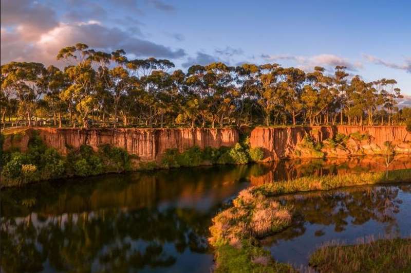
A short but spectacular walk to view the dramatic red cliffs over the Werribee River. A haven for waterbirds and photographers.
Wyndham Bay Trail to Werribee South Foreshore
Location: Werribee South
Distance: 5 km return
Dogs: Dogs are permitted on leash.
Facilities: At the Werribee South beach there is a playground, fishing jetty, BBQs and toilets plus the nearby Price Reserve has a playground and skate park. At Wyndham Harbour there are toilets, small playground and mini golf at The Elements Coastal Activity Park.
Take a seaside stroll along the less-explored coastline of Port Phillip Bay. The Wyndham Bay Trail stretches from the new Wyndham Harbour to the Werribee South Foreshore where the Werribee River meets the bay.
Yarra River
Yarra River Walk (Warburton)
Location: Warburton
Distance: 6 km circuit walk
Dogs: Dogs are permitted on leash.
Facilities: Lots of facilities including toilets and water tap. The route is very close to a range of coffee shops and cafes on the southern side of the river.
The walk loops on both sides of the Yarra River within the town limits of Warburton.

Banksia Park (Bulleen)
Location: Bulleen
Distance: Approximately 3 km of trails within the park
Dogs: Dogs must be on leash throughout the park. There is an area set aside for owners to let their dogs run off-leash in the Cherry Blossom Loop.
Facilities: Playground, picnic facilities and toilets.
An open space set beside the river with facilities for visitors. The park is located next to the Heide Museum of Modern Art which has a sculpture garden.
Birrarrung Park (Templestowe Lower)
Location: Templestowe Lower
Distance: There is an asphalt walking track above the banks of the Yarra River which is far below and 2.8 km of flat sealed trails.
Dogs: Dogs are permitted on leash.
Facilities: Playground, picnic facilities and toilets.
The 33 hectare park is situated at the confluence of the Plenty and Yarra Rivers. This area of parkland is primarily classified as 'Riparian Floodplain Woodland' that features River Red Gum and wetlands.
Finns Reserve to Westerfolds Park Walk (Templestowe Lower)
Location: Templestowe Lower
Distance: 5.6 km return walk
Dogs: Dogs are permitted on the walk on-leash. There is a large dog off leash area at Finns Reserve. The walk is very popular with dog owners on weekends.
Facilities: There is a playground and picnic facilities at the start of the walk.
The path meanders along undulating hillsides offering vistas across the Yarra River. There is a good chance of seeing lots of kangaroos.

Candlebark Park (Templestowe)
Location: Templestowe
Distance: Candlebark Park forms a 1.6 km extension of the Main Yarra Trail from Westerfolds Park to the western boundary of Pettys Orchard.
Dogs: Dogs permitted on Main Yarra Trail only. Dogs to be on leads at all times.
Facilities: None in Candlebark Park. Toilets and picnic facilities are available in Westerfolds Park, 100m west of the Fitzsimmons Lane Bridge along the Main Yarra Trail.
Candlebark Park is an important environmental link between Warrandyte and the Lower Yarra region.
Warrandyte State Park (Warrandyte)
Location: Warrandyte
Distance: Various walks ranging from 2-3.5 km including Pound Bend River walk, Jumping Creek nature walk, Mt Lofty to Wittons walk and the Gold Heritage walk.
Dogs: Dogs are not permitted within most of Warrandyte State Park, however there are three areas set aside to allow dogs on-lead. These areas include Norman Reserve, Taroona Reserve and Koornong Reserve.
Facilities: There are a number of picnic places throughout the park with toilets.
The lightly wooded landscape is dominated by the Yarra River as it winds through the Warrandyte Gorge. Several relics of the gold mine boom remain amongst old mines. During summer there is swimming at Pound Bend.

Yarra Bend Park and Dights Falls Walk (Kew)
Location: Kew and Abbotsford
Distance: 5.1 km walk
Dogs: Check signs for dog restrictions within Yarra Bend Park.
Facilities: Park seating and picnic areas; consult the individual MP walk listing for access and facilities.
Explore riverside bushland, historic features, Dights Falls and the junction of Merri Creek with the Yarra River.
Yarra Bend Park Loop Walk (Kew)
Location: Kew
Distance: 10.4 km loop
Dogs: Check park signs for dog restrictions.
Facilities: Rest points and picnic opportunities around Yarra Bend Park.
A longer outing through Yarra Bend Park with river views, Dights Falls, Kane's Bridge, Deep Rock and the flying-fox viewing area.
Little Yarra River
Little Yarra Riverside Walk
Location: Yarra Junction
Distance: 1 km
Dogs: Dogs are permitted on leash.
Facilities: Playground with picnic facilities including toilets and water tap.
A nice, easy walk along the Little Yarra River in Yarra Junction.
Plenty River
Plenty River Trail Walk (Greensborough)
Location: Greensborough
Distance: Approximately 2.5 km circuit
Dogs: Dogs permitted on leash.
Facilities: Toilets at Whatmough Park and nearby tennis club, plus a playground and picnic opportunities.
A surprisingly leafy river circuit close to Greensborough's shops. The route passes Whatmough Park and Carter Reserve and includes a suspension bridge, birdlife and a few short, steep grades.
Plenty River Trail (Lower Plenty)
Location: Lower Plenty to Viewbank
Distance: Approximately 3.1 km one-way for the southern section
Dogs: Dog restrictions vary by section; check local signs.
Facilities: Access to parks and recreation grounds along the trail, with some water taps.
Walk through bushland along the Plenty River before continuing through open parkland to connect with the Main Yarra Trail. Some sections are unsealed, and much of the later route is away from the water.
Diamond Creek
The creekside route through Eltham and Diamond Creek offers plenty of playground stops as well as opportunities for longer family walks.
Diamond Creek Trail (Eltham - Diamond Creek)
Location: Eltham to Diamond Creek
Distance: Approximately 11 km one-way
Dogs: Check local signs for dog restrictions.
Facilities: Playgrounds and nearby facilities at Eltham Lower Park, Alistair Knox Park, Eltham North Reserve and Diamond Creek Regional Playspace.
This mostly flat, paved shared trail follows the creek and railway through parklands and leafy suburban scenery. It is a good choice for families who want to combine a walk with playground stops, although some road crossings need care.
Mullum Mullum Creek
Follow a leafy creek through the eastern suburbs, with interpretive signs, wildlife habitat and remnants of the area's orchard history.
Mullum Mullum Creek Trail Walk (Ringwood - Croydon)
Location: Ringwood to Croydon
Distance: 5.8 km one-way
Dogs: Check local signs for dog restrictions.
Facilities: Toilets near Peter Vergers Reserve and Ringwood Lake, with playgrounds in reserves along the trail.
A creekside walk through bushland and former orchard country. Interpretive signs, bridges, native plantings and traces of local history make this an interesting walk for older children.
Gardiners Creek
Gardiners Creek Reserve (Ashwood - Burwood)
Location: Ashwood - Burwood
Distance: 2 km linear park stretching between Highbury Road and Station Street.
Dogs: Dogs are permitted on leash with some off-leash areas.
Facilities: Playground and picnic facilities.
Extensive walking trails that meander over bridges, around billabongs and alongside the creek itself. The reserve has wetlands and good bird-watching opportunities.
Dandenong Creek
One of Melbourne's longest green corridors, Dandenong Creek has accessible shorter sections as well as more energetic walks through bushland.
Dandenong Creek Trail - Heathmont to Boronia
Location: Heathmont to Boronia
Distance: 8 km one-way; shorter sections are possible
Dogs: Check local signs; keep dogs under control around wildlife and shared-path users.
Facilities: Toilets, playgrounds and picnic areas at HE Parker Reserve, Bayswater Park and Glen Park.
A leafy walk along Dandenong Creek through a series of bushland reserves. The trail passes creek crossings and local parks, with some gravel sections and a steeper alternative around The Bluff.
Dandenong Creek Trail - Wellington Road to Tirhatuan Park
Location: Mulgrave to Dandenong North
Distance: Approximately 4 km one-way
Dogs: Check local signs for dog restrictions.
Facilities: Playground and open parkland at Tirhatuan Park, with other small playgrounds along the route.
Follow Dandenong Creek beneath EastLink and into Tirhatuan Park. The walk combines creekside bushland with shared paths, a small lake, birdlife and play opportunities.
Kananook Creek
Parallel to the beach, this quiet coastal creek offers an alternative to a foreshore walk, with wetlands, boardwalks and native vegetation nearby.
Kananook Creek Walking Trail (Frankston)
Location: Frankston to Seaford and Carrum
Distance: Approximately 7.5 km one-way, with many shorter options
Dogs: Dog regulations apply; check the signs in each reserve.
Facilities: Seating and picnic areas along the creek; toilets near Frankston Foreshore.
Follow a peaceful waterway through coastal vegetation and urban parkland just behind the beach. Numerous access points allow families to explore shorter sections or combine the creek trail with the Seaford Foreshore Trail.
Coastal Wetlands and River Estuaries
For expansive views, birdwatching and saltmarsh landscapes, head to the wetlands where Melbourne's waterways meet the bay.
Cheetham Wetlands Tower Walk
Location: Point Cook
Distance: 3 km return
Dogs: Dogs are not permitted.
Facilities: There is drinking water at the observation tower but no public toilets.
Explore the wetlands and salt marshes from the boardwalks and observation tower at Cheetham Wetlands in Point Cook. This expansive park is important for migratory shorebirds that visit Port Phillip Bay from the northern hemisphere.

Seaford Wetlands Circuit Walk
Location: Seaford
Distance: 6.74 km circuit
Dogs: Check local signs, particularly near sensitive bird habitat.
Facilities: Seating, picnic tables and viewing platforms; mainly concrete shared paths with a short unpaved section.
A largely flat loop around extensive wetlands, reed beds and bird habitat. Look for the Gananyu Bulukul viewing platform and enjoy views across the marshes. The unpaved section beside Kananook Creek may be unsuitable for some prams and wheelchairs.


