Yarra Bend Park Loop Walk (Kew)


A moderate 10.4 km circuit through Yarra Bend Park, with river views, native bushland and several of the park's best-known landmarks. Allow about 2 to 2.5 hours. The route includes Dights Falls, Studley Park Boathouse, Kane's Bridge and the grey-headed flying-fox viewing area.
Route Description:
Start and finish at the Studley Park Boathouse car park. Follow the mapped circuit along the Yarra River and the park's connecting walking tracks. Landmarks along the route include the flying-fox viewing area, Fairfield Park Boathouse, the Pipe Bridge, Merri Creek, Deep Rock, Dights Falls and Kane's Bridge. Tracks include sealed shared paths and unsealed sections, with some uneven ground and climbs. Follow the linked map for the route through the park.
Yarra Bend Park Loop Walk Map
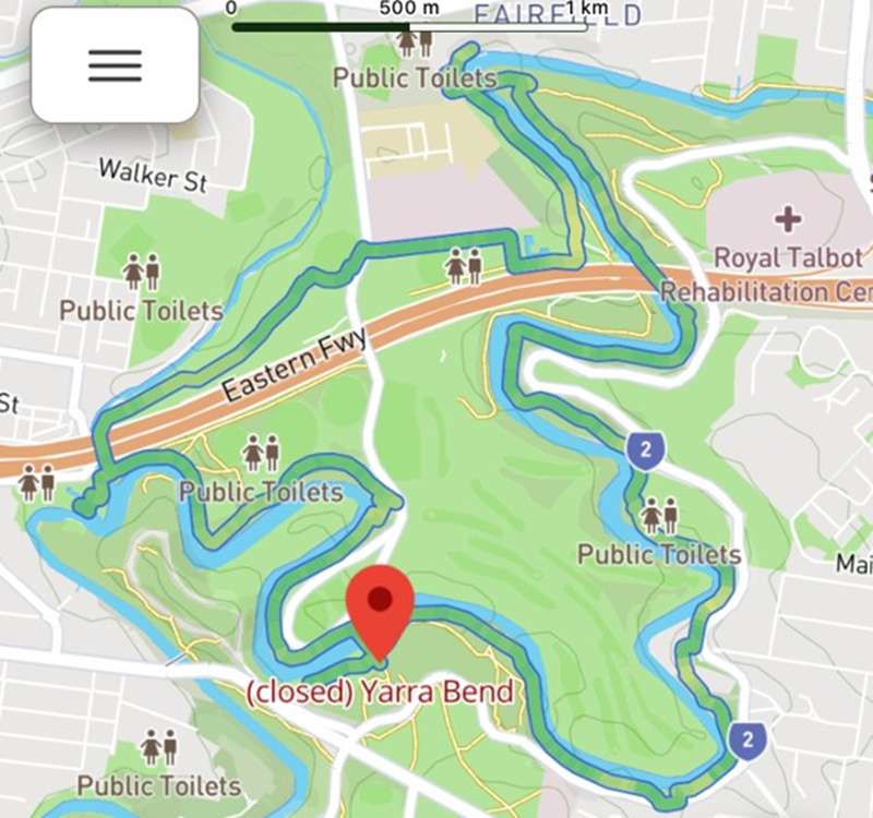
Map from Trail Navigator
Note: Kanes Bridge is now open after repairs.
Access for Dogs:
Dogs are permitted in most areas of the park. Leash rules and dog-exclusion areas apply. Check the Parks Victoria dog-walking fact sheet and follow signs.
How to Get There:
The walk starts at the Studley Park Boathouse car park, off Studley Park Road in Kew. Parking is available near the boathouse and picnic area.
Location
1 Boathouse Road, Kew 3101 View Map
Web Links
→ www.parks.vic.gov.au/places-to-see/parks/yarra-bend-park
→ Yarra Bend Park visitor guide and map (PDF)


