Eastern Sherbrooke Forest Walk (Sherbrooke)

This walk is 7.1 km, 2 hour loop and is graded moderate to difficult. This is a round trip starting and finishing at Grants Picnic Ground. The route follows Lyrebird Walk, then Neumann Road, passing though cleared areas of bush created by the successive wildfires of the early 1900's.
At Paddy Track Junction turn south and cross Hardy Creek before climbing Welch Track and following Coles Ridge Road back to the picnic ground.
Most of the walk is through Mountain Ash and Messmate Stringybark forest. There are steep sections on Paddy Road and Welch Track which may be slippery when wet.
Sherbrooke Forest Grants Picnic Ground Loop Walks Map
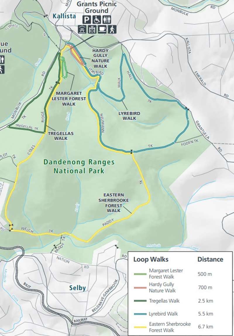
At Grants Picnic Ground there are toilets, many picnic tables and BBQs, large shelter with four tables and water tap. There is also a cafe on site.
Access for Dogs:
Dogs are not permitted at Grants Picnic Ground or on the walks.
Location
12 Coles Ridge Track, Sherbrooke 3789 View Map
Web Links
→ Dandenong Ranges National Park (Sherbrooke Area) Loop Walk Map
→ www.parks.vic.gov.au/places-to-see/sites/grants-picnic-ground


")