Alpine Area Lookouts


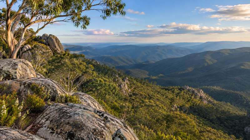
Victoria's High Country has some of the state's most spectacular mountain scenery, with deep green valleys, alpine peaks, granite cliffs and waterfalls. Around Bright, Mount Buffalo, Mount Beauty, Mount Hotham and Falls Creek, there are lookouts for almost everyone - from roadside stops requiring little walking to rewarding bushwalks that climb to panoramic viewpoints.
Some lookouts are easily reached by car, while others involve steep tracks, unsealed roads or alpine conditions. Use the guide below to choose a viewpoint that suits your family, fitness and vehicle.
Lookouts Accessible by Car
The Gorge Lookout (Mount Buffalo)
The Gorge Day Visitor Area, Mount Buffalo National Park - vehicle access and short walksOne of the most impressive and family-friendly viewpoints in Mount Buffalo National Park, The Gorge looks out from high granite cliffs over the surrounding mountains and valleys. Several lookouts can be explored near the historic Mount Buffalo Chalet, including an accessible viewing area. There are picnic facilities and toilets, making this an excellent place for a longer stop. The nearby Gorge Heritage Walk visits additional lookouts. In winter, the Gorge Day Visitor Area carpark closes and visitors park near the chalet.
Danny's Lookout (Mount Hotham)
Great Alpine Road, Mount Hotham - roadside lookoutOne of the highlights of the drive across Mount Hotham, Danny's Lookout offers sweeping views across the rugged Australian Alps. Stop at the designated roadside lookout to admire the distant mountains, including the Mount Feathertop area. Weather can change quickly at this elevation, so take extra care when driving through snow, fog or icy conditions.
Sullivans Lookout (Mount Beauty)
Tawonga Gap Road, between Mount Beauty and Bright - roadside lookoutSullivans Lookout offers one of the finest views of Mount Bogong, Victoria's highest mountain, with Mount Beauty township and the Kiewa Valley below. It is a convenient stop on the sealed Tawonga Gap Road and a particularly rewarding place to photograph the mountain scenery.
Tawonga Gap Lookout (Tawonga Gap)
Tawonga Gap Road, between Bright and Mount Beauty - roadside lookoutNear the top of the gap, this lookout has expansive views across the Kiewa Valley towards Mount Emu and Mount Bogong. A viewing platform and picnic tables make it a convenient place to break the drive. It is close enough to Sullivans Lookout to visit both on the same trip.
Mount Bogong Lookout (Tawonga)
Kiewa Valley Highway, between Tawonga and Tawonga South - roadside lookoutThis easily reached lookout has views along Mountain Creek and across the Kiewa Valley to the summit of Mount Bogong. It is a good option for families who want mountain scenery without taking on a steep walking track. There are seats and information signs about the region.
Lookouts Reached by Walking Tracks
Huggins Lookout Walking Track (Bright)
Corner of Deacon Avenue and Zivan Court, Bright - approximately 1.6 km return, Grade 3A short but steep climb through native bushland leads to a lookout overlooking Bright, the Ovens Valley and the surrounding ranges. Allow approximately one hour for the return walk. The track is signposted but has steep sections and occasional steps, so it is better suited to families comfortable with uphill walking.
Reform Hill Walking Track (Myrtleford)
Jones Park, Great Alpine Road, Myrtleford - approximately 3.5-3.7 km loop, Grade 3Reform Hill combines Ovens Valley views with Myrtleford's gold-mining history. The walking tracks pass old mine features, historic markers, native forest and mosaics before reaching the lookout, where views extend towards Mount Buffalo and the Victorian Alps. The loop includes steep sections. There is also vehicle access to within a short walk of the lookout, although road suitability should be checked locally.
Apex Lookout Walk (Bright)
Apex Lookout Track, off Mount Porepunkah Road, Bright - 3 km return, Grade 3This bushland track climbs to vantage points above Bright, with views towards the surrounding alpine ranges. The walk takes approximately 1.5 hours return and includes steep sections, steps and obstacles. It is a good choice for families who enjoy a more energetic bushwalk.
The Horn Walk (Mount Buffalo)
The Horn Picnic Area, Mount Buffalo National Park - approximately 1.5 km return, Grade 3For one of the grandest panoramas in the Victorian Alps, follow the steep rocky track from The Horn Picnic Area to Mount Buffalo's highest point, 1,723 metres above sea level. The summit lookout has views in all directions across the plateau and mountain ranges. The track involves steps and exposed rocky sections and is above the snowline. The access road is seasonally closed to vehicles during the snow season.
View Point Walk (Mount Buffalo)
Mount Buffalo National Park - 4 km return, approximately 2 hoursWalk through alpine ash forest and among granite boulders to a rocky viewpoint on the edge of the Mount Buffalo plateau. There are excellent views into the Buckland Valley. This is a more demanding option than visiting the nearby Gorge lookouts, with a steep track and steps.
Ropers Lookout (Falls Creek)
Eastern end of Rocky Valley Dam wall, Falls Creek - approximately 5 km returnThe walk follows an aqueduct before climbing through snow gums to a rocky lookout with views across Rocky Valley Lake, Falls Creek and the surrounding high country. Allow time for the uphill sections and be prepared for exposed alpine weather.
Fainter Falls Lookouts (Bogong)
Bogong High Plains Road, near Bogong Village - approximately 2 km returnFor a different kind of alpine view, follow a well-formed walking track alongside Fainter Creek to a series of lookouts overlooking the cascades. The last viewpoint involves some stairs. This is an appealing option for families interested in waterfalls and forest scenery as well as mountain panoramas.
High Lookouts Requiring 4WD Access
Big Hill Lookout (Mount Beauty)
Big Hill, near Mount Beauty - 4WD access recommendedAt approximately 1,067 metres, Big Hill has wide views of Mount Beauty, the Kiewa Valley, Mount Bogong and nearby peaks. Access is via unsealed tracks from the Bogong High Plains Road, and local tourism authorities recommend a 4WD. This is not a standard roadside stop for all vehicles.
Mount McKay (Falls Creek)
Near Falls Creek, Alpine National Park - gravel road, 4WD access recommendedMount McKay rises to approximately 1,842 metres and is described as Australia's highest drivable summit. A gravel road from Falls Creek leads towards extensive alpine panoramas. The route is recommended for 4WD vehicles, and access can be affected by snow and seasonal road conditions.
Tips for Visiting Alpine Lookouts
- Check road and park conditions: Snow, ice, fire management operations and other closures can affect alpine roads and tracks, even outside winter.
- Dress for changing weather: Mountain temperatures and wind can be very different from conditions in the valleys.
- Choose the right walk: Grade 3 tracks may include steep hills, steps, rough surfaces and exposed viewpoints. Keep children close to cliff edges and viewing platforms.
- Allow extra driving time: Winding mountain roads can be slow, particularly in poor visibility.
- Use designated parking areas: Pull over only where it is safe and permitted.
- Stay on marked tracks: Protect fragile alpine vegetation and observe any park signs and restrictions.


