Mornington Peninsula Bay Trail (Safety Beach to Portsea)

The 30km Mornington Peninsula Bay Trail is one of the most scenic shared trails on the Peninsula, winding along the foreshore, taking you in and out of the townships, stretching from Safety Beach to Portsea. Follow the Bay Trail signs and markers and visit some of the popular foreshore reserves, piers, camping areas and shops.
This shared pathway offer walkers and cyclists great views as it winds its way along the foreshore reserve and is flanked by the beautiful sandy bay beaches and clear waters of Port Phillip.
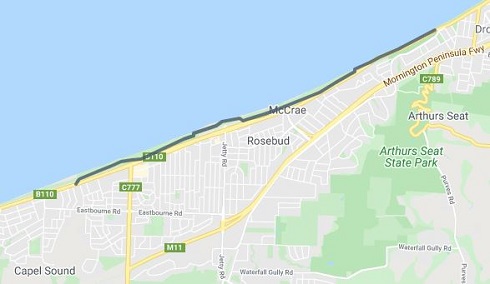
The township of Dromana was proclaimed in 1861 and was well established as a seaside resort by 1881. It's not hard to imagine the pier busy with steamships taking holiday makers and produce to and from Melbourne. The gravelled wide pathway offers an easy walk along the Dromana coast to the rocky cutting of Anthonys Nose - where Arthurs Seat falls steeply into the sea. The path continues through the boat ramp car park and then through the campsites and foreshore reserve through McCrae and past the tallest lighthouse in Port Phillip. It continues to wind through the tall banksia and tea tree with campsites on one side and the beach on the other to the pier at Rosebud (named after a shipwreck!)
On through the foreshore of Capel Sound with more campsites to the town of Rye where, at the base of the aptly named Whitecliffs, is an historic lime kiln that tells the story of how local limestone was mined and turned into lime to help create many of the buildings in Melbourne. Through the Moonah trees and back to the foreshore of Blairgowrie, past the picturesque yacht club marina to Sullivan Bay and the Collins First Settlement site. It was here in 1803 the first official European settlement of Victoria was established. From here it's on to Sorrento and up the hill behind the pier where the tram tracks built in 1889 for the Sorrento Tramway Company can still be seen. On through the Sorrento Park with its incredible playground and diverging a bit to take in part of the Sorrento Portsea Artists Trail known as Millionaires Walk between Lentell Avenue and Point King Road. Finish up and refresh at a favourite 'watering hole' in Portsea village.
Note: The original route was between Anthony's Nose in Dromana and Sorrento. The route is now extended by the section from Safety Beach to Anthony's Nose in Dromana and continuing to Portsea at the other end.
The Bay Trail stretches for over 26km. Some notes about the trail are:
- The path is suitable for beginners.
- Visitors may wish to enjoy sections of this trail on different visits.
- You can also ride the Bay Trail on-road which follows the Esplanade.
- The trail surface varies from asphalt, crushed rock and dirt.
- This trail is suitable for most pathway users, as there are many sealed sections.
- Drinking water is not available at all stops, please carry it with you.
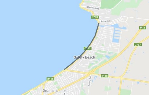
Safety Beach section: (3 km)
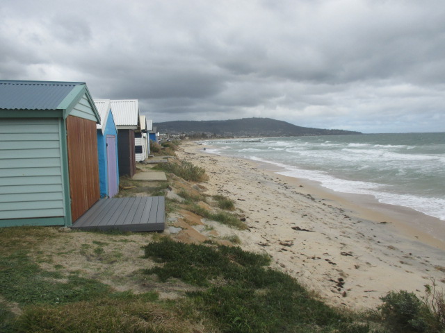
This is a picturesque section of the Bay Trail along Safety Beach. Start at the Martha Cove Underpass and head south past the Safety Beach Sailing Club. Go along the gravelled track past the Safety Beach Jetty, a memorial to William Buckley (opposite the shops), and on towards Dromana. This section also includes some of of the Peninsula's famous colourful bathing boxes.
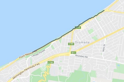
Dromana section: (3 km)
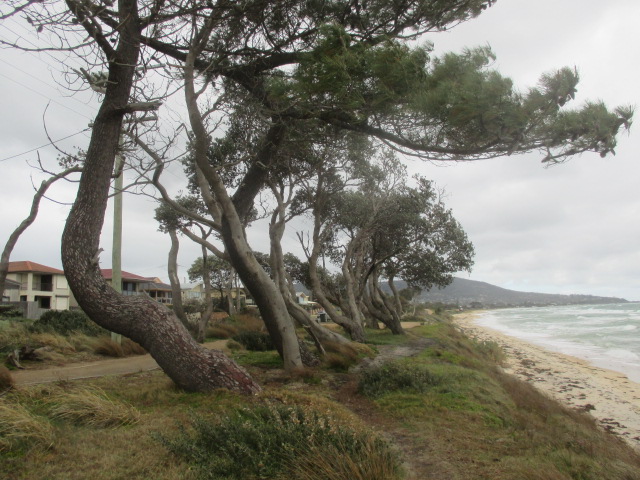
Starting at the corner of Marine Drive and Point Nepean Road, a gravel pathway weaves in between the trees on the Dromana Foreshore and takes you from the Safety Beach end of Dromana, to the McCrae end at the other. The Dromana Pier and the Dromana Lifesaving Club are prominent points situated about half way along this trail and the playground and reserve at the Dromana Pier offers riders and walkers a place to relax and grab some lunch, with many shops and restaurants directly across the road. The path continues through the camping sites of the foreshore reserve past the Visitor Information Centre towards McCrae. This section also includes some of of the Peninsula's famous colourful bathing boxes.
Rosebud and McCrae section: (7 km)
This section starts near the intersection of Point Nepean Road and La Trobe Parade, on the southern end of the Dromana foreshore. At the end of the camping area, the path goes though the boat ramp parking, and around the 'Anthony's Nose' headland which is a popular fishing location. The path winds through the camping sites of the foreshore before heading past the village of McCrae with its lighthouse and the McCrae Yacht Squadron. Through more campsites under the mature Coastal Banksia trees and along onto the gravelled paths of the foreshore camping areas of Rosebud. Past the Rosebud Pier with its wonderful kids playground opposite Jetty Road and passing through the sheltered Rosebud Foreshore with beautiful shell-covered stretches of beach. Opposite are many shops and cafes of Rosebud. This section finishes at Chinamans Creek, Capel Sound.
Capel Sound section: (4 km)
Capel Sound Foreshore Reserve is located along a 3.75km stretch of foreshore at Capel Sound (formerly Rosebud West). Generally the path surface is made of asphalt. This section of the Bay Trail takes you from Chinamans Creek through the Capel Sound camping grounds to the Rye foreshore opposite Marshall Street. You can stop at a cafe or do a spot of shopping at the village shopping strip close to Chinamans Creek, or at Rye. This section also includes some of of the Peninsula's famous colourful bathing boxes.
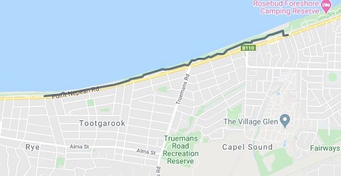
Rye section: (2 km)
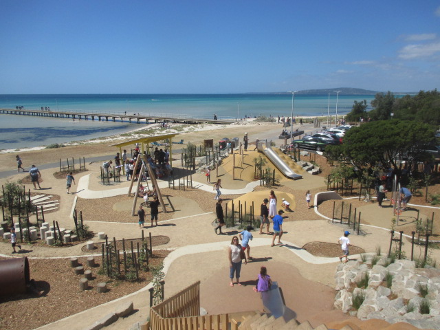
Starting at the beginning of the Rye Foreshore camping area opposite Marshall Street, passing through the camping grounds alongside bathing boxes dotted along the track, and finishing at the Rye Pier. The route passes the Rye shopping precinct with great cafes and the Rye Hotel which is perfect for a spot of lunch. Located east of the Rye Pier, is a fantastic community built playground with a nautical theme.
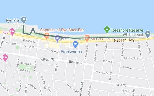
White Cliffs (Rye to Blairgowrie) section: ( 5km)
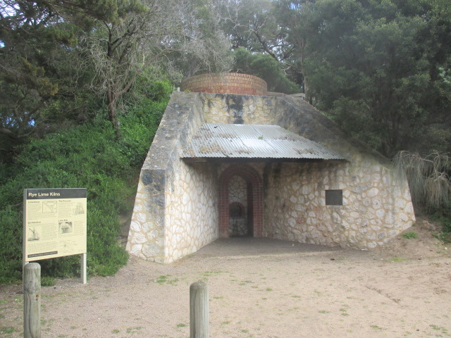
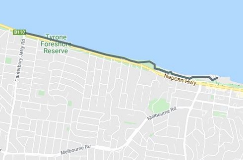
A path along the foreshore from Rye Pier to Canterbury Jetty Road, Blairgowrie. About a kilometre to the west of Rye Pier is White Cliffs - a rocky cliff outcrop on a small hill. At the base of the outcrop is a reconstructed Lime Burners Kiln that was built as a tribute to one of the major industries for the early settlers in the Rye area. During the mid 1800's, natural limestone was mined in the Rye area. It was then burnt in kilns such as this, to turn it into lime which was then shipped to Melbourne for use in the building industry. The last commercial burning of lime on the Peninsula was carried out in the Rye area. From the reconstructed Limeburners kiln there are steps leading to a lookout area at the top of the cliff, and while it is probably less than one hundred feet high, the views both to the East towards Arthur's Seat and West towards Blairgowrie are quite stunning on a sunny day. To continue towards Blairgowrie you will need to retrace your steps to cross Point Nepean Rd opposite Minnimurra Rd to a shared pathway. The walk then heads towards Blairgowrie and finishes at Canterbury Jetty Road.
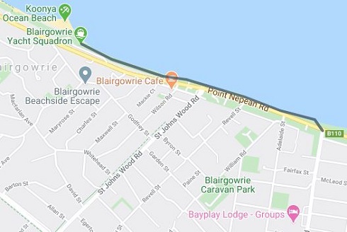
Blairgowrie section: (2 km)
Follow the Bay Trail from opposite Canterbury Jetty Road to the Blairgowrie Shops just past St Johns Wood Road where you can have some refreshments. The path winds through impressive stands of Moonah trees. This short section also includes some of of the Peninsula's famous colourful bathing boxes, and the impressive yachts of the Blairgowrie Yacht Squadron.
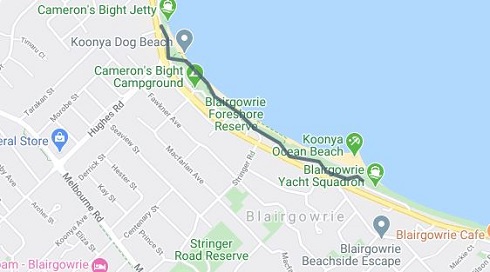
Hughes Road to Camerons Bight section: (2 km)
This short section of the Bay Trail goes along Blairgowrie beach through Blairgowrie shops from opposite St Johns Wood Road to Camerons Bight. Setting off from the Blairgowrie Marina where a $25 million marina expansion and clubhouse redevelopment was recently completed. Blairgowrie Yacht Squadron offers world class facilities in a relaxed and casual setting. Just past there as the beach merges into Camerons Bight there is a picturesque small jetty almost opposite the end of Hughes Rd that is worth a photograph.
Eastern Sister pathway section: (1 km)
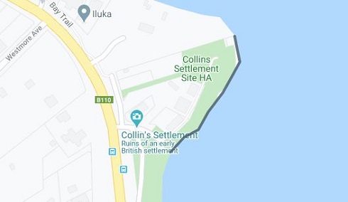
The Eastern Sister Headland connects Camerons Bight to Sullivan Bay at Sorrento and provides easy access around the historic Eastern Sister Headland situated at the northern end of Camerons Bight and the southern end of Sullivan Bay. The 270-metre-long rock revetment is topped with a two-metre-wide crushed rock pathway. The pathway, allows pedestrians better access the historically significant Collins Settlement Historic site - the first European settlement in Victoria dating back to 1803 and includes graves, monuments and lookout structures.
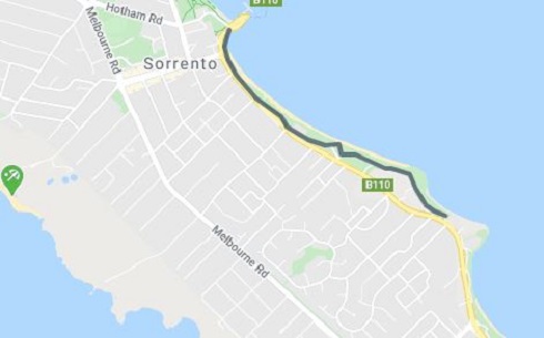
Sorrento Bay section: (2 km)
-embed01.jpg)
Travel from Sullivans Bay to Sorrento Pier through the camping grounds with the beautiful calm sandy bay beaches of Sorrento. The path along Sorrento Front Beach winds past a small pier and alongside statuesque Norfolk Island Pines to the pier where the Sorrento - Queenscliff ferry berths.
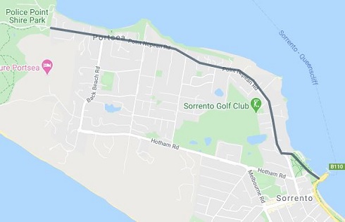
Sorrento to Portsea section: (5 km)
This section of the Bay Trail travels from the Sorrento Pier, through the large and scenic Sorrento Park with its adventurous playground, and inland past the majestic properties of Portsea. It finishes by going through the village of Portsea and ends at the entrance of the Point Nepean National Park. A short diversion can include the stretch known as Millionaire's Walk between Point King Road and Lentell Avenue.
The following is an alternative route description with map of the core part of the route between Anthony's Nose in Dromana and Sorrento.
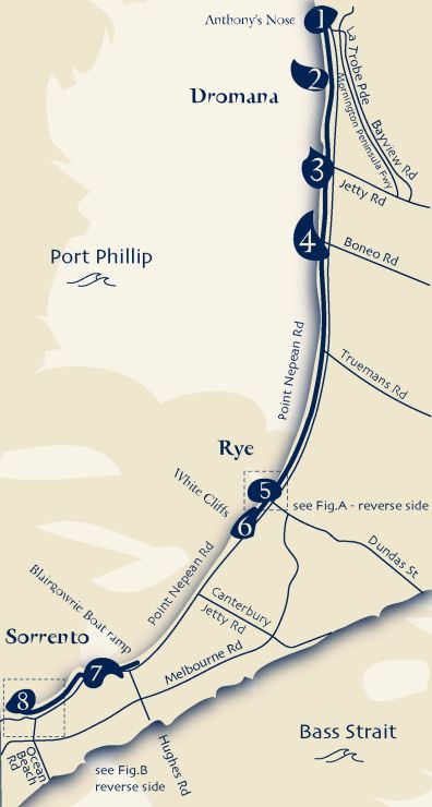
#1 Anthony's Nose - McCrae nestles into the Arthurs Seat State Park between Dromana and Rosebud. Anthony's Nose, on the coast, breaks the pattern of coastal development between Dromana and McCrae.
#2 McCrae Lighthouse - McCrae Foreshore Reserve consists of a number of play and picnic areas. George Kilborn Park and the Lighthouse Reserve offer local open space.
#3 Rosebud Pier - Rosebud began as a fishing village in the 185os. The name Rosebud probably derives from the name of the SS Rosebud which sank not far from the present day Rosebud Pier, in 1877. In the 1950s and 60s Rosebud was seen as a small rural town and popular summer holiday destination, with many families pitching tents on the foreshore and, in later years, replacing tents with caravans.
#4 Rosebud Foreshore, Coleman Park - Rosebud is situated approximately 75 kilometres from Melbourne on Port Phillip Bay. The foreshore provides local open space, along Point Nepean Highway with park areas such as C. R. Coleman Park and the Village Green. The nearby Arthurs Seat State Park provides walking trails and access to Kings Waterfall. Drum Drum Creek and Waterfall Creek
are significant waterways in the area.
#5 Rye Pier - The settlement on the east side of White Cliffs was known as Rye. Rye Pier was first built in 1860 to enable ships from Melbourne to transport lime from the local kilns to the city for the development of many new buildings.
#6 White Cliffs - Rye is located along Port Phillip Bay with a large foreshore area abutting the beach. White Cliffs is a major feature along the bay just past the Rye township. The coastal reserve provides for walking, nature activities, swimming, camping and a focus for water based activities. The beach is an important leisure resource all year round.
#7 Eastern Sister - Following nomination by Council, the Collins Settlement Site in Sorrento has been included on the Victorian Heritage Register.
#8 Sorrento Pier / Sorrento Park - Sorrento, like Portsea, is located at the southern extremity of the Peninsula and provides a beautiful and picturesque outlook for locals and tourists. It is situated on hilly ground, which shows off many of the old fine houses. Sorrento has a resort style setting and the historic township has much to offer. The Car and Passenger Ferry to Queenscliff also departs from Sorrento.
Location
195 Marine Drive, Safety Beach 3936 View Map
Web Links
→ Mornington Peninsula Bay Trail Map (Dromana - Sorrento)


")