Heritage Town Walks in Regional Victoria (North Central Region)

")
Regional Victoria's North Central region is rich with stories etched into bluestone walls, grand civic buildings and quiet country streets. From gold rush boomtowns to railway hubs, this part of the state offers some of the most rewarding heritage walks in Victoria. Whether you're exploring ornate 19th-century architecture, tracing the footsteps of prospectors, or discovering charming village centres, each town reveals a distinct chapter of the region's past.
The North Central region includes the following areas:
Central Goldfields Shire
(Maryborough, Carisbrook, Dunolly and Talbot)Shaped by the dramatic gold rush of the 1850s, Central Goldfields towns grew quickly, built grandly and have retained much of their historic character. Grand post offices, elegant railway stations and beautifully preserved shopfronts stand as reminders of the 1850s and 1860s, when fortunes were made and communities rapidly grew. From ornate civic buildings to modest miners' cottages and broad 19th-century streetscapes, heritage walks through the region reveal the ambition, optimism and resilience of the goldfields era.
Whether you're photographing grand public buildings in Maryborough, exploring the modest charm of Carisbrook, soaking up the authentic goldfields atmosphere in Dunolly, or admiring Talbot's preserved village streets, the Central Goldfields offers some of the most accessible and rewarding heritage walks in regional Victoria. Take your time, look up at the architectural details, and imagine the sound of horse hooves, the rumble of drays and the hopeful chatter of prospectors who once filled these streets.
Maryborough - Grand Goldfields Architecture

Maryborough is the architectural showpiece of the Central Goldfields. Once a booming administrative and commercial hub, it invested heavily in public buildings that still impress today.
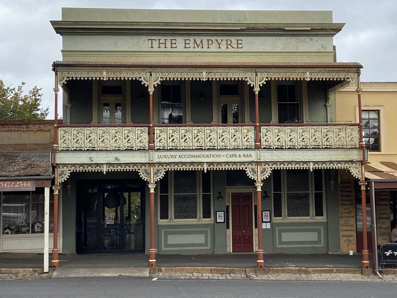
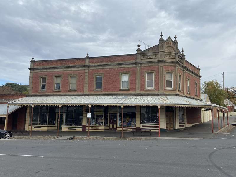
The magnificent Maryborough Post Office, completed in 1890, has a grand clock tower and richly decorated facade that reflects the wealth generated by nearby goldfields. Just a short stroll away, the elegant Maryborough Railway Station - often described as one of the finest country railway stations in Victoria - features sweeping verandahs, ornate detailing and expansive platforms that speak to the town's former importance. The town also boasts historic banks, hotels and civic buildings, many dating from the 1860s to 1880s. The former courthouse, Mechanics' institute and classical revival facades reveal the confidence of a community that expected prosperity to last.
Carisbrook - A Smaller Goldfields Neighbour
Just south of Maryborough, Carisbrook offers a quieter but equally engaging heritage walk. Established early in the gold rush period, the town retains a traditional 19th-century streetscape. You'll see historic shopfronts and former hotels that once served miners and travellers. The modest scale of Carisbrook's buildings contrasts with Maryborough's grandeur, yet the sense of history is strong. Churches, old residences and civic buildings reflect steady growth rather than boom-time exuberance. Carisbrook's charm lies in its authenticity - less restored grandeur, more lived-in goldfields character.
Dunolly - Goldfields Grit and Character
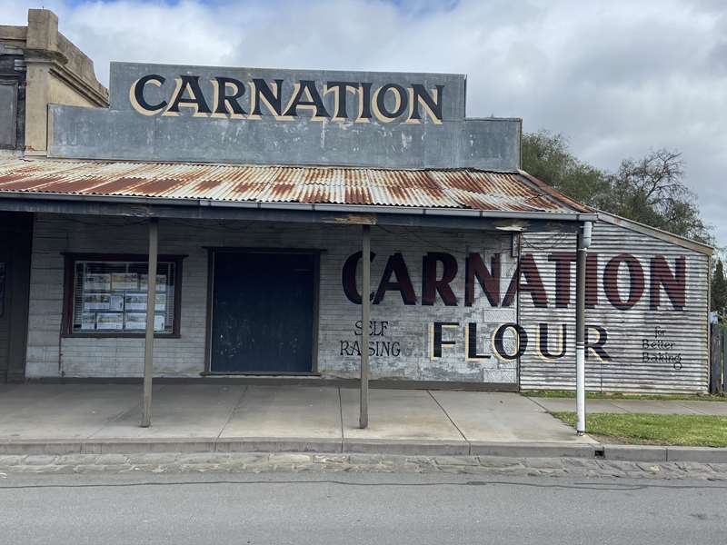
Dunolly was once one of the richest alluvial goldfields in Victoria. Today, its heritage walk captures the atmosphere of a working mining town that thrived on determination and luck. Broadway, the main street, retains a strong 19th-century feel, with historic hotels and commercial buildings lining the wide roadway. These wide streets were practical - designed for heavy wagons, equipment and bustling crowds of prospectors. Beyond the main street, you'll find miners' cottages and evidence of former diggings in the surrounding landscape. Unlike more polished towns, Dunolly still feels connected to its rough-and-ready gold rush origins.
Talbot - A Perfectly Preserved Gold Rush Village
Talbot is often regarded as one of the most intact gold rush townships in Victoria. Its main street feels like a step back in time, with beautifully preserved 19th-century buildings lining both sides.
Originally known as Back Creek during the height of the gold rush, Talbot quickly developed into a substantial town. Today, its heritage character remains remarkably cohesive. Walking along Scandinavian Crescent, you'll encounter former banks, hotels and shops that retain their original proportions and decorative features. The town's scale and preservation make it ideal for a relaxed self-guided walk. Interpretive signs and the regular farmers' market add to the experience, blending history with contemporary community life.
Shire of Mount Alexander
(Castlemaine, Maldon, Taradale, Chewton, Campbells Creek and Fryerstown)In the heart of the former goldfields, this area is renowned for its remarkably intact 19th-century architecture. Wandering through these towns feels like stepping back in time, with heritage streets, historic bridges and civic buildings reflecting both gold wealth and enduring community pride.
Take time to wander slowly, notice decorative details above shopfronts, and explore side streets where miners and merchants once lived.
Beyond the grand streets of Castlemaine and Maldon, the smaller settlements of Campbells Creek, Chewton and Fryerstown offer a more intimate connection to Victoria's gold rush past. Here, heritage walks are less about ornate civic buildings and more about the everyday lives of miners, storekeepers and families who built communities in the shadow of Mount Alexander's rich diggings. These towns grew rapidly in the 1850s, when gold discoveries transformed quiet bushland into bustling settlements almost overnight. Today, their modest scale and preserved streetscapes provide some of the most atmospheric heritage experiences in the region.
Castlemaine - Gold Rush Grandeur and Civic Pride
Castlemaine quickly rose to prominence during the 1850s gold rush and became a major administrative centre. Its wealth is still visible in its grand public buildings and elegant commercial streetscapes. A highlight is the imposing Castlemaine Post Office, an architectural centrepiece overlooking the main intersection. Admire the elaborate 19th-century facades, former banks, theatres and hotels that once served a booming population along Mostyn Street. Nearby, the Castlemaine Railway Station stands as a reminder of the town's importance as a transport hub, linking the goldfields to Melbourne. Bluestone gutters, iron lacework verandahs and decorative parapets add character at every turn.
Maldon - A Nationally Significant Historic Town
Maldon is widely regarded as one of Australia's best-preserved gold rush towns. Its remarkably intact 19th-century streetscape makes it a highlight of any heritage exploration in the region. Maldon offers one of Victoria's most immersive heritage walk experiences.
Walking along the main street feels like stepping into the 1860s. Decorative parapets, rendered facades and original shop proportions remain largely unchanged. The town's careful preservation has protected its historic character, allowing visitors to experience a cohesive goldfields village. A short walk beyond the centre reveals miners' cottages and evidence of surrounding diggings that once transformed the landscape.
Taradale - Railway Engineering and Goldfields Settlement
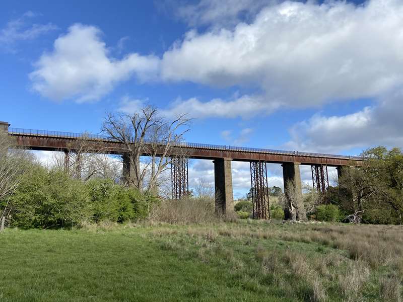
Taradale is small in size but significant in heritage value, particularly for its railway history. The township developed alongside the construction of the Melbourne-Bendigo rail line in the 1850s.
The impressive Taradale Viaduct, a large bluestone railway bridge, is a standout feature and a testament to 19th-century engineering ambition. Nearby historic buildings and cottages reflect the settlement that grew around both gold mining and railway construction.
Chewton - Birthplace of the Goldfields Boom
Chewton (formerly Forest Creek) was one of the epicentres of the early gold rush. In the 1850s, tens of thousands of miners camped along the creek and surrounding gullies, creating one of the largest alluvial goldfields in the colony.
A heritage walk through Chewton reveals a compact main street lined with 19th-century buildings, including former hotels, churches and civic structures. The scale is smaller than nearby Castlemaine, but the sense of authenticity is strong. Beyond the township, walking trails lead to former diggings, shallow gullies and interpretive sites that illustrate how dramatically the landscape was reshaped by mining. Chewton's heritage walk is as much about landscape as architecture.
Campbells Creek - A Working Goldfields Community
Just south of Castlemaine, Campbells Creek developed as a mining settlement closely tied to surrounding quartz reefs and alluvial workings. Its growth was steady rather than spectacular, and its heritage reflects that practical character.
Walking along the main road through town, you'll find historic cottages, former shops and community buildings that date back to the mid-to-late 1800s. The buildings are generally modest, built to serve a working population of miners and tradespeople. The nearby bushland still holds remnants of mullock heaps and mining sites, connecting the built heritage to the industrial activity that sustained it.
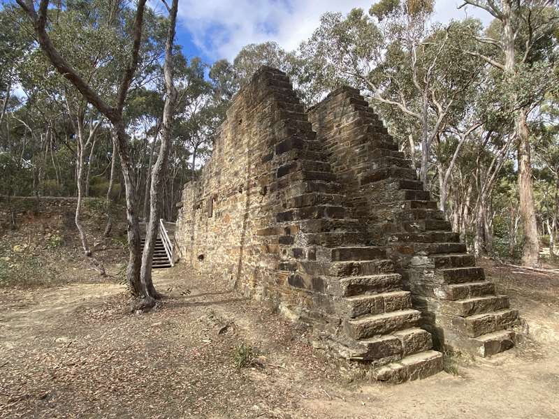
Fryerstown - A Remarkably Intact Gold Rush Village
Fryerstown is one of Victoria's most atmospheric gold rush settlements. Once home to thousands during the 1850s boom, it later declined, leaving behind a remarkably intact small township.
A heritage walk here feels like stepping into a preserved 19th-century village. The wide main street, historic hotel and surviving public buildings stand against a backdrop of rolling hills marked by old diggings. The modest number of surviving structures enhances the sense of authenticity. Rather than being heavily redeveloped, Fryerstown retains its original scale and layout.
Shire of Mitchell
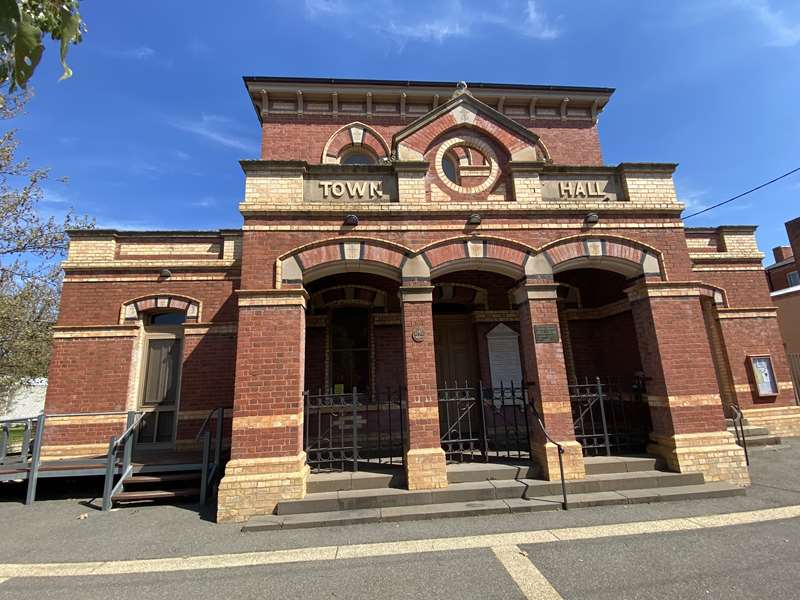
(Broadford, Kilmore and Seymour)Mitchell Shire sits at a crossroads of Victoria's early colonial expansion. Long before the gold rush reshaped the state, pastoral runs, transport routes and early townships were already emerging in this region. Unlike the dramatic boom-and-bust cycles of the goldfields, these towns grew through pastoralism, railways and regional administration. Today, heritage walks reveal layers of history from some of Victoria's earliest inland settlements to important railway and military connections. These towns offer a rich blend of bluestone architecture, wide colonial streets, grand civic buildings and reminders of the region's strategic importance.
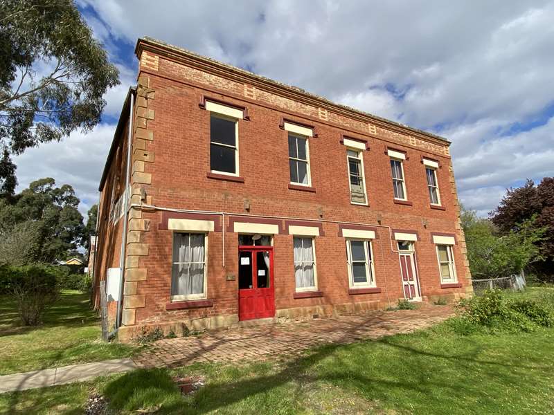
Kilmore - One of Victoria's Oldest Inland Towns
--macs-hotel.jpg)
Kilmore holds a special place in Victoria's history as one of the state's earliest inland settlements, established in the 1840s. Its heritage walk showcases a remarkably intact collection of 19th-century buildings. Wandering along Sydney Street, the main thoroughfare, you'll encounter bluestone churches, former banks, historic hotels and civic buildings that reflect both pastoral wealth and later gold rush prosperity. The town's wide streets and solid stone structures convey confidence and permanence.
Kilmore's heritage is distinguished by its strong Irish influence and early colonial character, giving it a slightly different feel from goldfields towns further north.
Seymour - Railways, River Crossings and Military History
Positioned along the Goulburn River, Seymour became a vital transport hub in the 19th century. Its development accelerated with the arrival of the railway, cementing its importance as a junction town.
Around the railway precinct, historic station buildings and associated infrastructure reflect Seymour's role in connecting Melbourne to northern Victoria and beyond. The broad main street features classic 19th- and early-20th-century commercial architecture, including hotels and former banks.
Seymour is also closely associated with Australia's military history, with nearby training facilities shaping the town's identity throughout the 20th century.
Broadford - Rural Heritage and Federation Character
Broadford developed as a rural service centre, supporting surrounding pastoral and agricultural districts. Its heritage walk reveals a cohesive main street lined with late-19th- and early-20th-century buildings. The town's architecture reflects steady growth rather than rapid boom. Red-brick Federation buildings, traditional verandah-lined shopfronts and historic hotels give Broadford a welcoming and approachable character.
Shire of Murrindindi
(Alexandra, Marysville and Yea)Heritage walks in this area are defined less by gold rush grandeur and more by adaptation to landscape. Timber towns, farming communities, alpine retreats and engineering projects all contributed to the region's identity. Close-knit rural communities shaped by both prosperity and hardship.
Walking these towns offers a layered story - of early prospectors, forestry workers, farmers, railway builders and tourism pioneers. Surrounded by forests, rivers and mountains, Murrindindi's heritage is inseparable from its natural setting. Take your time, explore beyond the main street, and you'll discover a region where history is written not only in brick and bluestone, but in timber, water and mountain air.
Yea - Agriculture and Federation Architecture
Yea's historic streetscape reflects its development as an agricultural service centre. Walking along the main street reveals an attractive collection of late-19th-century and red-brick Federation-era buildings. The former courthouse, hotels and civic buildings highlight the town's administrative importance, while its position along major travel routes helped it prosper.
Together, these towns offer an extraordinary open-air museum of Victoria's past. This guide invites you to slow down, look closely and discover the architecture, landmarks and local stories that continue to define these communities today.
Our Favourite Heritage Town Walks in North Central Region
Click on the links below for detailed information on each of the heritage walks.

In the latter half of the 19th century, (Campbells Creek was a bustling township catering for the needs of its hundreds of miners and their families from all over the world with nu ..

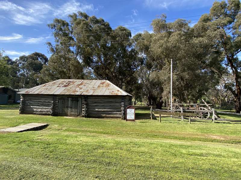
Carisbrook is situated on the junction of Tullaroop and McCallums Creeks. It was the territory of the Wurn balug people William Urquhart surveyed the township in July 1851. Many of ..

The Dja Dja Wurrung were the First People of this area, with the Wurn Balug (the boomerang clan) in the Carisbrook district. White squatters occupied the area is the 1840's fol ..

In late 1851 and early 1852, the first year of the Mount Alexander gold rush, tens of thousands of prospectors poured into the broad valley of Forest Creek. They spread out along t ..

This 45-60 minute circular walk covers the central town area, its public buildings and commercial areas. As you commence, pause a moment on the Market Building steps and look a ..

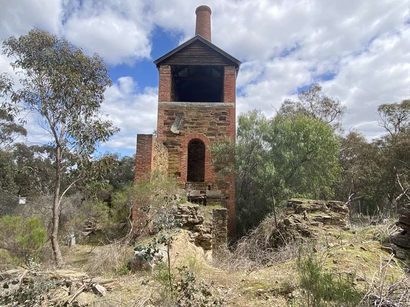
The Eureka Reef section of the Castlemaine Diggings National Heritage Park contains some of the oldest and best-preserved quartz mining relics in Victoria, offering visitors a gold ..

The Chewton area is part of the Jaara country. The Dja Dja Wurrung people are the traditional owners and one of the five large language groups making up the Kulin nation of what is ..

Dunolly was first named in 1845, by the Scottish pioneer Archibald Campbell McDougall, who took up a sheep run in the district. He named his run after the Castle Dunolly in Scotlan ..

Fryerstown was originally called Fryer's Creek. The name was changed to Fryerstown in 1854 when a survey was carried out and it became a township. In its heyday, following the disc ..
")
Kilmore is Victoria's oldest inland settled town. Apart from the Stone-Axe Quarry at Mt William, little is recorded, and little evidence remains regarding the lifestyle of Kilm ..
")
Kilmore is Victoria's oldest inland settled town. Following the overlanding by Hume and Hovell in 1824, squatters soon made their way into the area and as part of Hamlyn's Run, ..

Discover some of Maldon's rich history as you explore our historic buildings, places and streetscapes. If you explore with the mobile app, each location reveals its story through ' ..

This brief walk, which takes approximately 60 minutes, covers Maldon's historic residential area. Catch a glimpse of the combination of trees, gardens, roofscapes. fences, verandah ..

Discover some of Maldon's rich history as you explore our historic buildings, places and streetscapes. If you explore with the mobile app, each location reveals its story through ' ..

Discover some of Maldon's rich history as you explore our historic buildings, places and streetscapes. If you explore with the mobile app, each location reveals its story through ' ..

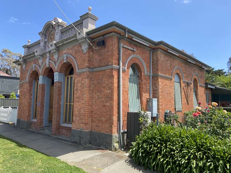
Maryborough is full of history and heritage. Discover evidence of the first inhabitants and reimagine the heady heyday of the gold rush. The Dja Dja Wurrung Aboriginal people ( ..

The Seymour Heritage Walk begins at the Seymour Visitor Information Centre, located in the Old Court House. Pop into the Visitor Information Centre before you start. There is a ..

Originally the land encompassing Talbot formed part of the native territory of the Jajawurrung tribe (also called Djadjaurrung). The aboriginal population before the arrival of ..

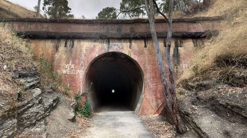
This walk explores the history of Taradale. EARLY YEARS Taradale is a small town in Central Victoria nestled in a valley on Back Creek close to its junction with the Coliban Ri ..

The Yea township was surveyed and laid out in 1855 by Thomas Pinniger, Surveyor. Beginning in 1852, Mr Pinniger, a government surveyor, spent the next 20 years completing the g ..


")