Graytown - POW Camp, Gold Diggings and Cemetery Walk


This intriguing 3.5km history walk takes you through the Graytown WWII Prisoner of War Camp site into Heathcote-Graytown National Park and onto the Graytown Cemetery, then back via Graytown gold diggings to close the loop at the old township site.
Local History
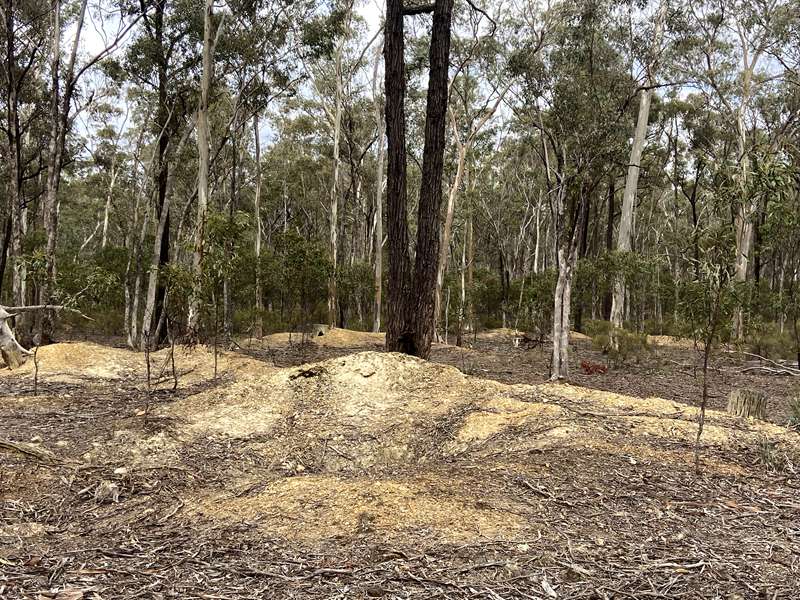
Graytown was known as Spring Creek when gold was discovered in September 1868. Within a few months over 30,000 people had arrived. Shop keepers followed, tents and shanties made way for wooden structures. By June 1869, there were 216 beer premises, 36 butchers, 14 bakeries, 17 general stores, 5 banks, 4 chemists, 5 doctors, 2 newspapers, 5 soft drink manufacturers, 10 drapers, 8 restaurants, 6 tobacconists, 10 boot makers, 6 timber yards, 18 blacksmiths, 2 watch makers, 3 ironmongers, 2 tin smiths and 72 unknown stores, a Cobb & Co Station and 19 Police Officers.
Life was rough, illegal mining was a problem along with larrikanism. At its worst families had their children sleep on the floor to avoid stray revolver shots.
However, the diggings came to a sudden end in the winter of 1871. Flooding caused extensive damage and most miners lost everything. They moved on. Some hardened prospectors kept going into the early 1900s.
The cemetery was registered on June 3, 1870. Many were too poor to pay, resulting in unauthorised and unrecorded burials. There are many unmarked Chinese graves. The first burial was a 2 month old baby on June 21. Diarrhoea and mining related injuries were common causes of death.
Pressure to mine the area was so great it resulted in tunnelling under the fences and into the cemetery.
Eventually, the cemetery size had to be reduced as a result. As a consequence, graves exist outside of the cemetery.
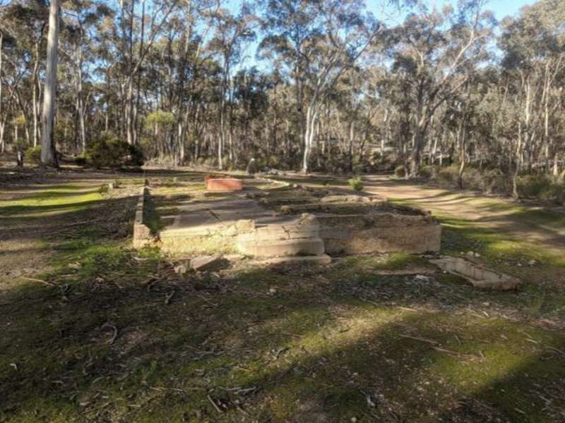
During the Second World War a Prisoner of War Camp was established at Graytown (Camp 6). Approximately 250 Italian and then German POWs were detained. They were not released until January 1947. The German POWs were mostly crew members from the German raider ship "Kormoran" that sunk the HMAS Sydney off the West Australian coast in 1941. Some Finnish seamen were also held. The wreckages of the Sydney and Kormoran were not found until March 2008.
Each compound was enclosed by a double row of wire fencing 2 metres high with coiled barbed wire in between. Guard towers stood at each corner and the perimeter was lit at night.
About 20 Prisoners were held in each of the timber framed barracks. Kitchens, mess huts, shower blocks, laundries and latrines were all located within the compounds. Camps were divided to separate nationalities.
The surrounding forest has been cut for firewood since early settlement. POWs were engaged in unpaid work cutting firewood in the forest. Timber cutting continued until 2002 when the National Park was declared.
Foundations and wire are all that remain of the camp today.
Location
Corner of Polkinghorne St and Heathcote-Nagambie Rd, Graytown 3608. Walk through the Prisoner of War (POW) Camp, following the track below the main road to Graytown Cemetery Rd. When leaving the cemetery, take the track opposite the gate through the diggings. Turn left at Graytown-Rushworth Rd to head back toward the old township site and POW Camp.
Map of Walk Route
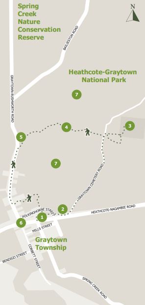
Points on map:
1. Graytown Prisoner of War Camp
2. Dirt track to Graytown Cemetery Rd
3. Graytown Cemetery
4. The Diggings
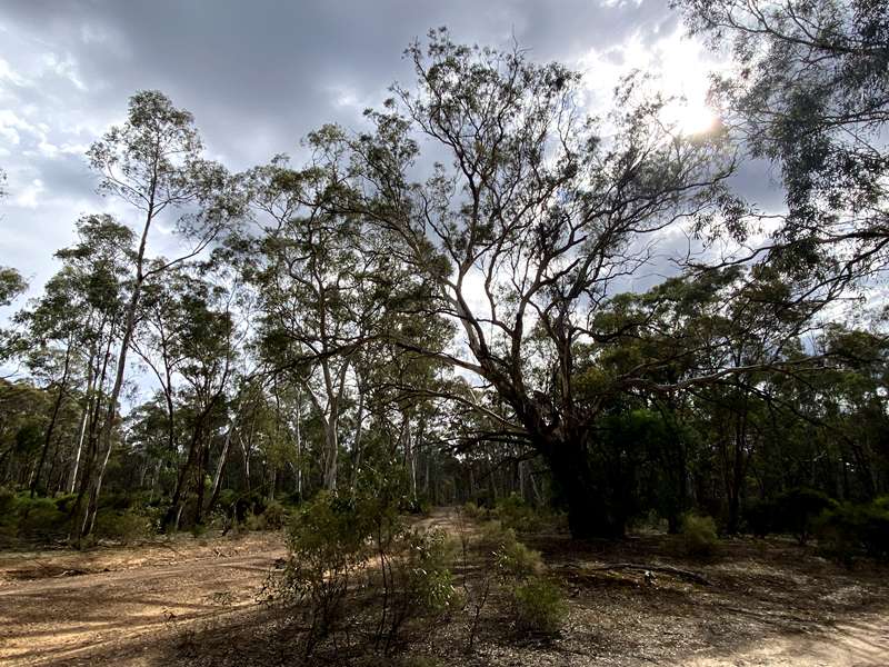
5. Grand Yellow Box tree
6. Site of Graytown Township.
7. A small corner of Heathcote-Graytown National Park
Interactive Map
Access for Dogs:
Dogs are not permitted.
Graytown's Heyday
Graytown was known as Spring Creek when gold was discovered there in September of 1868. It was the first significant find in the area even though prospecting had been carried out for several years. Within a few months over thirty thousand people had arrived in the locality and Spring Creek had transformed into a busy diggings. As usual shopkeepers followed the miners and set up their businesses to supply the miners needs. Tents and shanties soon became wooden buildings as shops sprang up all over the diggings. A census of shopkeepers taken in June 1869 gave the number of beer premises as 216. There were 36 butchers, 14 bakeries, 17 general stores, 5 banks, 4 chemists, 5 doctors, 2 newspapers and 5 soft drink manufacturers. The town also boasted 10 drapers, 8 restaurants, 6 tobacconists, 2 watchmakers, 3 ironmongers, 2 tinsmiths, 18 blacksmiths, 10 bootmakers and 6 timberyards. There were a further 72 unknown stores as well as various boarding houses, stables, tentmakers, photographers, solicitors and even an oyster bar. The town had it's own Post office and Cobb and Co coach office. The police force numbered 19.
The name of Spring Creek was changed to Graytown in 1870 to avoid confusion with the numerous other Spring Creeks in existence at the time. For a while the aboriginal name Moormbool was favoured and some parts of Graytown are still known as this today. The town received it's name from Wilson Cray, the local Member of Parliament.
The town's gold history came to a sudden end on a wintry night in 1871, when floodwaters filled the diggings and caused widespread damage. With the shafts filled with water and most miners losing all their possessions, the miners moved on to other diggings and left Graytown to start the decline into a ghost town.
Graytown became a predominately grazing area after the gold rush had ended. Some of those who stayed behind relied on woodcutting in the local forests to make a living but some hardened prospectors persevered with gold digging into the 1900's.
Little is left now to show that Graytown was once a thriving town except for the abandoned diggings and the little cemetery where the miners left behind their loved ones.
Information about Graytown Cemetery
Graytown Public Cemetery was formerly known as Spring Creek Burial Ground until this historic cemetery was surveyed and reserved for cemetery purposes on the 3rd May 1870. On the same day a public meeting was held at Simpsons's Bendigo Hotel in Corbett St and trustees were elected to represent the various religious denominations.
Although 15 acres was originally surveyed only 8 acres were set aside with the land being allotted as follows: Church Of England - 1 and 1/2 acre, Roman Catholic - 1 acre, Weslyan - 1 and 1/4 acre, Congregational - 3/4 acre, Presbyterian - 3/4 acre, Jewish - 1/2 acre, Other denominations - 3/4 acre, Neutral - 1 acre, Chinese - 1/2 acre, Main paths 12 ft
The cemetery was registered and posted in the Government Gazette on June 3 1870. From as early as 1871 trustees records were negligent and the trustees often at loggerheads. Trustees had trouble collecting fees for interments as many were too poor to pay the fees or simply moved away. Illegal mining was a problem as was unauthorised and unrecorded burials. Some trustees favoured throwing the cemetery open for mining purposes but the motion was thrown out and mining parties told to remove themselves. Illegal mining still went on however, with some parties tunnelling in from the outside boundaries In the following years illegal mining and the cost of maintaining the fences forced the trustees to halve the cemetery area, almost certainly leaving some unmarked graves, including Chinese, outside the present boundaries.
The first burial recorded in the trustees' burial register was that of Elizabeth Ann McDonald, an infant of two months, on the 21st June 1870, but it is known that several burials took place before this and it is highly likely that many more were unrecorded. There are 267 European burials recorded with 135 of them being infants and young children, victims of the harsh and unsanitary life on the goldfields and the pre-immunisation years. There is also thought to be in excess of 40 unrecorded Chinese burials.
Please help to preserve this historic site by keeping to the paths as much as possible as there are many unmarked graves and please take your litter home.
Review:
An easy walk along gravel roads with the highlights being the beautifully maintained and atmospheric Cemetery and POW Camp. There is separate trail through the remains of the former POW Camp.
Photos:
Location
Cnr Polkinghorne Street and Heathcote-Nagambie Road, Graytown 3608 View Map
Web Links
→ Walk Notes - POW Camp, Gold Diggings and Cemetery Walk (PDF)
→ POW Camp, Gold Diggings and Cemetery Walk, Graytown (Walking Maps)


")