Warracknabeal - Yarriambiack Creek Walk


The scarce water resource provided by the Yarriambiack Creek was the deciding factor in the selection of this site for settlement by the Scott brothers and the early survival of the community was dependent on it as the town's only water supply.
Today, it provides a haven for numerous water birds and the majestic gums that line its banks attract many varieties of native birds and animals to share this unique environment with the local residents. A walking track follows both sides of the creek providing a relaxing 6.8km stroll to enjoy the scenery and fresh air.
A striking feature of the creek is the largely undisturbed quality of the trees lining its banks. It is estimated that some of the older River Red Gums (E.camaldulensis) and Black Box (E.largiflorens) are 700 to 800 hundred years old. Make a point of inspecting the magnificent Yellow Gum (E.leucoxyon) on the west bank near the ski area that would be a least 500 years old.
Many of the species of birds and the occasional wallaby can be seen along the creek. The best times for bird watching are in the early morning and evening.
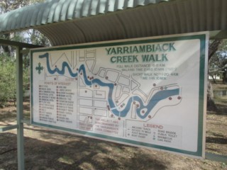
Yarriambiack Creek Walk Map
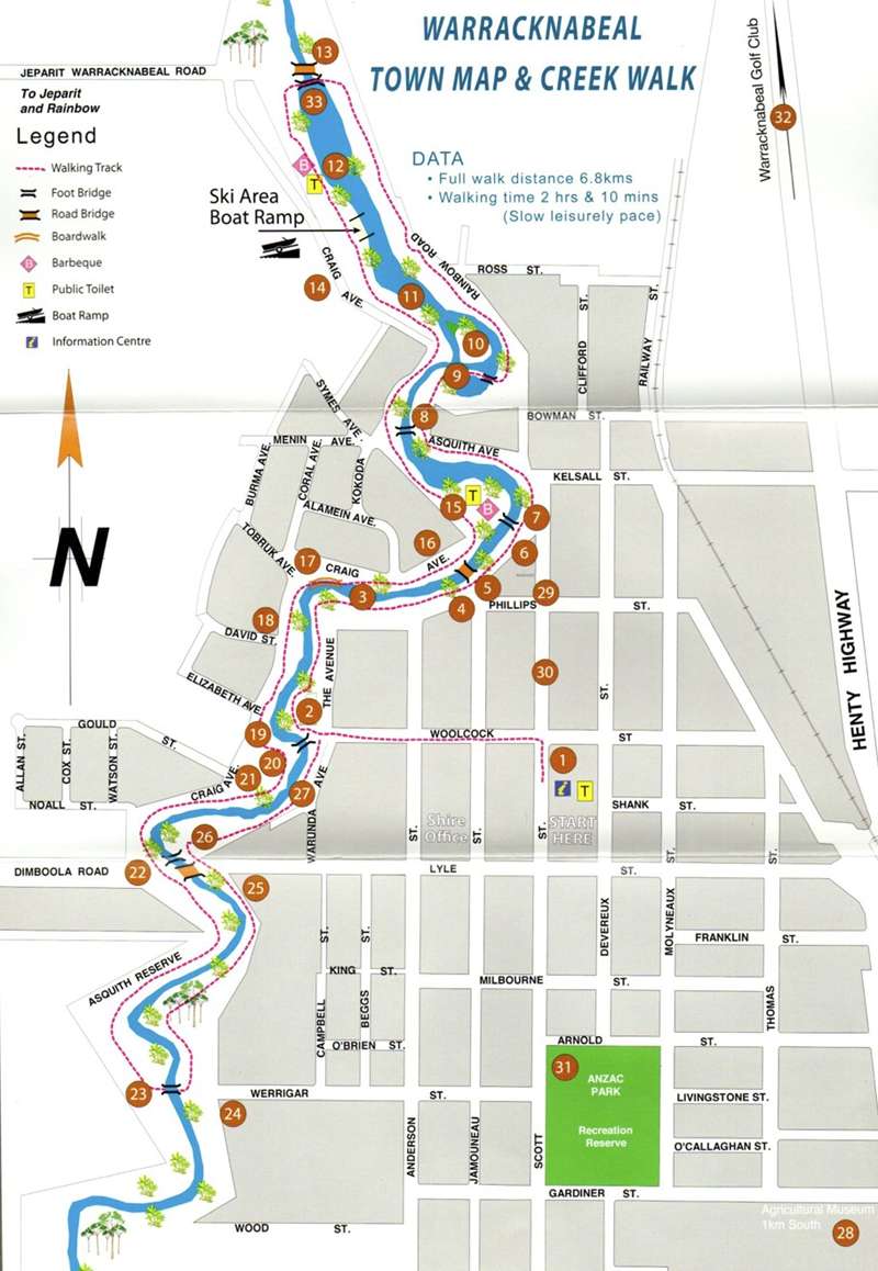
Historical Points of Interest
1. Post Office (built 1907).
2. Bowling Club and Croquet Club, previously Chinese Market Gardens.
3. Swimming area from about 1915 - 1958.
4. In this area once existed a host of features of the town, including:
• Pumping Station for the town water supply.
• Rowe’s Flour Mill, est 1879 and later Stevens’ Brewery.
• Wooden Flume Bridge carrying town drainage across the Creek to the Chinese Market Gardens.
5. Jamouneau Street Bridge, first vehicular bridge built in 1950. Present structure built in 1982.
6. Commercial Hotel c 1875.
7. Footbridge - Lions Park.
8. Footbridge - Asquith Avenue.
9. Lagoon Boardwalk.
10. Shag Island.
11. Monument.
12. Former weir site built to supply water to Warracknabeal Station. Washed away 1909 flood.
13. Weir c 1912. Rainbow Road Bridge.
14. Site of Woodbine Homestead c 1860 - 1939.
15. Lions Fauna Park.
16. Chinese Gardens, later War Service homes area.
17. Woodbine Boardwalk.
18. Woodbine School, Hostel and Administration.
19. Aboriginal Corroboree tree.
20. Coronation Bridge.
21. Roma Ross Reserve.
22. Dimboola Road Bridge - 1927.
23. Werrigar Street Boardwalk.
24. Warracknabeal Children’s Centre.
25. Apex Bicentennial Park.
26. Caravan Park.
27. Former Chinese market garden.
Other Points of Interest
28. Wheatlands Agricultural Machinery Museum - Henty Highway (1km south) Open daily - groups welcome. Ph 03 5398 1616
29. Wheatlands Warehouse - Cnr Scott and Phillips Streets. Secondhand store operated by Museum volunteers - Open daily.
30. Historical Centre - Scott Street. Open daily 2 - 4pm Closed Saturdays Ph 03 5398 2371.
31. Anzac Park - Scott Street. Sporting centre of Warracknabeal. Football, cricket, netball, tennis and swimming.
32. Warracknabeal Golf Club - Henty Highway (3kms north). 18 hole, sand belt course with first class greens and lush watered fairways. Ph 03 5398 2035
15. Lions Fauna Park and Picnic area - Craig Avenue. Free electric BBQ’s, picnic tables, rotunda, children’s adventure playground and collection of native birds and animals.
33. Rainbow Road Footbridge - 2014
Location
Craig Avenue, Warracknabeal 3393 View Map
Web Links
→ Yarriambiack Creek Walk (Walking Maps)
→ Yarriambiack Creek Walk Map with Points of Interest (PDF)


