Waranga Rail Trail (Rushworth to Murchison)


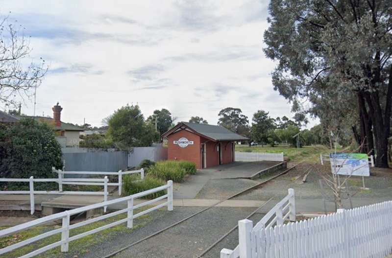
The Waranga Rail Trail is a scenic 19 km shared walking and cycling trail connecting the historic towns of Rushworth and Murchison in northern Victoria, approximately 180 km north of Melbourne.
The trail follows the route of the former Rushworth to Murchison railway line, passing through picturesque farming country, native bushland and wetland environments.
The relatively flat trail provides an enjoyable experience for walkers and cyclists, with a combination of asphalt and fine gravel surfaces. The route includes historic railway bridges, irrigation canals, Waranga Basin and Doctors Swamp Wildlife Reserve.
Trail Details:
- Distance: 19 km one way, approximately 38 km return
- Difficulty: Easy, with a relatively flat gradient
- Surface: Asphalt and compacted fine gravel, with some loose gravel sections
- Suitable for walking, cycling, mountain bikes, gravel bikes and hybrid bikes
- Trail follows the former railway corridor between Rushworth and Murchison
- Interpretive signs describing the area's railway, agricultural and natural history
- Seating at selected points along the route
- Road crossings requiring care
- Shared path for pedestrians and cyclists
Trail Highlights:
- Rushworth - A historic gold mining town with heritage buildings, cafes and shops
- Former Rushworth Railway Station precinct - Historic railway goods shed, siding and turntable
- Waranga Basin - A large irrigation water storage with views across the surrounding landscape
- Cattanach Canal - Part of the region's irrigation infrastructure
- Stuart Murray Canal - Features a restored historic railway bridge
- Doctors Swamp Wildlife Reserve - Wetland habitat supporting native birds and wildlife
- Farmland and bushland - Views across open countryside and native vegetation
- Murchison - Historic town on the Goulburn River, with cafes, picnic facilities and nearby riverside attractions
Trail Route:
The trail can be travelled in either direction, starting from Rushworth or Murchison.
Rushworth to Murchison (19 km)
Starting near High Street in Rushworth, the trail follows the former railway alignment eastwards.
The first section is asphalt before changing to a fine gravel surface. The route passes the former Rushworth railway precinct before heading through farmland towards Waranga Basin.
The trail continues near Harriman Point and Waranga Basin, crossing irrigation infrastructure and passing Doctors Swamp Wildlife Reserve.
One of the highlights is the historic railway bridge over the Stuart Murray Canal, which has been refurbished for walkers and cyclists.
The eastern section continues through rural scenery before finishing at Impey Street in Murchison.
The trail crosses Murchison-Rushworth Road at two locations, and care is required at these road crossings.
Railway History:
The original railway line between Murchison East and Rushworth opened in 1890 to transport agricultural produce, timber, goods and passengers.
The railway was extended to Colbinabbin in 1914, and a branch line from Rushworth to Girgarre opened in 1917.
Construction of Waranga Basin required part of the original railway alignment to be diverted.
Rail services eventually declined, and the line closed in 1987.
The eastern section of the Waranga Rail Trail was developed by Greater Shepparton City Council in 2015, while Campaspe Shire Council completed the western section in 2025.
Facilities:
- Car parking at trail access points
- Picnic areas and public toilets in Rushworth and Murchison
- Food and refreshments available in both towns
- Interpretive signage along the trail
- Seating at selected locations
- Historic railway infrastructure
- Wildlife watching opportunities
How to Get There:
Rushworth Trailhead:
High Street, Rushworth
Murchison Trailhead:
South-western end of Impey Street, near 39 Impey Street, Murchison
Trail Map:
Waranga Rail Trail map (PDF)
Location
High Street, Rushworth 3612 View Map
Web Links
→ www.railtrails.org.au/trails/murchison-to-rushworth-rail-trail/


