Urban Yarra Ranges Historical and Heritage Tour

The Urban Yarra Valley Heritage Tour covers the towns of Lilydale, Mooroolbark, Mount Evelyn and Chirnside Park.
Urban Yarra Valley Heritage Tour Map
1. Hookey Park
Address: Charles St, Mooroolbark
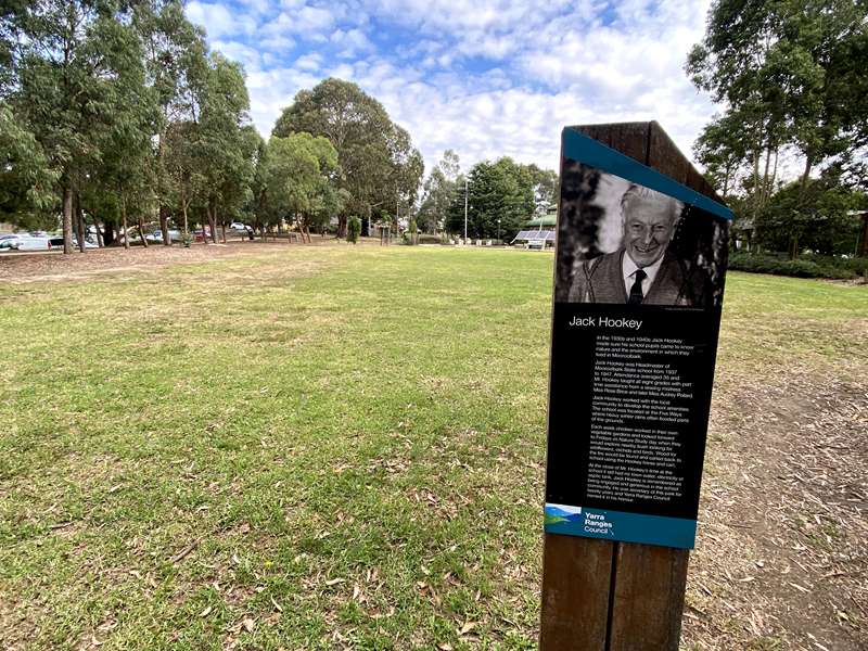
This early public meeting place was named for Jack Hookey, Headmaster of Mooroolbark State school from 1937 to 1947, and secretary of the park for twenty years. The park contains information on Edna Walling, Jack Hookey and Bob Gatherum, and War Memorial.
2. Bickleigh Vale Village
Address: Pembroke Rd, Mooroolbark
Edna Walling's 1920s cottage and garden village. No public access to gardens
3. "Mooroolbark Park" now Chirnside Park Country Club
Address: 68 Kingswood Dr, Chirnside Park
Chirnside Park Country Club welcomes visitors. The property boasts an oak tree planted when the Chirnsides' original homestead was built in 1853.
4. Grave of Dame Nellie Melba GBE
Address: Lilydale Lawn Cemetery, 120 Victoria Rd, Lilydale
Lilydale Lawn Cemetery offers a heritage walk with 26 signposts throughout the grounds. Contact Lilydale & District Historical Society for guided tours.
Born Helen Porter Mitchell on May 19, 1861, singer Dame Nellie Melba died on 23 February 1931, at which time the world went into mourning. After a funeral service in Scots Church, Collins Street, the hearse travelled to Lilydale, where the coffin was moved to a gun carriage for the final journey to the Lilydale Cemetery. Fittingly, on Melba's grave are Mimi's words from La Boheme: Addio
senza rancore, 'Farewell without bitterness'.
5. Old Lilydale Court House
Address: 61 Castella St, Lilydale
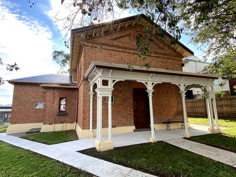
Built in 1876, the building operated as a Court House for over 100 years, until the court moved to Ringwood in 1997. It is the oldest civic building in the Shire and was listed on the National Trust of Victoria's register in 1970 and the National Estate Register of the Australian Heritage Commission in 1978. It is now the home of the Lilydale & District Historical Society, who share the building with Yarra
Ranges U3A.
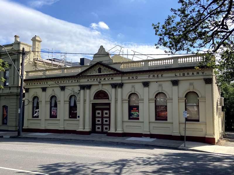
6. Athenaeum Theatre
Address: 39-41 Castella St, Lilydale
7. Yarra Ranges Regional Museum
35-37 Castella St, Lilydale
.jpg)
Yarra Ranges Regional Museum opened in 2011 after a redevelopment of the former Lillydale Shire Offices. With stunning architectural design set in tranquil surrounds, the museum features exhibition spaces, programs for all ages and abilities, museum shop and cafe.
The collection and exhibition program focuses on the region, including the urban area, Dandenongs and Yarra Valley. A range of historic and present-day exhibitions and programs bring art, artefacts and fascinating stories to life.
8. Melba Park and David Mitchell Memorial Gates
Address: Cnr Castella and Market Sts, Lilydale
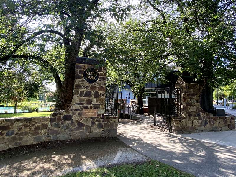
When the township was laid out in 1860, this area was set aside as a reserve for the people. In 1927, in recognition of the great contribution made by Dame Nellie Melba, the area was re-named Melba Park. Melba was proud and flattered that it was named after her, and officiated in declaring the park open.
David Mitchell was the father of Dame Nellie Melba and owner of Cave Hill quarry, a major employer of the district. Melba designed and organised the building of the gates erected in his memory. Melba's only grandchild, Pamela Armstrong, laid the foundation stone for the gates on 5 November 1928.
9. Mafeking Tree
Address: Melba Park, between Museum and Croquet Club
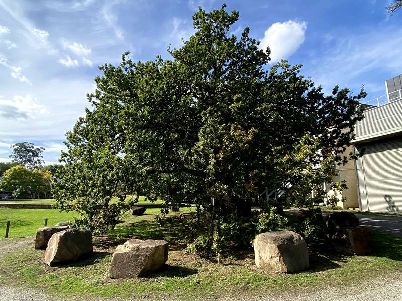
The Quercus robur oak tree was planted in 1900 to mark the end of the 209 day siege of the British Garrison at Mafeking, commanded by Colonel BadenPowell, during the Boer War.
10. Lillydale Lake & Cashin's Mill
Address: 432 Swansea Road, Lilydale
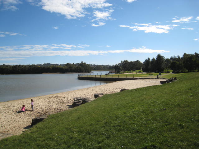
The 28 ha Lillydale Lake was built to stop the flooding of Lilydale's lower Main Street and to provide a local recreational facility. It was officially opened on 7 July 1989. Cashin's Mill, built in the 1850s, was Lilydale's first industrial building. Local farmers, including Aboriginal farmers from Coranderrk,
brought their wheat to be ground there. The mill was destroyed by fire on 25 March 1915.
11. The Blanche Mitchell Competition Ground (The First Aid Post)
Address: 115 David Road, Mt Evelyn
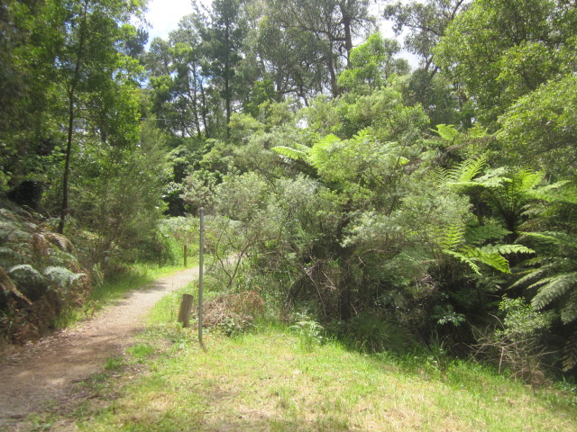
This bushland reserve beside the Lilydale to Warburton Rail Trail was the site of competitions between Railway First Aiders (1940s-1990s). The open-fronted sheds that served as backdrops for 'accident' scenes can still be seen. Blanche Mitchell, who donated the land in 1944, was a daughter-in-law of entrepreneur David Mitchell and sister-in-law of Dame Nellie Melba. Interpretive signage at site.
12. The Puddle Dam (Water Race Trail)
Address: Between 112 and 114 Birmingham Rd, Mt Evelyn
Opened in 1905, the water race provided Lilydale's original water supply from the Cascades on Olinda
Creek. Part of the route can still be followed as the Water Race Trail. The race ended in a 'clay puddled dam' (the Puddle Dam), which is largely intact. Interpretive signage at site
13. Mt Evelyn Station House (The Lilydale to Warburton Rail Trail)
Address: 50 Wray Crescent, Mt Evelyn
At 738 feet (225 metres) above sea level, Mount Evelyn was the highest point on the Lilydale to Warburton railway. The station was connected to Silvan via a flying fox to supply materials for the construction of Silvan Reservoir. Mt Evelyn Community House is located in the Station House, which was the original Stationmaster's residence, dating from 1911.
14. Mt Evelyn Aqueduct Walk
Address: Swansea Road to Hunter Road
The aqueduct through Mt Evelyn, constructed late 1920s-1933, is now preserved as the Mt Evelyn Aqueduct Walk. The section between Hunter Road and Priestley Crescent passes through bushland and still has its original concrete lining and bridges. The Aqueduct Walk connects to Silvan via the Olinda Creek Trail.


")