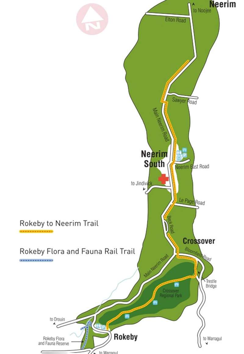
Rokeby to Neerim Rail Trail


Commencing at Rokeby Common, this 12.6km (one-way) trail, which can be cycled or walked, passes through the Crossover Regional Park before heading north to Neerim South and then follows the Main Neerim Road to the edge of Neerim.
Highlights include the Trestle Bridge at Crossover, views of the Tango Reservoir. Bunyip State Forest in the west and towards Mount Baw Baw in the east.
The length of sections of the trail is:
Rokeby to Crossover: 4 km
Crossover to Neerim South: 3 km
Neerim South to Neerim: 5.59 km
Total Distance: 12.59 km
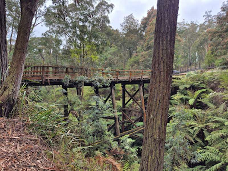
Crossover Trestle Bridge
This wooden trestle bridge, constructed in 1891 is the original bridge built by the railway construction contractor. The Crossover Trestle Bridge spans around 40 metres with six trestles, the central of which is 15 metres tall. Trains ran between Warragul and Neerim South from 1892. It was used to transport local timber and farm produce. The railway line closed in 1958, operating for 66 years. The bridge is a key restoration project for the Rokeby Crossover Friends Group.
The Crossover Trestle Bridge is the last of its kind in original condition and still standing in Victoria. It is an example of a timber trestle road bridge built using the construction methods typically used on timber raft bridges. It differs in detail from the many timber trestle road bridges in the use of squared timbers for stringers and the picket style railings.
Bloomfield road was realigned to accommodate heavy traffic in 1968. Fill from a large cutting just north of the railway line was placed in the old railway cutting for the road to pass over. The Crossover bridge remained open to service local traffic until it became structurally unsound and was closed in 2004.
Rokeby to Neerim Rail Trail Map
Location
1016 Brandy Creek Road, Rokeby 3821 View Map
Web Links
→ www.rcfg.org.au/crossover-bridge


")