Richards Curves Walk (Big Pats Creek)

This 4.2km return walk follows the curves of an old tramline built to provide an easier descent between the Mississippi Fireline and Big Pats Creek.
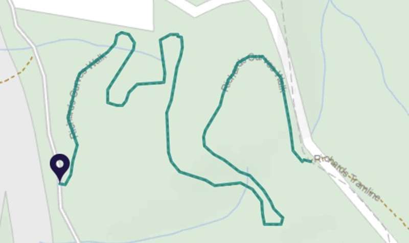
Starting at Big Pats Recreation Area, 'The Curves' is a 2 km section of track that gets its name from the series of bends constructed along the tramline. The curved tramline was made in 1916 to haul timber from the forest on a steady descent down the steep terrain.
This walk contains other remnants of the old tramway, including sleepers and road spikes. Once you've walked the 2 km track, you can choose to come back the way you came or continue on a longer walk along Richards Tramline through to Braham's Road (12 km one way).
Big Pats Recreation Area has toilet and picnic facilities. Please be aware that snakes are active here in summer months.
How to get there
From Melbourne head out along the Maroondah Highway to Lilydale. Past Lilydale, head right onto Warburton Highway. Continue the extent of Warburton Highway, through the township of Warburton onto Woods Point Road. Just after you cross the Yarra River about 3km up Wood Point Road take a right turn up Riverside Drive and take your next left up Big Pats Creek Road. Continue along this road through the small settlement of Big Pats Creek until you cross the creek itself, then take you first right just after the bridge up Burns Road. Not far up this road you will reach the Big Pats Recreation Area on your right hand side. Here you will find directional signage to Richards Curves Walk. Suitable for 2WD vehicles.
Access for Dogs:
Dogs allowed
Location
Burns Road, Big Pats Creek 3799 View Map
Web Links
→ www.exploreoutdoors.vic.gov.au/activities/walking-in-victoria/richards-curves-walk


")