Pentland Hills - Werribee Gorge Circuit Walk

The Werribee Gorge Circuit Walk is a 10km iconic medium to hard walk (grade 3) which takes up to 4.5 hours.
Werribee Gorge State Park retains a wild, rugged natural beauty surrounded by a cleared and developed landscape. The park is vitally important to the survival of native plants and animals that live here in its steep forested gorge carved by the Werribee River.
Werribee is thought to derive from an Aboriginal word Wearibi, meaning either "swimming place" or "backbone".
Werribee Gorge Circuit Walk Map
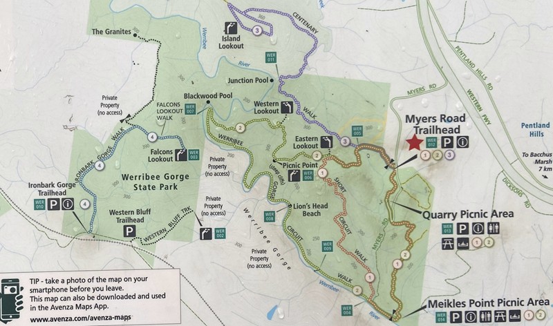
Werribee Gorge Circuit Walk is (2) on the map. The Werribee Gorge Shirt Circuit Walk (5km), (1) on the map follows part of the Werribee Gorge Circuit Walk.
Start at one of the three carparking locations on Myers Road - Myers Road Trailhead, Quarry Picnic Area or Meikles Point Picnic Area and walk in an anti-clockwise direction. If travelling early or late in the day, be careful of kangaroos on Myers Road.
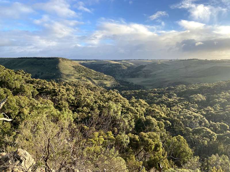
We started from the first carpark you come to; Myers Road Trailhead. This means you have have an uphill section with excellent views along the gorge rim, followed by a descent down to the river level which has some sections of rock scrambling but is flat. After reaching Meikles Point Picnic Area, there is a steep and sustained uphill section to Quarry Picnic area where the walk is a bit flatter. If you want to get almost all of the uphill parts done first then start at Meikles Point Picnic Area and do in an anti-clockwise direction. This might be a good tactic on a hot day. Quarry Picnic Area and Meikles Point Picnic Area both have toilets.
From the Myers Road Trailhead, head north along Myers Road for a short distance and the track starts on the left. From this point there are three walks; Werribee Gorge Circuit Walk, Werribee Gorge Short Circuit Walk and Centenary Track. After a 250m uphill section you will see the remains of the Hanson family's freestone cottage, stone-walled orchard and garden.
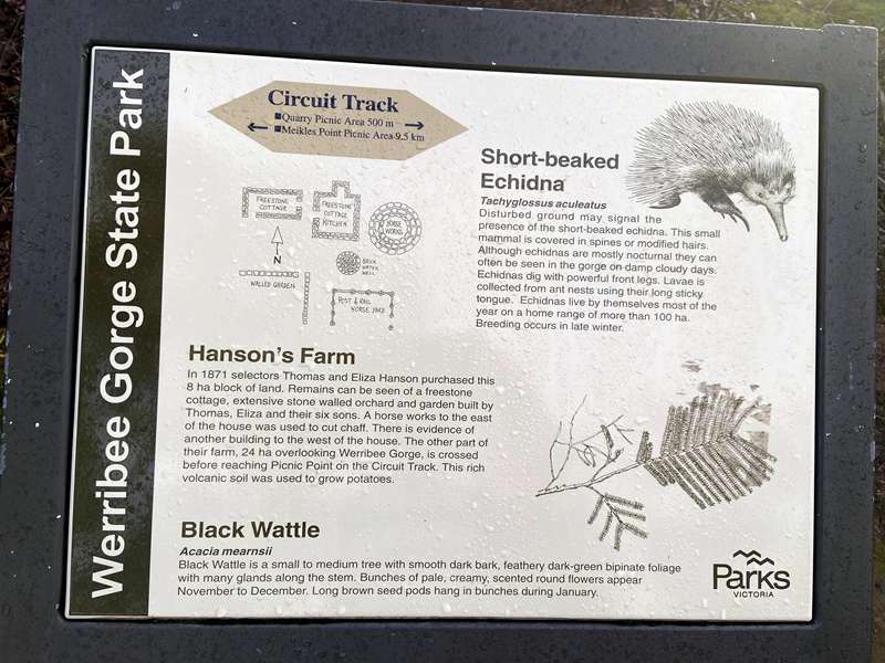
Hanson's Farm
In 1871 selectors Thomas and Eliza Hanson purchased this 8 ha block of land. Remains can be seen of a freestone cottage, extensive stone-walled orchard and garden built by Thomas, Eliza and their six sons. A horse works to the east of the house was used to cut chaff. There is evidence of another building to the west of the house. The other part of their farm, 24 ha overlooking Werribee Gorge, is crossed before reaching Picnic Point on the Circuit Track. This rich volcanic soil was used to grow potatoes.
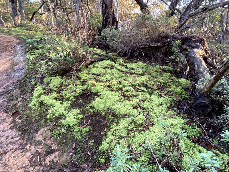
A further distance along the Centenary Track branches off and the rocky track passes through an area covered in rocks and beautiful bright green moss.
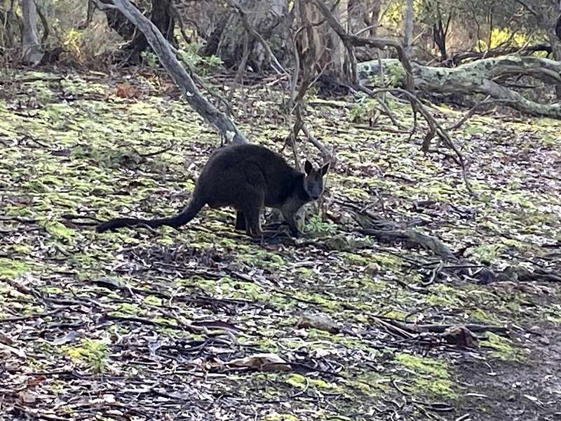
In this area we saw a black wallaby grazing.
A little distance further the Short Circuit Walk branches off.
The next point of interest is the Eastern Viewpoint. The view north is over the Pentland Hills towards Mt Blackwood, an extinct volcano. The lava flow filled river valleys and has eroded to leave flat topped hills like The Island. Lava flowed south from Mt Bullengarook (an extinct volcano to the north-east between the folds in the hills), and can be seen on the Western Freeway at Anthony's Cutting. To the east, showing blue in the distance, are the Dandenong Ranges and Melbourne skyline. Mt Cottrell is an extinct shield volcano.
The trail then passes through Picnic Point, an area of newer volcanics. A weathered olivine basalt and scoria layer in the Picnic Point area is evidence of a volcanic flow from Mt Blackwood about three million years ago. Some of this is now weathered to rich red volcanic soil. Erosion has removed much of the basalt capping and evidence of many other geological periods. Under the basalt is a huge deposit of glacial tillite and sandstone with conglomerate. This was deposited by a series of continental ice sheets (glaciers) about 280 million years ago. The Circuit Track crosses these Permian rocks each side of Picnic Point.
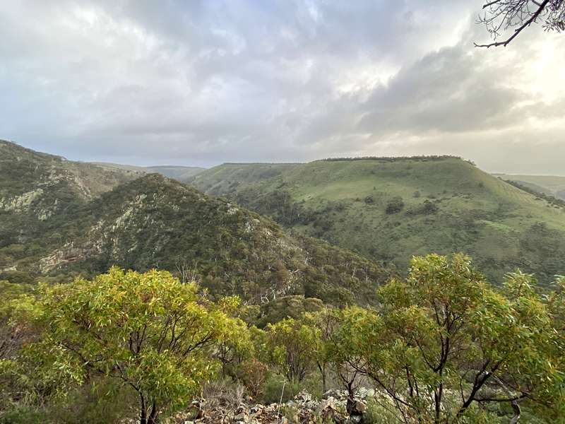
There is another lookout point at the Western Viewpoint. The Island, to the north-west, was formed when lava from Mount Blackwood flowed south and filled the old valley of Myrniong Creek. The stream wore a new valley parallel to and north of the Werribee River. A relatively hard basalt cap protected The Island from erosion. South of The Island, the course of the Werribee River follows the Werribee Gorge Fault. The track crosses Ordovician marine sediments that have been upended during the Devonian Period.
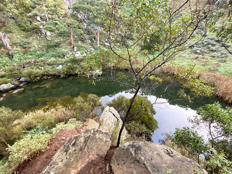
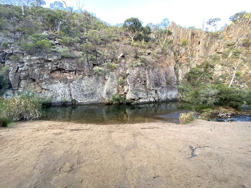
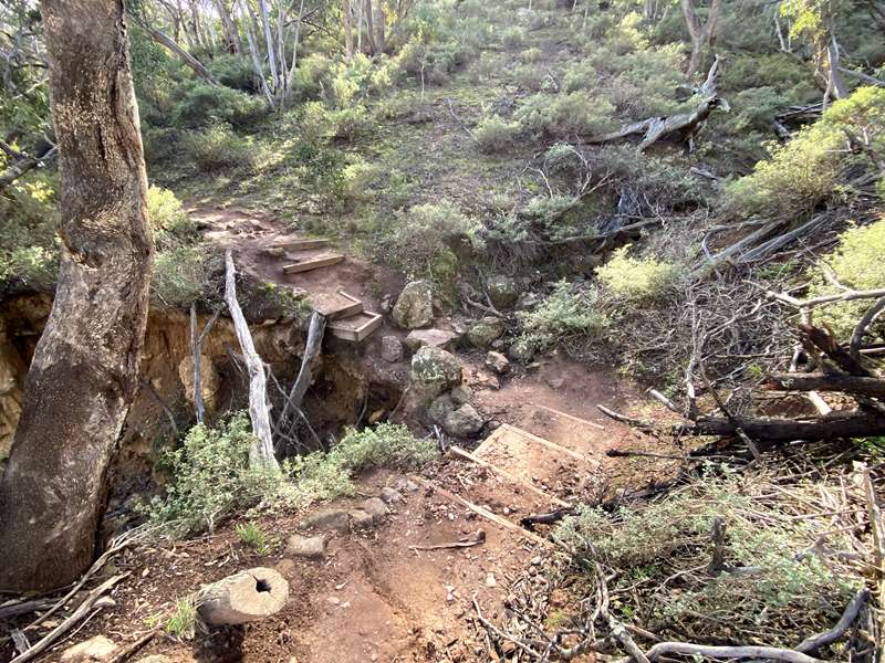
The track then heads downwards towards the river which is quite steep, hard on the knees and slippery with loose rocks. You can see Blackwood Pool far below. At the point where the track does a sharp bend to the south you can clamber down a rock face to get to the river which forms Blackwood Pool at a bend in the river. The pool has areas where it was deep and clean but there were also areas of weed.
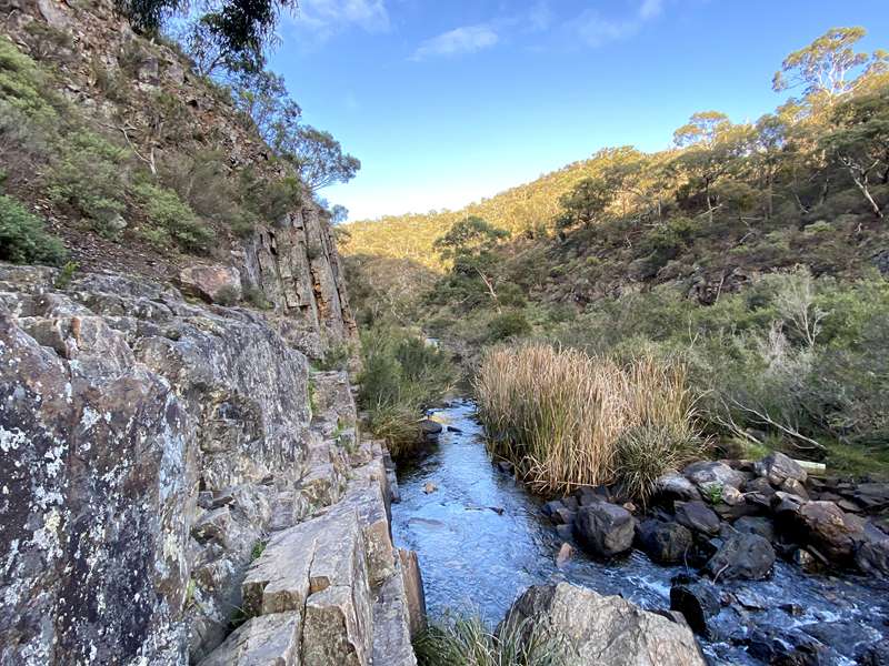
The track becomes quite flat and follows beside the river. There are sections where you walk along narrow rock ledges above the river and other sections on a sandy path at river level.
After 4.85km from the starting point you reach Needles beach. The needles, points of vertical shale deposits, are marine sediments tipped on their end and broken by inward pressure as tectonic plates moved together. Such huge pressure was exerted that some sediments changed their structure. At the same time, about 350 million years ago, these rocks were lifted above sea level.
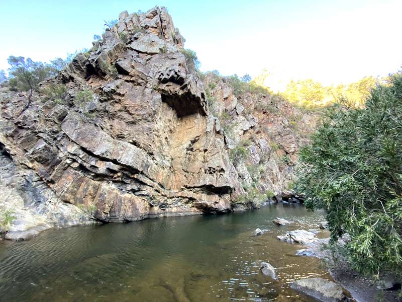
At 5.55km from the starting point, you reach Lionhead beach. Above the beach and river the Lionhead formation is the dramatic remains of a syncline. About 500 million years ago fine layers of eroded material deposited by marine currents built up in the sea. These horizontal deposits were compressed and during the Middle Devonian period, about 380 million years ago, were subjected to tremendous inward pressure by tectonic plate movement. This folded and faulted the layers into the synclines and anticlines found along this cliff. Look for features of a lion's head on the rockface.
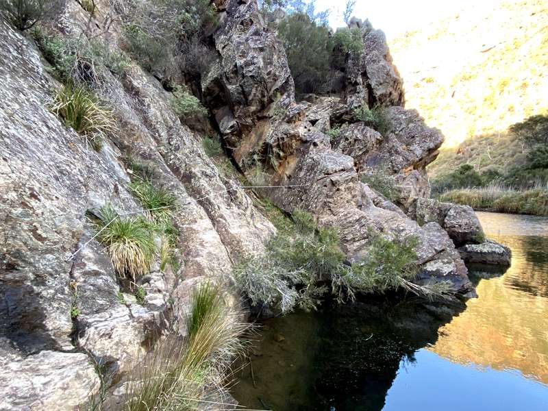
A short distance along the river is a section where you use fixed ropes to traverse along a wall above the river. This is exciting but manageable for most people.
The next point of interest are the water channels, located 1.8km from the Meikles Point Picnic Area.
McFarlane's Water Race
On the south side of the river (the side you are walking on) are the remains of rock walls and cuttings which show the route of a water race built during 1904–1906 for local farmer William H. McFarlane. Dynamite was used to remove great sections of cliff face to create a bed for the 2.5 mile long water race. McFarlane intended to irrigate 100 acres to produce dried lucerne chaff for the Melbourne poultry-food market.
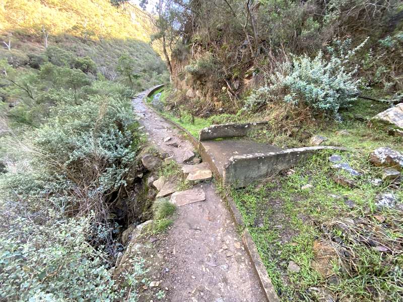
Water Commission Channel
The concrete Water Commission Channel on the northern side of the river was constructed from 1926–29. Hundreds of tons of rock were blasted away, falling into the gorge below. Sluice gates were installed to control the flow of water. Concrete bridges crossed the channel to divert storm water to the river. Water flowed by gravity from the river in the gorge to Bacchus Marsh for town supply and irrigation.
On the opposite side of the river, located 1.3km from the Meikles Point Picnic Area is a cliff face with interesting geological features.
Cliff Face
Anticlines, upward folds and synclines, downward folds, are exposed along the cliff face in the Ordovician sandstones and slates. These folds were formed during the Devonian Period about 380 million years ago when the inward pressure from plate movement caused the Ordovician sandstone to buckle. A layer of Permian glacial sandstone sits above the Ordovician folds.
At the Emergency Marker WER009, steps and a track lead down to an old weir with a deep area surrounded by rocky slabs. It is possible to swim here.
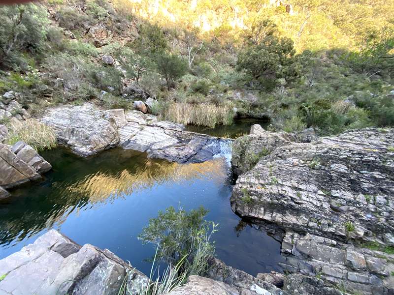
This is the last opportunity for a swim because the river starts to be bordered by lots of reeds and is not as attractive.
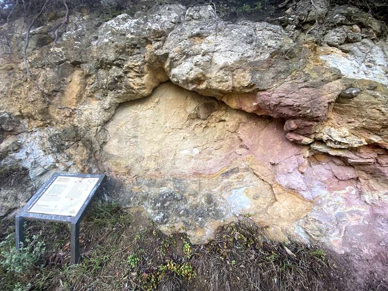
On the left wall, 400m from the Meikles Point Picnic Area is an example of Permian Glaciation. This fine blue-grey clay embedded with mixed size pebbles and boulders is called tillite. Tillite dropped to the bottom as the ice sheet melted about 280 million years ago during the Permian period. Parallel scratch marks made by rocks in the moving ice can be seen on some embedded boulders.
At the point where steps lead down to a bridge across a generally dry creek, the Short Circuit Walk connects back into the Gorge Circuit Walk.
From here it is a short distance to the Meikles Point Picnic Area where there is a carpark, toilets, firepit and three unshaded tables.
In the south east corner of the carpark a little bridge leads to the 400m Discovery Walk circuit. This is a gravel path loop with seats and interpretative signage.
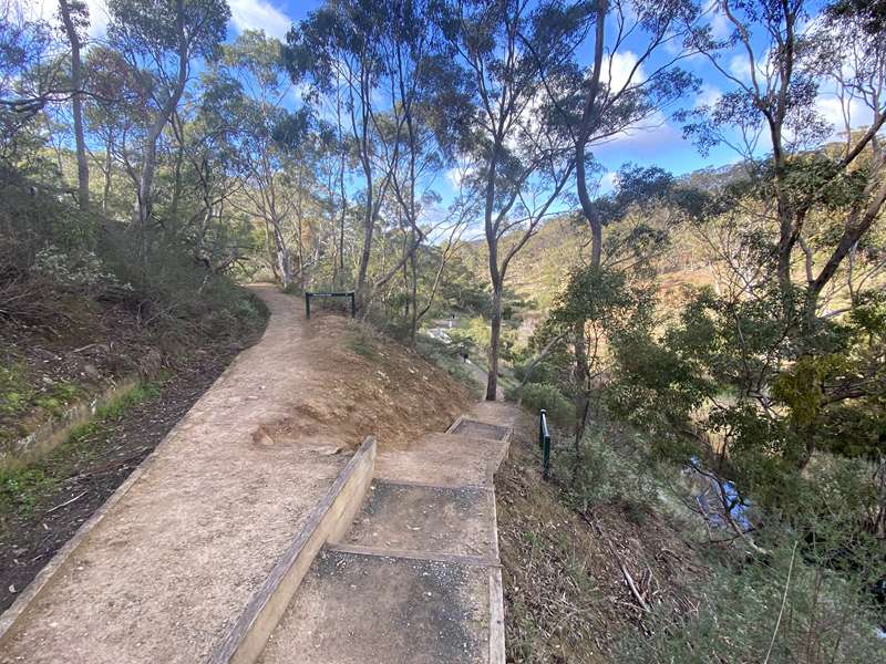
The track leads northwards on a sustained steep rutted track to the Quarry Picnic Area before leveling off. There is a crossing of a creek on the way.
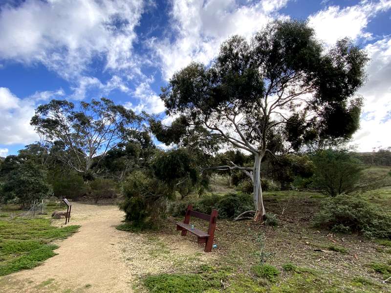
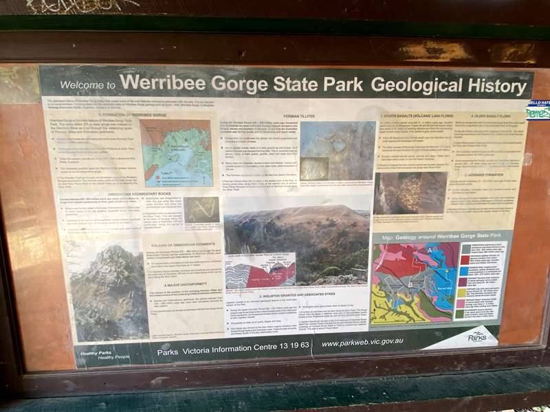
At Quarry Picnic Area there is a carpark, toilets, one table, firepit, shelter with information panels about the geology of the Werribee Gorge State Park and water tap (untreated rainwater, don't drink).
Head northwards for a short distance past a dry creek gully to Myers Road Trailhead. That's the end of a fantastic walk.
Prohibited Activities
Motorbikes, camping, horses and shooting are prohibited.
Access for Dogs:
Dogs and cats are prohibited.
Swimming:
This walk provides the opportunity to have a dip at Needles Beach, Lionhead beach, the old weir or at the biggest rock pool, Blackwood Pool for experienced swimmers. The water quality at Blackwood Pool is often poor and don't expect clear water.
Be safe, be prepared, plan ahead
- Please take your rubbish home for recycling.
- Ensure you let someone know where you are going and when you intend to return.
- Always wear sturdy non-slip footwear and protective clothing.
- Be aware of creek crossings, especially after heavy rains. Rocks may be slippery.
- There are steep cliffs in the park; please stay on the track at all times. Do not short cut. Stay safe.
- Fires only permitted in the permanently provided fireplaces.
- Supervise children at all times.
- Note that the track along the river may become impassable after heavy rain.
SES Safety Advice
There are usually more than 10 rescues per year in The Werribee Gorge. Are you prepared?Key Risks
- Grade 3 terrain. Steep, rocky and narrow trails
- Limited or no phone reception
- Limited trail markers and possible water crossings
- At least 4 hours daylight
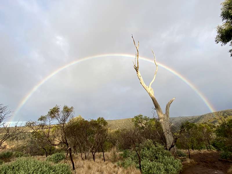
- Check expected weather conditions. When we did the walk, there were dark skies, a rainbow, cold wind and sunny blue skies
- Water and snacks
- Good fitness and suitable boots
- Torch, first-aid kit, map, photo of information board
- Inform others of your plan and expected return
- Make sure you have checked the conditions and are prepared for this trail!
- If you are prepared, ENJOY and STAY SAFE
Other Walks in the Area
Short Circuit Walk - 5km loop- 2 hrs Grade - Medium
The Short Circuit Walk is the best introduction to Werribee Gorge State Park, offering a shorter version of the famous gorge circuit. The trail passes through open rocky woodland, follows sections of the Werribee River, and visits several scenic lookouts overlooking the dramatic gorge. It provides a good taste of the park's rugged landscapes without committing to the full 10km circuit.
River Walk - 3km return - 1.2 hrs return Grade - Medium
Start at Meikles Point Picnic Area and follow the old aqueduct upstream to a point where you need to climb around the base of a cliff. This is the end of the River Walk. A wire rope attached to the rock wall assists navigation of this section for those wanting to continue further along the gorge.
Falcons Lookout - 3km return - 2 hr return Grade - Medium
Panoramic views of the gorge and beyond. Walk in from the Ballan-Ingliston Road through the picturesque Ironbark Gorge. Falcons Lookout offers a fantastic rock climbing experience. It is currently the only area in the park available for rock climbing.
Centenary Walk - 4km return - 2.5 hrs return Grade - Medium - Hard
Start at Quarry Picnic Area and follow Circuit Track before diverging and passing through open woodland to the bridge across Myrniong Creek. After crossing the creek there is a very steep climb to the top of the James Whyte Island Reserve with panoramic views over Werribee Gorge and beyond.
Photos:
Location
Myers Road, Pentland Hills 3341 View Map
Web Links
→ Werribee Gorge State Park Visitor Guide (PDF)
→ Werribee River Association (WRivA) on Facebook
→ Friends of Werribee Gorge & Long Forest Mallee Inc. on Facebook
→ Werribee Gorge State Park (Parks Victoria)


")