Mount Major Walk


This walk is for those in a fit state of health, as most of it is uphill until you reach the plateau at the summit – well worth the effort for the stunning views however!
Start / Finish: Turn off the Dookie Nalinga Road onto Mount Major TV Road and continue until you reach the entrance gate on the right hand side with the University of Melbourne sign behind it. Climb over the stile and you’re on your way. The walk is up to the top of the hill where there are a number of television and mobile phone signal stations, follow the path on the map. The return walk is back down the same trail.
Distance: 6.4km. Follow the path outlined on the map.
Surface / Access: The walk is on a designated sealed footpath / roadway, until the summit is reached, where there are some unsealed tracks. Take the track leading straight ahead to approach the panoramic lookout. Terrain is hilly. This walk is not considered wheelchair accessible.
Mount Major Walk Map
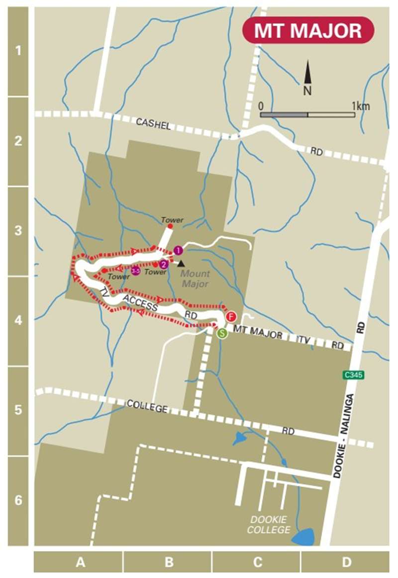
Points of Interest (shown on map):
1 The magnificent views including the canola fields in Spring. Summer gives you the sight of hundreds of rolls of hay that are produced in the district. Autumn brings the patchwork of red volcanic soil and the green growth of a cooler season. Vineyards are scattered throughout the area and there are excellent views of Strathbogie and surrounding ranges from the summit.
2 Lions Club fixture at summit indicating the distances to surrounding landmarks.
3 At its peak, Mount Major is 381 (1251 feet) metres above sea level.
4 Mount Major has special significance in Greater Shepparton because of its native flora and fauna as well as its grazing potential.
5 Mount Major is now used as Greater Shepparton’s premier mountain bike event location.
Walk Note: Note the conditions of access at the entrance sign to Mount Major.
Hazards: Be aware of snakes during the warmer months and any uneven ground on the unsealed tracks.
Location
Mount Major TV Road, Mount Major 3646 View Map
Web Links
→ Walking in Greater Shepparton Brochure


