Mason Falls Loop Walk (Kinglake West)

Kinglake National Park is the largest national park close to Melbourne. This 4.6km loop walk gives you a very pleasant taste of what the park has to offer, taking in a waterfall, forest pools and picnic areas.
Masons Falls are visible from a high viewing platform. You can't get close to the falls or view them from the bottom. Often there isn't a lot of water, but it's a high and dramatic waterfall, especially when there has been a lot of rain. You can reach Masons Falls by a just a short stroll from the Masons Falls Picnic Area but this walk extends that.
Halfway round this walk is Blackwood Picnic Area, which is fairly flat, with a grass area to throw a ball etc. There's also a picnic area next to the Masons Falls car park, pleasantly set amongst high trees, which has more facilities but no grass area.
The walk has Masons Falls as a highlight but also beautiful forest pools and cascades above the falls. They make for a great place to explore and paddle around or just sit and relax. If you follow this walk clockwise then the falls and cascades provide a nice reward at the end of the walk.
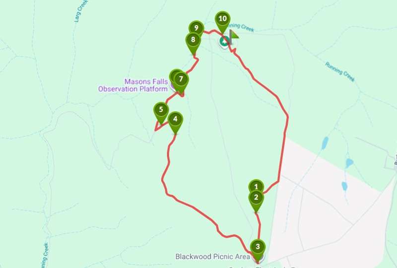
Mason Falls Loop Walk Map
Interactive map
This walk is not well sign-posted so you may need to navigate yourself a bit, but the tracks are all on google maps. Check you have good coverage when you arrive or better yet take a printed map.
From point (3), follow Wallaby Trail, after point (5) Walllaby Trail intersects into Running Creek Track, point (6) is Masons Falls and point (10) is Masons Falls Picnic Area.
Access for Dogs:
Dogs are not permitted.
Location
National Park Road, Kinglake West 3757 View Map
Web Links
→ Masons Falls loop, Kinglake National Park (Walking Maps)


")