Marysville - Michaeldene Nature Trail Walk


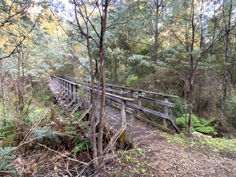
The Michaeldene Nature Trail Walk loop walk is a medium grade walk through pristine Australian Bushland. After the 2009 Black Saturday Bushfires devastated the area, the Department of Environment & Primary Industries (DEPI) restored the track and rebuilt the Timber Tramway Bridge and the viewing platform beside the Taggerty River (long loop).
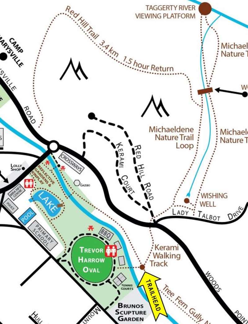
You can complete either the 2.7 km (20 min) short loop to the Timber Tramway Bridge, or the 4.3 km (40 min) long loop past the bridge to the Taggerty River. The walk starts from the Steavenson River crossing at the tennis courts in Gallipoli Park, but you can also intersect with the walk track at the corner of Marysville-Woods Point Road and Red Hill Road (S37.511075, E145.753680).
Features
- Starts from Gallipoli Park, Marysville
- Easy grade walking track
- Visits old Timber Tramway Bridge (rebuilt)
- Visits Taggerty River
- Taggerty River platform with a seat
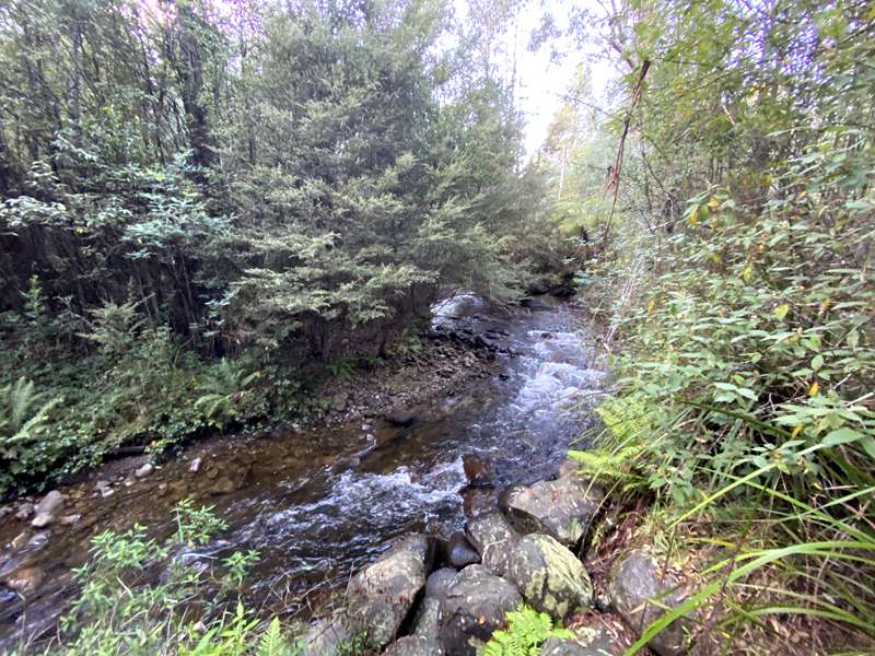
- River and stream crossings
- Beautiful fernery glades
- Abundant flora and fauna
- Great walk for finding moss, lichen and fungi
- Excellent photographic opportunities
- Interpretative Signage at the track-head
Review:
We started the walk at the intersection of Red Hill Road and Lady Talbot Drive. There is a small carpark and signage about the walk here.
Initially there is quite a wide track and after a short time you come to the start / end of the loop(s) which make up the walk. We went on the right (east) side of the loop and soon came to a sign pointing to a side branch to the Wishing Well which is a gully filled with ferns. As we continued there was a lush gully on our left and signs of lyrebird scratchings along the track.
At the trestle bridge you can either return on the short loop or follow the Tramway signage to the right on the long loop.
We did the longer loop. The track now passes through bushland and becomes narrower. After a while the track crosses over a gravel road, across a little bridge over a creek and through thicker vegetation with more tree ferns. The signage becomes a little complicated because the track intersects with another track. Here turn left onto the Cascades Trail and you will come to a short branch to the Viewing Platform on the Taggerty River.
Retrace back to the main trail which passes through light bushland and crosses over the gravel road again. Just before the trestle bridge the track turns to the right and continues on. After a while the Cascades Trail (seems to be named Red Hill Trail on the map above) diverts off to the right but you should stay on the Michaeldene Track to the south.
We would definitely recommend doing the longer loop because it has the added attraction of reaching the Taggerty River.
Photos:
Location
2 Kerami Crescent, Marysville 3779 View Map
Web Links
→ The Best Family Activities in the Yarra Valley
→ The Best Waterfalls in Melbourne and Victoria for Family Visits


")