Indecipherable Signage Walk (Mount Evelyn)


.jpg "Indecipherable Signage Walk (Mount Evelyn)")
This 5km walk doesn't have an official name but we've unofficially named it "Indecipherable Signage Walk" because the broken and missing direction signs and the difference in track names between different maps makes it quite difficult to find and follow the route. The saving grace is that you should have phone reception and can use maps on your phone to stay on track.
Indecipherable Signage Walk (Mount Evelyn) Map
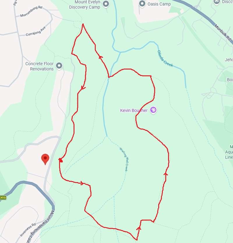
The walk starts opposite 82 Inverness Road, Kalorama where there is a water tank and a small parking area.
- From the back of the Inverness Road car park, walk uphill (towards Mount Dandenong Tourist Road) about 50 meters until a small trail leads off to the left. This is actually one of two short connector tracks used by BMX riders.
- This joins into Wols Track (which is not signposted at this point). Walk straight ahead.
- Stay on Wols Track for about 1km until it joins into Richardsons Track. Half way along Wols track there is a very steep gully which can be extremely muddy and slippery. If you don't fancy traversing the gully, there is an alternative route south of Wols Track along good bush roads which bypasses the steep section of the gully. This route initially ignores Wols Track and eventually connects into it.
- Then turn left into Richardsons Track and follow it until it junctions with Alpina Track. Turn left into Alpina Track.
- Alpina Track descends following a ridgeline for about 1.3km. This area has a lot of bike trails leading off from Alpina Track.
- Alpina connects into Track 20 (this could also be called Pipeline Track, Track 10 or Rd 10 on various maps). Turn left. Various tracks intertwine in this area but they all head in the same direction and reach the same end point.
- After about 1km, the tracks merge at the end of Murrunbung Road / Wombalano Road. Down the hill in the distance is Mt Evelyn Recreation Reserve. Turn left onto Wols Track again, and head up the hill.
- After about 300m you will reach a track junction. You can turn left to stay on Wols Track and return to where you first joined it or walk straight ahead on Willkilla Track to return to the parking area. Both options are more of less the same distance but Wols Track is more up and down.
-embed01.jpg)
Access for Dogs:
Dogs are not permitted.
Photos:
Location
82 Inverness Road, Kalorama 3766 View Map


