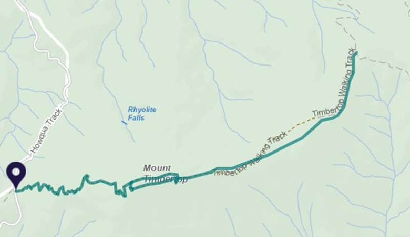
Howqua Hills - Mt Timbertop Walk

This is one of the best day walks in the Victorian High Country with simply unforgettable views to reward you at the peak. The Timbertop Saddle picnic area has picnic tables and fire pit.
At the start of the 5.5 km return walk, you are surrounded by tall eucalypt forest and as you climb you reach majestic snow gum woodland. See if you can spot native wildlife along the way, including wallabies, wombats and parrots.
The summit loop provides expansive and spectacular views over the Mansfield area, the Delatite Valley and beyond to the peaks of the Victorian Alps. Stop and take in these awe-inspiring sights.
There are occasional steps, short steep hills, formed track, some obstacles and limited signage. Bushwalking experience recommended.
How to get there
The walking track is best accessed from Timbertop Saddle picnic area and car park. From Mansfield follow the Mt. Buller Rd to Merrijig. Turn right onto the Howqua Track, follow for 6.5kms.
The co-ordinates of the start point of the walk are: -37.879808,145.1261952
Access for Dogs:
Dogs allowed
Location
Howqua Track, Howqua Hills 3723 View Map
Web Links
→ www.exploreoutdoors.vic.gov.au/activities/walking-in-victoria/mt-timbertop-walk


")