Harrietville - Tronoh Dredge Swimming Hole and Walks


The Tronoh Dredge hole was once the location of the biggest bucket dredge in the southern hemisphere which operated from 1942 to 1954. A section of the Ovens River east branch was cut off from the main river course to dredge it for gold.
Nowadays, the hole has been filled with water to create a recreational lake. It is a great location for a picnic, swim or canoe. The lake has a pier (Joop's Jetty), floating swimming pontoon and a rope swing.
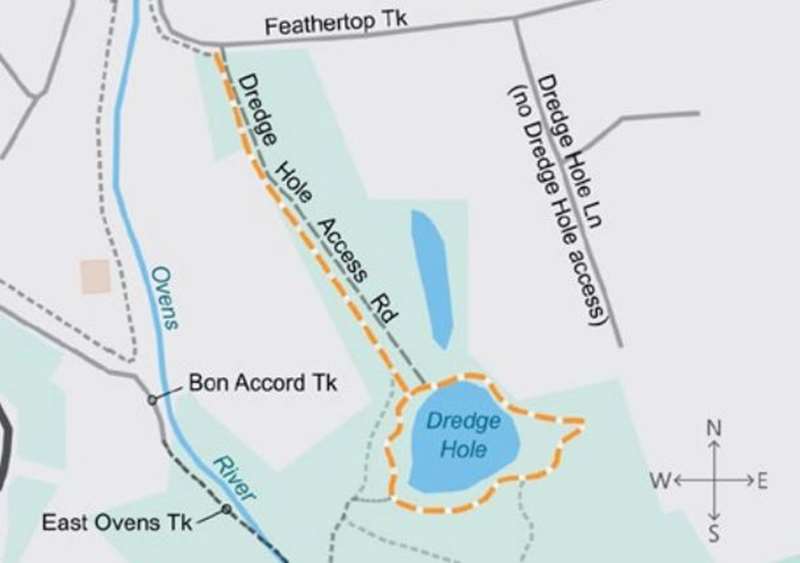
There are also a number of walking trails that meander around the dredge holes. Begin your walk from the Tronoh Dredge Hole car park off Feathertop Track and head either way around this man-made lake. The walking tracks weave through native bush and ferns, along the Ovens River or around the dredge holes. These tracks are signposted and offer further information on the significance of historical sites along the trails.
One problem with the swimming hole is algal blooms which have occurred on a number of occasions due to lack of flow of fresh water. There is a second smaller lake to the north but that is not suitable for swimming due to the stagnant water. It is recommended that you check that the swimming hole is open before travelling there.
The waterhole is most suited to experienced swimmers since the banks are fairly steep and the hole is deep.
Tronoh Dredge Walking Track
Explore the remnants of a historical gold dredging site on a serene walk around a deep waterhole.
Distance / time: Distance / time: 2.2 km / 45 min
Grade 2: No bushwalking experience required. Formed track with gentle hills and steps. Signposted.
Start at the parking area at the corner of Feathertop Track and Dredge Hole Track. Follow Dredge Hole Track south for 400m to the Tronoh Dredge Hole Picnic Area. From here, the trail runs along the water's edge and can be walked in either direction.
Tronoh Dredge Walking Tracks
Short distances. Grade 2, no bushwalking experience required. Well formed with some steps. Clearly sign posted.
A series of short walking tracks are found within the Reserve, weaving through native bush along the East Branch of the Ovens River and around the dredge holes. Many historic and natural features can be found within the reserve, some of which have been highlighted by interpretive signs.
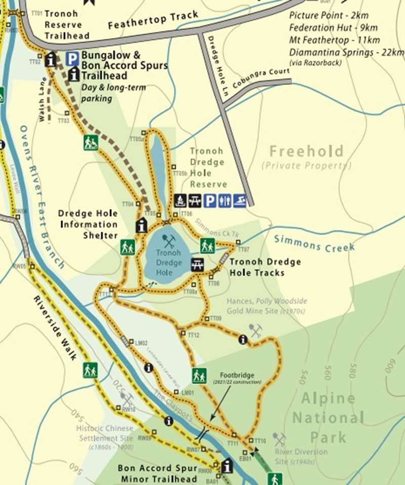
Dredge Hole Loop: Beginning at the Tronoh Dredge Hole car park, this loop is a pleasant stroll around the ponds left by the mammoth Tronoh dredge. There are several spots to picnic and a pleasant fern-filled gully crossing Simmons Creek. This loop also links with Hance's Mine Tk, the East Ovens River Tk, and Landmates Levee Wall Track.
Hance's Mine: A deep lead alluvial mine re-opened by Mr. Don Hance during the 1970s and 1980s. The workings mined gold-bearing alluvial gravels not able to be accessed by the bucket dredges.
Landmates Levee Wall Track: An earth bank constructed by the Tronoh Company to divert the course of the East Branch of the Ovens River as part of the preparatory works associated with the Tronoh bucket dredge during the 1940s.
Location
Tronoh Lane, Harrietville 3741 View Map
Web Links
→ Harrietville Tracks Guide (PDF)


")