Glenlyon - Biolink Walk


The Biolink walk is an easy 4.6 km return, 1.5 hour walk.
Biolink Walk Map
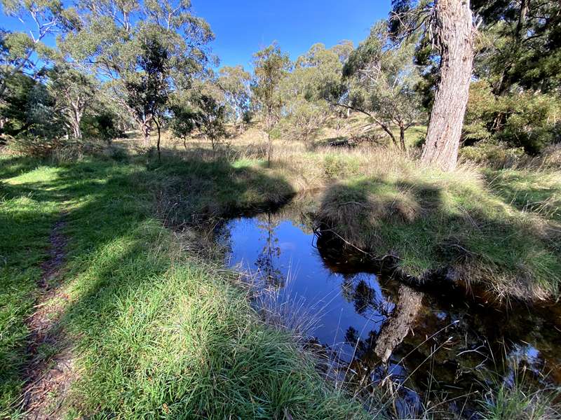
The Glenlyon Biolink meanders alongside the Loddon River at Glenlyon, from Loddon Drive to Dysart Street. Sometimes the river is full and fast flowing, at other times only the occasional puddle or spring is evident. Always there is something to see or hear.
Alongside the trail is the Glenlyon Recreation Reserve and Mineral Spring - lovely spot to 'take the waters'. There is ample parking, picnic tables and chairs, with public toilets and access to a BBQ.
Historic Sites Along the Trail
1. Site of flour mill and water wheel pit. The mill ran from 1873-1886. It's closure was due to the statewide drought which lasted from 1880-1886, resulting in lack of water and crop failures.
2. Site of former river crossing. There are still a few cobblestones visible. This was the only way to cross the Loddon before the first bridge was built in 1864. The track came down the hill beside the present road, along the bottom and wound up to Loddon Drive.
3. Site of a pine plantation planted by Glenlyon School pupils circa 1956 with the purpose of selling the mature timber and earning money for the school.
4. Remains of a weir built by Jack and George (Curly) Dixon to irrigate their potato patch circa 1950s. George Dixon was a WWI veteran. Above, former bluestone quarry: Quarry Reserve.
5. Site of gravel pit owned by the Fleischer family. The Shire Council used the gravel for road metal and local women collected pipe clay to whitewash their fireplaces. Ian collected it to whitewash the Hall fireplaces.
6. The gate up the hill marks a former entrance to the reserve. It is proposed to restore the track and use it again.
7. The river has changed course many times due to flooding, fallen trees, debris etc. Traces of the old course are still visible.
8. The small gate up the hill used to be the access from Molesworth Street, via a turnstile. Another turn-stile was situated at the Loddon Drive entrance.
9. Weir and swimming pool. In the 1950s and 60s Glenlyon kids learned to swim in this pool. Those who were older and more competent swam in the dam. The wall of the weir was raised in later years.
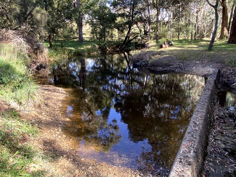
10. Here one can see the traces of the water race along the west side of the track, against the base of the hill.
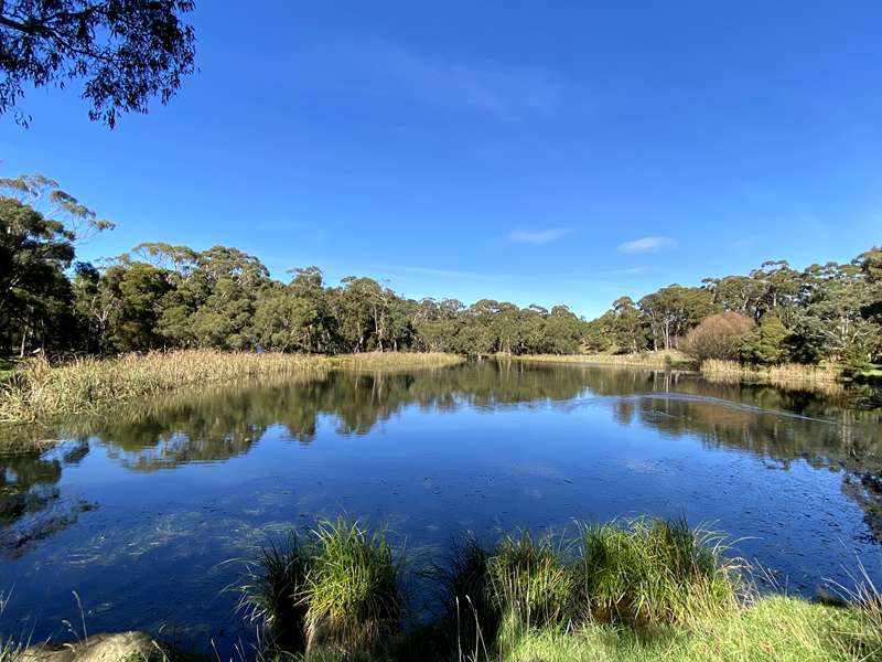
11. Glenlyon Dam was originally constructed circa 1875 to supply water to the flour mill. It now serves the community as a recreational and emergency water supply. Traces of a former fish hatchery can be seen on the east side. Below the present dam wall is the location of the beginning of the water race. The road had a different configuration in years gone by; the present gravel entry and concrete pad were non-existent and fire trucks used a track nearer the bridge and parked below the dam wall to fill up.
Information and map by Ian Fleischer and the Glenlyon Upper Loddon Landcare Group
Walk Safety
- Check weather conditions before setting out.
- Always carry water.
- Wear sturdy footwear, appropriate clothing & sunscreen
- Stick to the track. Keep well away from mine shafts.
- Plan your walk and inform someone where you are going and your intended return.
- Never walk alone in the bush.
- Observe fire regulations and total fire bans.
- If you need urgent help, call 000.
Please Remember
- Take any rubbish when you leave.
- All native animals and plants are protected, as well as relics such as stone walls & old huts.
Access for Dogs:
Dogs must be kept on a leash.
Review:
A lovely walk following the Loddon River with the nature of the walk dependent on the amount of water in the Loddon River. When we did the walk there were only sections with water. There is a small space to park beside Loddon Drive off Daylesford-Malmsbury Road. At this point it is a steep gully down to the Loddon River. Walk about 100m south along Loddon Drive and look out for the "Walking Trail" sign.
When you get to point 9 on the map, you can cross a bridge for a diversion into the Recreation Reserve which has a playground, table and toilets.
At the end of the walk you can either retrace your steps or do what we did - head to the Glenlyon Mineral Spring south of the Recreation Reserve and then cross the reserve to get to Loddon Drive using Google maps for navigation if needed.
Interpretative Signage
A Changing Landscape
During the late 1850’s, a township grew up where the Loddon River crossed the road to the Jim Crow diggings. Stores and hotels were built to serve those passing through and those who lived in the area.
This township became known as Glenlyon after the original “Glenlyon” run, taken up by Richard Babington in 1846. The farming potential of the area was quickly recognised. After the Land Act of 1860 came into being, closer settlement soon followed. Trees were felled and burned to clear the land as the Act required and a thriving sawmill industry started up, supplying timber for gold mines, buildings, roof shingles and firewood.
Wattlebark was harvested for the leather industry, and in later years, the smoke from charcoal burners’ kilns could be seen throughout the forest. Farmers also burned off the stubble in their fields at the end of summer after the harvest. Settlement and changing land uses have dramatically shaped the landscape you see today. Take some time to reflect on the history of the township and look out for signs of times past that are still evident today.
The Glenlyon township and businesses set up along the Loddon River thrived throughout the goldrush, aided by the construction of the town’s first wooden bridge in 1864. At its highest point, the road surface was 15m above the riverbed, quite a height in those days. The bridge was crossed for the first time by a Cobb & Co coach from Malmsbury on July 17, 1864.
Early photographs of the old Glenlyon Bridge show an overall lack of both vegetation and weeds. Whilst the construction of the bridge made travel to and from Glenlyon quicker and easier, it also aided the introduction and spread of invasive weeds to the area, a legacy of times past that continues to be battled today.
However it was the discovery of gold in 1851 in central Victoria that initiated the most extensive timber harvesting in the region. The forests surrounding Glenlyon were exploited for saw milling and firewood cutting over many years until the introduction in 1940 of State Government policy to control the rates of timber extraction and conserve dwindling timber resources.
The Forest of the Foothills
The landscape around Glenlyon has been shaped by many volcanic eruptions. Huge lava flows from these ancient volcanoes poured along existing valleys, filling them in and creating the rolling countryside of red earth that we know today. Beyond the reach of the lava, the hills and rugged slopes of more ancient rock and clay were densely covered in tall forest, while the rich red soil of the volcanic plains was covered with tall grass dotted with shrubs such as bottlebrush and wattle.
In 1846 it took six weeks to travel from Melbourne to Glenlyon via Mt Macedon. An early visitor described his visit to the area: "At that time there was only a shepherd's hut in Glenlyon and the reserve was covered in large gum and wattle trees but the flat on the Loddon was denuded of timber and the long grass made it difficult to get over. The grass was about 6 feet high and the only difficulty we had was finding our bullocks in the morning."
The rich volcanic soils and damp river valley around Glenlyon support a beautiful diversity of native vegetation, which has been enhanced over time by revegetation projects and natural regeneration.
A platypus is a resident species of the Loddon River, often spotted by local walkers along the Bio-link trail.
Listen out for the distinctive call of the Pobblebonk frog, which sounds like a loud "bonk" or "plonk".
Loddon River Restoration and Recovery
Birds of the bushland
The Bio-link is a wonderful place which supports a bounty of birdlife. As this walk takes you through a range of habitat types you will come across a wide variety of birds. Take a moment to listen to the songs of the birds and the sounds of the bush.
Locals commonly observe the delightful Superb Fairywren bouncing around the ground excitedly whilst the charismatic Laughing Kookaburra prefers to perch patiently in the trees above, searching for its next meal.
Birds bring the bush alive with their colours and songs but they also have a very important role to play in restoring and regenerating the local landscape. As birds move around they disperse seeds, pollinate flowering plants and predate pest insects that threaten native vegetation.
Keep a look out for these commonly seen birds along the Bio-link Trail: White-winged Chough, Azure Kingfisher, New Holland Honeyeater, Red Wattlebird, Grey Shrike-thrush, Superb Fairywren and Kookaburra
The Glenlyon Upper Loddon Landcare Group formed in 1995 to deal with gorse, hawthorn, blackberries, bent grass, bracken and cape broom, rabbits, foxes and erosion. The group has been successful in obtaining grants from various land management agencies to control these noxious invasive weeds. The group has been very active since forming, supporting landowners to control weeds through chemical subsidies and loans of equipment, facilitating gorse and rabbit control programs and running many community field days to learn about managing our natural environment. In 1999 work to clean up the Loddon River in Glenlyon Township began in earnest. Glenlyon Landcare, along with Glenlyon Pony Club and Glenlyon Gun Club, were successful in jointly obtaining a Parks Victoria community grant to control the gorse and noxious weeds on the south bank of the river opposite the Glenlyon Reserve.
In the following years, with the support of the Department of Sustainability and Environment (DSE), North Central Catchment Management Authority and Hepburn Shire Council, the Glenlyon Landcare Group extended the work along the river, cutting through walls of blackberries and gorse to establish the Bio-link, a walking path between the Glenlyon Reserve and the Glenlyon Bridge. Extensive replanting has replaced the noxious weeds and local birds and animals are returning to the site. This work is ongoing, as the area is prone to flooding and the regrowth of noxious weeds requires constant follow-up. The floods in 2010–11 extensively damaged the work undertaken along the Bio-link. The Glenlyon Landcare Group has held many working bees to propagate plants, replant the site, maintain plantings and the track, follow up weed control and, of course, have some fun together.
Photos:
Location
Loddon Drive, Glenlyon 3461 View Map


")