Geelong Industrial Heritage Trail


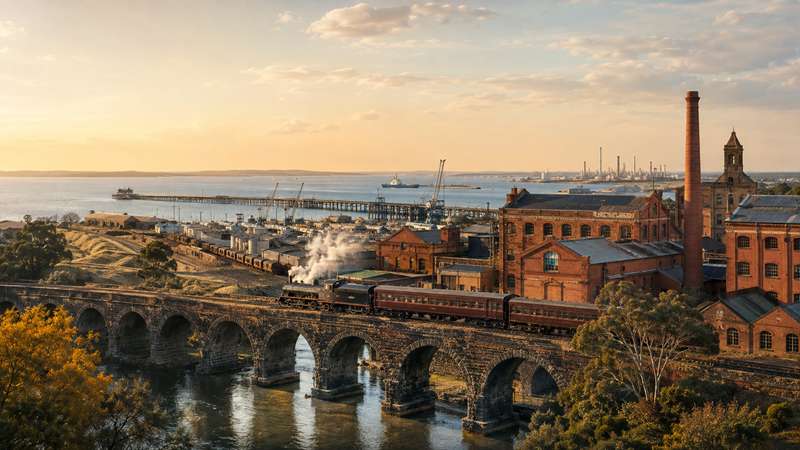
Geelong - Industrial Heritage Trail
The Geelong Industrial Heritage Trail explores the factories, bridges, railways, power stations, port infrastructure and communications buildings that helped transform Geelong into one of Victoria's most important manufacturing centres.
The official City of Greater Geelong trail is a collection of heritage places spread across central Geelong, the Barwon and Moorabool river corridors, North Geelong, Corio, Moolap, Point Henry, Batesford, Fyansford and Queenscliff. It is not a continuous, signposted walking trail and the council does not provide a total distance, duration or prescribed route.
A vehicle is required to visit the entire collection. Smaller groups of sites can be explored on foot or by bicycle, particularly along the Barwon River, around Fyansford and within central Geelong.
Distance: No official total distance - sites are spread across Greater Geelong and Queenscliff
Time: Allow most of a day to see the principal exterior locations, or longer if visiting museums, businesses and guided tours
Route: Self-guided driving, cycling and walking trail
Suggested Start: Geelong Telegraph Station, 83A Ryrie Street, Geelong
Accessibility: Varies considerably between locations
Trail Map: No complete mapped route is currently provided by the City of Greater Geelong
The trail features:
- Historic factories and industrial complexes
- Railway, maritime and communications infrastructure
- Bluestone, iron, steel and concrete bridges
- Sites associated with salt, aluminium, petroleum, paper, whisky, electricity and motor-vehicle production
- Several places that have been adapted as museums, galleries, hospitality venues and creative precincts
- Historic structures dating from the 1830s through to the late twentieth century
Suggested Trail Sections:
Central Geelong and the Barwon River
This group includes Geelong Telegraph Station, Geelong Gaol, Moorabool Street Bridge, James Harrison Bridge, McIntyre Bridge and Queens Park Bridge. The river bridges can be combined with sections of the sealed Barwon River Trail.
Fyansford and Batesford
This particularly rewarding heritage cluster includes Fyansford Hotel, Fyansford Paper Mills, Moorabool Viaduct and Batesford Bluestone Bridge. Some locations can be combined with riverside walks, although a vehicle is useful for travelling between Fyansford and Batesford.
North Geelong, North Shore and Corio
Sites include the former Ford factory, Geelong B Power Station, Corio Distillery, Viva Energy Refinery and Refinery Pier. Most are working, redeveloped or privately controlled industrial properties and should generally be viewed from public roads.
Moolap and Point Henry
Cheetham Salt Works, Point Henry Smelter and Point Henry Pier illustrate the industrial use of Geelong's eastern shoreline. Public access is limited and visitors must remain outside operational, fenced or restricted land.
Geelong to Queenscliff Railway
The former railway alignment can be followed towards Queenscliff using sections of the Bellarine Rail Trail. The surviving Queenscliff station is now used by the Bellarine Railway.
Heritage Locations:
1. Cheetham Salt Works
Addresses: 11-129 Portarlington Road, Newcomb VIC 3219 and 45-131 Point Henry Road, Moolap VIC 3224
Manchester manufacturing chemist Richard Cheetham arrived in Victoria during the nineteenth century and established salt works near Geelong. The first salt was produced in 1894.
Increasing demand led the company to acquire additional land in Victoria and later expand into South Australia and Queensland. Food-grade and industrial salt were produced, while the works also included accommodation for employees and their families. The company became Cheetham Salt Proprietary Limited in 1903 and was acquired by Ridley Corporation in 1992.
This is a working industrial area rather than a conventional visitor attraction. View the landscape and surviving industrial features only from legal public access points.
2. Point Henry Smelter
Address: Point Henry Road, Moolap VIC 3224
Construction of the Point Henry aluminium smelter began in 1960, with smelting commencing in 1962. The plant eventually had an annual production capacity of approximately 185,000 tonnes of aluminium and became one of the most recognisable industrial complexes on Geelong's eastern shoreline.
After production ended, extensive decommissioning and environmental assessment were undertaken, including groundwater bores and soil sampling across the former industrial land.
The site is not a publicly accessible industrial museum. Observe fences and closure signs and do not enter the former smelter property.
3. Point Henry Pier
Address: End of Point Henry Road, Moolap VIC 3224
Point Henry Pier opened in 1963 to serve the aluminium smelter.
The wider location is also important to the history of shipping in Corio Bay. Before European settlement, a sandbar extending between Point Lillias and Point Henry restricted ships from entering the inner harbour. Work on a channel through the sandbar began in 1853. A deeper channel opened in 1893 and was named the Hopetoun Channel after Lord Hopetoun.
The shoreline can be viewed from public areas around Point Henry, but access to industrial structures may be restricted.
4. Geelong-Queenscliff Railway
Address: Queenscliff Railway Station, 20 Symonds Street, Queenscliff VIC 3225
The Queenscliff railway opened in 1879 as a branch of the railway at South Geelong and was among Victoria's earliest branch lines. The original journey between Geelong and Queenscliff took approximately one hour.
Passenger services ceased in 1931 following increasing competition from road transport, although Sunday excursion services continued and became particularly popular from the 1950s.
Part of the former alignment is now followed by the Bellarine Rail Trail. Heritage trains operated by the Bellarine Railway use the section between Drysdale and Queenscliff. Check the official Bellarine Railway website for current services, bookings and fares.
5. Breakwater Across the Barwon River
Address: Breakwater Road at the Barwon River, Breakwater VIC 3219
The structure that gave the suburb of Breakwater its name was constructed to prevent saltwater from moving upstream and to maintain the river level through Geelong.
Construction began in late 1838 under Captain Foster Fyans and was completed in May 1840 using convict labour. The early structure failed during a flood in 1844 and was not completely rebuilt until 1849. It remained substantially unchanged until reconstruction for modern traffic during the 1960s.
The site remains an important river crossing and a reminder of Geelong's earliest public works.
6. Moorabool Street Bridge
Address: Moorabool Street at the Barwon River, Belmont VIC 3216
This bridge occupies the site of the first formal crossing of the Barwon River. A wooden bridge opened in 1848 but was swept away by a major flood on 23 May 1852. Two government punts were subsequently used to create a temporary pontoon crossing.
A two-lane iron bridge opened in 1859 and was replaced in 1924 because it was too narrow for tram traffic. The replacement concrete and steel-girder bridge opened in 1926 and was widened to four lanes in 1966.
The bridge carries Moorabool Street across the river between South Geelong and Belmont. The structure and river can be viewed from the adjoining Barwon River Trail.
7. James Harrison Bridge
Address: Princes Highway at the Barwon River, Belmont VIC 3216
The James Harrison Bridge carries the Princes Highway across the Barwon River. Construction began in 1988 and was completed in 1990, diverting heavy through-traffic away from the Belmont shopping centre.
The crossing consists of twin, parallel two-lane bridges. Its main river span uses a concrete cantilever design, with smaller concrete box spans extending the viaduct to the south.
It was named after James Harrison, the Geelong newspaper proprietor, engineer and pioneer of mechanical refrigeration.
8. McIntyre Bridge
Address: Barwon River Trail near Barwon Grange, Newtown VIC 3220
The 192-metre McIntyre Bridge crosses the Barwon River east of the James Harrison Bridge. It combines a concrete pedestrian walkway with a utility pipe supported by steel cable stays.
Constructed in 1967, it carried sewage from Geelong towards the ocean outfall at Black Rock and reduced pressure on the earlier sewer aqueduct further downstream. The bridge was designed by engineer J.L. van der Molen and was among Australia's early structures to use computer engineering during its design.
Pedestrians and cyclists can cross the bridge as part of the Barwon River Trail.
9. Queens Park Bridge
Address: 1 Queens Park Road, Highton VIC 3216
The narrow bridge across the Barwon River links Highton and Newtown. The original crossing point was served by a punt before a wooden cattle bridge was constructed in 1861.
The first bridge collapsed during a flood in 1870. A replacement opened in 1872 and remained a toll crossing until 1877. Flooding again damaged the bridge in 1909.
The present one-lane steel bridge was constructed in 1930. A water main and pedestrian path were added in 1963, and the deck height was subsequently modified. The historic bridge remains open to traffic and pedestrians.
10. Fyansford Hotel
Address: 67 Hyland Street, Fyansford VIC 3218
The Fyansford Hotel stands near the junction of the Barwon and Moorabool rivers, one of the earliest river-crossing locations in western Victoria and the centre of the former settlement known as Fyans Town.
The two-storey brick hotel was constructed in 1854-55 for publican C.B. Dawson. Its transitional Colonial Georgian design includes a symmetrical arrangement of windows and an originally open angled corner entrance.
It was one of numerous hotels and public houses constructed around Geelong immediately after the gold rushes. The hotel remains an important landmark and continues to operate as a hospitality venue. Check its official website for current opening and kitchen hours.
11. Moorabool Viaduct
Address: Shepherd Road, Batesford VIC 3213
The 440-metre-long Moorabool Viaduct opened in 1862 to carry the Geelong-Ballarat railway across the Moorabool River valley.
Constructed principally from bluestone and iron, the viaduct remains in railway use. Additional steel piers were installed in 1918 to a design by Victorian Railways engineer Frederick Esling.
The site is also geologically important. Exposures beside the viaduct include white and red-stained sands, calcareous sandstone and lava flows of different ages. The locality gave its name to the Moorabool Viaduct Sand geological formation.
Use public roads and designated viewing locations. Do not enter railway land or walk on the tracks.
12. Batesford Bluestone Bridge
Address: Midland Highway at the Moorabool River, Batesford VIC 3213
The five-span bluestone bridge was erected in 1859 at the historic ford across the Moorabool River, replacing a timber bridge constructed in 1848.
The masonry bridge was built by contractor Barry to designs prepared by the Roads Division of the Victorian Government Board of Land and Works. Its segmental basalt arches are unusually constructed without a central keystone.
The bridge stands near the former Traveller's Rest Inn and has connected the Geelong and Ballarat districts since 1859. It remains substantially intact and in use.
13. Viva Energy Refinery
Address: 90 Refinery Road, Corio VIC 3214
The refinery commenced operation in 1954 as the Shell Refinery and became one of the defining features of Geelong's post-war industrial expansion.
Rail sidings and an overhead loading gantry allowed petrol and diesel to be transferred into tanker wagons for distribution throughout Victoria. Destinations included Bendigo, Kerang, Mildura, Shepparton, Swan Hill and Wodonga. Petroleum transport by rail gradually declined and ended during the 2000s.
The refinery remains an operational and security-controlled industrial site. It should only be viewed from public roads and approved public areas.
14. Refinery Pier
Address: 90 Refinery Road, Corio VIC 3214
The Geelong refinery commenced production on 18 March 1954, becoming the first of Australia's post-war oil refineries to enter service.
More than 1,000 people from 14 countries worked on its construction during the early 1950s. Shell commissioned internationally renowned photographer Helmut Newton to document the project.
The pier and associated refinery infrastructure form part of a restricted working port and industrial complex. There is no general public access.
15. Corio Distillery
Address: 35 Lowe Street, Corio VIC 3214
The Corio Distillery was established by British Distillers during the 1920s. Its surviving main building was formally opened in March 1929.
Burnett's Dry Gin was the first spirit produced at the site. Corio whisky followed after being matured in oak casks. At its peak the operation supplied a substantial proportion of the Australian whisky and gin market and was described as one of the largest distilleries in the Southern Hemisphere.
The former distillery is now used for commercial purposes. It is not a public whisky museum, so the historic building should generally be viewed from the street.
16. Ford Motor Company
Address: 379 Melbourne Road, Norlane VIC 3214
The Ford Motor Company established its Geelong complex during the 1920s. The site became central to Geelong's manufacturing history and to the development of the Australian automotive industry.
The original 1925 sections are nationally significant examples of the stripped Classical architectural style. Distinctive elements include large brick and rendered wall planes, vertically emphasised pavilions, glazed colonnaded bays, monumental terminal pylons and landscaped grounds containing mature palm trees.
Vehicle manufacturing in Australia ended in 2016, but significant sections of the historic complex survive. The property is not generally open as a public museum and should be viewed from public roads.
17. Geelong B Power Station
Address: 50 Mackey Street, North Geelong VIC 3215
Geelong B Power Station was officially opened in 1954 and was the largest Victorian power station outside the Latrobe Valley. Much of its electricity supplied Geelong's expanding industrial sector.
The station's boilers produced high-pressure steam, with coal transported to the fuel bunkers by mechanical conveyors. By the 1960s the station was primarily used during periods of peak demand because newer Latrobe Valley plants operated more economically. It closed in 1970.
The surviving building later became known for the Powerhouse Geelong industrial street-art project. The property has subsequently been associated with redevelopment plans, so do not assume that interior access or a public street-art venue is currently available.
18. Fyansford Paper Mills
Address: 100 Lower Paper Mills Road, Fyansford VIC 3218
The Fyansford Paper Mill complex was constructed between 1876 and 1878 using locally quarried bluestone and brick.
The surviving heritage complex includes former mill buildings, a manager's residence, six workers' cottages, a bluestone water race, an impeller, tower and stone weir. Paper production began in 1878, with early paper manufactured from shredded rags and cloth.
The former mill has been adapted as a food, arts and cultural precinct containing studios, galleries, a winery, cafe, restaurant and other businesses. Guided heritage tours provide access to stories and areas that may not be evident during an independent visit. Check the official precinct and tour pages for current business and tour information.
19. Geelong Gaol
Address: 202 Myers Street, Geelong VIC 3220
Geelong Gaol was constructed in stages between 1849 and 1864. Built from bluestone to a design by Victoria's first colonial architect, Henry Ginn, it follows the severe Pentonville prison model developed in nineteenth-century Britain.
The building's confined layout, masonry and brickwork preserve evidence of harsh historic prison conditions. Six executions were conducted at the gaol, with Thomas Menard becoming the last person executed there on 28 October 1865.
The building now houses the National Crime and Justice Museum. Exhibitions explore imprisonment, criminal justice, capital punishment and the lives of prisoners and staff. Check the museum's official website for current admission prices, opening hours and tours.
20. Geelong Telegraph Station
Address: 83A Ryrie Street, Geelong VIC 3220
Geelong Telegraph Station was built in 1857-58 following the establishment of the telegraph connection between Melbourne and Geelong. It became the principal centre of communications for the district.
Its time ball linked the building with Geelong's maritime history. The ball was released at 1 pm each day, providing an accurate time signal for residents and shipmasters in Corio Bay.
The building is currently used as office space by Geelong Arts Centre. Its exterior can be viewed from Ryrie Street, but Working Heritage advises that the interior is closed to visitors.
Public Access and Safety:
Several trail locations are private businesses, working factories, operational port facilities, railway property or redevelopment sites. They are not conventional visitor attractions.
Important information:
- Remain on public roads, paths and designated visitor areas
- Do not enter fenced industrial, port, railway or former factory land
- View private properties and businesses externally unless public entry is clearly offered
- Conditions and access arrangements may change at redeveloped industrial properties
- Take care around busy roads, railway crossings and bridge approaches
- Not every section is connected by an off-road cycling path
- Follow current warning, closure and security signs at each location
Opening Hours:
Outdoor locations visible from public roads and paths can generally be viewed at any time. Museums, guided tours, hospitality venues and commercial precincts have their own opening hours. Check the official venue websites before visiting.
Cost:
Viewing the exterior heritage locations is free. Admission fees apply to Geelong Gaol's National Crime and Justice Museum, Fyansford Paper Mill heritage tours, Bellarine Railway services and some other attractions.
Location
83A Ryrie Street, Geelong 3220 View Map
Web Links
→ www.geelongcity.vic.gov.au/whats-happening/arts-and-culture/geelong-arts-and-culture-trails/heritage-trail


