Forrest - West Barwon Reservoir


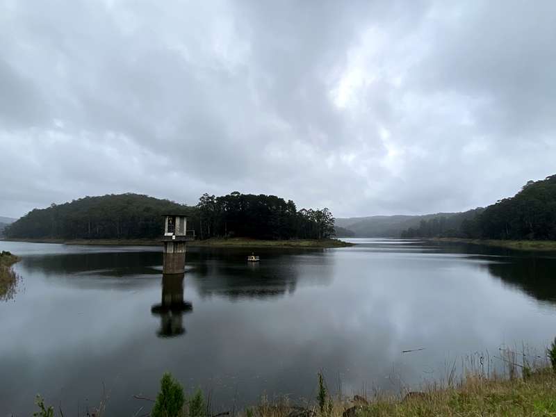
Surrounded by the lush forests of the Otways, West Barwon Reservoir is a peaceful destination for picnics, short walks and spectacular scenery. Built across the Barwon River, the reservoir is the main water supply for the Geelong region and is set within a beautiful forested catchment just a few minutes' drive from Forrest.
A sealed path leads visitors across the impressive dam wall, offering panoramic views over the reservoir on one side and the Barwon River valley on the other. At the far end of the wall, a short path descends to the spillway, where you can often watch water cascading into the river below after periods of heavy rain. Several walking tracks continue through the surrounding forest, allowing visitors to enjoy towering eucalypts, fern gullies and abundant birdlife.
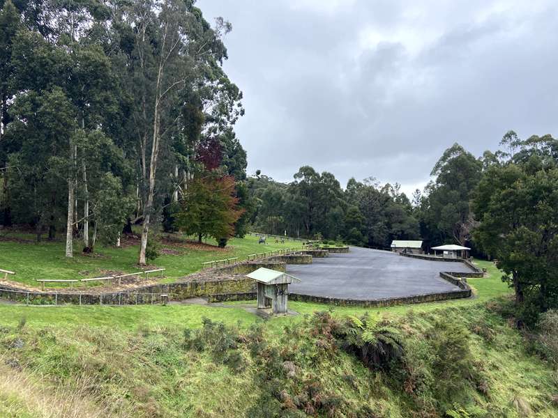
The spacious picnic area includes lawns, picnic tables, free electric barbecues and toilets, making it an ideal stop for families exploring the Otways. The reservoir is also a good place to spot native wildlife, with koalas, kookaburras, superb fairy-wrens and eastern yellow robins regularly seen around the picnic area and walking tracks.
Swimming and boating are not permitted because the reservoir forms part of Geelong's protected drinking water supply. Visitors are encouraged to stay on designated walking tracks and enjoy the tranquil natural surroundings.
Allow 30–60 minutes to stroll across the dam wall and explore the nearby walking tracks, or stay longer to enjoy a picnic. After heavy rainfall, the spillway is particularly impressive.
Fishing
Recreational fishing is permitted from the bank in designated areas. A Victorian Recreational Fishing Licence is required, and boats, kayaks and wading are not permitted.
Access to the Reservoir:
There are two access points to the reservoir. There is direct vehicle access to the main picnic area off Grant Street/Forrest - Apollo Bay Road (just south of Tip Road and Titchs Track immediately south of Forrest township).
A more attractive access point is from Kaanglang Road, south east of Forrest. There is a carpark and shelter with table.
Access for Dogs:
Dogs are permitted on leash and not permitted in the water.
Geography
Located in the picturesque Great Otway National Park roughly a kilometre south of Forrest, the West Barwon dam straddles the junction of the West Barwon River and Munday Creek. The 5,100 hectare catchment consists of steep forested hills rising in elevation from 172 metres above sea level at the dam to 600 metres at Mount Sabine.
The average rainfall of the catchment approximately doubles that of Geelong, the main supply area. Downstream of the dam, the West Barwon River winds through a steep valley for about seven kilometres before widening into a floodplain around a kilometre wide.
Tributaries entering the West Barwon River between the dam and Birregurra include Roadknight Creek, Dividing Creek, Boundary Creek, East Barwon River, Timmins Creek and Matthews Creek.
West Barwon Reservoir History
Work began on the West Barwon Dam in 1959, and the reservoir officially opened in 1965. The project was the largest dam construction in Victoria at the time.
Water supply
Geelong's first reservoirs were constructed on the Moorabool River system between 1872 and 1954, but a growing population and subsequent demand necessitated a new water source. In 1955, the state government sold the Barwon supply system to the Geelong Waterworks and Sewerage Trust, which would later become Barwon Water. Work began on the West Barwon Dam in 1959.
The Governor of Victoria officially opened the dam on 17 November 1965 to an audience of more than 600 guests. The project was the largest dam construction in Victoria at the time and, at the peak of construction, almost 150 workers representing 25 different nationalities were housed in the nearby temporary village. Tragically, two workers were killed during the dam's construction.
Today the system comprises the West Barwon Reservoir, 52 kilometres of open channel and five kilometres of piped siphons to the Wurdee Boluc Reservoir south of Winchelsea, the adjacent Wurdee Boluc Water Treatment Plant, extensive pipelines and numerous tanks and service basins around Geelong, the Surf Coast and the Bellarine Peninsula.
Logging
The Otway forests hold a proud logging history stretching back more than 150 years, with local timber harvesting peaking in 1961. While plantation logging continues in parts of the Otways today, native timber has not been harvested since 2008 and logging in the West Barwon catchment ceased in 2001.
Many of the numerous picturesque walks and cycling tracks around the area follow the old timber tramways - a reminder of the region's logging heritage.
Recreation in the area
Walking
A walk along the dam crest will take in the reservoir, outlet tower and spillway. Continue down the hill past the spillway lookout and cross the bridge over the West Barwon River. Left, towards the dam, is the valve house.
Downstream is a small weir and outlet where water is piped through the hills to the East Barwon River and the Wurdee Boluc inlet channel. Continue on either side of the river half a kilometre or so downstream where the track meets Kaanglang Road in Forrest. The Great Otway National Park features many walks, from short strolls to multi-day hikes.
Picnicking
You're in the Len Sprague Reserve, which has picnic tables, toilet facilities, rubbish bins and free electric barbecues. Camping is prohibited in the reserve and around the reservoir, but there are many campsites elsewhere in the Great Otway National Park.
Watch closely for platypus - they are occasionally spotted in the reservoir.
Fishing
The reservoir is stocked with Brown Trout and has self-sustaining populations of Rainbow Trout and other fish species. Fishing is permitted from the banks of the reservoir, provided you have a valid fishing licence. Boating, wading, berleying, ground baiting and digging for bait are not allowed.
Fauna and flora
The local area has abundant wildlife. Swamp wallabies, koalas, ring-tailed possums, grey kangaroos and crimson rosellas are common. Also present are tiger quolls and yellow-bellied gliders, though they are rarely seen. Watch closely for platypus – they are occasionally spotted in the reservoir. All native plants and animals are protected. Please do not disturb or remove them.
Mountain biking
Designed around the village of Forrest, 15 mountain bike trails showcase the natural beauty of the Otways, passing through tall eucalypt forests, dry heathy scrub and dense fern gullies. Refer to the sign near the toilet block or contact Parks Victoria for more information.
About the Reservoir
Dam embankment
The dam is a zoned earth and rockfill dam with an upstream sloping clay core flanked with filters and rock shoulders referred to as a Nantahala design.
Reservoir
The reservoir holds more than 21,500 million litres of water when full – enough for about six months' supply for the greater Geelong region. The reservoir is home to fish, eels, platypus and a myriad of small macroscopic invertebrate fauna pivotal to the health of the waterway.
Outlet tower
The 30 metre tall concrete outlet tower draws water from the reservoir and pipes it through the dam to the valve house below. There are four inlet portals on the side of the tower, although only two are used. This is to ensure that water is drawn nearer the top of the reservoir, regardless of how full it is.
Spillway
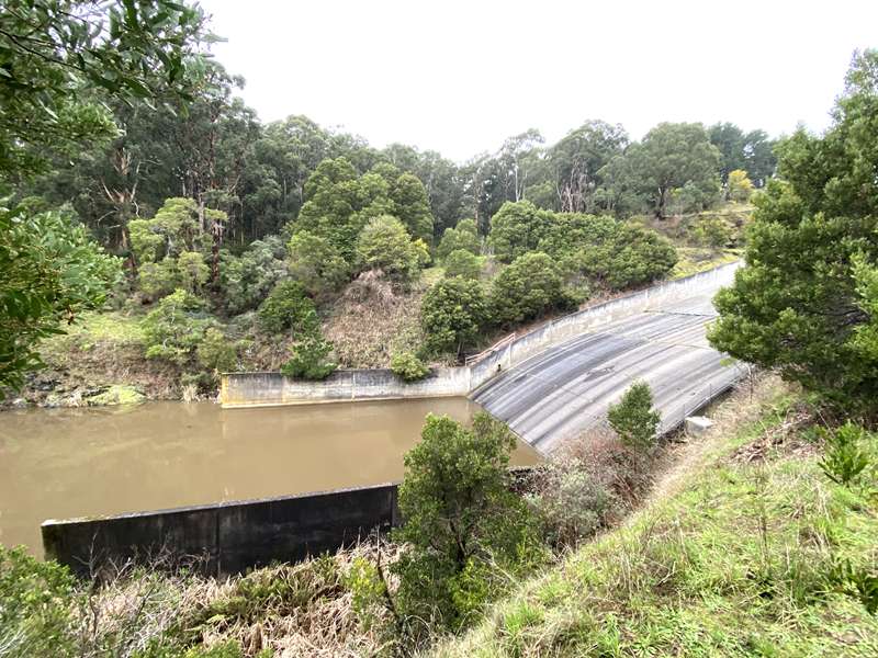
In the rare event of flood, the large concrete ogee weir, 100 metre long spillway and chute collect overflow and direct excess water back to the West Barwon River.
Valve house
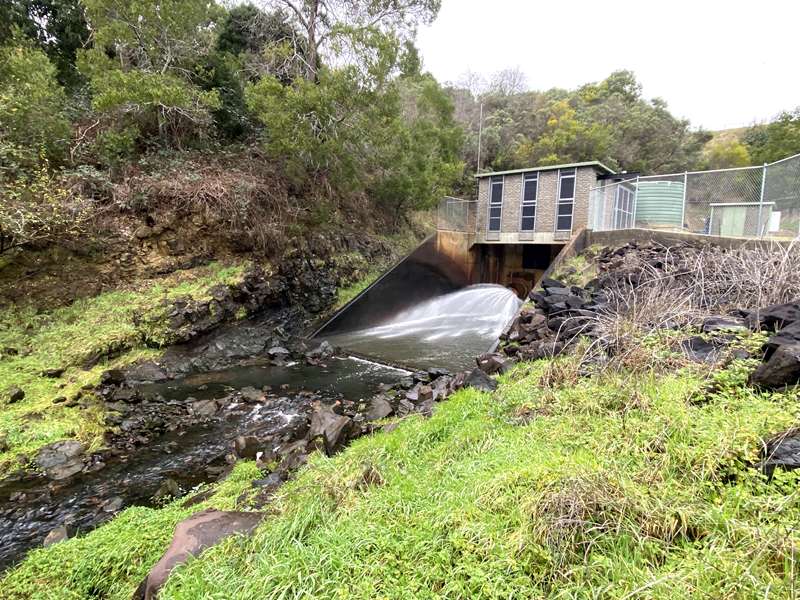
The valve house below the dam regulates water flow from the outlet tower via a cone valve. The maximum throughput of the valve house is 300 million litres per day. The minimum release is four million litres per day to meet passing flow requirements of the Barwon River.
Downstream works
About 400 metres downstream of the valve house, water is diverted through a 600 metre long tunnel to the East Barwon River. Five kilometres further downstream, water is diverted to the Wurdee Boluc Inlet Channel – a 57 kilometre long channel connecting to the large Wurdee Boluc holding reservoir south of Winchelsea.
Number Crunch
Length of dam: 320 m
Height of dam: 43 m
Reservoir surface area (when full): 1.76 km²
Maximum depth of reservoir: 21.4 m
Capacity: 21,504 million litres
Usable capacity: 20,900 million litres
Elevation above sea level (at full supply level): 192.8 m
Area of catchment: 51 km²
Height of outlet tower: 30 m
Length of outlet tunnel: 170 m
Diameter of outlet tunnel: 3.3 m
Daily flow through valve house: 4–300 million litres/day
Daily flow through East Barwon diversion: 3–180 million litres/day
A curious occasional phenomenon is the reservoir "turn over". Sometimes occurring around the first autumn cold snap, this is when newly chilled surface water sinks, pushing deeper water up to the surface. This can disturb sediment from the bottom of the reservoir and give it a brownish appearance.
Review:
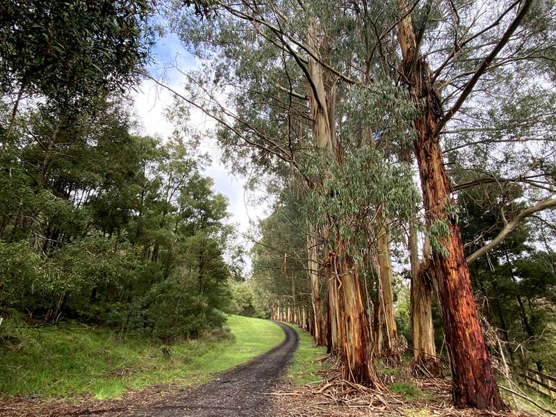
We accessed the reservoir by walking from Kaanglang Road and were pleasantly surprised by how interesting our experience was. From the carpark there is a nice 1.3km walk beside the Barwon River West Branch to the dam wall. Along the way there is a little weir, a beautiful row of gum trees, a metal bridge and a lovely stone bridge with culverts. You will then reach the valve house where water was gushing out of a valve. Near here is a bridge leading to a track with views over the spillway up to the dam weir.
After walking along the top of the dam wall, you reach a picnic area (Len Sprague Reserve) with five unshaded tables, two shaded BBQs and toilets.
To get back to the carpark, you can follow paths on either side of the Barwon River West Branch waterway.
Photos:
Location
Forrest - Apollo Bay Road, Forrest 3236 View Map
Web Links
→ www.yoursay.barwonwater.vic.gov.au/forrest-hub/west-barwon-reservoir


