Dookie Rail Trail Walk


This walk is for those who are keen to experience one of the rail trails scattered throughout Victoria. The Dookie trail is the first in Greater Shepparton.
Start / Finish: Dookie CWA Gardens, Mary Street, Dookie.
Distance: 9.3kms - Return. Follow the path outlined on the map.
Surface / Access: This walk is on sealed gravel path with one small area which is unsealed. Terrain is generally flat with a few small undulations.
Dookie Rail Trail Walk Map
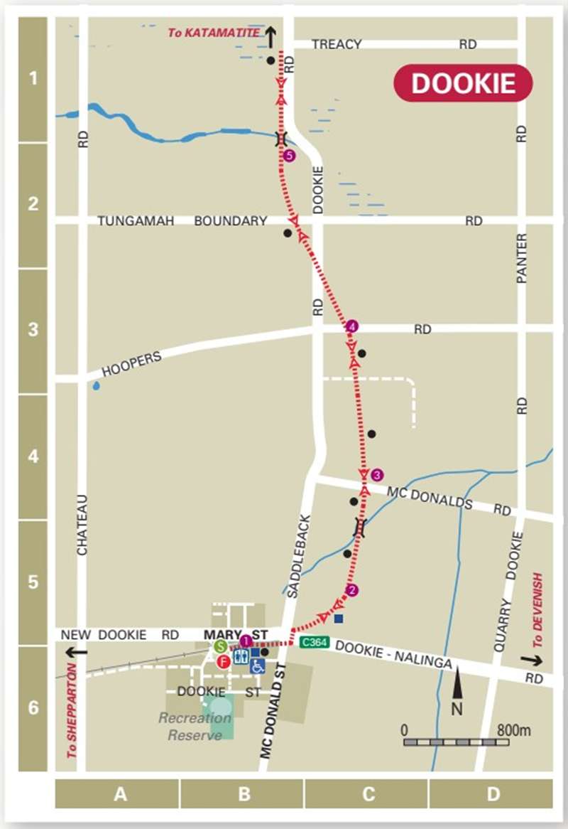
Points of Interest (shown on map):
1 CWA Gardens is home to the towns historic clock, originally housed in the historic Dookie Chateau tower and cellars, built in 1889.
2 The trail is set at the base of Mount Saddleback. To the South you can see Mount Major, Gentle Annie hill to the South East and to the West you will see St Mary’s Church, built in 1898. The church features stained glass windows dating from 1911.
3 The branch line to Katamatite was constructed by the Yarrawonga Shire in 1890 and taken over by the Victorian Railways in 1892. The railway was closed in 1986 and the rails removed shortly after. The branch line from Shepparton to Dookie is still used by grain trains.
4 At the third intersection, you might be lucky to spot the local resident “Willy the Wombat” whose den is the under the road drain.
5 Spot the various fauna and flora including echidnas, blue tongue lizards, kangaroos and even wedge tailed eagles.
Walk Note: There are no toilet or water facilities offered on the trail, but are available at the Dookie CWA Gardens. This walk provides access to geocaches.
Hazards: Care is required when crossing all roads and also be aware of snakes during the warmer months.
Web Links
→ Walking in Greater Shepparton Brochure


