Daylesford - Grounded in Truth: Reading the Country at Contact


This self-drive tour explores important places in the Dja Dja Wurrung landscape where historical records document contact between Dja Dja Wurrung people and pastoralists from the late 1830s. The route follows places recorded in the diary of George Augustus Robinson during his 1840 visit to the area.
The guide acknowledges the survival and continuing culture of Dja Dja Wurrung people and includes confronting accounts of frontier violence. Allow time to pause at each location and reflect on the stories shared.
Distance: 108 km round trip
Driving time: Approximately 1 hour 34 minutes without stops
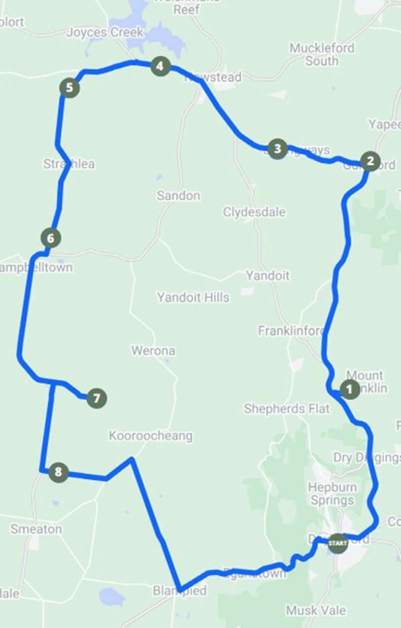
Route: Self-drive loop from Daylesford through Mount Franklin, Guildford, Strangways, Newstead, Joyce’s Creek and Kooroocheang
Start and finish: Daylesford Regional Visitor Information Centre, 98 Vincent Street, Daylesford
Map of Route
Download the Grounded in Truth: Reading the Country at Contact guide.
Tour Stops:
1. Mount Franklin (Lalgambuk) and Mount Franklin Crater (Larnebarramul)
The crater and surrounding landscape are places of significance to Aboriginal people. The guide describes evidence of large ceremonial gatherings in the area. Visitors can walk from inside the crater to the rim for views across the surrounding district.
GPS: -37.27073, 144.16639
2. Big Tree, Guildford
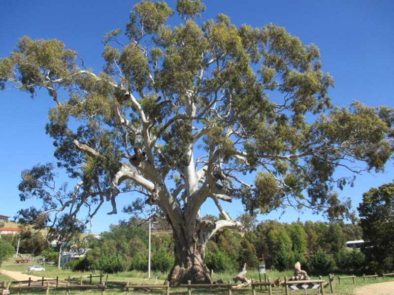
This large River Red Gum is estimated to be at least 500 years old and is listed on the National Trust Register of Significant Trees of Victoria.
GPS: -37.14949, 144.16330
3. Loddon Valley at Strangways
This stop overlooks the fertile Loddon River flats, part of an Aboriginal travel route. Public access to the river is available via the road easement.
GPS: -37.14372, 144.10364
4. The Majors Line
This stop follows the route taken by Major Thomas Mitchell’s wagons in 1836. George Augustus Robinson later travelled through the district in 1840, recording Aboriginal camps, shelters and food sources.
GPS: -37.10120, 144.02931
5. Joyce’s Creek
Robinson recorded Aboriginal shelters, ovens and evidence of food gathering around Joyce’s Creek. The area’s varied waterways, woodlands and plains supported a wide range of food resources.
GPS: -37.11020, 143.97104
6. European Grave Site
This roadside memorial marks the graves of three people associated with the Glengower pastoral run in the 1840s. The guide discusses the historical accounts connected with the deaths commemorated here.
GPS: -37.18846, 146.95905
7. Williams Road
This gravel road offers views across the Stony Rises and Smeaton Plains towards Mount Kooroocheang. The guide describes Aboriginal food gathering and remnant Red Gums recorded in Robinson’s diary.
GPS: -37.27005, 143.98837
8. Hepburn Family Private Gravesite
John Hepburn and members of his family are buried at this site. Public walking access is provided across privately owned paddocks from a car park on Estate Lane. The gravesite is approximately 750 metres on foot from the car park.
GPS: -37.30807, 143.96423
Important Information:
The guide warns that the tour includes powerful and confronting historical content. Most stops are roadside locations. Do not trespass on private property. The walk to the Hepburn family gravesite crosses privately owned paddocks but is permitted from the Estate Lane car park.
Cost:
Free.
Location
98 Vincent Street, Daylesford 3460 View Map
Web Links
→ Grounded in Truth: Reading the Country at Contact Brochure (PDF)


