Daylesford - Cornish Hill Walk


Close to Daylesford's main street take a walk through a magical Reserve where bushland is regrowing on a former gold mining ground.
Cornish Hill is a Crown Land Reserve that was intensively mined between 1852 and the 1950s. It was named after the Cornish miners whose expertise in deep mining techniques was crucial to the extraction of (potentially gold-bearing) quartz from the sandstone reefs running deep under the Hill.
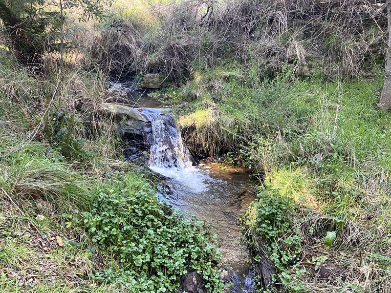
Mining left the Hill turned over and denuded of trees, and it soon became an area where goats and cows grazed and the children of Wombat Hill roamed - all refreshed by the spring-fed Smiths Creek which bisects the Reserve and flows through Lake Daylesford into the Loddon River system.
By following walking tracks through the Reserve you'll see relics of the mining era and evidence of revegetation. Woody weeds such as gorse, blackberry and broom had become established in the disturbed soil, making reclamation and regeneration by the Friends of Cornish Hill a challenging and lengthy process. Wildflowers and native animals now thrive in the Reserve.
Historical Marker Descriptions
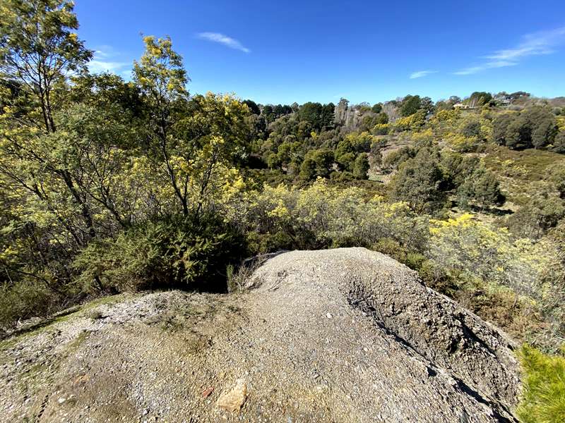
1. Thomas' Lookout & Cornish Miners Monument
Located on the mullock heap of Bonnard's Mine, Thomas' Lookout was built during 1945 by the Daylesford Progress Association as an initiative designed to revive tourism in the 1940s.
Thomas' Lookout sits on top of the rock and gravel brought up when digging Bonnard's mine. It was built after 1945, to appeal to tourists as it has a fine view of the township. Nearby is a monument to the immigrants from Cornwall, England, who worked the mines. Here lies underground the Cornish Reef which, among other deep reefs was a rich source of gold and the Cornish Miners had a long history of mining for tin and other metals deep underground.
2. Bonnard's Mine
Remnants of the mine include the large mullock heap, the shaft has been capped and fenced off and winder foundations remain.
3. Mitchell's Mine
A large mullock heap with one main dumping line approximately 50 metres long and 12 metres high. The shaft has been capped and the winder footings remain.
This shaft, originally 1000ft deep, is the southern end of the Bonnard's/Mitchell's mine complex. Here too was a complex of sheds and a massive poppet head, which was used to move men and material up and down the mine. The two mines became one working unit with underground connections up to 1000ft below ground. The waste (mulloch) was dumped nearby and the gold bearing ore was transported by a small tramway to Freeman's Battery at the site of the current skatepark.
4. Argus Mine
The mine has been capped with a steel grid. A large mullock heap lies to the east and all foundations were removed some time ago to use as road material. The open cut to the east of the Argus is a significant feature and the new track from Smiths creek passes to its southern end.
The Argus mine was part of a massive concentration of deep shaft quartz gold mining on Cornish Hill in Daylesford. Today, fenced off and filled-in, the Argus mine's main shaft once descended 1,000 feet (330m) with horizontal tunnels at many levels below ground. It was worked in conjunction with the nearby Bonnard's and Mitchell's shafts, although they were not connected underground. The valuable gold-bearing ore was transported by a small tramway to the main processing plant of Freeman's Battery, which crushed the quartz to separate the gold.
5. Wildflowers
From June to December wildflowers flourish in this area including six different orchid varieties. The Friends of Cornish Hill emblem is the Nodding Greenhood.
6. Murray's Hill
Fellow volunteer, octogenarian Murray Winter singlehandedly cleared broom and gorse from this area by using only a small mattock.
7. Picnic Area
A popular place to picnic or to rest and take time to reflect.
8. Adit or Horizontal Tunnel
Standing beside the creek and looking upwards towards the adit, you will notice a handmade retaining stonewall, designed to support a water race.
Being close to Smiths Creek this adit provided horizontal access into the sandstone reef within the hillside. It is probably associated with the Argus Company whose capped shaft and mullock heap can be found on the ridge above, at the end of the Argus Spur. Following the creek is a path, once a water race, one of many in the gold mining areas, bringing water to sluice away soil and clay to lay bare the reef. and recover the gold.
9. Smiths Creek Battery Site
Once powered by a large water wheel, all that remains of the Battery is a rectangular shape dug into the ground.
10. South Cornish Mine
Now fully capped with steel grid, the massive mullock heap is easily visible from the track.
11. Long Tunnel
Long Tunnel was described in 1894 as being 2150 ft long. The entrance has been secured.
12. Puddler
Driven by a horse walking in a circle, this equipment was used to 'puddle' or wash the ore with water to separate the gold. A pan or rocker box was then used to further separate the gold.
This circular, flat-bottomed depression, originally up to 1m deep, was dug out to receive material from a private mine nearby. To loosen the clay and separate the gold, water was carried there and large volumes of pay dirt were puddled by a horse that walked all day dragging a set of harrows around. Nearby is the footprint of the original Scascighini cottage built on its Miner's Right block. Close by too is the entry to a mine/drive and a spring that provided the water for puddling.
13. Railway Line
Opened in 1887 and closed in 1953, a portion of the track cuts a swathe through the Hill. The train was used to transport potatoes and firewood. Passenger traffic was high in the early years with an all time record of 50,000 passengers recorded in 1884. Central Highlands Tourist Railway was formed in 1980 and has been restored as a tourist attraction, running regularly on Sundays.
14. School Plantings
Since 2008, local schools have assisted the Friends of Cornish Hill with tree planting activities along the Smiths Creek corridor.
15. Cock's Reward
Another of many filled mine shafts that exist throughout Cornish Hill.
Other sites include Little Cornish Mine, old Trout Hatchery at East Street Spring and Community Park, site of Freeman's Battery.
Access for Dogs:
Dogs are permitted on leash. Cornish Hill is a haven for wildlife. Please restrain and dean up after your dog.
Information by Friends of Cornish Hill
Cornish Hill Reserve Guided Tour
A Two Hour Guided Walk explores beautiful Cornish Hill Reserve located in the town of Daylesford. The Cornish Hill river valley, traversed by Smith Creek, is rich in former mining sites including tunnels, mullock heaps, puddling circle, cuttings, water races and mine workings. Explore the goldrush history of this spectacularly successful goldfield from the 1850s that yielded over a billion dollars in gold.
Review:
A tale of two areas. The northern part around Thomas' Lookout is still being regenerated and has areas of cut bracken, blackberries and stubs of bushes and it not such an attractive area. However the southern part along Smiths Creek is beautiful and interesting.
The best idea is to park in Grant Street and follow the main track marked on the map which passes most of the points of interest. You can make a couple of diversions to see other locations not directly beside the track. There are "Great Dividing Trail" signs with markers to follow. A combination of the signs, the map, some signposted areas and Google maps should get you around the area without getting too lost.
There are some tables beside the lovely creek which has shady areas with tree ferns.
Photos:
Location
5 Grant Street, Daylesford 3460 View Map
Web Links
→ www.cornishhilldaylesford.com.au


")