Buxton Mountain Bike Park


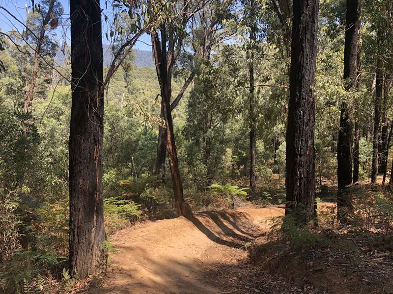
Buxton Mountain Bike Park is situated within the Black Range State forest, approximately 100 km north east of Melbourne. There is around 23 km of purpose built mountain bike single track in the park that can be ridden in a number of different length loops. The trails are ridden in one direction and are signed accordingly. The trails are characterised by gentle climbs and fast flowing descents. When ridden with care, the majority of trails are suitable for riders of all abilities, but when ridden faster, the tracks are more challenging.
Note: All trails are one way and should be ridden in the direction as signed.
There are 9 trails (1 x easy, 6 x more difficult and 2 x very difficult).
The Mountain Bike Trails are:
1. Platypus 0.6 km one way, 1 m elevation gain. This circuit trail starting and finishing at the day visitor area is an easy trail suitable for young children and those new to mountain biking. It contains small rollers and berms (Green easy level)
2. Acheron Ridge 13.3 km one way, 278 m elevation gain. Starting at the car park, this is the longest trail in the network and is filled with jumps, berms, log drops and loads of exhilarating fast single track. It includes the famous spider gully, which starts with a series of tight corners weaving through tall tree ferns before opening out and increasing in speed as it descends. This trail finishes back at the car park (Blue intermediate level)
3. Boobook 2.8 km one way, 46 m elevation gain. This trail starts and finishes in the same place on Acheron Ridge. With a fun filled steep start and a tight switchback climb, this trail adds a challenging extension to your ride (Blue intermediate level)
4. Off Camber 1.4 km one way, 15 m elevation gain. This fun filled predominately downhill trail is littered with potential for air time and grin inspiring berms (Blue intermediate level)
5. Snakes and Ladders 1.7 km one way, 62 m elevation gain. This climbing trail contains a number of tight climbing switch backs and offers great views (Blue intermediate level)
6. Midget 0.4 km one way, 6 m elevation gain. This trail creates a short-cut removing all the climbing on Acheron Ridge and re-enters at the bottom of spider gully (Blue intermediate level)
7. Friendly Fox 0.3 km one way, 7 m elevation gain. This trail creates a short-cut removing the last climb and descent gully on Acheron Ridge. The trail is named after a fox that watched from a safe distance during construction (Blue intermediate level)
8. Skinny 0.6 km one way, 0 m elevation gain. This old school hand-built trail drops steeply off Acheron Ridge straight to the car park, avoiding Spider Gully. It is skinny, steep, rocky and off camber with many exposed roots (Black difficult level)
9. Cathedral 1.6 km one way, 60 m elevation gain. This trail starts with a long climb (Cathedral Climb) to the lookout, utilising numerous climbing switchbacks. It then heads down the hill (Buxton BOM) and the real fun begins with tight berms and lots of jumps. BEWARE of the gap jumps and don't let your ambition get confused with your ability. Keep your speed in check. This trail rejoins Acheron Ridge just before the carpark (Black difficult level)
Trail Maps:
Trail Map and Description (FFM)
Buxton Mountain Bike Park Trail Map (Trailforks)
Location:
From Melbourne, follow the Maroondah Highway to Buxton. Turn left onto Dyes Lane and follow the road for approximately 1 km. Cross the Acheron River and turn right to reach the trailhead and day visitor area.
Opening Times:
All trails are closed during the wetter months each year from the Tuesday after Queens Birthday weekend in June and re-open at the beginning of the September / October school holidays. This is to protect the track surface from erosion.
Location
Mill Creek Road, Buxton 3711 View Map
Web Links
→ Buxton Mountain Bike Park Map (PDF)
→ Buxton MTB Park on Facebook
→ Mountain Bike (MTB) Parks in Melbourne and Victoria


