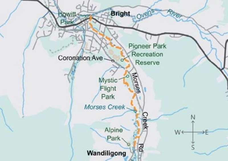
Bright to Wandiligong Walk

A pleasant trail that rambles alongside Morses Creek through pine plantation and native bush.
Distance / time: Distance / time: 11.2 km / 3 hrs
Grade 2: No bushwalking experience required. Formed path with some hills and no steps. Partly signposted.
A series of walking tracks provide access along Morses Creek all the way to the Alpine Park, near the picturesque village of Wandiligong. The total distance is 5.6 km one way, but it can easily be done in shorter stages.
This track starts at the swimming pool where Morses Creek joins the Ovens River. Follow the signs and markers under the road bridge, then along the creek through the caravan park. The path passes the Hawthorn Village Hostel, then crosses Hawthorn Lane, around 1 km from the start.
The next section, Bennetts Walk, features Pioneer Park, with its picturesque setting and a number of aged elm trees. The Park is the outdoor recreation area of Bright, with the football ground, tennis courts, a pony club and BMX track. The walk continues past pine plantations to Dougherty's Bridge, a distance of 2.6 km from the start.
The Wandi Walk section starts over Dougherty's Bridge on Morses Creek Road, and ends at Alpine Park, Wandiligong. It follows Morses Creek for 3 km along a rough bush track.
Features of the walk include old mining areas (especially the flat valley floor where dredging has occurred) and extensive pine plantations. A rich variety of bird life can be found along this walk, with habitats varying from native bush to pine forest, open fields, small wetlands and parklands.
Bright to Wandiligong Walk Map
Location
7 Riverside Avenue, Bright 3741 View Map


")