Bright - Cherry Walk

Follow the Ovens River through bushland and pine forest on this family-friendly adventure.
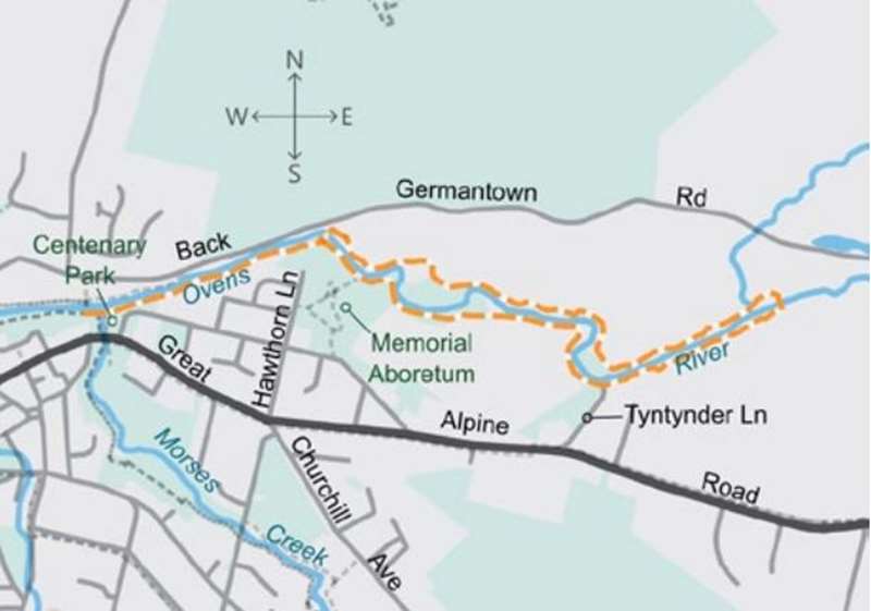
The terrain upstream from Bright varies considerably. The first section of the track skirts rocky cliffs similar to the Canyon. Beyond the first swing bridge the north section traverses high banks with views of the river and low sections susceptible to minor flooding. On the south side, features include the Memorial Arboretum and popular swimming and picnic spots. The track also skirts extensive pine plantations, and evidence of gold dredging is apparent where sections are paved with river stones. Cherry's Bridge at the eastern end permits the walk to be completed as a loop.
Distance / time: 5.1 km / 1 hr 30 min
Grade 2: No experience required. Formed track with gentle hills and occasional steps. Signposted.
Start at Centenary Park and walk east along the riverbank, joining a dirt track past the waterslide. Cross at the first footbridge and continue east along the northern bank. Cross at the swing bridge and return along the southern bank.
Cherry Walk Map
Location
125 Gavan Street, Bright 3741 View Map


")