Blackwood - Whipstick Loop Walk


A summary of the Whipstick Loop Walk is:
Grade of Walk: Grade 3
Distance: Circuit 5.0km
Time: 2 hours return
Gradient: Short steep hills
Quality of Path: Formed track, some obstacles
Quality of Markings: Sign posted
Steps: Occasional steps
Experience required: Some bushwalking experience recommended
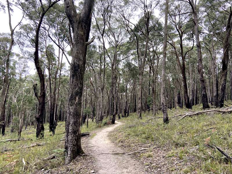
This walk is situated in the Wombat State Forest and traverses part of the Great Dividing Trail but then loops down around Whipstick Creek through some beautiful open eucalypt forest, to bring you back to your starting point at the Jack Cann Reserve.
Along the walk there is historical evidence of various types of mining with both vertical and horizontal shafts. All of the mining in the area was conducted by hand in very difficult conditions.
There is a fenced area with a viewing platform along the track, where you can safely view one of the old mine shafts. Take the time to look and appreciate the extent of works undertaken but for your safety, please stick to the track.
Further along the trail you will also get to walk along the remnants of a water-race, Miners hand dug these trenches to direct water both to and from their mine workings. At one section of the track a boardwalk has been constructed around an old tree through which the miners once diverted the water course. There is also evidence of a structure that once spanned the creek that may have been a tramway or bridge foundations.
Map
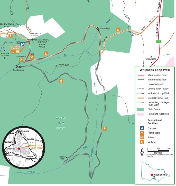
Download Walk Notes & Map
As you travel along the Whipstick Loop Walk you will circle through the famous Simmons Reef goldfield. From Jack Cann Reserve (named after a local philanthropist from years gone by), the walk follows water races and mining tracks. On the journey you will be able to see the remnants of historic mines and alluvial diggings.
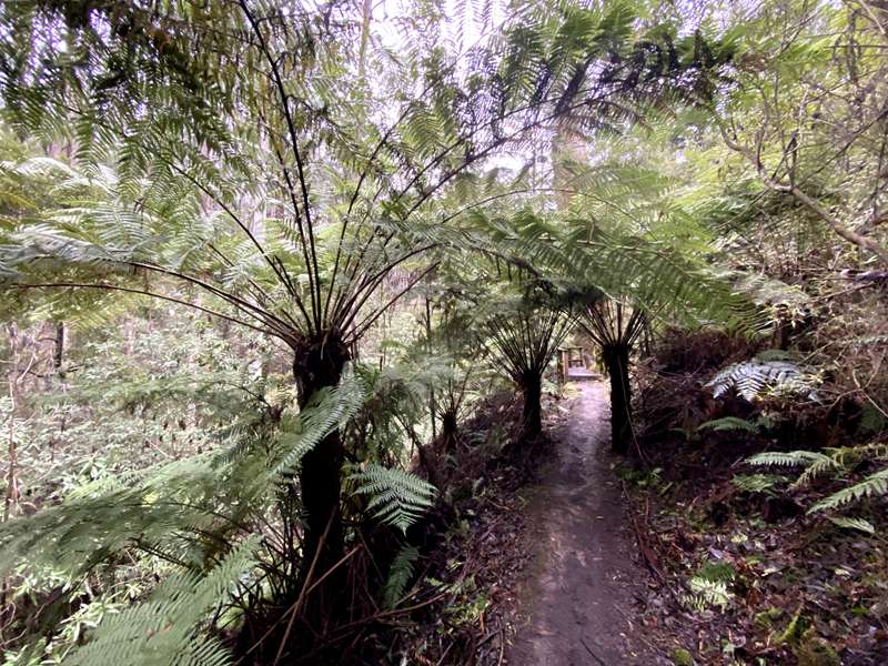
The walk also takes you across the valleys of Back Creek and Whipstick Creek. Vegetation ranges from open forest with low heath to a dense 'wet sclerophyll' forest of tall trees, ferns and mossy logs.
Flora and Fauna
The predominant overstorey vegetation in the area is a mixture of Narrow-leaf Peppermint (E.radiata), Candle Bark (E.rubida), and Messmate (E.obliqua), along with some magnificent examples of Blackwood (A.melonoxylon).
Picnic Facilities
Picnic facilities, car parking and public toilets are available at the Jack Cann Reserve.
Access for Dogs:
Dogs are allowed in State forest but must be under direct control at all times and are expected to be on a leash in picnic and camping areas or when near other visitors.
Getting There
The Whipstick Loop Walk starts and ends at the Jack Cann Reserve near The Garden of St Erth at 189 Simmons Reef Road, Blackwood. It is located approximately 1.5 hours from Melbourne and approximately 40 minutes from Ballarat. The walk is also easily accessed from the towns of Daylesford, Trentham and Woodend.
Review:
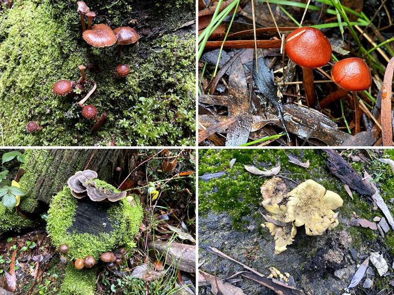
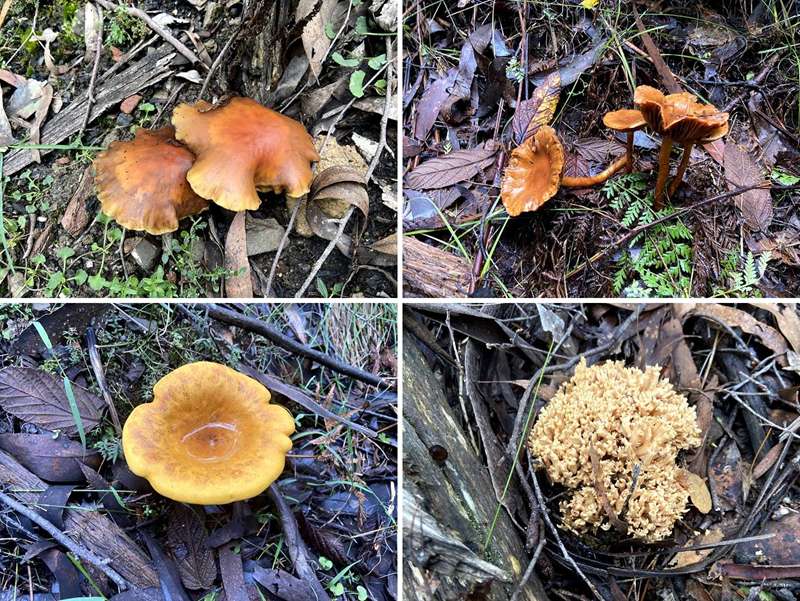
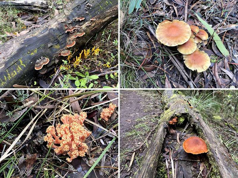
A really interesting walk with a range of habitats including tree fern gullies littered with fallen mossy trees, big pockets of Blanket Bush trees, light bushland with heath plants, dense 'wet sclerophyll' forest with tall trees, ferns and mossy logs and a number of creeks running through the area. We went in June and there was a wonderful array of different fungi and colourful flowering heath.
The walk is fairly flat and winds around gullies at a constant height but the track can get wet, muddy and slippery after rain.
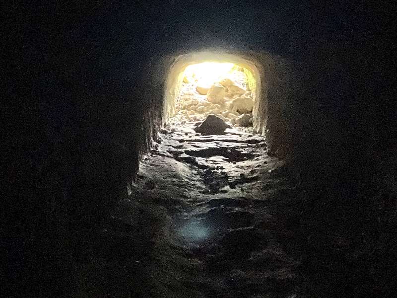
From the start point which has toilets and two unshaded tables, the track leads past a horizontal tunnel which opens out for a distance of about 10m. It is possible to enter the tunnel which is blocked by rocks at the back.
After a short distance you come to an intersection which creates the loop for the walk. It is recommended to continue straight ahead and do the loop in an anti-clockwise direction. When you complete the loop and reach this intersection again, turn right back to the carpark. The signage at this point is confusing.
Another problem with the signage is that part of the walk is named the Whipstick Loop Walk and part is named Great Dividing Trail. This caused us some confusion towards the end of the walk, in the north east part, where a whole lot of trails, tracks and signage converge. At this point we headed downhill to Back Creek where there was a information sign (4) Alluvial Workings which confirmed we were on the right track.
Interpretative Signage
Along the walk there is the following interpretative signage:
A STEP BACK IN TIME
Although well-known as one of the gold fields closest to Melbourne, Blackwood remained a hard place in which to mine. Dr Bacchus (of Bacchus Marsh fame) reported gold in the Lerderderg River in July 1851. The ravines and forests of the ranges blocked any great rush for several years. Not until 1854 were prospectors able to strike gold near Mount Blackwood. Most of the diggers were again frightened off by the harsh terrain. Then on 4 January 1855 Edward Hill hit on a rich find, sparking the first real rush to Blackwood. In September 1863 the Victorian government rewarded Edward Hill with 300 pounds for his pioneering discovery.
By April 1855 there were 2000 miners digging for gold around Blackwood. In June there were to 10,000 diggers and by September 13,000. An Argus reporter wrote that at Simmons Reef, gold "was seen lying on top of the reef just as openly as you would see gold watches, trinkets etc in a jeweller's shop".
The gold seekers soon turned from creekbed diggings to excavating shafts, so they could mine deep reefs of gold-bearing quartz rock. The Argus newspaper reported that by 1859 the miners were "anxiously" awaiting for a crusher to arrive, so they could break up the quartz rock and extract gold. The first wave of diggers swept hastily through Blackwood, moving on to new finds to the west and north.
By 1860 C R Longbottom, the local Mining Surveyor, reported 760 alluvial miners at work in Blackwood alongside 100 quartz miners. By then diggers were running out of water and had to stop sluicing work. Quartz mining also slowed and the Surveyor reported that "Simmons Reef is very dull at present, presenting a striking contrast to the noise lately occasioned by the crushing machines".
From 1861 a new Simmons Reef Reservoir brought water to the miners and by 1866 there were over 1000 alluvial and 280 quartz miners at work. Of these, more than 400 were Chinese. A Chinese settlement grew up around Blackwood's Golden Point, with shops, a temple, boarding house and a Chinese doctor and herbalist.
As well as baffling steep slopes and dense forest, diggers around Blackwood were often washed out by sudden floods. They often had to stop sluicing because of drought. Despite such harsh conditions local miners managed to extract an estimated 700,000 pounds worth of gold after 1869. Small mining companies worked through the quartz reefs until well into the twentieth century.
A few prospectors returned to the fields in the 1930s Depression and the Easter Monday Mine, Simmons Reef, did not close down until 1938. Remnants of these several eras of gold mining are now scattered through the Wombat forest.
2. MINE SHAFT
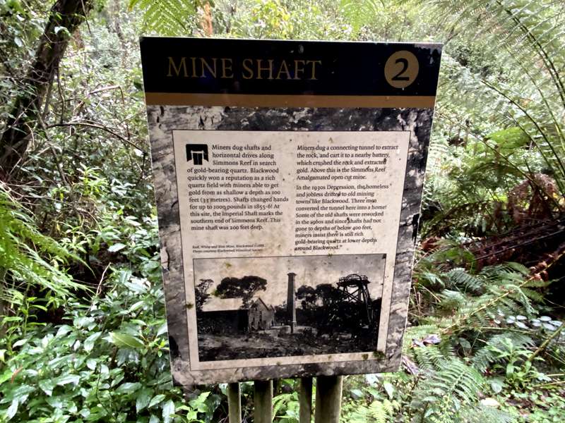
Miners dug shafts and horizontal drives along Simmons Reef in search of gold-bearing quartz. Blackwood quickly won a reputation as a rich quartz field with miners able to get gold from a shallow a depth as 100 feet (33 metres). Shafts changed hands for up to 100,000 pounds in 1855-61. At this site, the Imperial Shaft marks the southern end of Simmons Reef. This mine shaft was 200 feet deep.
Miners dug a connecting tunnel to extract the rock, and cart it to a nearby battery, which crushed the rock and extracted gold. Above this is the Simmons Reef Amalgamated open cut mine.
In the 1930s Depression, the homeless and jobless drifted to old mining towns like Blackwood. Three men converted the tunnel here into a home! Some of the old shafts were reworked in the 1960s and since shafts had not gone to depths of below 400 feet, miners insist there is still rich gold-bearing quartz at lower depths around Blackwood.
3. WATER RACE
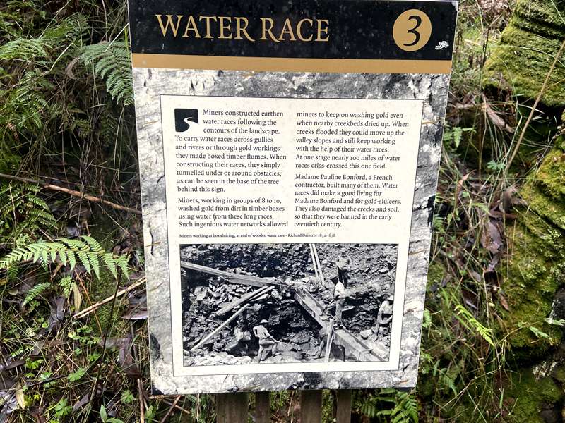
Miners constructed earthen water races following the contours of the landscape. To carry water races across gullies and rivers or through gold workings they made boxed timber flumes. When constructing their races, they simply tunnelled under or around obstacles, as can be seen in the base of the tree behind this sign.
Miners, working in groups of 8 to 10, washed gold from dirt in timber boxes using water from these long races. Such ingenious water networks allowed miners to keep on washing gold even when nearby creekbeds dried up. When creeks flooded they could move up the valley slopes and still keep working with the help of their water races. At one stage nearly 100 miles of water races criss-crossed this one field.
Madame Pauline Bonford, a French contractor, built many of them. Water races did make a good living for Madame Bonford and for gold-sluicers. They also damaged the creeks and soil, so that they were banned in the early twentieth century.
4. ALLUVIAL WORKINGS
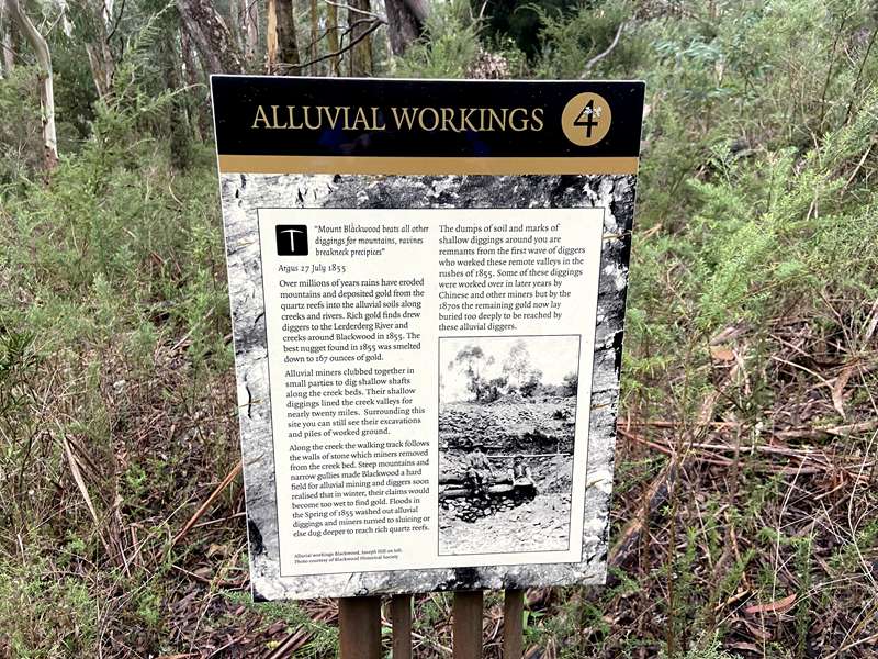
“Mount Blackwood beats all other diggings for mountains, ravines breaking precipices”
Argus, 27 July 1855
Over millions of years rains have eroded mountains and deposited gold from the quartz reefs into the alluvial soils along creeks and rivers. Rich gold finds drew diggers to the Lerderderg River and creeks around Blackwood in 1855. The best nugget found in 1855 was smelted down to 167 ounces of gold.
Alluvial miners clubbed together in small parties to dig shallow shafts along the creek beds. Their shallow diggings lined the creek valleys for nearly twenty miles. Surrounding this site you can still see their excavations and piles of worked ground.
Along the creek the walking track follows the walls of stone which miners removed from the creek bed. Steep mountains and narrow gullies made Blackwood a hard field for alluvial mining and diggers soon realised that in winter, their claims would become too wet to find gold. Floods in the Spring of 1855 washed out alluvial diggings and miners turned to sluicing or else dug deeper to reach rich quartz reefs.
The dumps of soil and marks of shallow diggings around you are remnants from the first wave of diggers who worked these remote valleys in the rushes of 1855. Some of these diggings were worked over in later years by Chinese and other miners but by the 1870s the remaining gold now lay buried too deeply to be reached by these alluvial diggers.
5. WET SCLEROPHYLL FOREST
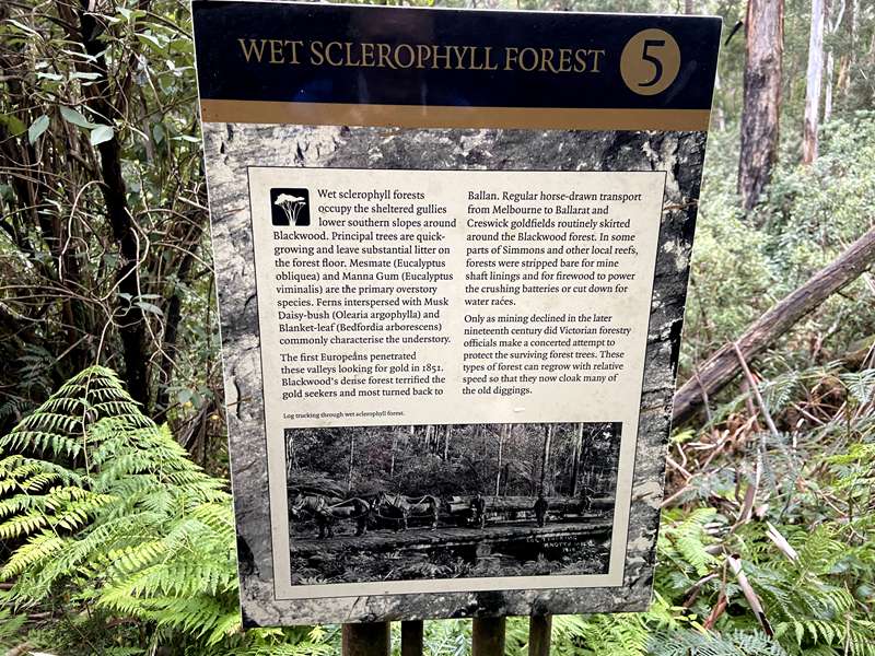
Wet sclerophyll forests occupy the sheltered gullies and lower southern slopes around Blackwood. Principal trees are quick-growing and leave substantial litter on the forest floor. Messmate (Eucalyptus obliqua) and Manna Gum (Eucalyptus viminalis) are the primary overstorey species. Ferns interspersed with Musk Daisy-bush (Olearia argophylla) and Blanket-leaf (Bedfordia arborescens) commonly characterise the understorey.
The first Europeans penetrated these valleys looking for gold in 1851. Blackwood’s dense forest terrified the gold seekers and most turned back to Ballan. Regular horse-drawn transport from Melbourne to Ballarat and Creswick goldfields routinely skirted around the Blackwood forest. In some parts of Simmons and other local reefs, forests were stripped bare for mine shaft linings and for firewood to power the crushing batteries or cut down for water races.
Only as mining declined in the later nineteenth century did Victorian forestry officials make a concerted attempt to protect the surviving forest trees. These types of forest can regrow with relative speed so that they now cloak many of the old diggings.
6. CRUSHER
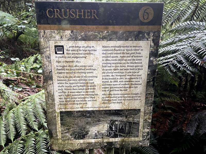
“…great doings are going on, that some of the large machines have commenced operations in crushing and amalgamating”
Argus, 12 September 1855
In August 1855, after winter rains flooded out their creekbed workings, diggers turned to crushing quartz.
This is the site of one of two crushing batteries that once operated close to where the Imperial Company sunk shafts nearby and brought up quartz rock. Miners then carted rock to the crusher. A water wheel in the creek and a boiler powered the crushing battery. Steam power (stampers) lifted huge wood and iron blocks and then dropped, crushing the rock.
Miners eventually turned to mercury, commonly known as ‘Quick Silver’ so they could extract the last gold from crushed quartz. At the end of summer in 1860, creeks dried up and the seven crushing machines on the Blackwood field had to shut down. Miners gave up on quartz shafts and went back to their old alluvial workings. A new type of crusher, the ‘Nonpareil’, was first used at Blackwood in 1861, to a patent by J. S. Martin. By 1868, with new water races and better types of crushers, Blackwood miners had extracted more than two tons of gold from the reef.
After 1869 eleven companies brought up and crushed gold-bearing quartz on Simmons Reef, with the richest finds at about 250 feet depth.
Photos:
Location
189 Simmons Reef Road, Blackwood 3458 View Map
Web Links
→ Whipstick Loop Walk Brochure & Map (PDF)
→ Whipstick Loop Walk (Alltrails)
→ www.exploreoutdoors.vic.gov.au/activities/walking-in-victoria/whipstick-loop


")