Birregurra Heritage Walk


Discover the history and scenic beauty of the Birregurra township.
Birregurra and its story... Bowden's Point, as Birregurra was first named, developed as a white settlement in the 1860's. It soon became known as Birregurra-on-the-Barwon, after the earliest European settlement had to move from the Birregurra Creek site because of a lack of water.
Earlier in 1839, the first Victorian Aboriginal mission was set up below Bowden's Point known as Buntingdale Mission Station.
Birregurra became a thriving town with its railway being the lifeblood of the vast Otways timber industry in the early 1900's.
Now, in the 21st Century, Birregurra remains a unique and beautiful township in the Otway hinterland - a special place to live in and visit.
Discover Birregurra's vivid past as you wander about our scenic and peaceful country town.
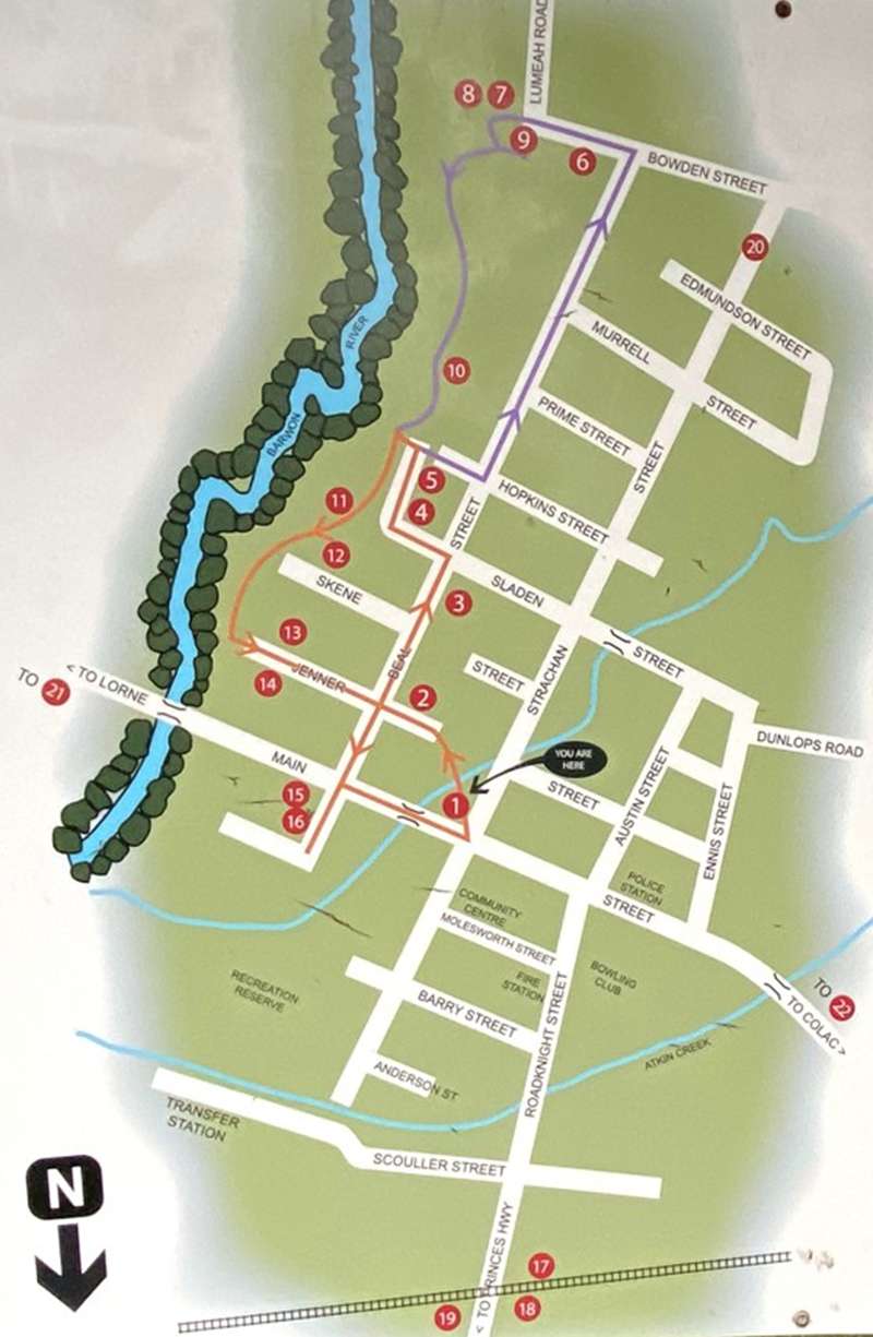
The locations of the walk are:
1. Public Park
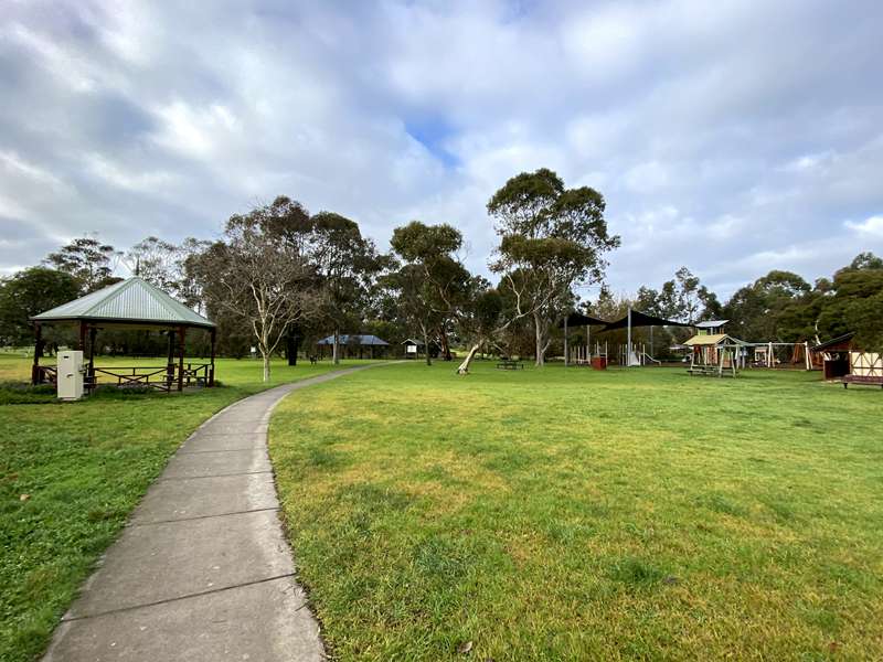
This park began as a village common, where townsfolk could graze their milking cows, each identified by a Shire of Winchelsea registration badge. Here in the 1880's, a small gasworks on the corner of Strachan Street provided gas, mainly for street lighting. At sunset, a man would walk along Main Street lighting up the gas lamps, and later on at 10pm, he would return to extinguish them. Since the 1980's, the Birregurra & District Action Group has organised the tree plantings and play equipment, the Birregurra Lions' Club provided shelters and BBQ, and the Birregurra Gardeners' Group constructed the rotunda in memory of Lindsay MacMahon. Our local community provided the seating and rose bed around the rotunda to remember loved ones.
2. Ex-Methodist Church (PRIVATE HOME)
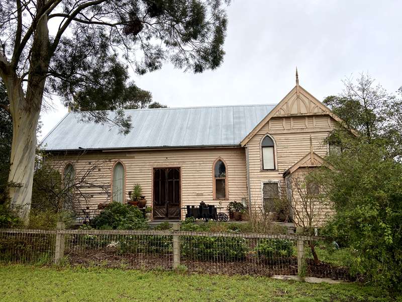
The original timber Wesleyan chapel (built in 1863) still stands here and is now a private residence. Pit-sawn beams and other timbers from the Buntingdale Aboriginal Mission (1839-1851) may have been used in the construction of the back portion of this building. The front section was added in 1909. Buntingdale Mission was the first church Aboriginal mission established in the Port Phillip District. (NO VISITORS PLEASE)
3. Birregurra Primary School No. 723
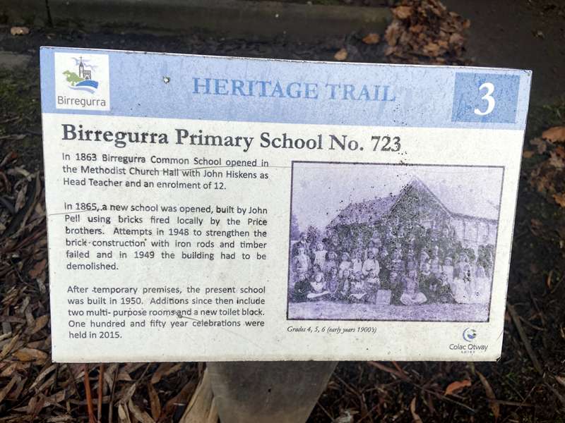
Classes were held in the Wesleyan Church (ex-Methodist Church) before John Hiskins opened the first school in the Methodist Church Hall in 1864, with an enrolment of 12. In 1865, a new school was opened, built by Henry Price of locally burnt brick. Attempts in 1948 to strengthen the brick construction with iron rods and timber failed, and in 1949 the building was demolished.
4. Christ / Anglican Church
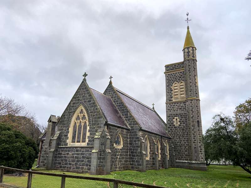
The superb bluestone Christ Church was opened in 1871, built of Mt Gellibrand bluestone with freestone from Waurn Ponds. In its design, the architect Leonard Terry was influenced by the Gothic and Norman styles. The Bell Tower and Spire were added in 1890. The original brick Sunday School was built by Mrs Edmundson of Elliminook, in memory of her second husband. The original Brass Bell from Buntingdale Aboriginal Mission (1839-1851) can be seen in the entrance porch. An historic Cork Oak (120 years old) stands in the church grounds.
5. Anglican Vicarage
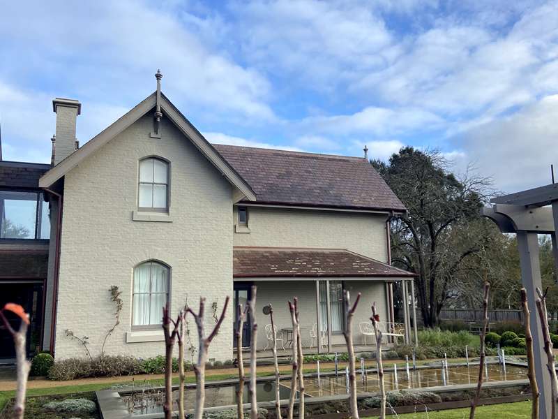
The charming Victorian Gothic two storeyed home was built in 1866-67, designed by architect Leonard Terry and built by Paton and Pepper. A rare example of Gothic domestic building in rural Victoria, it is now a private residence. Reverend Thomas Sabine was the first vicar to reside here with his family.
6. Band Rotunda
The current park site of Birregurra's Nine Hole Golf Course was originally the Birregurra Public Park, established in 1886. At the top of the hill (known as Bowden's Point), there was a Band Rotunda positioned in pride of place. On Saturday afternoons, townsfolk in horse-drawn gigs and buggies would parade up what is now the middle fairway (9th hole), to listen to a brass band playing in the rotunda.
7. Lumeah
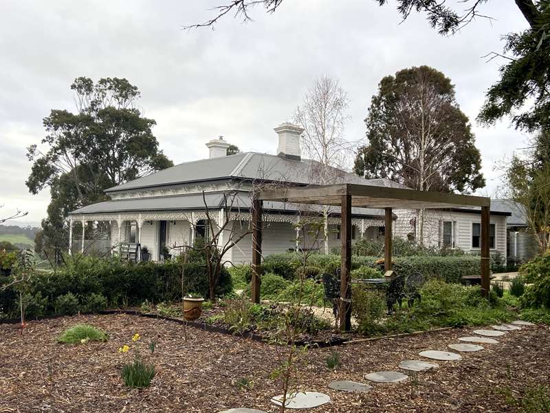
This fine Victorian house in a perfect location was built by/for Alexander Johnston. The house was designed by renowned architect William Henry Cleverdon. The Johnston family ran a dairy farm on the Barwon River flats below. The house passed to Alexander and Alice's son, Surrey Alexander Johnston, in 1934 and remained in that family until 1968. Private residence.
8. View of the Otways
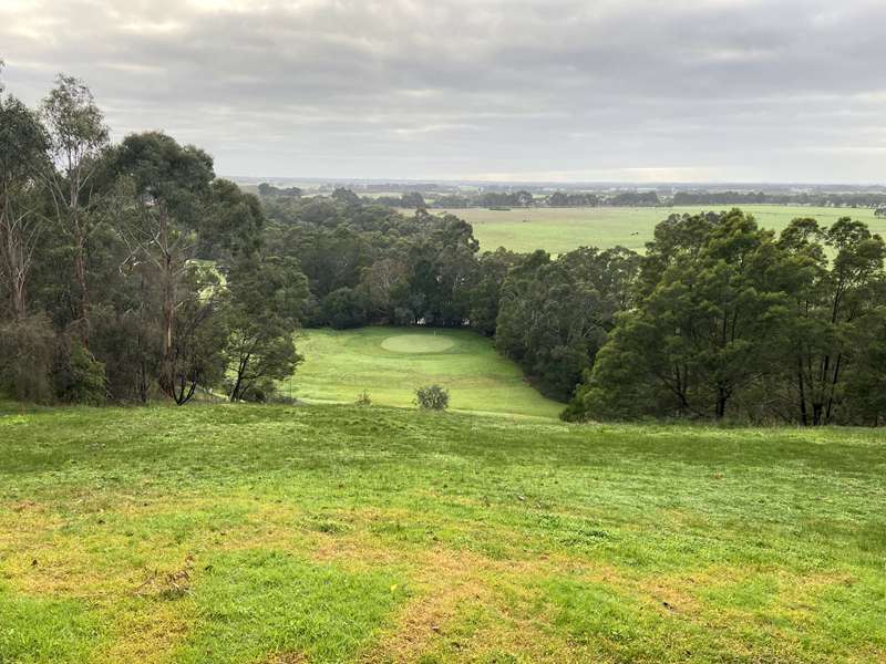
At the top of 'Niagara' we look east across the Barwon River flats, past historic Whoorel Cemetery and beyond towards the Otway Ranges. W H Bowden ran sheep at Buntingdale Mission Station which was based on the eastern edge of the hilltop, now the south east end of Bowden Street. After the 1850's, Bowden's Point became known as Birregurra on the Barwon. The original settlement of Birregurra beside the Birregurra Creek had to move to the Barwon River when the creek dried up. This creek crosses the Princes Highway today. Finally the two Birregurra settlements became one on the present site.
9. Niagara / Gallipoli Pine
Niagara - The second hole on the Birregurra golf course is referred to as Niagara by locals. This infamous hole causes the loss of many balls, particularly in the Barwon River. The river is prone to occasional flooding and the extensive flats on the far side can be totally inundated. When this happens the green below becomes an island in a vast lake.
Gallipoli Pine - The Gallipoli pine is a direct descendant of the Lone Pine at Gallipoli. The Lone Pine assault was named for the solitary Turkish (Aleppo) pine that stood on the battlefield. Although the attack was a victory for the Anzacs, 2,277 Australians were killed or wounded, with Ottoman losses estimated between 5000-6000. Lone Pine was chosen as the site of the annual Anzac Day dawn memorial service due to the battle's significance to our nation.
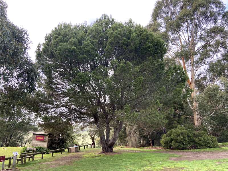
10. Old Cricket Ground
The original scenic cricket ground lies below the edge of the Barwon River. Bowden's Point Cricket Club on the Barwon was established in 1866. Bands played here in the early days and Highland dancing competitions were held. In the 1920's and 1930's a dance platform was set up in the park, between the cricket ground and the hill.
11. Barwon River
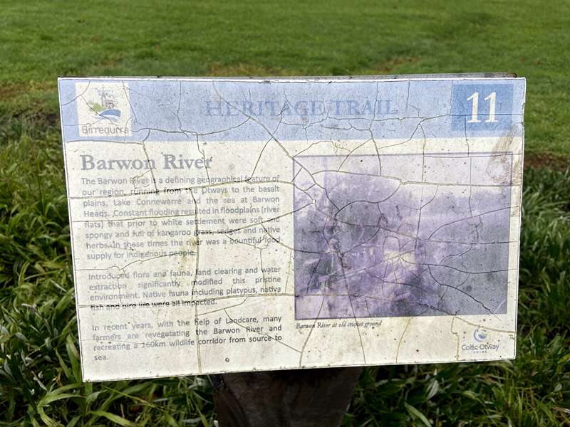
Fed by various local creeks, the Barwon used to flood the adjoining plain regularly (3 or 4 floods per year in the mid 1950's), disrupting traffic and farming, until the roadway was raised and culverts added in the 1980's. In 1867, a party of Royal visitors was met at the Birregurra Bridge by a procession of cavalry and locals, and was presented with an address. In the 1870's a pumping station near this bridge pumped water to the tank adjacent to the newly established railway station so that the steam engines could be refilled. Today this stretch of the Barwon River remains an important habitat for platypus.
12. Catholic Church and Presbytery
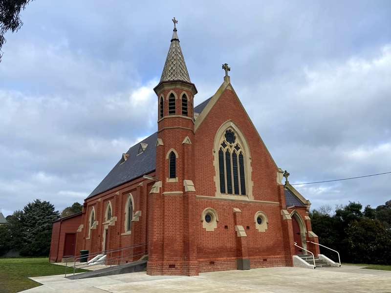
The first Catholic Church on the site of the present St Peter's Church was a small timber structure, completed by 1864. The present red-brick building was opened in May 1907, the red-brick Presbytery being completed in the same year, a fine example of Federation architecture. A large stained-glass window in the Sanctuary and the Stations of the Cross were presented by local families.
13. Uniting Church (Buntingdale Cairn)
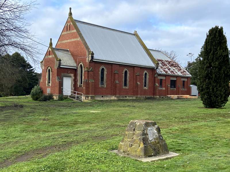
The first Presbyterian Church on this site was built in 1865, of bluestone, and the first
Manse built in 1902. The present church known as the McLennan Memorial Presbyterian Church was built in 1908, of red brick. (Note: Foundation Stone). Five stained-glass windows honour pioneering families. The stone cairn in the grounds bears a plaque commemorating Buntingdale Aboriginal Mission. Grindstones from Scoullers' flourmill support the culvert at the entrance here.
14. Worker's Cottages
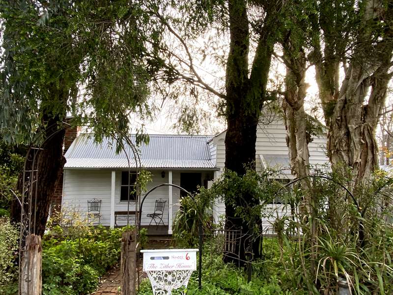
The Birregurra township was laid out on the European model with a grid of wide streets and introduced trees. Surrounded by large farming properties, the predominately worker's town had railway and timber workers, shearers, butter factory employees and a district saleyard.
As well as being a commercial centre, the town provided a Mechanics Institute and Public Library and social and sporting clubs. Small worker's cottages such as these often housed large families.
15. Native Youth Hostel
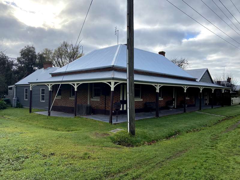
Constructed in 1866 as a Cobb & Co. coaching station between Inverleigh and Lorne, the building features two tone Flemish bond brickwork, built by John 'Brickie' Pell. He also built local landmarks 'Sunnybrae', 'Elliminook', 'Ripple Vale', 'Bushy Park' and 'Happy Valley' in this same brickwork style during the 1860's and 1870's. The Native Youth Hotel was delicensed in 1921 and served as a coffee palace and boarding house prior to World War II. Eventually it was divided into flats and existed as a rooming house until purchased in 1974 by Lindsay MacMahon who began its restoration process.
16 Bills' Horse Trough
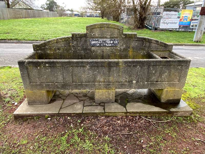
Animal lovers, Mr & Mrs George Bills, were concerned about the many neglected horses of the early 20th century. Horses were used in transport eg gigs, buggies, wagons and saddled, and were often poorly treated. George Bills died in 1927, and in his will left half of his estate to provide 500 animal drinking troughs to be placed around Australia (including some in Central Australia for camels). Another 50 troughs were placed overseas in England, Ireland, US, Romania and elsewhere.
Additional points of interest in Birregurra
17. Railway Station
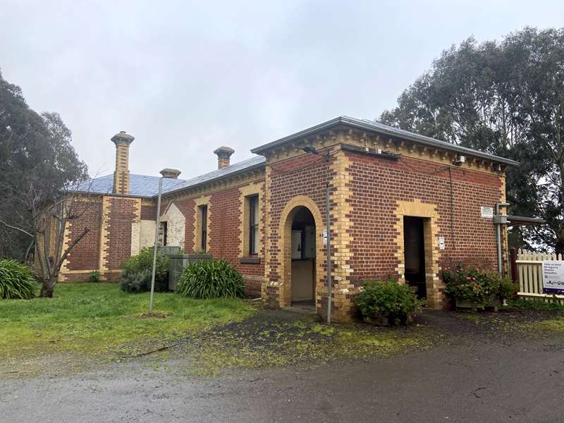
The line from Winchelsea to Birregurra was opened in 1877. The Birregurra to Colac line was opened in the same year. The stately brick station building, timber residence and two storeyed signal box were constructed later. The Birregurra - Forrest line ran from 1891 to 1957. 'The Tiger' motor rail (adorned in yellow and brown stripes) carried passengers, cream cans, mail and parcels to and from Birregurra to Forrest from 1937 to 1952.
18. Butter Factory
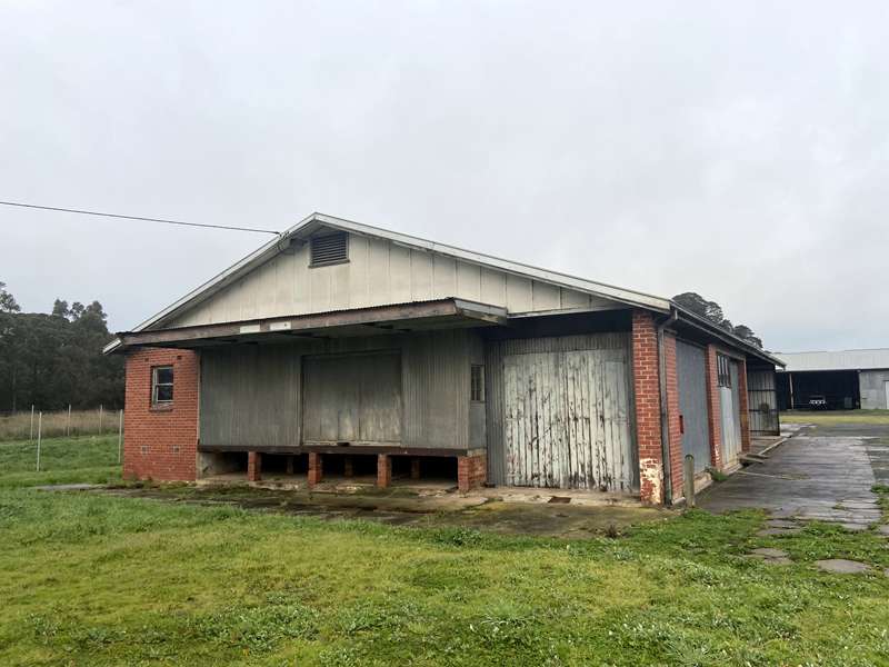
Birregurra butter was a household name back in the 1940's and 1950's. At one stage the factory employed up to five trucks and drivers, producing butter until 1955 when it was bought by Colac Dairying Company and used as a produce store.
19. Timber Mill
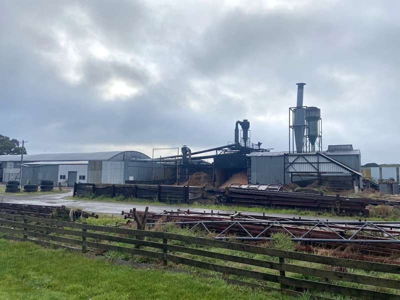
Established by W H Bennett & Sons in 1970 / 71, this was the first automated hardwood sawmill in Western Victoria, employing mill workers, drivers and timber fellers. For 30 years it was the town's largest employer. The mill closed by 2001, but now creates other timber products. In the early 1900's the nearby Otway Ranges had many on-site timber mills. Logs would be railed through from Forrest to Birregurra Railway Station.
20. View of Mt Gellibrand
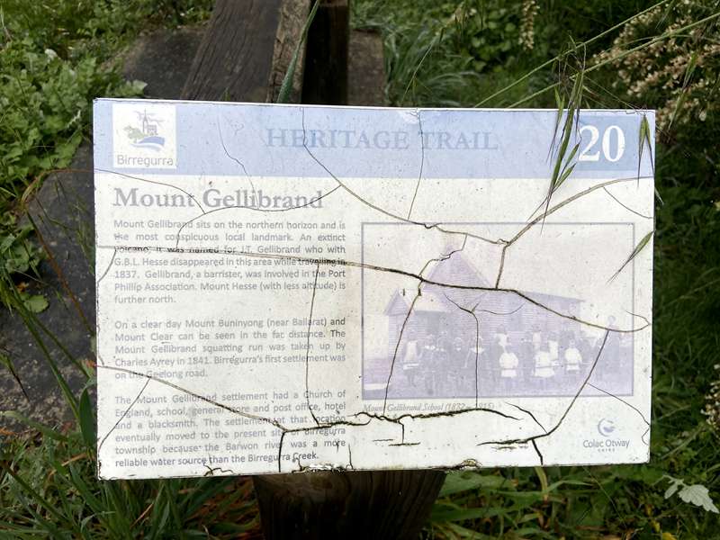
This local landmark was named for J T Gellibrand who disappeared in the area in 1837. A squatting run bearing the name Mt Gellibrand was set up by Charles Ayrey in 1841. Birregurra's first settlement on the Geelong Road was called Mt Gellibrand. On a clear day one can see Mt Buninyong and Mt Clear in the distance.
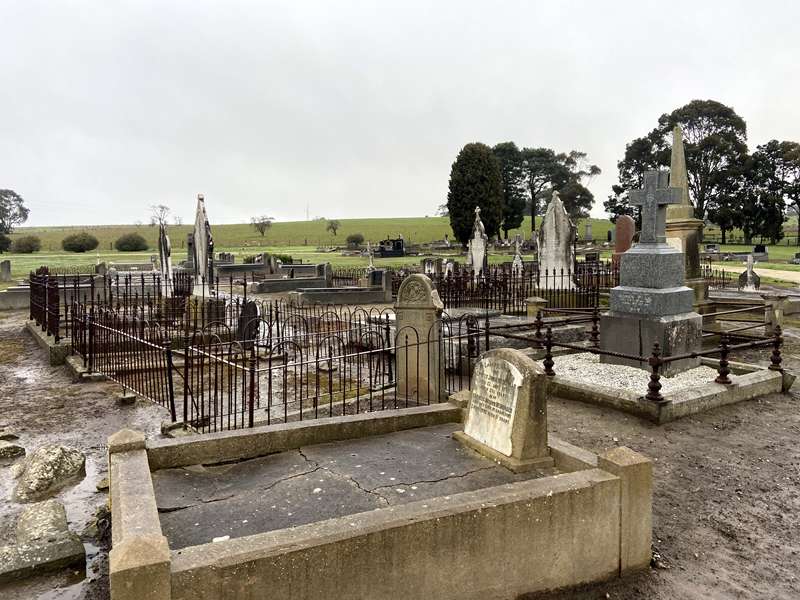
21. Whoorel Cemetery
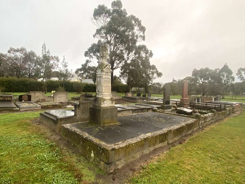
22. Warncourt Cemetery
Location
Main Street, Birregurra 3242 View Map
Web Links
→ Birregurra Heritage Walk Brochure with Map (PDF)


