Alexandra Self Guided Town Tour

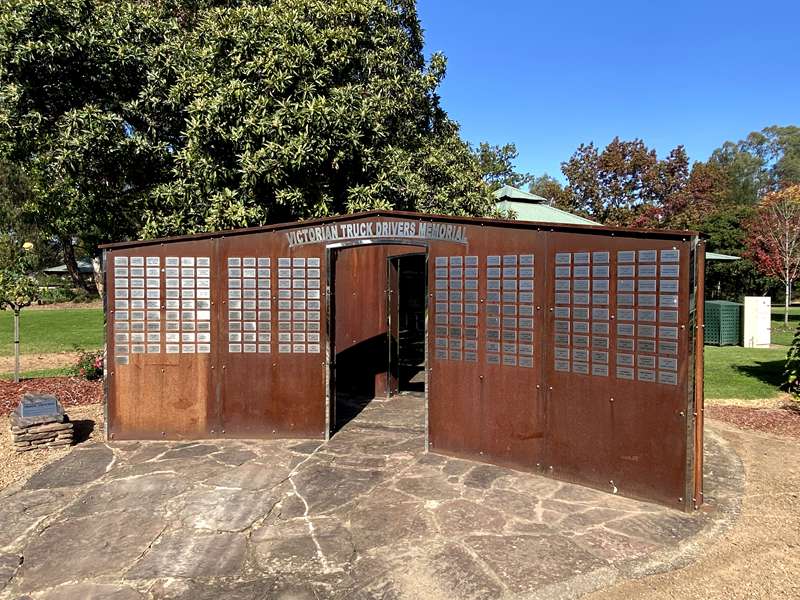
Start at Alexandra Visitor Information Centre located at Rotary Park, in Grant Street. Walk around the grounds to see the Sound Stage and the Truck Memorial.
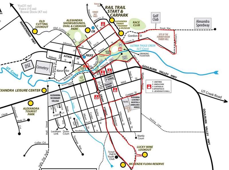
Map of Walk
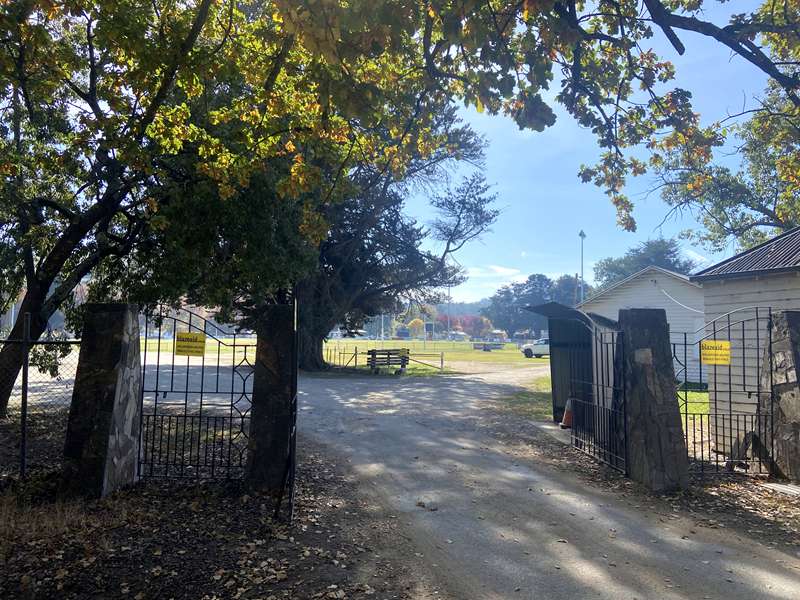
Turn left (north) from the front of the Visitor Information Centre and follow main road (Grant Street) past the Police Station to Green Street. Turn right into Green Street. On your left is the Alexandra Football Club and the showgrounds.
Follow Green Street as it becomes William Street. At the end turn right into Station Street. Immediately left is the carpark for the start of the Great Victorian Rail Trail.
The old Alexandra Station also marks the start of the once busy railway line to Tallarook and Melbourne with the main line at Cathkin going to Mansfield. This is now the Alexandra Timber Tramway and Museum, which is open to the public on the second Sunday of each month and staffed by volunteers. Train rides around the track are only available on these days. Feel free to wander around the grounds.
In the area also is a shed manned by the Eildon and District Wood Workers Guild. This operates each Tuesday and visitors are welcome.
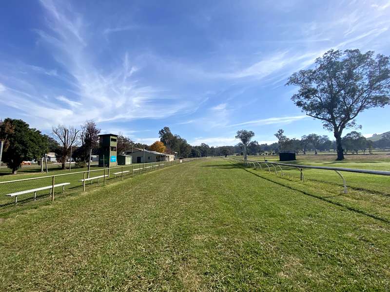
Just past the Timber Tramway and Museum turn left into Lamont Street and follow the bitumen as it veers left. On your left is the racecourse and later the golf club, which share common grounds.
The road now turns to gravel and at its end is the Alexandra Hot Rod Speedway. Soon after the start of the gravel, turn right into Lethbridge Street. On the right are the remains of the largest timber mill in Victoria and formally one of the biggest employers in the town. Follow the road around back to Station Street and turn right and then immediately left into Vickery Street.
The basketball courts on your left are used as an emergency heliport. The cricket oval and heliport were used extensively during the 2009 bushfires for the fire fighting helicopters. Today the oval is used for more peaceful sporting activities and a public toilet and free shower is available.
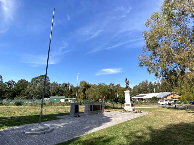
On your left is the Leckie Park Reserve. It was named after John Leckie of the Pioneer Leckie Family - a well known identity and Shire President. Turn left into Paynes Avenue where there are a number of areas of interest:
- Bowling club
- War memorials
- Dove Cottage
- Walk bridge over the UT Creek
Return to Vickery Street and turn left towards the main street (Grant Street). Turn left into Grant Street and continue over the UT (Ultima Thule) Creek bridge. Turn immediately left into Perkins Street. The first building on your left is the historic Alexandra Library.
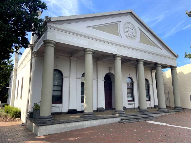
On the opposite corner is the Alexandra Shire Hall, built before Federation (hence the motif on the front has the Emu and Kangaroo reversed). Opposite the Town Hall is a mural above one of the shops. It depicts an early gold mining scene reminiscent of times gone by.
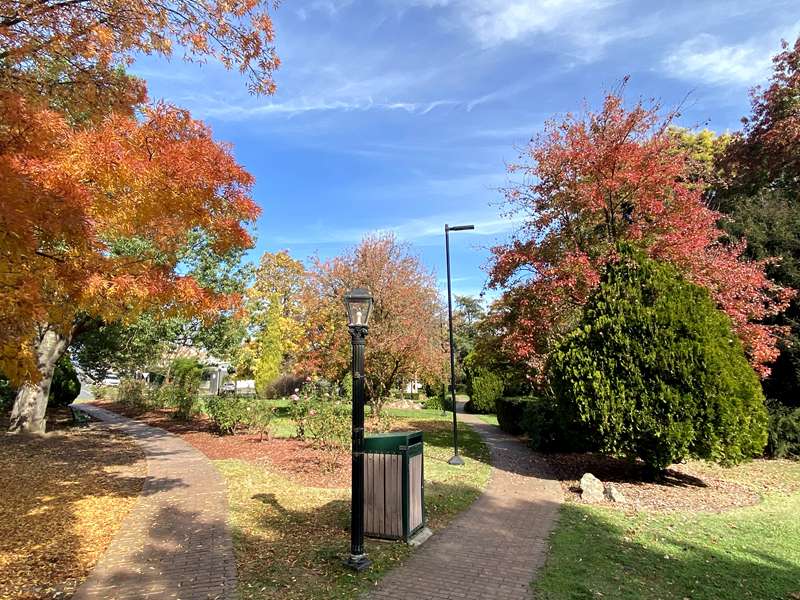
Behind the Library is a 2012 Red Gate replica of the historic gate that separated two early pastoral runs and marked the historic centre of Alexandra. Many businesses over the years have had the name Red Gate incorporated into their title. The small area behind the library has been converted into a mini park with seats and a small garden.
Continue along Perkins Street where the historic CWA building is located on your left and the current Shire Offices on your right.
Further along Perkins Street on your left are the swimming pool and tennis courts.
Continue to the end of Perkins Street and turn right into Station Street. Travel past the Hardware Megastore to the intersection of Station Street and the Goulburn Valley Highway. Turn left and immediately right into Wattle Street. Turn right into Cooper Street (second street on the right) and the new Hospital is immediately on your left. At the top of the Cooper Street hill (corner with Myrtle Streets) is the former red brick Hospital on the left. At the rear is a Medical clinic.
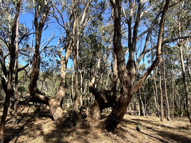
Continue over the hill past Myrtle and Villeneuve Streets and turn left down Webster Street. Continue for 300 m and turn left to the 'Lucky Mine' lookout. A bush walk in the Alexandra Bushland Reserve can be started here.
Return to Webster Street and turn left, and continue to the bitumen road (Mount Pleasant Road). Turn right towards the town. On your left after 1 km is the entrance to McKenzie Reserve, which is a good place for a walk to look for birds and wildflowers (in season) or just to get some exercise.
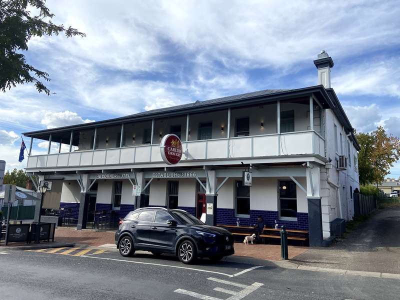
Travel back down Grant Street to the main shopping centre. Many shops have changed hands over the years and been renovated in some way. The first is the supermarket which was originally Courtney's Holden agency and garage. The four hotels - whilst modernised internally - have remained much the same externally throughout the 20th century.
At the end of the first section of shops is Alexandra's main intersection. Turn left to travel to the Alexandra Motel, Alexandra Secondary College, and Melbourne. Turn right to travel past the old Butter Factory to Thornton, Eildon and Jamieson or continue ahead to the Visitor Information Centre, Yea, Seymour, Mansfield, Melbourne or Sydney.
History of Alexandra:
Gold was first discovered in the Alexandra District in 1866, 42 years after explorers Hume and Hovel passed through the Goulburn Valley District in 1824. This was around 35 years after Europeans started to settle in the area.
The township of Alexandra was established when gold was discovered in 1866. Gold was subsequently found in payable amounts at the Eglington, Eldorado and Luckie claims, causing a rush to the area. The township that grew as a result of the rush was named "Redgate Diggings" due to a gate painted red and located on a fence line beside the creek. At the height of the Gold Rush, three thousand miners were working claims within ten miles of the town. The township of Alexandra was built upon filled in tunnels and shafts, which still cave in from time to time as they continue to settle further.
Fifty-one quartz and 12 alluvial claims were registered by the end of 1866, and a large crushing machine was built and operated shortly afterwards, where the Alexandra Bowling Club stands today.
In 1873 work on the Luckie Mine, the last of the larger quartz mines, drew to a close as payable amounts of gold were exhausted. By 1885 virtually all mining had ceased. Alexandra township grew into an agricultural and services centre and timber milling town, thanks to the large amounts of timber in the Rubicon Ranges.
In 1888, the Union Bank opened in Grant Street, Alexandra. This was the first bank in the District and is now the ANZ Bank.
The railway was connected to Koriella in 1890 and connected with Alexandra in 1909. Timber and livestock became the main export by rail, mostly heading to the fast growing Melbourne markets. On the return trip, freight trains carried food and materials to the township which was also growing quickly.
In the early 1900s, sheep grazing expanded to dairying, crops and orchards. The timber industry became a powerful local employer, with many mills operating in the Rubicon Ranges. The processed timber was carried from the Rubicon Ranges to the Alexandra railhead by two foot gauge "Little Loco" rail trams.
The dairy industry became well established, and eventually became a centralised industry where dairy farmers from the Alexandra District supplied the local Alexandra Dairy Company with large amounts of milk and cream. The butter factory closed in 1974 due to the dropping price of milk powder, which the Dairy Company had begun producing decades earlier.
Alexandra's first school was established 1867. By 1871 numerous other schools were being built by parent committees who also provided the land. The schools were small, with an average of only 10 children and only opened a few days a week. The Government often paid rural teachers to teach at two schools each week. The schools were close to each other, as transport was a problem. It is believed that as many as 20 such schools once operated in the Alexandra and District. As these schools merged, a larger Alexandra State School was formed, before the Alexandra High School was built in the 1950s.
In 1869 the Alexandra District became known as the 'Shire of Alexandra'. The township was named after Princess Alexandra of Denmark, A statue of her is now located in Jack Shield Gardens.
Shearing was a large industry in the District during the early to mid 1900s. Even farmers wives would have to manually sheer the sheep with clippers, as pictured above. Today there are few sheep farming properties left in the Shire.
Today Alexandra is best known as a Tourism Town, and is home to popular events as well as being a service town for the broader area.
Location
36 Grant Street, Alexandra 3714 View Map
Web Links
→ Self Guided Tour Brochure (PDF)


")