Yaapeet - Wyperfeld National Park


Located in the flat, semi-arid north-western corner of Victoria, Wyperfeld is one of Australia's most fascinating national parks. This vast Mallee park is a place of endless space with three distinct landscapes each offering a new experience ‐ Big Desert country to the west, Mallee to the east and floodplains and shifting sand dunes to the north. Autumn, winter and spring are the best times to visit. There is plenty of country to cover for 4WD enthusiasts.
The central feature of this huge park is a chain of lake beds connected by Outlet Creek, the northern extension of the Wimmera River. The lakes only fill when the Wimmera River over-supplies Lake Hindmarsh to the south of Lake Albacutya. When it rains the semi-arid landscape is transformed by tiny desert plants that sprout from long-dormant seeds, carpeting the ground with clusters of flowers.
Enjoying the Park
Camping and day visits
Camping facilities include picnic tables, fireplaces and toilets. General supplies and accommodation are available in Hopetoun, Rainbow, Patchewollock, Walpeup, Underbool and O'Sullivan's Pine Plain Lodge. Camp fees apply at the Wonga camping area. Bookings are required.
Wonga Camping Area and Visitor Information Centre
This camping area, in the southern end of the park, is spacious and includes an Information Centre. Displays provide insights into the industrious Malleefowl, along with general natural and cultural history. Enjoy three self‐guided interpretive walks, a scenic nature drive and basic camping facilities.
Casuarina Camping Area
This is a good base to explore the northern Pine Plains area of the park. The camping area is set amid Pine‐Buloke woodlands surrounded by Mallee sand dunes and a circular‐walking track to Bracky Well.
Snowdrift Picnic and Camping Area
This area is accessible by 2WD and is set alongside one of the largest white sand dunes in the area. A fantastic experience is to go sand tobogganing. Bring along a piece of cardboard or a boogie board to slide down the dunes on. Fireplaces, toilet and tables are provided.
Walking
Choose from a range of short and long walks. Wear suitable clothing and carry drinking water, maps and a small first aid kit. Stay on tracks.
Eastern Lookout via Lignum Track (Duration: 4 hours (return), 10km)
Start at the Information Centre. 200 metres along the James Barrett Nature Drive Track, turn left along Lignum Track. Travel about 2km to a track junction, then turn left.
When you reach James Barrett Nature Drive Track again, turn right to Eastern Lookout. Return via Lignum Track, opposite the carpark.
The track crosses or passes close to several dry lake beds that can become muddy after rain. Keep an eye out for kangaroos and emus among the red gums and dry lake beds.
Discovery Walk (Duration: 2 hours (return), 4 km)
Start at the Wonga Campground, eastern toilet block and follow the 'lifting the lid' signs detailing the mallee environment
Tyakil Walk (Duration: 2 hours (return), 4.4 km)
When the spring rains come, the park is transformed. Wildflowers bloom, and Malleefowl, cockatoos, mallee ring-neck parrots and waterbirds flock to previously dry lakes. This self-guided walk through typically stunning Wyperfeld terrain is a great introduction to the dramatic seasonal changes that shape the Mallee desert.
The best time to see the wildlife here is at dawn and dusk, when western grey kangaroos, brush-tailed possums and emus come out to graze. While you may find the trail too sandy for cycling, the park's entrance roads and tracks around Eastern Lookout are ideal for two-wheeled traffic.
Start and finish at Black Flat carpark, 4km from the western end of the Wonga Campground. There are interpretive signs on the Mallee along the track.
Best time: Winter and spring.
Desert Walk (Duration: 2.5 hours (return), 6km)
Start at the Nine Mile Square carpark, west of the entrance road (4.5km from Wonga Campground). Walk west along the track from the carpark for 450m, then turn left along the Desert Walk. The track eventually loops back near the start of the Nine Mile Square Track. There are excellent views across to Big Desert and Outlet Creek on this walk.
Scenic drives
James Barrett Nature Drive in the south is suitable for 2WD, while 4WD may enjoy a visit to the snow‐white sand dunes of Snowdrift at Pine Plains in the north.
Eastern Lookout Nature Tour (Duration: 1 hour)
The Eastern Lookout Nature Tour begins at the eastern side of the Wonga Campground. Look for the signposts. This is an easy loop drive, suitable for 2WD vehicles and travel along 15km of gravel road.
Pass through usually dry lakebeds, flood plains, sand dunes and peaceful Mallee country. Morning and evening are best times for wildlife viewing.
Please travel slowly, look out for wildlife and ensure you don't drive off the formed road - it's very easy to get bogged off-road in the sandy soil. Roadside numbers refer to the notes provided in the park note.
Four‐wheel driving
Access to the remote west of the park is via Murrayville‐Nhill Road, but check with rangers for current track conditions, especially after wet weather and during high fire danger periods.
Caution: The following tracks are narrow and have deep sand ‐ North South Access, Milmed Rock, Chinamans Well, Gunners and North Callitris Track. Vehicles must have good ground clearance. Some smaller 4WD vehicles may have difficulty. Please note: No vans or trailers.
The Mallee Drive is one of Victoria's Iconic 4WD Adventures and passes through Wyperfeld National Park. Visit Iconic 4WD for more information.
Plants and Animals
Spring is the best time to see wildflowers. Around 450 species of native plants occur in Wyperfeld and many are in distinct communities.
River Red Gum and Black Box woodlands cover the floodplains of Outlet Creek and its lakes, while Pine and Buloke grow on nearby dunes.
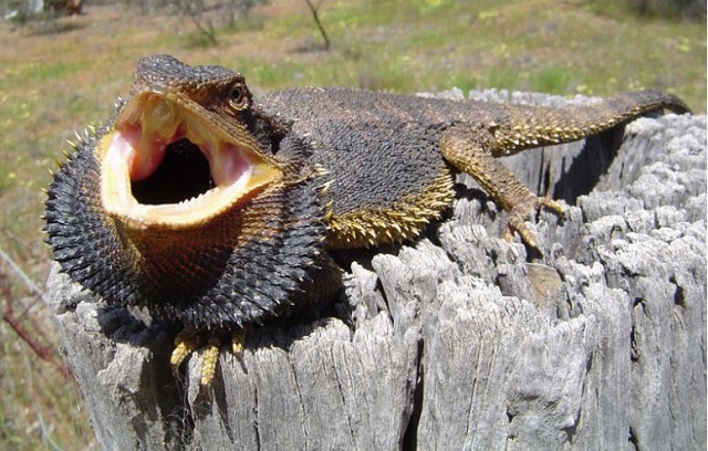
Mallee eucalypts cover most of the eastern section of the park, with rolling sand plains covered with heathland in the western section. Wyperfeld National Park is a birdwatcher's delight with over 200 species recorded.
Location and Access
Wyperfeld National Park is 450 km north‐west of Melbourne and may be reached:
- via the Western Highway at Dimboola through Rainbow to southern Wyperfeld
- via the Sunraysia Highway at Speed through Patchewollock to Pine Plains
- via Hopetoun on the Henty Highway
- via Underbool on the Mallee Highway
Casuarina and Snowdrift camping areas in the north of the park are accessible from Patchewollock by 2WD. If coming from Underbool along Gunners Track or Wonga 4WD is required.
Location
Park Road, Yaapeet 3424 Map
Web Links
→ Wyperfeld National Park (Parks Victoria)
→ Park note - Wyperfeld NP - Eastern Lookout Nature Walk
→ Park note - Birds of the Mallee Parks (PDF)
→ Park note - Wyperfeld National Park (PDF)
→ Video of sand tobogganing at Wyperfeld National Park
")


")