Wonthaggi - State Coal Mine Central Area Walks


Wonthaggi's historic coal mining sites, including the Number 5 Brace and Rescue Station can be easily viewed from the path along the State Coal Mine Central Area Walking Tracks. Each of the five designated walking tracks reveal a different aspect of the central mining area.
Location: Access via Campbell Street or West Area Road, Wonthaggi.
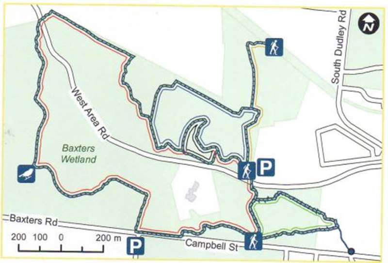
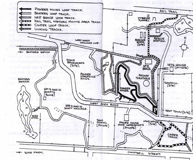
Pioneer Mines Loop track (1.3km) takes you to where boring for coal started in 1909
Baxters Loop track (4.5km) takes you to No. 9 and No. 10 shafts, Baxters wetland and bird hide via the West Area haulage track
No. 5 Brace Loop track (2km) takes you to the main central area workings, up/down uneven dirt steps and along the haulage line.
The Rail Trail Historic Mining Track (1.4km) takes you through the central area workings and along the railway marshalling yards
The Cinder Loop track is unique in that a section of the track is made of cinders (ash) from the powerhouse boilers
Summary:
- Moderate rating
- Track surface varies with crushed rock, gravel, mown grass, natural surface, and bitumen road
- Parking available at unmarked car park (gravel) off West Area Road
- Not wheelchair friendly
- Not pram friendly
- Bicycles not permitted
Access for Dogs:
Dogs permitted on lead.
Review:
A really interesting area with a myriad of walks which encompass many historical elements from the coal mining period. Join up walks to cover as much territory as you want.
Park in the car park at the entrance to this area at 80 West Area Road. On the north side of the car park are cut grass paths. We followed the 'No. 5 Brace Loop track' to the north. The intial area, Tent Town, was the site where 12 miners first lived when the State Coal Mine opened in 1909. By mid 1910 the township of Wonthaggi was established with the construction of 100 miners' cottages.
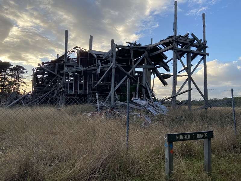
The first area you come to has old equipment and a huge, dilapidated building, No. 5 Brace, which is fenced off for safety and creaks and groans in the wind. Don't sneeze too hard or it may fall down! The building was a sorting plant for the coal, operating from 1909 to 1968. For hundreds of 14 year old boys this was their first place of work as they picked stones out of the coal.
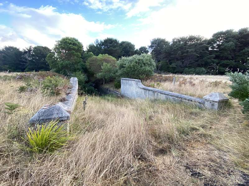
This area has a section of old railway line, mine store area, oil store, change room, McBride Haulage, Loading Shed and Crane.
We then headed further north of the No. 5 Brace where there are engine shed foundations in the long grass on the left side, and after crossing a deep dry creek, you come to the McBride tunnel and Pit Pony Adit.
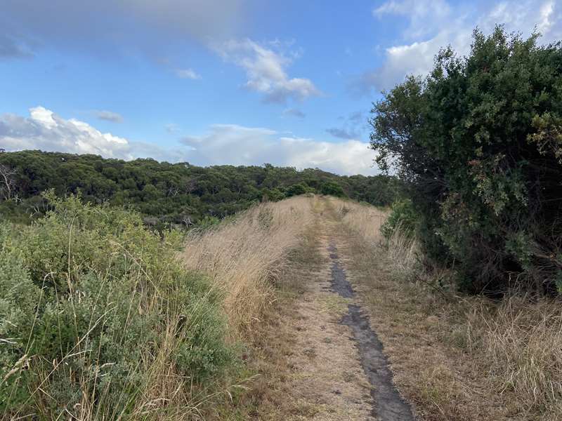
We retraced our steps to the No. 5 Brace where there is a path that leads underneath the big tree and up some steps which has some more old equipment to the West Area Haulage Road, which is an elevated track with nice views. Other tracks lead off in this area.
We followed the West Area Haulage Road until it reached West Area Road. 80m to the east along the road is the entrance to Baxters Wetland on the south side of the road. Alternatively there is a track leading to Baxters beach.
The Baxters Loop Track goes back to the car park where the Cinder Loop Track starts.
Photos:
Location
80 West Area Road, Wonthaggi 3995 Map
Web Links
→ Wonthaggi Central Area Trail (Walking Maps)
")


")