Wonthaggi - Baxters Wetland


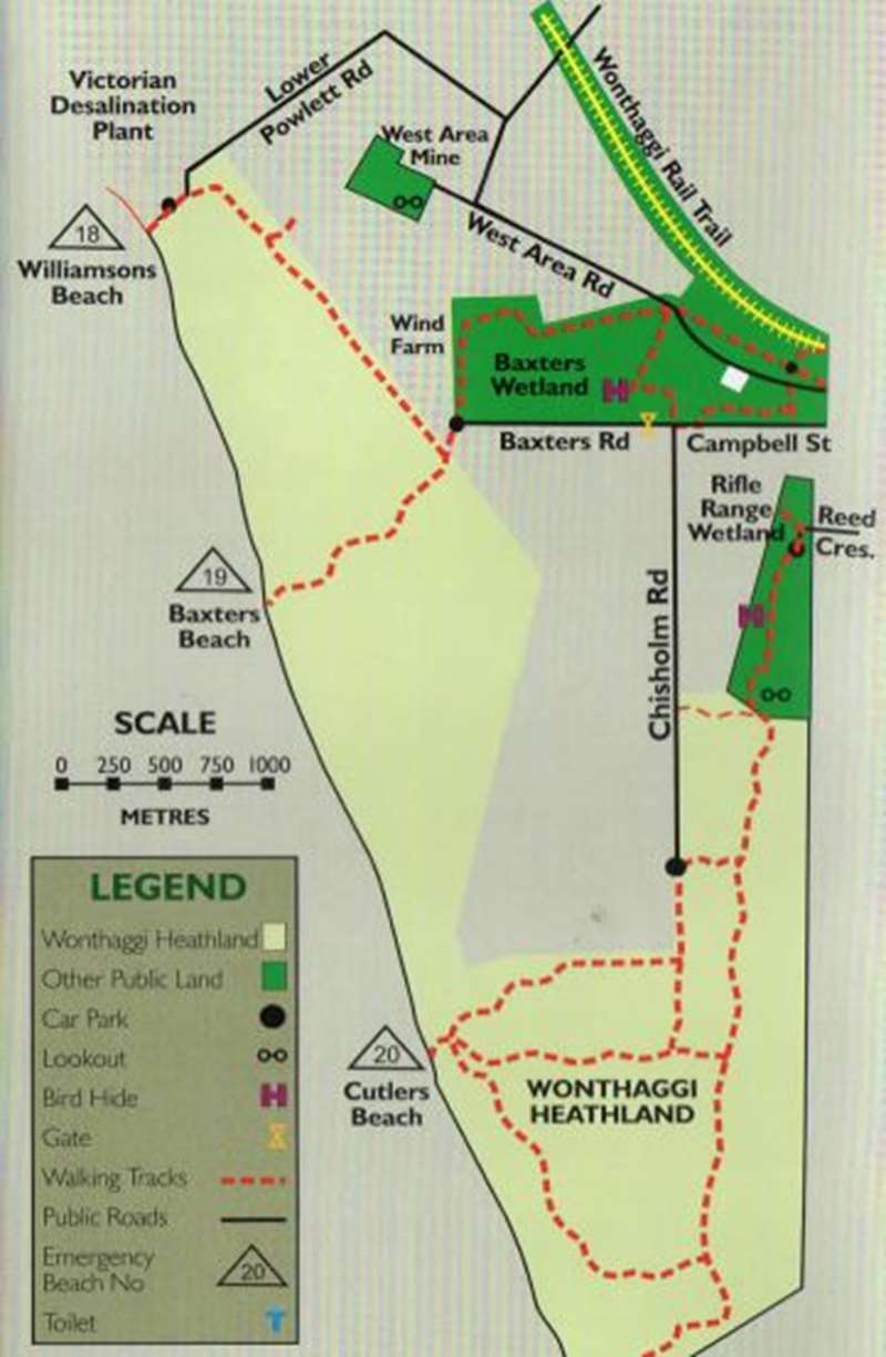
A track, mainly raised between ephemeral wetlands, goes from the end of Campbell Street north-west to West Area Road, while another proceeds from this point south-westerly to the end of Baxters Road, providing a good view of the wind farm. Today's adventurer may find earthworks, claypits, building sites, drainage channels, remnants of mining days. Birdwatch from the hide (tally 120 and counting), botanise along the tracks, note the wildlife, or merely stretch the legs and enjoy the views.
Baxters Wetland, which is an attractive walk for wildlife lovers and has it's very own bird hide, is home to indigenous vegetation, wetlands and plenty of birds. The bird hide is at the bottom of a fairly steep slope which may present a challenge to some people.
Wander a little further along the Baxter Wetlands trail to discover views of the Wonthaggi Wind Farm, and if you're feeling adventurous, follow the track all the way to Baxters Beach - but be warned it is a rough, steep track that can at times be a little muddy!
Map of general area including Baxters Wetland
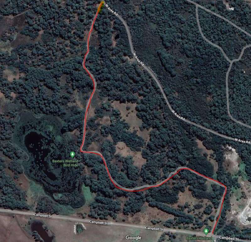
Map of Baxters Wetland Walk
History of Baxters Wetland
- Once an area of sandhills and swamps hunted over by the Bunurong tribe
- 1846 Wild Cattle Run established by squatters named for the cattle abandoned from the 1826 Corinella settlement
- 1909 situated in the Powlett Coal Field, centred on the Dudley Basin of the State Coal Mine
- No 9 Shaft operated 1914- 1920
- No 10 Shaft. operated 1911-1921
- No 12 Airshaft was a common airshaft for both pits
- Change shed and bathroom to accommodate 400 men with 40 showers
- Nearby Power Station (today's Donmix) began operating in 1912
- State Brick Works 1910-1915
- Source of timber (Messmate, Manna, Peppermint) for shoring up tunnels
- At the close of the State Coal Mine in 1968, this land was available for grazing lease. The main swamp was partly drained for summer and autumn stock feeding. Grazing lease was terminated in 1993.
- 1993-1996 students from Wonthaggi Primary School and Wonthaggi Secondary College collected indigenous seed, propagated and planted around the wetlands.
- 1996 Westernport Field and Game restored the wetland, erected nesting boxes
- 2000-2001 and 2005 saw further planting by local groups
Flora
Almost denuded of vegetation except for few old eucalypts and some thickets of paperbark, this area been transformed since 2000. Using locally sourced indigenous seed for tube stock and two patches of direct seeding, many groups have participated in planting, weeding and seed collecting.
Species include: Coast Banksia, Blackwood, Drooping and Scrub Sheoak, Narrow-leaf Peppermint, Coast Manna, Messmate, Swamp Gum, White Sallee, Swamp and Scented Paperbark, Yellow Hakea, Kangaroo Apple, Oonderoo, Prickly Moses.
Fauna
Both waterfowl and bush birds abound, but occasionally a rarer visitor passes through and causes a stir among birdwatchers. Glossy Ibis, Spotted Harrier, Australasian Bittern, Magpie Goose, Latham's Snipe, Freckled Duck. Koalas have been seen irregularly, kangaroos abound; a Long-necked Turtle has laid eggs in the middle of the track.
- Rating is easy walk around the wetlands with some steep sections
- Mown grass, sand, gravel, dirt and sand
- Car parking on grass verge (subject to weather conditions)
- Bicycles permitted
Access for Dogs:
Dogs permitted on a lead.
Review:
We did the 2.8km walk through the wetlands from the corner of Campbell Street and Chisholm Road to the intersection with the West Area Road and return.
Keep to the track because there are unstable mineshafts in the area. After about five minutes walking we came to a side track which leads down to the bird hide which overlooks a huge wetlands area. In mid March there was only one single cormorant drying its wings to see.
The rest of the walk is through dry coastal woodlands. There are some seats beside the path for a rest. When I hear the words wetlands and walk, I instinctively think of snakes. However the paths are quite wide and it should be fairly easy to see any snakes. Judging by the amount of poop on the trails, there are a significant number of animals about but we didn�t see any.
When you reach West Area Road, there is the option to skirt around the western side of the Baxters Wetland and optionally continue onto Baxters Beach.
Photos:
Location
Cnr Campbell Street and Chisholm Road, Wonthaggi 3995 Map
")


")