Tallarook - Trawool (Seymour) Reservoir

 Reservoir")
The Trawool Reservoir was commissioned in the 1890s by the Seymour Water Trust, and opened in 1895. It was built to supply the growing town of Seymour (15 km away) with water using a gravity fed low maintenance system. The water was piped to Seymour via a seven inch steel pipe with half inch thick walls. It ran from the reservoir to the Goulburn Valley (near Trawool) and then north to Seymour. It was a simple gravity fed design with the reservoir being 270 m above Trawool and Seymour.
Picnic tables and fire pits were constructed near the bluestone wall and a small undercover picnic area built.
Access to the site is via a hard grade 1-1.5 hour walk from Trawool or via the seasonal tracks (marked on the map). A 4WD is recommended, though the tracks marked on our map offer 2WD access to the site (at own risk). All other tracks are strictly 4WD only. Seasonal gates apply.
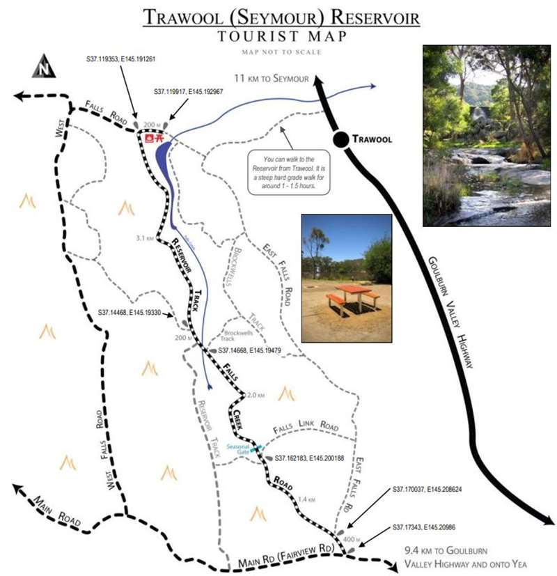
Directions
1. Travel to Yea.
2. Travel north along the Goulburn Valley Highway towards Seymour for 17 km to King Parrot Creek Road.
3. Turn left and travel 5.8 km to Fairview Road.
4. Turn right, cross the bridge and continue along Fairview Road up the range.
5. Travel 6.5 km to East Falls Creek Road.
6. Turn right and travel 400 m to Bridge Track.
7. Turn left and travel 1.4 km to Falls Link Road.
8. Veer left (through the gate) and travel 2.0 km to Brockwells Track.
9. Continue along Reservoir Track across the bridge and travel 200m to the unmarked track.
10.Continue on Reservoir Track for 3.1 km to West Falls Road.
11.Turn right onto West Falls Road and travel 200 m to the Day Visitor Area.
Location
East Falls Road, Tallarook 3659 Map
Web Links
→ Trawool (Seymour) Reservoir Brochure (PDF)
")


")