The Tuckey Track (Sorrento)

The track crosses from one side of the Mornington Peninsula to the other. The start of the walk is at the Western Sister headland of Sullivan Bay Sorrento (3157 Point Nepean Road, Sorrento). From the Sorrento Sailing Couta Boat Club cross Point Nepean Road and follow the sign posts. The Tuckey Track takes you through a mix of paved residential streets, undulating tracks, and the Tuckey Reserve.
Map of Route:
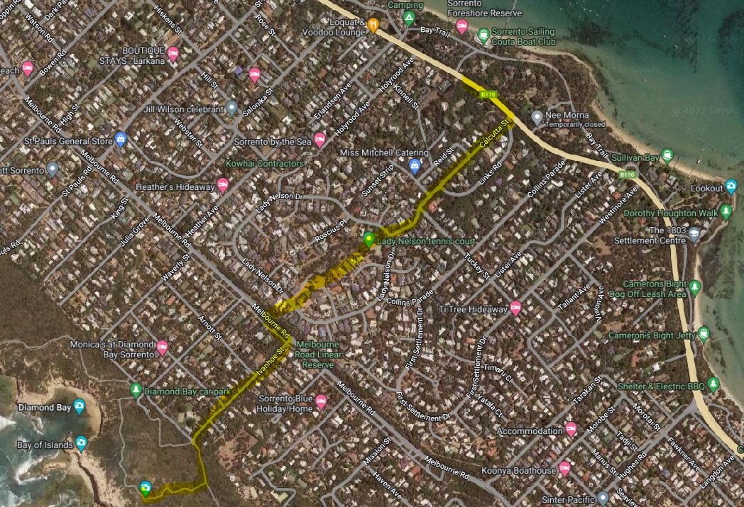
Once you reach Melbourne Road, turn left and cross the road to head down Ivanhoe Street. You will end up following a sandy path which at times is hilly, and there are some steep stairs. It is all worth it though when you reach the Mount St Paul lookout and see the views over the rugged coastline on one side and across to Port Phillip in the other direction. From the lookout you can join the Coastal Walk or turn right to follow the boardwalk down to Bay of Islands.
There is signage along the Tuckey Track providing information about the history of this track which is believed to have been used by Lieutenant James Tuckey and the local indigenous people to walk from Port Phillip to the ocean beaches. Lieutenant James Tuckey wrote 'An Account of a Voyage to Establish a Colony at Port Phillip'. This account provided information about the convict settlement and the landscape in 1804.
Location
3157 Point Nepean Road, Sorrento 3943 View Map


")