Riddells Creek Town Walks


Approximate 30 minute (2.5km) and 60 minute (4.4km) walking loops within the town to help get you moving and more active. The walks highlight some interesting places around the town.
The walking route map has been designed as part of the Healthy Active People Initiative in partnership with local walking groups.
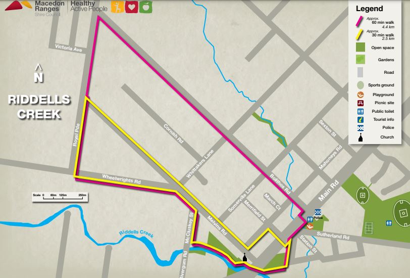
Note: These walks may not be accessible to all and may have uneven and undulating surfaces in some areas.
The walks start near the Lions Park playground along Main Road.
The most interesting part of the walk is along Riddells Creek. Head south-west and pass through the Walter J Smith Reserve which has a lake with a large flock of resident geese which means there is plenty of goose poop on the ground.
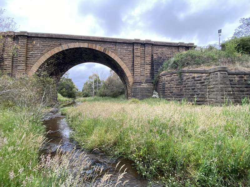
The arched Riddells Creek Bridge is an impressive sight and after crossing Main Street to follow the creek have a look at the lovely St John's Anglican Church.
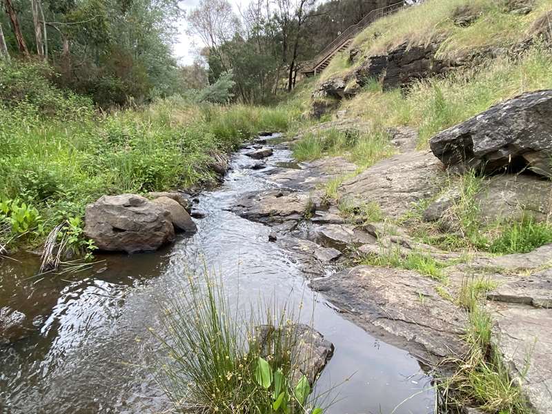
The track beside the creek in the Wyberjong Streamside Reserve is lovely but avoid this area if the creek is in flood. The track passes some stairs but you continue until you reach the end of McCluskey Street.
From here the rest of the walk is along asphalt / gravel roads with some sections having footpaths.
Photos:
Location
63a Main Road, Riddells Creek 3431 Map
Web Links
→ Riddells Creek Town Walks Map (PDF)
")


")