Myrtleford - Reform Hill Walk

Reform Hill is located at the south eastern end of Myrtleford, opposite the Old Butter Factory.
Reform Hill is named from a rich gold bearing quartz reef discovered in 1854. Trial crushings yielded a high proportion of gold, ten ounces to the ton. The gold bearing quartz was 7 metres wide in places and ran through the core of the hill, estimated to have yielded approximately 21,500 ounces of gold. For over 30 years the Reform Mine was a principal employer within Myrtleford. The mine closed in 1888 due mainly to a large amount of water entering the shafts. Today it is a peaceful recreational location providing great walking tracks past historical mining features and picturesque native forests, the typical trees including Red Box, Long-leaf Box, Red Stringybark and Broadleaf Peppermint.
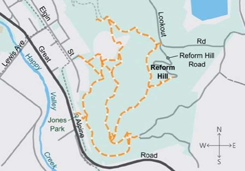
The bushland walk is a 3.4km loop past old mining sites, historic markers and mosaics to reach a pleasant lookout. It is a formed, signposted track with some steep hills and steps.
Start at Jones Park on Myrtle Street. A number of short trails loop around the State Forest and can be walked in various configurations. Follow the signage to the lookout along the trail on the northern side of the hill and descend on the southern side.
If walking is not an option you may drive your car to within 50 metres of the lookout, providing views down the Ovens Valley, Mount Buffalo and the Victorian Alps. Well worth visiting at any time of year.
Map of Route
Location
Jones Park, Murray to the Mountains Rail Trail, Myrtleford 3737 Map
")


")