Beaches


The Best Family Beaches in MelbourneThe Best Family Beaches in Melbourne

Melbourne has a series of nice beaches, which ring Port Phillip Bay, which are great spots to cool off when the weather warms up. Many of the beaches are patrolled during the summer season which helps you to have a safe ..


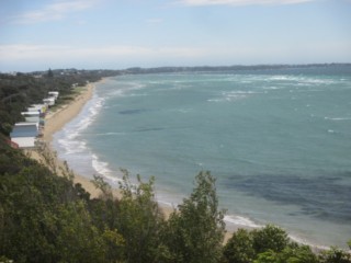
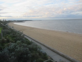
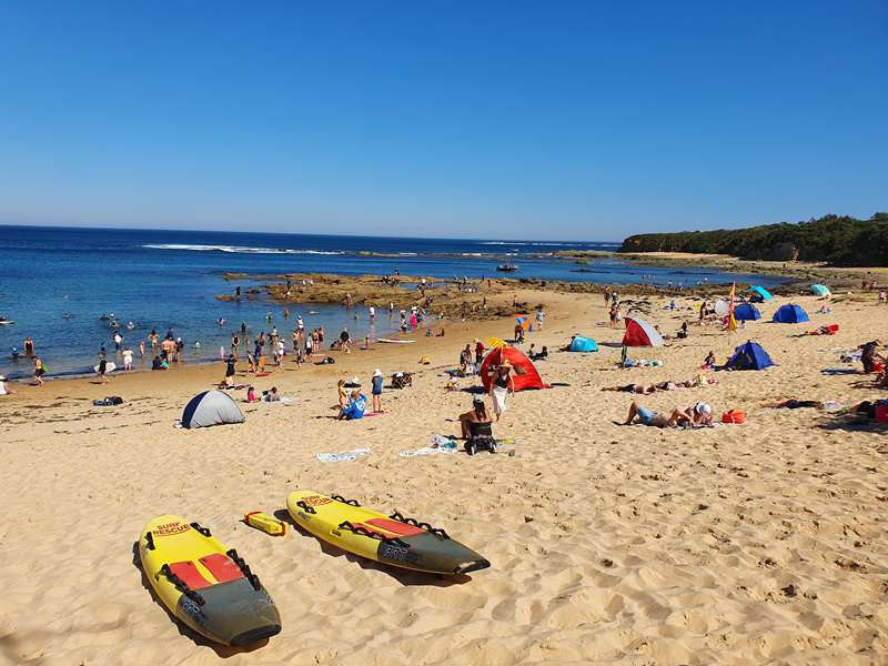
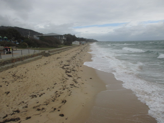
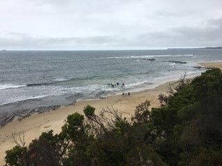
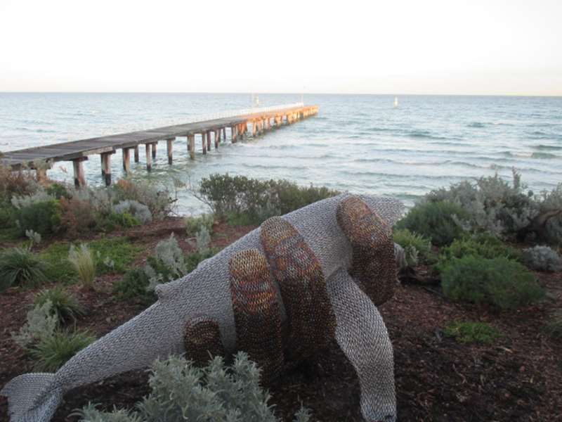
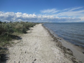
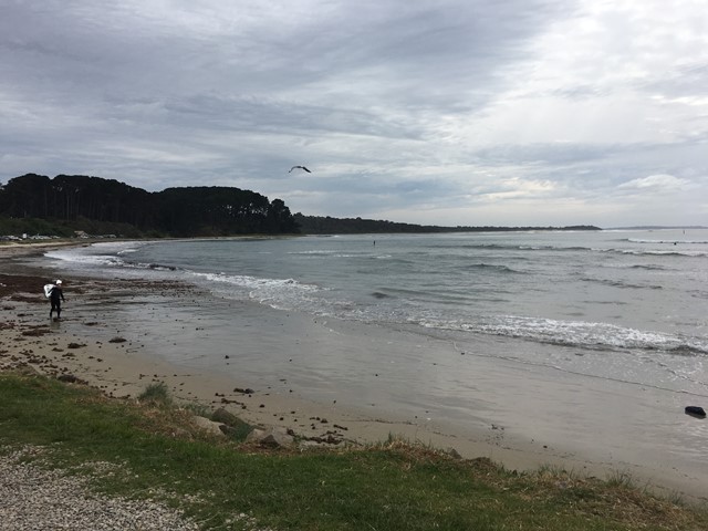
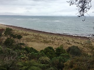
The Best Family Beaches in MelbourneMelbourne has a series of nice beaches, which ring Port Phillip Bay, which are great spots to cool off when the weather warms up. Many of the beaches are patrolled during the summer season which helps you to have a safe (03)The Best Family Beaches in Melbourne
Melbourne
The Best Accessible Beaches in Melbourne and Regional VictoriaThe Best Accessible Beaches in Melbourne and Regional Victoria

When the weather warms up there is no reason why a disability has to stop you having fun in the water. Everyone, irrespective of their abilities, deserves to enjoy the beach. A number of beaches across Melbourne and p ..


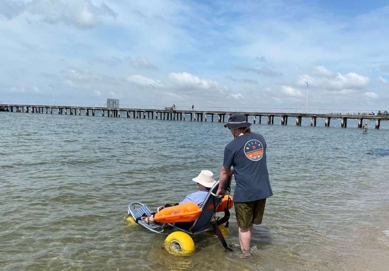
The Best Accessible Beaches in Melbourne and Regional VictoriaWhen the weather warms up there is no reason why a disability has to stop you having fun in the water. Everyone, irrespective of their abilities, deserves to enjoy the beach. A number of beaches across Melbourne and p(03)The Best Accessible Beaches in Melbourne and Regional Victoria
Summary of Mornington Peninsula BeachesSummary of Mornington Peninsula Beaches

A summary of the facilities at the beaches, both Port Phillip Bay and Ocean, along the Mornington Peninsula is: Port Phillip Bay Beaches Portsea / Sorrento Portsea Pier area: Good deep water, BBQ facilities, toi ..


Summary of Mornington Peninsula BeachesA summary of the facilities at the beaches, both Port Phillip Bay and Ocean, along the Mornington Peninsula is: Port Phillip Bay Beaches Portsea / Sorrento Portsea Pier area: Good deep water, BBQ facilities, toi(03)Summary of Mornington Peninsula Beaches
Altona BeachAltona Beach

A long, 3.1 km accessible beach, with good facilities at the pier and reserves at each end. Altona Beach forms the southern boundary of Altona with the Esplanade paralleling the beach. The Altona Railway Station is lo ..


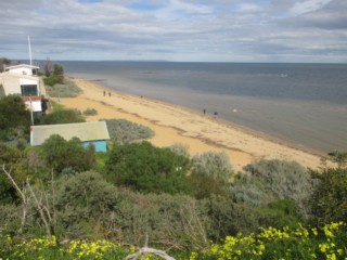
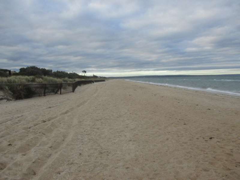
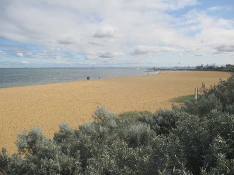
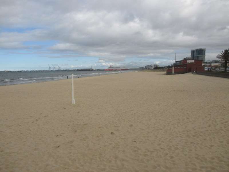
Altona BeachA long, 3.1 km accessible beach, with good facilities at the pier and reserves at each end. Altona Beach forms the southern boundary of Altona with the Esplanade paralleling the beach. The Altona Railway Station is lo(03)Altona Beach
141 Esplanade,
Anglesea BeachAnglesea Beach

Anglesea Beach is a popular summer beach, offering good parking and access, and a moderately safe patrolled beach. Anglesea Beach lies next to the mouth of the Anglesea River and fronts the town of Anglesea. The beach ..


Anglesea BeachAnglesea Beach is a popular summer beach, offering good parking and access, and a moderately safe patrolled beach. Anglesea Beach lies next to the mouth of the Anglesea River and fronts the town of Anglesea. The beach(03)Anglesea Beach
135 Great Ocean Road,
Aspendale BeachAspendale Beach

Aspendale beach is a popular locals beach with rail access and some parking for visitors. Aspendale Beach forms the northern 3 km section of the 7.5 km long beach that stretches between the Patterson River mouth and t ..


Aspendale BeachAspendale beach is a popular locals beach with rail access and some parking for visitors. Aspendale Beach forms the northern 3 km section of the 7.5 km long beach that stretches between the Patterson River mouth and t(03)Aspendale Beach
Gnotuk Avenue,
Balnarring BeachBalnarring Beach

Balnarring is a small beach settlement located at the end of Balnarring Road. The road ends at the main Balnarring Beach (also called Tulum Beach), which has a foreshore reserve with picnic facilities. There is a sma ..


Balnarring BeachBalnarring is a small beach settlement located at the end of Balnarring Road. The road ends at the main Balnarring Beach (also called Tulum Beach), which has a foreshore reserve with picnic facilities. There is a sma(03)Balnarring Beach
1B Foreshore Road,
Balnarring West Beach (Balnarring Beach)Balnarring West Beach (Balnarring Beach)

There is a reserve and picnic area are located behind the Balnarring West beach. The beach is 1.3 km long and curves around from sandy Balnarring Point to face the east by Palmer Bluff, its southern boundary. The bea ..


Balnarring West Beach (Balnarring Beach)There is a reserve and picnic area are located behind the Balnarring West beach. The beach is 1.3 km long and curves around from sandy Balnarring Point to face the east by Palmer Bluff, its southern boundary. The bea(03)Balnarring West Beach (Balnarring Beach)
10 Seawind Road,
Beach 240 (Shoreham)Beach 240 (Shoreham)

Between Shoreham and Flinders, the coast trends south-south-west and consists of steep, 20 to 40 m high, grassy bluffs. The bluffs are fronted by 100 m wide intertidal reef flats, with a series of narrow, sandy, high tid ..


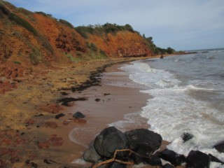
Beach 240 (Shoreham)Between Shoreham and Flinders, the coast trends south-south-west and consists of steep, 20 to 40 m high, grassy bluffs. The bluffs are fronted by 100 m wide intertidal reef flats, with a series of narrow, sandy, high tid(03)Beach 240 (Shoreham)
25 Beach Road,
Beaumaris BeachBeaumaris Beach

Beaumaris beach is an attractive relatively natural beach with good access and parking, however there is as much reef flat as sand here, so watch where you swim. Beaumaris Beach is a 650m strip of sand facing south an ..


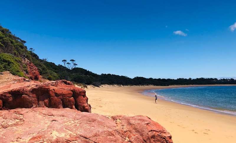
Beaumaris BeachBeaumaris beach is an attractive relatively natural beach with good access and parking, however there is as much reef flat as sand here, so watch where you swim. Beaumaris Beach is a 650m strip of sand facing south an(03)Beaumaris Beach
420 Beach Road,
Beaumaris North BeachBeaumaris North Beach

Beaumaris North beach is a relatively natural, narrow beach with a strip of sand and an increasingly rock and reef dominated surf. North of Ricketts Point, the coast trends north-west and is dominated by 10 to 20 m hi ..


Beaumaris North BeachBeaumaris North beach is a relatively natural, narrow beach with a strip of sand and an increasingly rock and reef dominated surf. North of Ricketts Point, the coast trends north-west and is dominated by 10 to 20 m hi(03)Beaumaris North Beach
365 Beach Road,
Beaumaris Yacht Club BeachBeaumaris Yacht Club Beach

Beaumaris Yacht Club beach is a relatively natural, narrow beach with a strip of sand and an increasingly rock and reef dominated surf. North of Ricketts Point, the coast trends north-west for 2 km to Quiet Corner. It ..


Beaumaris Yacht Club BeachBeaumaris Yacht Club beach is a relatively natural, narrow beach with a strip of sand and an increasingly rock and reef dominated surf. North of Ricketts Point, the coast trends north-west for 2 km to Quiet Corner. It(03)Beaumaris Yacht Club Beach
399 Beach Road,
Berrys Beach (Phillip Island)Berrys Beach (Phillip Island)

The 1km long Berrys Beach lies at the southern end of Berry Beach Road, where there is a gravel car park on the 40 m high bluffs behind the beach, but no other facilities. The closest cafes and shops are located in Cowes ..


Berrys Beach (Phillip Island)The 1km long Berrys Beach lies at the southern end of Berry Beach Road, where there is a gravel car park on the 40 m high bluffs behind the beach, but no other facilities. The closest cafes and shops are located in Cowes(03)Berrys Beach (Phillip Island)
493 Berrys Beach Road,
Birdrock Beach (Mount Martha)Birdrock Beach (Mount Martha)

Birdrock Beach is one of four natural beaches (Birdrock, Dava, Fossil and Fosters) lying below the busy Esplanade, but little used owing to the difficult access and limited parking. Between Craigie Beach and Linley Po ..


Birdrock Beach (Mount Martha)Birdrock Beach is one of four natural beaches (Birdrock, Dava, Fossil and Fosters) lying below the busy Esplanade, but little used owing to the difficult access and limited parking. Between Craigie Beach and Linley Po(03)Birdrock Beach (Mount Martha)
585 Esplanade,
Birdrock Beach Dog Off Leash Area (Mount Martha)Birdrock Beach Dog Off Leash Area (Mount Martha)

Birdrock Beach is one of four natural beaches (Birdrock, Dava, Fossil and Fosters) lying below the busy Esplanade, but little used owing to the difficult access and limited parking. Between Craigie Beach and Linley Po ..


Birdrock Beach Dog Off Leash Area (Mount Martha)Birdrock Beach is one of four natural beaches (Birdrock, Dava, Fossil and Fosters) lying below the busy Esplanade, but little used owing to the difficult access and limited parking. Between Craigie Beach and Linley Po(03)Birdrock Beach Dog Off Leash Area (Mount Martha)
585 Esplanade,
Black Rock BeachBlack Rock Beach

Black Rock beach is a popular summer beach next to the main Beach Road, but shielded by the vegetated bluff, with the protection of the lifesaving club and shops across the road in Black Rock. Black Rock Beach is a re ..


Black Rock BeachBlack Rock beach is a popular summer beach next to the main Beach Road, but shielded by the vegetated bluff, with the protection of the lifesaving club and shops across the road in Black Rock. Black Rock Beach is a re(03)Black Rock Beach
288 Beach Road,
Black Rock Point BeachBlack Rock Point Beach

Black Rock Point beach is a small beach north of the popular Black Rock beach. It is next to the main Beach Road, but shielded by the vegetated bluff. The main beach is 120 m long and is composed of medium to coarse s ..


Black Rock Point BeachBlack Rock Point beach is a small beach north of the popular Black Rock beach. It is next to the main Beach Road, but shielded by the vegetated bluff. The main beach is 120 m long and is composed of medium to coarse s(03)Black Rock Point Beach
Cerberus Way,
Blairgowrie BeachBlairgowrie Beach

Blairgowrie Beach is a long low beach, backed by a reserve and all facilities and fronted by shallow sand flats. Blairgowrie is the first in a series of long, sandy beaches and wide sand flats that swing in a 24 km lo ..


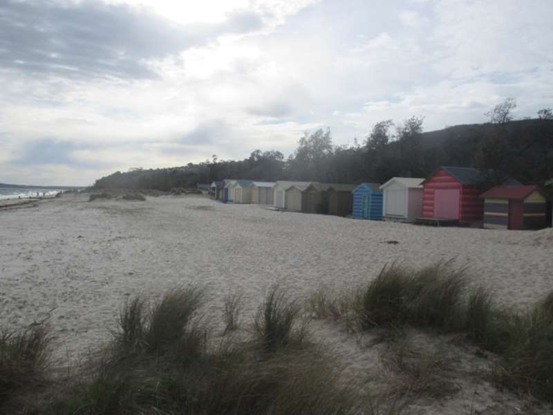
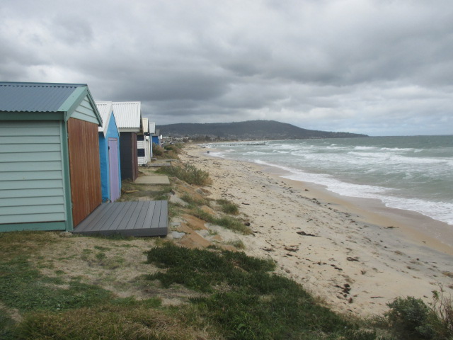
Blairgowrie BeachBlairgowrie Beach is a long low beach, backed by a reserve and all facilities and fronted by shallow sand flats. Blairgowrie is the first in a series of long, sandy beaches and wide sand flats that swing in a 24 km lo(03)Blairgowrie Beach
2761 Nepean Highway,
Bonbeach BeachBonbeach Beach

Bonbeach beach is most suited to locals and train travellers, as parking is very limited. Bonbeach beach forms the southern end of the 7.7 km long beach that includes Bonbeach, Chelsea, Edithvale and Aspendale Beaches ..


Bonbeach BeachBonbeach beach is most suited to locals and train travellers, as parking is very limited. Bonbeach beach forms the southern end of the 7.7 km long beach that includes Bonbeach, Chelsea, Edithvale and Aspendale Beaches(03)Bonbeach Beach
13 Williams Grove,
Bridgewater Bay (Blairgowrie)Bridgewater Bay (Blairgowrie)

Bridgewater Bay has extensive rock pools which are great to explore at low tide. The bay forms a large natural amphitheatre surrounded by impressive sandstone cliffs. There is a sandy section of beach between the rock fo ..


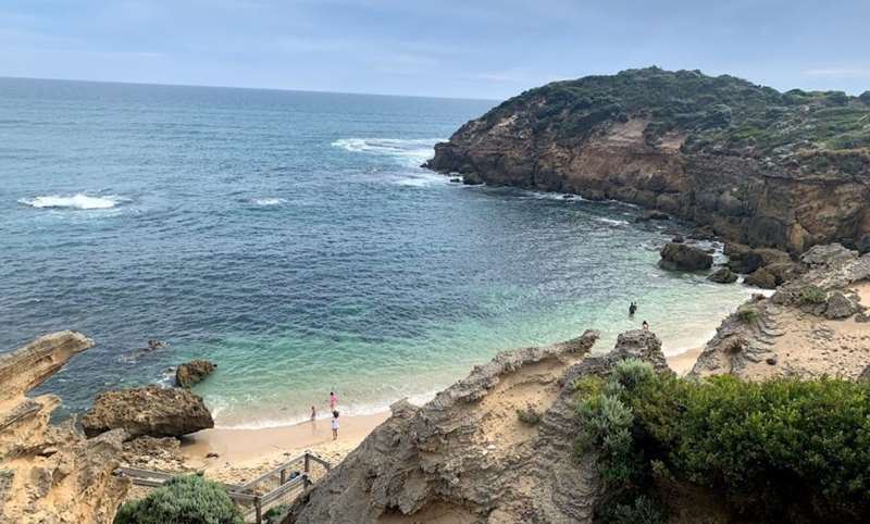
Bridgewater Bay (Blairgowrie)Bridgewater Bay has extensive rock pools which are great to explore at low tide. The bay forms a large natural amphitheatre surrounded by impressive sandstone cliffs. There is a sandy section of beach between the rock fo(03)Bridgewater Bay (Blairgowrie)
108 St Johns Wood Road,
Brighton BeachBrighton Beach

Brighton beach is a very accessible and popular beach with foreshore facilities. However beware of the often deep water and reefs. Brighton Beach is a 1 km long, south-west facing beach, lying between the New Street g ..


Brighton BeachBrighton beach is a very accessible and popular beach with foreshore facilities. However beware of the often deep water and reefs. Brighton Beach is a 1 km long, south-west facing beach, lying between the New Street g(03)Brighton Beach
Cnr Beach Road and South Road,
Campbells Cove Beach (Werribee South)Campbells Cove Beach (Werribee South)

Campbells Cove is a south-east facing section of low coast, located at the end of Cunninghams Road and backed by the rough Campbells Cove Road, which runs along the 5 m high basalt bluffs. Numerous fishing shacks back an ..


Campbells Cove Beach (Werribee South)Campbells Cove is a south-east facing section of low coast, located at the end of Cunninghams Road and backed by the rough Campbells Cove Road, which runs along the 5 m high basalt bluffs. Numerous fishing shacks back an(03)Campbells Cove Beach (Werribee South)
Campbells Cove Road,
Canadian Bay Beach (Mount Eliza)Canadian Bay Beach (Mount Eliza)

Canadian Bay Beach is composed of two sandy beaches which are 850m long backed by red bluffs and dominated by reefs, with good access and parking. Access - The Canadian Bay Road is used for access to both Canadian Bay ..


Canadian Bay Beach (Mount Eliza)Canadian Bay Beach is composed of two sandy beaches which are 850m long backed by red bluffs and dominated by reefs, with good access and parking. Access - The Canadian Bay Road is used for access to both Canadian Bay(03)Canadian Bay Beach (Mount Eliza)
1 Canadian Bay Road,
Cape Paterson Bay BeachCape Paterson Bay Beach

Cape Paterson's Bay Beach is a 400 metres curved beach located adjacent to the centre of the Cape Paterson township and at the foot of the Caravan and Camping grounds. This is a popular beach for surfers, bathers, beach ..


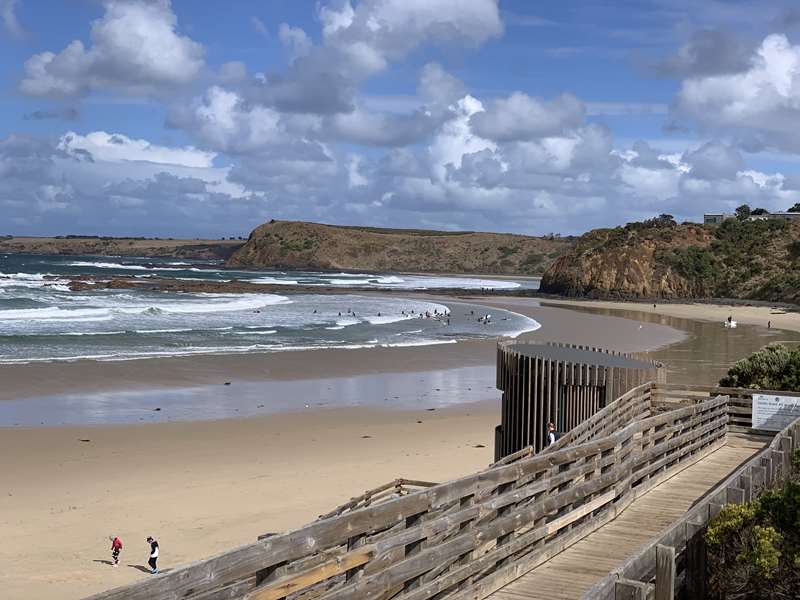
Cape Paterson Bay BeachCape Paterson's Bay Beach is a 400 metres curved beach located adjacent to the centre of the Cape Paterson township and at the foot of the Caravan and Camping grounds. This is a popular beach for surfers, bathers, beach (03)Cape Paterson Bay Beach
16 Bay Beach Road,
Cape Paterson Surf BeachCape Paterson Surf Beach

The 0.5km long Cape Paterson Surf Beach (also called First Surf) is the bathing and surfing beach for the holiday town of Cape Paterson, which lies immediately behind the beach. In general, a relatively safe and popu ..


Cape Paterson Surf BeachThe 0.5km long Cape Paterson Surf Beach (also called First Surf) is the bathing and surfing beach for the holiday town of Cape Paterson, which lies immediately behind the beach. In general, a relatively safe and popu(03)Cape Paterson Surf Beach
15 Legge Way,
Cape Woolamai Safety Beach (Phillip Island)Cape Woolamai Safety Beach (Phillip Island)

Cape Woolamai Safety Beach is a quiet and calm beach which is perfect for families. A popular summer beach is ideal for a range of water activities including swimming, stand up paddle boarding, jet skiing, beach walk ..


Cape Woolamai Safety Beach (Phillip Island)Cape Woolamai Safety Beach is a quiet and calm beach which is perfect for families. A popular summer beach is ideal for a range of water activities including swimming, stand up paddle boarding, jet skiing, beach walk(03)Cape Woolamai Safety Beach (Phillip Island)
28 The Esplanade,
Cape Woolamai Surf Beach (Phillip Island)Cape Woolamai Surf Beach (Phillip Island)

Cape Woolamai Surf Beach is the longest and most exposed beach on Phillip Island, and is a popular spot for experienced surfers. An exposed, high energy beach for more experienced bathers and surfers. Best during summer ..


Cape Woolamai Surf Beach (Phillip Island)Cape Woolamai Surf Beach is the longest and most exposed beach on Phillip Island, and is a popular spot for experienced surfers. An exposed, high energy beach for more experienced bathers and surfers. Best during summer (03)Cape Woolamai Surf Beach (Phillip Island)
Woolamai Beach Road,
Carrum BeachCarrum Beach

Carrum Beach forms the northern 2 km of the 9 km long Frankston-Carrum beach. Located at the beach are the Carrum Surf Life Saving Club, Carrum Sailing Club and Patterson River Yacht Club. The Carrum Surf Life Saving ..


Carrum BeachCarrum Beach forms the northern 2 km of the 9 km long Frankston-Carrum beach. Located at the beach are the Carrum Surf Life Saving Club, Carrum Sailing Club and Patterson River Yacht Club. The Carrum Surf Life Saving(03)Carrum Beach
Stephens Street,
Chelsea BeachChelsea Beach

Chelsea Beach is 1.5 km long straight stretch of sand between Bonbeach and Edithvale. The beach is patrolled by the Chelsea Longbeach Life Saving Club. Chelsea beach is situated between Edithvale and Bonbeach and is a ..


Chelsea BeachChelsea Beach is 1.5 km long straight stretch of sand between Bonbeach and Edithvale. The beach is patrolled by the Chelsea Longbeach Life Saving Club. Chelsea beach is situated between Edithvale and Bonbeach and is a(03)Chelsea Beach
8 Camp Street,
Cowes Main Beaches (Phillip Island)Cowes Main Beaches (Phillip Island)

The only northern facing beaches in Victoria, the Cowes Main Beaches are ideal for swimming and summer fun. Mussel Rocks Beach lies between Mussel Rocks and the ferry jetty; while the main Cowes Beach is immediately e ..


Cowes Main Beaches (Phillip Island)The only northern facing beaches in Victoria, the Cowes Main Beaches are ideal for swimming and summer fun. Mussel Rocks Beach lies between Mussel Rocks and the ferry jetty; while the main Cowes Beach is immediately e(03)Cowes Main Beaches (Phillip Island)
The Esplanade,
Cowes West Beaches (Phillip Island)Cowes West Beaches (Phillip Island)

The Anderson Road to Red Rocks beaches (between Penguin Point and Richardson Point) in Cowes are popular with families due to their low waves and stunning coastal views of French Island and the Mornington Peninsula. It i ..


Cowes West Beaches (Phillip Island)The Anderson Road to Red Rocks beaches (between Penguin Point and Richardson Point) in Cowes are popular with families due to their low waves and stunning coastal views of French Island and the Mornington Peninsula. It i(03)Cowes West Beaches (Phillip Island)
1 Anderson Road,
Craigie Beach (Mount Martha)Craigie Beach (Mount Martha)

Craigie Beach is a 120m long isolated pocket beach with a bluff behind the beach. The Esplanade parallels the shore on top of the bluffs. To reach Craigie Beaches requires a walk up the beach or a steep climb down the ..


Craigie Beach (Mount Martha)Craigie Beach is a 120m long isolated pocket beach with a bluff behind the beach. The Esplanade parallels the shore on top of the bluffs. To reach Craigie Beaches requires a walk up the beach or a steep climb down the(03)Craigie Beach (Mount Martha)
560 Esplanade,
Dava Beach (Mount Martha)Dava Beach (Mount Martha)

Dava Beach is one of four natural beaches (Birdrock, Dava, Fossil and Fosters) lying below the busy Esplanade, but little used owing to the difficult access and limited parking. Between Craigie Beach and Linley Point ..


Dava Beach (Mount Martha)Dava Beach is one of four natural beaches (Birdrock, Dava, Fossil and Fosters) lying below the busy Esplanade, but little used owing to the difficult access and limited parking. Between Craigie Beach and Linley Point (03)Dava Beach (Mount Martha)
614 Esplanade,
Dava Beach Dog Off Leash Area (Mount Martha)Dava Beach Dog Off Leash Area (Mount Martha)

Dava Beach is one of four natural beaches (Birdrock, Dava, Fossil and Fosters) lying below the busy Esplanade, but little used owing to the difficult access and limited parking. Between Craigie Beach and Linley Point ..


Dava Beach Dog Off Leash Area (Mount Martha)Dava Beach is one of four natural beaches (Birdrock, Dava, Fossil and Fosters) lying below the busy Esplanade, but little used owing to the difficult access and limited parking. Between Craigie Beach and Linley Point (03)Dava Beach Dog Off Leash Area (Mount Martha)
614 Esplanade,
Daveys Bay Beach (Mount Eliza)Daveys Bay Beach (Mount Eliza)

There are three narrow beaches in a 1.5 km long section of coast backed by 20 to 30 m high bluffs. The area is mainly used by the Daveys Bay Yacht Club and fishers. Daveys Bay is named after James Davey who built a je ..


Daveys Bay Beach (Mount Eliza)There are three narrow beaches in a 1.5 km long section of coast backed by 20 to 30 m high bluffs. The area is mainly used by the Daveys Bay Yacht Club and fishers. Daveys Bay is named after James Davey who built a je(03)Daveys Bay Beach (Mount Eliza)
31 Daveys Bay Road,
Dendy Street Beach (Brighton)Dendy Street Beach (Brighton)

Dendy Street, with its boat sheds, is one of Melbourne's most photographed beaches. It is also very popular, with good parking and access. Dendy Street Beach is 500 m long and tied to two reefs, with the famous series ..


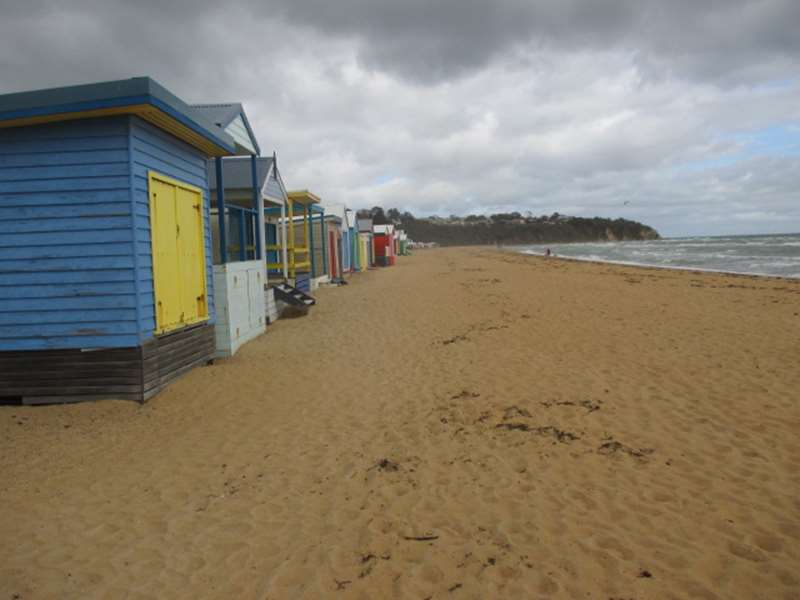
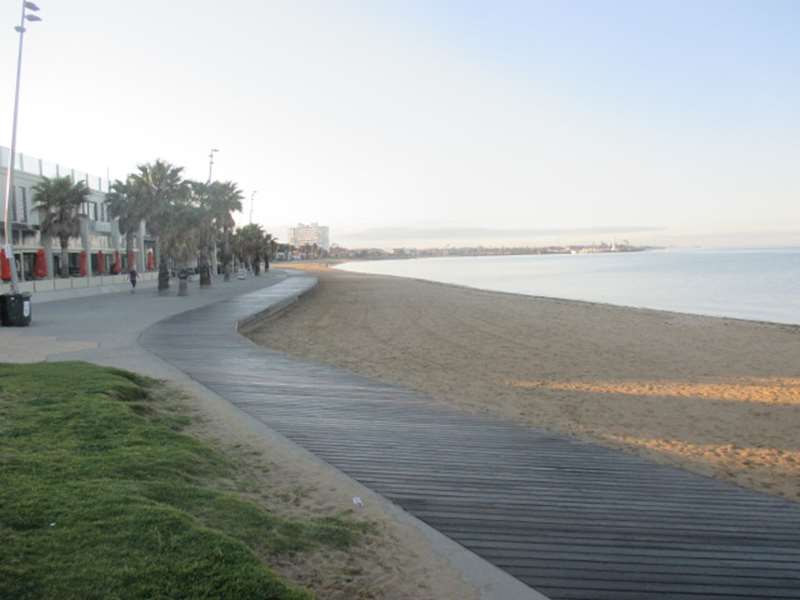
Dendy Street Beach (Brighton)Dendy Street, with its boat sheds, is one of Melbourne's most photographed beaches. It is also very popular, with good parking and access. Dendy Street Beach is 500 m long and tied to two reefs, with the famous series(03)Dendy Street Beach (Brighton)
114 Esplanade,
Dodds Creek Beach (Flinders)Dodds Creek Beach (Flinders)

The town of Flinders lies behind the elongated Flinders Point. Beaches lie either side of the point, with two sheltered beaches on the east side called Dodds Creek and Kennon Cove. Dodds Creek Beach faces east and is ..


Dodds Creek Beach (Flinders)The town of Flinders lies behind the elongated Flinders Point. Beaches lie either side of the point, with two sheltered beaches on the east side called Dodds Creek and Kennon Cove. Dodds Creek Beach faces east and is(03)Dodds Creek Beach (Flinders)
3 Cove Lane,
Dromana BeachDromana Beach

Dromana Beach, which is 3 km long, is a very accessible beach with a foreshore reserve with numerous facilities. A Tourist Information Centre is located on Marine Drive just west of the pier. Dromana and Safety Beache ..


Dromana BeachDromana Beach, which is 3 km long, is a very accessible beach with a foreshore reserve with numerous facilities. A Tourist Information Centre is located on Marine Drive just west of the pier. Dromana and Safety Beache(03)Dromana Beach
215 Point Nepean Road,
Duncans Road Beach (Werribee South)Duncans Road Beach (Werribee South)

The small, 150m wide, beach is located between low basalt bluffs and seawalls. There are 100 to 200 m wide intertidal sand flats and swimming is best at high tide when the tidal flats are under water. The beach is loc ..


Duncans Road Beach (Werribee South)The small, 150m wide, beach is located between low basalt bluffs and seawalls. There are 100 to 200 m wide intertidal sand flats and swimming is best at high tide when the tidal flats are under water. The beach is loc(03)Duncans Road Beach (Werribee South)
Beach Road,
East Creek Beach (Point Leo)East Creek Beach (Point Leo)

The 1.5 km long East Creek beach continues from a prominent bluff at the west of Merricks Beach to the bluff just past the mouth of East Creek, at Point Leo. The beach is backed by 10 to 20 m high, vegetated bluffs. ..


East Creek Beach (Point Leo)The 1.5 km long East Creek beach continues from a prominent bluff at the west of Merricks Beach to the bluff just past the mouth of East Creek, at Point Leo. The beach is backed by 10 to 20 m high, vegetated bluffs. (03)East Creek Beach (Point Leo)
6 Western Parade,
Edithvale BeachEdithvale Beach

Edithvale Beach is a 1.5 km long, straight section of sand located between Chelsea and Aspendale Beaches. The beach is patrolled by the Edithvale Life Saving Club. The beach faces west-south-west and, like adjoining ..


Edithvale BeachEdithvale Beach is a 1.5 km long, straight section of sand located between Chelsea and Aspendale Beaches. The beach is patrolled by the Edithvale Life Saving Club. The beach faces west-south-west and, like adjoining (03)Edithvale Beach
The Esplanade Lane,
Elwood BeachElwood Beach

The Elwood foreshore with its bridges, walking paths, bike paths, coastal vegetation, BBQ areas, lifesaving club, sailing and angling clubs, sea scouts and restaurant and kiosks is a great place to take the family. T ..


Elwood BeachThe Elwood foreshore with its bridges, walking paths, bike paths, coastal vegetation, BBQ areas, lifesaving club, sailing and angling clubs, sea scouts and restaurant and kiosks is a great place to take the family. T(03)Elwood Beach
67 Ormond Esplanade,
Fishermans Beach (Mornington)Fishermans Beach (Mornington)

Fishermans Beach is a very accessible popular beach, which can provide a few waves to play in. Fishermans Beach is 550m long and is located in lee of Linley Point. The Esplanade runs on 20 m high bluffs right behind t ..


Fishermans Beach (Mornington)Fishermans Beach is a very accessible popular beach, which can provide a few waves to play in. Fishermans Beach is 550m long and is located in lee of Linley Point. The Esplanade runs on 20 m high bluffs right behind t(03)Fishermans Beach (Mornington)
729 Esplanade,
Fossil Beach (Mornington)Fossil Beach (Mornington)

Fossil Beach is one of four natural beaches (Birdrock, Dava, Fossil and Fosters) lying below the busy Esplanade, but little used owing to the difficult access and limited parking. Between Craigie Beach and Linley Poin ..


Fossil Beach (Mornington)Fossil Beach is one of four natural beaches (Birdrock, Dava, Fossil and Fosters) lying below the busy Esplanade, but little used owing to the difficult access and limited parking. Between Craigie Beach and Linley Poin(03)Fossil Beach (Mornington)
630 Esplanade,
Fosters Beach (Mornington)Fosters Beach (Mornington)

Fosters Beach is the most northerly of four natural beaches lying below the busy Esplanade, but little used owing to the difficult access and limited parking. Between Craigie Beach and Linley Point is a 3 km section o ..


Fosters Beach (Mornington)Fosters Beach is the most northerly of four natural beaches lying below the busy Esplanade, but little used owing to the difficult access and limited parking. Between Craigie Beach and Linley Point is a 3 km section o(03)Fosters Beach (Mornington)
662 Esplanade,
Frankston Beach and WaterfrontFrankston Beach and Waterfront

Frankston Beach forms the southern end of a 9 km long beach that runs north to the Patterson River mouth at Carrum. The Frankston section is 2.5 km long and begins at the southern boat launching area. It includes the 500 ..


Frankston Beach and WaterfrontFrankston Beach forms the southern end of a 9 km long beach that runs north to the Patterson River mouth at Carrum. The Frankston section is 2.5 km long and begins at the southern boat launching area. It includes the 500(03)Frankston Beach and Waterfront
Long Island Drive,
Gunnamatta Ocean BeachGunnamatta Ocean Beach

Gunnamatta Ocean Beach is a 3km long surf beach located in the Mornington Peninsula National Park which has consistently high swells and rocky reefs. Gunnamatta Beach is an exposed, high energy beach with a wide, rip dom ..


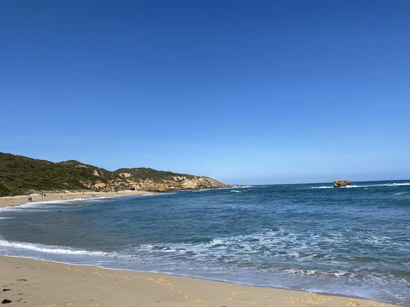
Gunnamatta Ocean BeachGunnamatta Ocean Beach is a 3km long surf beach located in the Mornington Peninsula National Park which has consistently high swells and rocky reefs. Gunnamatta Beach is an exposed, high energy beach with a wide, rip dom(03)Gunnamatta Ocean Beach
Truemans Road,
Half Moon Bay Beach (Black Rock)Half Moon Bay Beach (Black Rock)

Half Moon Bay beach has a very active and accessible southern corner, with a more natural and quieter northern section. Access and parking are good at both ends. Care should be taken if near the remains of the Cerberus, ..


Half Moon Bay Beach (Black Rock)Half Moon Bay beach has a very active and accessible southern corner, with a more natural and quieter northern section. Access and parking are good at both ends. Care should be taken if near the remains of the Cerberus, (03)Half Moon Bay Beach (Black Rock)
Cerberus Way,
Half Moon Bay Beach (Mount Eliza)Half Moon Bay Beach (Mount Eliza)

Half Moon Bay consists of over 200 m of high tide, sandy beach, which sweeps in three small arcs below the red bluffs and between more prominent reefs. There is good access and parking. Access - The Canadian Bay Road ..


Half Moon Bay Beach (Mount Eliza)Half Moon Bay consists of over 200 m of high tide, sandy beach, which sweeps in three small arcs below the red bluffs and between more prominent reefs. There is good access and parking. Access - The Canadian Bay Road (03)Half Moon Bay Beach (Mount Eliza)
1 Canadian Bay Road,
Hampton BeachHampton Beach

The southern boat harbour is perfect for boating, however the beach has been heavily degraded by the lack of sand and numerous rock structures. Hampton Beach was once part of a continuous strip of sand running from Pi ..


Hampton BeachThe southern boat harbour is perfect for boating, however the beach has been heavily degraded by the lack of sand and numerous rock structures. Hampton Beach was once part of a continuous strip of sand running from Pi(03)Hampton Beach
45 Beach Road,
Hawker Beach (Mount Martha)Hawker Beach (Mount Martha)

Hawker beach, which is 600 m long, is one of three narrow beaches north of Balcombe Creek in Mount Martha which is backed by boat sheds and bluffs. The Esplanade parallels the shore on top of the bluffs. To reach Hawk ..


Hawker Beach (Mount Martha)Hawker beach, which is 600 m long, is one of three narrow beaches north of Balcombe Creek in Mount Martha which is backed by boat sheds and bluffs. The Esplanade parallels the shore on top of the bluffs. To reach Hawk(03)Hawker Beach (Mount Martha)
546 Esplanade,
Holloway Beach (Brighton)Holloway Beach (Brighton)

Holloway Beach is a smallish beach between Green Point to the south and the popular Dendy Street beach with its boat sheds to the north. At Green Point, the low rocks and reefs have been encased in a 300 m long seawal ..


Holloway Beach (Brighton)Holloway Beach is a smallish beach between Green Point to the south and the popular Dendy Street beach with its boat sheds to the north. At Green Point, the low rocks and reefs have been encased in a 300 m long seawal(03)Holloway Beach (Brighton)
Cnr Were Street and Esplanade,
Inverloch Surf BeachInverloch Surf Beach

Inverloch Surf Beach is a great "learn to surf" beach. It is a narrow beach fronted by extensive intertidal sand flats and shoals, including some areas of rock flats. A low energy, sandy shore runs along the front of tow ..


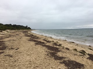
Inverloch Surf BeachInverloch Surf Beach is a great "learn to surf" beach. It is a narrow beach fronted by extensive intertidal sand flats and shoals, including some areas of rock flats. A low energy, sandy shore runs along the front of tow(03)Inverloch Surf Beach
163 Surf Parade,
Kackeraboite Creek Beach (Frankston South)Kackeraboite Creek Beach (Frankston South)

There are three narrow beaches in a 1.5 km long section of coast backed by 20 to 30 m high bluffs. The area is mainly used by the Daveys Bay Yacht Club and fishers. At Pelican Point, the coast turns east into Daveys B ..


Kackeraboite Creek Beach (Frankston South)There are three narrow beaches in a 1.5 km long section of coast backed by 20 to 30 m high bluffs. The area is mainly used by the Daveys Bay Yacht Club and fishers. At Pelican Point, the coast turns east into Daveys B(03)Kackeraboite Creek Beach (Frankston South)
23 Gulls Way,
Kennon Cove Beach (Flinders)Kennon Cove Beach (Flinders)

The town of Flinders lies behind the elongated Flinders Point. Beaches lie either side of the point, with two sheltered beaches on the east side called Dodds Creek and Kennon Cove. Kennon Cove provides the best access an ..


Kennon Cove Beach (Flinders)The town of Flinders lies behind the elongated Flinders Point. Beaches lie either side of the point, with two sheltered beaches on the east side called Dodds Creek and Kennon Cove. Kennon Cove provides the best access an(03)Kennon Cove Beach (Flinders)
12 The Esplanade,
Kilcunda BeachesKilcunda Beaches

Kilcunda's three south-west facing beaches, Shelly, Kilcunda West 1 and Kilcunda West 2 are known for excellent rock fishing, surfing and stunning views. Kilcunda's three beaches consist of narrow, high tide beaches b ..


Kilcunda BeachesKilcunda's three south-west facing beaches, Shelly, Kilcunda West 1 and Kilcunda West 2 are known for excellent rock fishing, surfing and stunning views. Kilcunda's three beaches consist of narrow, high tide beaches b(03)Kilcunda Beaches
Bass Highway,
Kitty Miller Bay Beach (Phillip Island)Kitty Miller Bay Beach (Phillip Island)

Kitty Miller Bay is a 0.5km long picturesque, circular bay inside the bordering Watts Point and Kennon Head with a large rock platform that becomes exposed at low tide, making this spot ideal for snorkelling. Kitty Mille ..


Kitty Miller Bay Beach (Phillip Island)Kitty Miller Bay is a 0.5km long picturesque, circular bay inside the bordering Watts Point and Kennon Head with a large rock platform that becomes exposed at low tide, making this spot ideal for snorkelling. Kitty Mille(03)Kitty Miller Bay Beach (Phillip Island)
Kitty Millers Bay Road,
Martha Point Beach / Pebble Beach (Mount Martha)Martha Point Beach / Pebble Beach (Mount Martha)

Martha Point beach is a small, pocket, rock bound and relatively isolated beach for those who want a change from the adjacent long beaches. On the southern side of Martha Point is a 100 m pocket of sand and cobbles, l ..


Martha Point Beach / Pebble Beach (Mount Martha)Martha Point beach is a small, pocket, rock bound and relatively isolated beach for those who want a change from the adjacent long beaches. On the southern side of Martha Point is a 100 m pocket of sand and cobbles, l(03)Martha Point Beach / Pebble Beach (Mount Martha)
225 Marine Drive,
Mentone BeachMentone Beach

Mentone beach is an easily accessible and popular beach offering usually lower waves and a shallower surf zone. The 1.6km beach is backed by Beach Road and 20 m high bluffs. The once bare and eroding bluffs were the s ..


Mentone BeachMentone beach is an easily accessible and popular beach offering usually lower waves and a shallower surf zone. The 1.6km beach is backed by Beach Road and 20 m high bluffs. The once bare and eroding bluffs were the s(03)Mentone Beach
64 Beach Road,
Merricks BeachMerricks Beach

Merricks Beach is a small holiday settlement at the end of Merricks Beach Road. The road ends at a foreshore reserve where there is a yacht club and picnic facilities. Merricks Beach is mainly used by locals and sailors. ..


Merricks BeachMerricks Beach is a small holiday settlement at the end of Merricks Beach Road. The road ends at a foreshore reserve where there is a yacht club and picnic facilities. Merricks Beach is mainly used by locals and sailors.(03)Merricks Beach
Surf Street,
Middle Brighton Baths (Brighton)Middle Brighton Baths (Brighton)

The Middle Brighton Baths are probably the safest place to bathe in Port Phillip. The Brighton Baths are open to members and casual visitors alike. The Baths are the perfect venue for swimming laps, a recovery session ..


Middle Brighton Baths (Brighton)The Middle Brighton Baths are probably the safest place to bathe in Port Phillip. The Brighton Baths are open to members and casual visitors alike. The Baths are the perfect venue for swimming laps, a recovery session(03) 9592 7350Middle Brighton Baths (Brighton)
251 Esplanade,
Middle Brighton Beach (Brighton)Middle Brighton Beach (Brighton)

Middle Brighton beach is a very accessible patrolled beach right next to the main road, with a promenade running the length of the beach. Best bathing is toward the centre, away from the rocks and reefs at each end. M ..


Middle Brighton Beach (Brighton)Middle Brighton beach is a very accessible patrolled beach right next to the main road, with a promenade running the length of the beach. Best bathing is toward the centre, away from the rocks and reefs at each end. M(03)Middle Brighton Beach (Brighton)
154 Esplanade,
Middle Park BeachMiddle Park Beach

Middle Park Beach is a readily accessible beach, with amenities at the lifesaving club. This is a popular windsurfing area. Middle Park is part of a 4 km long beach that runs from the Cowdroy Street drain to the large ..


Middle Park BeachMiddle Park Beach is a readily accessible beach, with amenities at the lifesaving club. This is a popular windsurfing area. Middle Park is part of a 4 km long beach that runs from the Cowdroy Street drain to the large(03)Middle Park Beach
264 Beaconsfield Parade,
Mills Beach (Mornington)Mills Beach (Mornington)

Mills Beach is a popular patrolled beach just off the Esplanade, with a grassy picnic area, lifesaving club and a kiosk. Mills Beach is a 700 m long,backed by boatsheds and a vegetated bluff for most of its length. Th ..


Mills Beach (Mornington)Mills Beach is a popular patrolled beach just off the Esplanade, with a grassy picnic area, lifesaving club and a kiosk. Mills Beach is a 700 m long,backed by boatsheds and a vegetated bluff for most of its length. Th(03)Mills Beach (Mornington)
822 Esplanade,
Mordialloc Beach and ForeshoreMordialloc Beach and Foreshore

Mordialloc Beach is a well developed and popular beach, with the added safety of the lifesaving club and the attraction of the pier. Mordialloc Beach is the southern section of a 4 km long beach running from Mordiallo ..


Mordialloc Beach and ForeshoreMordialloc Beach is a well developed and popular beach, with the added safety of the lifesaving club and the attraction of the pier. Mordialloc Beach is the southern section of a 4 km long beach running from Mordiallo(03)Mordialloc Beach and Foreshore
195 Beach Road,
Mornington Park Beach (Flinders)Mornington Park Beach (Flinders)

Between Shoreham and Flinders, the coast trends south-south-west and consists of steep, 20 to 40 m high, grassy bluffs. The bluffs are fronted by 100 m wide intertidal reef flats, with a series of narrow, sandy, high tid ..


Mornington Park Beach (Flinders)Between Shoreham and Flinders, the coast trends south-south-west and consists of steep, 20 to 40 m high, grassy bluffs. The bluffs are fronted by 100 m wide intertidal reef flats, with a series of narrow, sandy, high tid(03)Mornington Park Beach (Flinders)
25 Beach Road,
Mothers Beach (Mornington)Mothers Beach (Mornington)

A coastal area with a choice of three beaches (Shire Hall Beach, Scout Beach and Mothers Beach) in one with a foreshore reserve and picnic facilities. There is a continuous, 600 m long beach that begins as Mothers Bea ..


Mothers Beach (Mornington)A coastal area with a choice of three beaches (Shire Hall Beach, Scout Beach and Mothers Beach) in one with a foreshore reserve and picnic facilities. There is a continuous, 600 m long beach that begins as Mothers Bea(03)Mothers Beach (Mornington)
Schnapper Point Drive,
Mount Martha North Beach (Mount Martha)Mount Martha North Beach (Mount Martha)

Mount Martha North beach, which is 900 m long, is one of three narrow beaches north of Balcombe Creek in Mount Martha which is backed by boat sheds and bluffs. The Esplanade parallels the shore on top of the bluffs. T ..


Mount Martha North Beach (Mount Martha)Mount Martha North beach, which is 900 m long, is one of three narrow beaches north of Balcombe Creek in Mount Martha which is backed by boat sheds and bluffs. The Esplanade parallels the shore on top of the bluffs. T(03)Mount Martha North Beach (Mount Martha)
520 Esplanade,
Mount Martha South Beach (Mount Martha)Mount Martha South Beach (Mount Martha)

Mount Martha South beach is a popular beach for bathers, sailors and boaters, with facilities for all. Mount Martha Beach is 2 km long, with Balcombe Creek mouth dividing it into two equal halves: Mount Martha South a ..


Mount Martha South Beach (Mount Martha)Mount Martha South beach is a popular beach for bathers, sailors and boaters, with facilities for all. Mount Martha Beach is 2 km long, with Balcombe Creek mouth dividing it into two equal halves: Mount Martha South a(03)Mount Martha South Beach (Mount Martha)
464 Esplanade,
Musk / Manton Creek Beach (Shoreham)Musk / Manton Creek Beach (Shoreham)

Between Shoreham and Flinders, the coast trends south-south-west and consists of steep, 20 to 40 m high, grassy bluffs. The bluffs are fronted by 100 m wide intertidal reef flats, with a series of narrow, sandy, high tid ..


Musk / Manton Creek Beach (Shoreham)Between Shoreham and Flinders, the coast trends south-south-west and consists of steep, 20 to 40 m high, grassy bluffs. The bluffs are fronted by 100 m wide intertidal reef flats, with a series of narrow, sandy, high tid(03)Musk / Manton Creek Beach (Shoreham)
25 Beach Road,
Navy / Sandy Beach (Somers)Navy / Sandy Beach (Somers)

The beach is part of Sandy Point which is a 4.5 km long sand spit that has been deposited by waves and tides across the entrance to the north arm of Western Port. The point and beach are on Royal Australian Navy property ..


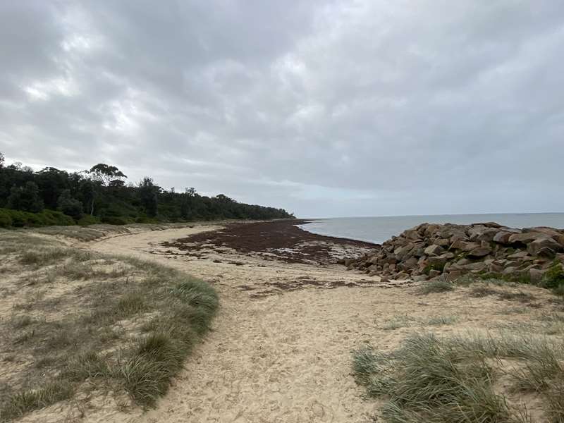
Navy / Sandy Beach (Somers)The beach is part of Sandy Point which is a 4.5 km long sand spit that has been deposited by waves and tides across the entrance to the north arm of Western Port. The point and beach are on Royal Australian Navy property(03)Navy / Sandy Beach (Somers)
121 Miramar Road,
New Beach (Port Melbourne)New Beach (Port Melbourne)

New Beach is a newly created beach which borders Sandridge beach to the west and Princes Pier to the east. It is backed by high rise apartments. Access for Dogs: 1 April - 31 October: Dogs permitted at all times on t ..


New Beach (Port Melbourne)New Beach is a newly created beach which borders Sandridge beach to the west and Princes Pier to the east. It is backed by high rise apartments. Access for Dogs: 1 April - 31 October: Dogs permitted at all times on t(03)New Beach (Port Melbourne)
First Point,
Newhaven Beach (Phillip Island)Newhaven Beach (Phillip Island)

The area also has several small sandy bays at the base of the rocky cliffs along Forrest Avenue, perfect for picnics and enjoying the beautiful views of Western Port Bay and San Remo. This beach is also called Pines ..


Newhaven Beach (Phillip Island)The area also has several small sandy bays at the base of the rocky cliffs along Forrest Avenue, perfect for picnics and enjoying the beautiful views of Western Port Bay and San Remo. This beach is also called Pines (03)Newhaven Beach (Phillip Island)
51 Forrest Avenue,
Ocean Beach (Flinders)Ocean Beach (Flinders)

Ocean Beach lies on the south side of the Flinders point and is 800 m long and backed by high grassy bluffs, reaching 50 m in height. The beach is also narrow at high tide and includes sand and cobbles and fronted by ext ..


Ocean Beach (Flinders)Ocean Beach lies on the south side of the Flinders point and is 800 m long and backed by high grassy bluffs, reaching 50 m in height. The beach is also narrow at high tide and includes sand and cobbles and fronted by ext(03)Ocean Beach (Flinders)
Flinders Ocean Beach Entry Road,
Ocean Grove BeachOcean Grove Beach

Ocean Grove Beach is located in the centre of the 9.5 km long beach that curves in a broad, south facing arc from Point Lonsdale to the Barwon River mouth. The Ocean Grove section is 2 km long and faces south-east. T ..


Ocean Grove BeachOcean Grove Beach is located in the centre of the 9.5 km long beach that curves in a broad, south facing arc from Point Lonsdale to the Barwon River mouth. The Ocean Grove section is 2 km long and faces south-east. T(03)Ocean Grove Beach
Surf Beach Road,
Parkdale BeachParkdale Beach

Parkdale Beach is located between Mordialloc and Mentone Beaches and 1 km south of the Parkdale railway station. Beach Road runs along the top of the bluff that backs the beach, the road providing most of the parking for ..


Parkdale BeachParkdale Beach is located between Mordialloc and Mentone Beaches and 1 km south of the Parkdale railway station. Beach Road runs along the top of the bluff that backs the beach, the road providing most of the parking for(03)Parkdale Beach
151 Beach Road,
Pelican Point Beach (Mount Eliza)Pelican Point Beach (Mount Eliza)

At Pelican Point, the coast turns east into Daveys Bay, then swings back to face west past Kackeraboite Creek. This 1.5 km long section is dominated by 20 to 30 m high bluffs, rocks and reefs. The narrow, 200m long Pelic ..


Pelican Point Beach (Mount Eliza)At Pelican Point, the coast turns east into Daveys Bay, then swings back to face west past Kackeraboite Creek. This 1.5 km long section is dominated by 20 to 30 m high bluffs, rocks and reefs. The narrow, 200m long Pelic(03)Pelican Point Beach (Mount Eliza)
31 Daveys Bay Road,
Pilot Station Beach (Flinders)Pilot Station Beach (Flinders)

Pilot Station Beach lies below the old Pilot Station. It is 600 m long; backed by 20 m high, grassy bluffs; composed of sand and basalt cobbles; and fronted by extensive rocks and reefs making it less suitable for safe b ..


Pilot Station Beach (Flinders)Pilot Station Beach lies below the old Pilot Station. It is 600 m long; backed by 20 m high, grassy bluffs; composed of sand and basalt cobbles; and fronted by extensive rocks and reefs making it less suitable for safe b(03)Pilot Station Beach (Flinders)
Golf Links Road,
Pines Beach (Shoreham)Pines Beach (Shoreham)

Between Shoreham and Flinders, the coast trends south-south-west and consists of steep, 20 to 40 m high, grassy bluffs. The bluffs are fronted by 100 m wide intertidal reef flats, with a series of narrow, sandy, high tid ..


Pines Beach (Shoreham)Between Shoreham and Flinders, the coast trends south-south-west and consists of steep, 20 to 40 m high, grassy bluffs. The bluffs are fronted by 100 m wide intertidal reef flats, with a series of narrow, sandy, high tid(03)Pines Beach (Shoreham)
25 Beach Road,
Point Gellibrand Beach (Williamstown)Point Gellibrand Beach (Williamstown)

Point Gellibrand beach is a narrow winding beach dominated by basalt rock flats and boulders. Swimming is best at high tide when the rocks and sand flats are covered. A road parallels the back of the 500 m long beach, ..


Point Gellibrand Beach (Williamstown)Point Gellibrand beach is a narrow winding beach dominated by basalt rock flats and boulders. Swimming is best at high tide when the rocks and sand flats are covered. A road parallels the back of the 500 m long beach,(03)Point Gellibrand Beach (Williamstown)
Battery Road,
Point King Beach (Sorrento)Point King Beach (Sorrento)

Point King beach is used primarily by local residents and boat owners, with limited public access. Point King is a 20 m high bluff, south of which lie two narrow strips of sand, fronted by 50 to 100 m wide sand and re ..


Point King Beach (Sorrento)Point King beach is used primarily by local residents and boat owners, with limited public access. Point King is a 20 m high bluff, south of which lie two narrow strips of sand, fronted by 50 to 100 m wide sand and re(03)Point King Beach (Sorrento)
8 Point King Road,
Point Leo BeachPoint Leo Beach

This is the quieter, safer and more sheltered of the Point Leo beaches, but is only suitable for swimming when the tide is in. The small settlement of Point Leo is set back from the 20 m high point, which is covered b ..


Point Leo BeachThis is the quieter, safer and more sheltered of the Point Leo beaches, but is only suitable for swimming when the tide is in. The small settlement of Point Leo is set back from the 20 m high point, which is covered b(03)Point Leo Beach
34 Western Parade,
Point Leo Point BeachPoint Leo Point Beach

The small settlement of Point Leo is set back from the 20 m high point, which is covered by a wide foreshore reserve. Three beaches surround the point: Point Leo Beach, the Point Beach and Point Leo Surf Beach. Point ..


Point Leo Point BeachThe small settlement of Point Leo is set back from the 20 m high point, which is covered by a wide foreshore reserve. Three beaches surround the point: Point Leo Beach, the Point Beach and Point Leo Surf Beach. Point(03)Point Leo Point Beach
64 Western Parade,
Point Leo Surf BeachPoint Leo Surf Beach

Point Leo Surf Beach is an attractive, well-maintained beach and reserve, offering safe family bathing in summer, with the chance of some good point and reef breaks during higher winter swell. Point Leo is composed of ..


Point Leo Surf BeachPoint Leo Surf Beach is an attractive, well-maintained beach and reserve, offering safe family bathing in summer, with the chance of some good point and reef breaks during higher winter swell. Point Leo is composed of(03)Point Leo Surf Beach
55 Western Parade,
Point Macarthur Beach (Portsea)Point Macarthur Beach (Portsea)

A 350m protected beach used by locals and boat owners, but with limited public access and facilities. Shelly Beach and Point Macarthur Beach lie between the 20 m high bluffs of Point Franklin and Point King, with Poin ..


Point Macarthur Beach (Portsea)A 350m protected beach used by locals and boat owners, but with limited public access and facilities. Shelly Beach and Point Macarthur Beach lie between the 20 m high bluffs of Point Franklin and Point King, with Poin(03)Point Macarthur Beach (Portsea)
4 Hemston Avenue,
Port Melbourne BeachPort Melbourne Beach

Port Melbourne Beach is one of the closest patrolled beaches to Melbourne city. However, the most accessible parking is restricted to Beaconsfield Parade, and hence the beach is more popular with locals than visitors. ..


Port Melbourne BeachPort Melbourne Beach is one of the closest patrolled beaches to Melbourne city. However, the most accessible parking is restricted to Beaconsfield Parade, and hence the beach is more popular with locals than visitors. (03)Port Melbourne Beach
38 Beaconsfield Parade,
Portsea Surf BeachPortsea Surf Beach

Portsea Beach is one of Victoria's most popular and infamous beaches, being near the spot where Prime Minister Harold Holt disappeared in the surf in 1967. Portsea is a popular summer beach with extensive parking are ..


Portsea Surf BeachPortsea Beach is one of Victoria's most popular and infamous beaches, being near the spot where Prime Minister Harold Holt disappeared in the surf in 1967. Portsea is a popular summer beach with extensive parking are(03)Portsea Surf Beach
Back Beach Road,
Quiet Corner Beach (Black Rock)Quiet Corner Beach (Black Rock)

Quiet Corner beach is a relatively natural, narrow beach with a strip of sand and an increasingly rock and reef dominated surf. North of Ricketts Point, the coast trends north-west for 2 km to Quiet Corner. It is domi ..


Quiet Corner Beach (Black Rock)Quiet Corner beach is a relatively natural, narrow beach with a strip of sand and an increasingly rock and reef dominated surf. North of Ricketts Point, the coast trends north-west for 2 km to Quiet Corner. It is domi(03)Quiet Corner Beach (Black Rock)
355 Beach Road,
Ranelagh Beach (Mount Eliza)Ranelagh Beach (Mount Eliza)

Ranelagh Beach is a difficult to find beach used mainly by locals and the boat owners. Ranelagh Beach is surrounded by bluffs and houses, with the best public access via a path from Earimil Drive to the south. The bea ..


Ranelagh Beach (Mount Eliza)Ranelagh Beach is a difficult to find beach used mainly by locals and the boat owners. Ranelagh Beach is surrounded by bluffs and houses, with the best public access via a path from Earimil Drive to the south. The bea(03)Ranelagh Beach (Mount Eliza)
20 Earimil Drive,
Red Rocks Beach (Phillip Island)Red Rocks Beach (Phillip Island)

This sheltered sandy beach is popular with swimmers during the summer months. The relatively safe beach which is 250m long has deep, calm water against the beach at high tide and extensive reef flats exposed at low tide. ..


Red Rocks Beach (Phillip Island)This sheltered sandy beach is popular with swimmers during the summer months. The relatively safe beach which is 250m long has deep, calm water against the beach at high tide and extensive reef flats exposed at low tide.(03)Red Rocks Beach (Phillip Island)
1 Red Rocks Road,
Rhyll Beach (Phillip Island)Rhyll Beach (Phillip Island)

Rhyll is a quiet little village where you can get out in the boat, catch a fish for lunch and spend the day on the beach with the family. Rhyll Beach is popular with families due to the low waves and scenic outlook. The ..


Rhyll Beach (Phillip Island)Rhyll is a quiet little village where you can get out in the boat, catch a fish for lunch and spend the day on the beach with the family. Rhyll Beach is popular with families due to the low waves and scenic outlook. The (03)Rhyll Beach (Phillip Island)
Beach Road,
Rosebud BeachRosebud Beach

The entire 9 km long Rosebud Beach is backed by a 100 m wide foreshore reserve. The reserve contains numerous facilities including the 300 m long Rosebud Jetty, a boat ramp, swimming pool and camping area. The beach face ..


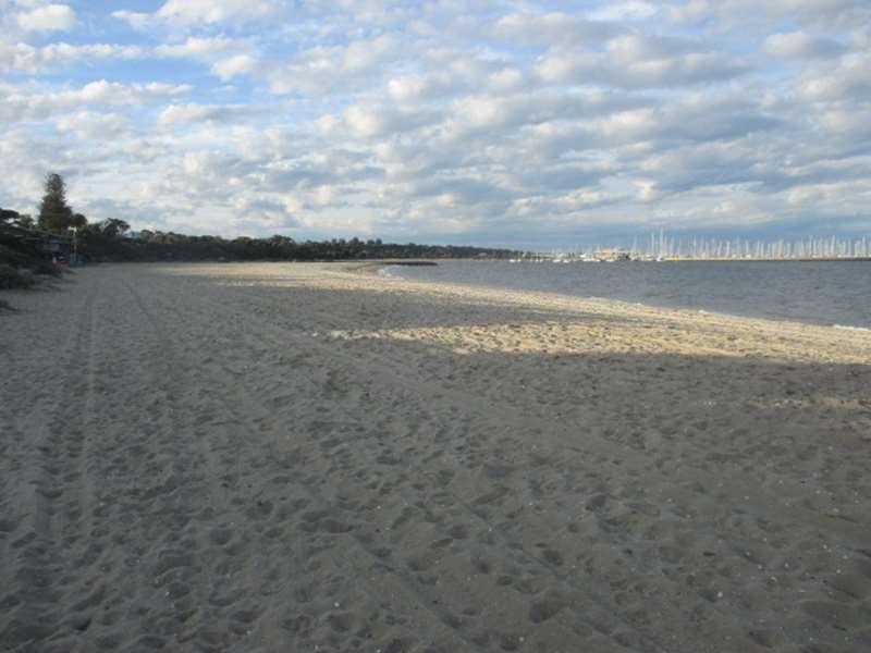
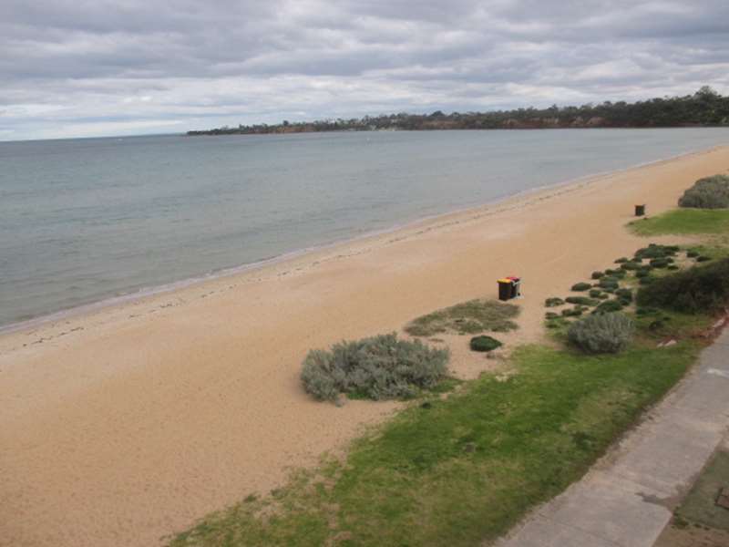
Rosebud BeachThe entire 9 km long Rosebud Beach is backed by a 100 m wide foreshore reserve. The reserve contains numerous facilities including the 300 m long Rosebud Jetty, a boat ramp, swimming pool and camping area. The beach face(03)Rosebud Beach
Cnr Point Nepean Road and Beverley Road,
Royal Beach (Mornington)Royal Beach (Mornington)

A small accessible beach dominated by the backing bluffs and fronting rocks and reefs. Royal Beach is a small pocket beach, just 150 m long, lying between two 10 to 20 m high, red sandstone bluffs, and backed by grass ..


Royal Beach (Mornington)A small accessible beach dominated by the backing bluffs and fronting rocks and reefs. Royal Beach is a small pocket beach, just 150 m long, lying between two 10 to 20 m high, red sandstone bluffs, and backed by grass(03)Royal Beach (Mornington)
774 Esplanade,
Rye BeachRye Beach

Rye Beach has a very popular and always full summer camping reserve while the Jetty area attracts day visitors. Rye Beach begins at White Cliffs and runs past the 300 m long Rye Jetty, almost due east for 4 km. A fore ..


Rye BeachRye Beach has a very popular and always full summer camping reserve while the Jetty area attracts day visitors. Rye Beach begins at White Cliffs and runs past the 300 m long Rye Jetty, almost due east for 4 km. A fore(03)Rye Beach
2385 Point Nepean Road,
Safety BeachSafety Beach

Safety Beach, which is 2.7km long, is a very accessible beach, with a foreshore reserve with numerous facilities and a slightly more energetic surf. Dromana and Safety Beaches occupy the eastern 6 km of the 18 km long ..


Safety BeachSafety Beach, which is 2.7km long, is a very accessible beach, with a foreshore reserve with numerous facilities and a slightly more energetic surf. Dromana and Safety Beaches occupy the eastern 6 km of the 18 km long(03)Safety Beach
157 Marine Drive,
Sandown Street Beach (Brighton)Sandown Street Beach (Brighton)

Sandown Street Beach is enclosed by the pier and breakwater with boats moored offshore. At the southern end of the beach is the large Middle Brighton pier and breakwater, in lee of which is Sandon Street Beach. Two ro ..


Sandown Street Beach (Brighton)Sandown Street Beach is enclosed by the pier and breakwater with boats moored offshore. At the southern end of the beach is the large Middle Brighton pier and breakwater, in lee of which is Sandon Street Beach. Two ro(03)Sandown Street Beach (Brighton)
7 Sandown Street,
Sandridge Beach (Port Melbourne)Sandridge Beach (Port Melbourne)

Sandridge Beach is surrounded by piers and port facilities. However, recent redevelopment of the surrounding area, including new beach amenities and landscaping, have produced a reasonably attractive beach. A relative ..


Sandridge Beach (Port Melbourne)Sandridge Beach is surrounded by piers and port facilities. However, recent redevelopment of the surrounding area, including new beach amenities and landscaping, have produced a reasonably attractive beach. A relative(03)Sandridge Beach (Port Melbourne)
245 The Boulevard,
Sandringham BeachSandringham Beach

A beach of two parts: a narrow, difficult to access southern half; and a very accessible and well-serviced northern half. The northern section is the most popular and is patrolled by the lifesaving club. Sandringham B ..


Sandringham BeachA beach of two parts: a narrow, difficult to access southern half; and a very accessible and well-serviced northern half. The northern section is the most popular and is patrolled by the lifesaving club. Sandringham B(03)Sandringham Beach
116 Beach Road,
Scout Beach (Mornington)Scout Beach (Mornington)

A coastal area with a choice of three beaches (Shire Hall Beach, Scout Beach and Mothers Beach) in one with a foreshore reserve and picnic facilities. There is a continuous, 600 m long beach that begins as Mothers Bea ..


Scout Beach (Mornington)A coastal area with a choice of three beaches (Shire Hall Beach, Scout Beach and Mothers Beach) in one with a foreshore reserve and picnic facilities. There is a continuous, 600 m long beach that begins as Mothers Bea(03)Scout Beach (Mornington)
793 Esplanade,
Seaford BeachSeaford Beach

Seaford Foreshore beach is popular among locals and less known to visitors. This hidden gem is a 4.6 kilometre coastal strip of beach, where you can walk from one end to the other, and is one of only a few extensive area ..


Seaford BeachSeaford Foreshore beach is popular among locals and less known to visitors. This hidden gem is a 4.6 kilometre coastal strip of beach, where you can walk from one end to the other, and is one of only a few extensive area(03)Seaford Beach
125 Nepean Highway,
Seaholme BeachSeaholme Beach

Seaholme Beach is backed by a large foreshore reserve and has very low energy waves. The Altona Coastal Park lies at the mouth of Kororoit Creek and is the northern end of the beach. Most of the beach is fronted by 50 ..


Seaholme BeachSeaholme Beach is backed by a large foreshore reserve and has very low energy waves. The Altona Coastal Park lies at the mouth of Kororoit Creek and is the northern end of the beach. Most of the beach is fronted by 50(03)Seaholme Beach
1 Beach Street,
Shelley Beach (Portsea)Shelley Beach (Portsea)

A 1.2 km protected beach used by locals and boat owners, but with limited public access and facilities. Shelly Beach and Point Macarthur Beach lie between the 20 m high bluffs of Point Franklin and Point King, with Po ..


Shelley Beach (Portsea)A 1.2 km protected beach used by locals and boat owners, but with limited public access and facilities. Shelly Beach and Point Macarthur Beach lie between the 20 m high bluffs of Point Franklin and Point King, with Po(03)Shelley Beach (Portsea)
7 Franklin Road,
Shire Hall Beach (Mornington)Shire Hall Beach (Mornington)

A coastal area with a choice of three beaches (Shire Hall Beach, Scout Beach and Mothers Beach) in one with a foreshore reserve and picnic facilities. There is a continuous, 600 m long beach that begins as Mothers Bea ..


Shire Hall Beach (Mornington)A coastal area with a choice of three beaches (Shire Hall Beach, Scout Beach and Mothers Beach) in one with a foreshore reserve and picnic facilities. There is a continuous, 600 m long beach that begins as Mothers Bea(03)Shire Hall Beach (Mornington)
799 Esplanade,
Shoreham BeachShoreham Beach

Shoreham is a small holiday settlement lying between Flinders Road and the coast. A foreshore reserve parallels two beaches in Shoreham. Beach Road runs out to Shoreham Beach, where a long car park runs between the bluff ..


Shoreham BeachShoreham is a small holiday settlement lying between Flinders Road and the coast. A foreshore reserve parallels two beaches in Shoreham. Beach Road runs out to Shoreham Beach, where a long car park runs between the bluff(03)Shoreham Beach
25 Beach Road,
Shoreham Camping BeachShoreham Camping Beach

Shoreham is a small holiday settlement lying between Flinders Road and the coast. A foreshore reserve parallels the beach with the Shoreham Foreshore Camping Reserve located behind the main beach. The beach is very p ..


Shoreham Camping BeachShoreham is a small holiday settlement lying between Flinders Road and the coast. A foreshore reserve parallels the beach with the Shoreham Foreshore Camping Reserve located behind the main beach. The beach is very p(03)Shoreham Camping Beach
57 Prout Webb Road,
Silverleaves Beach (Phillip Island)Silverleaves Beach (Phillip Island)

Silverleaves is a beautiful golden beach located in Westernport Bay, with low winds and gentle waves. Silverleaves Beach is a northern facing beach, making it ideal for beach walks, fishing, swimming and more. It's a ..


Silverleaves Beach (Phillip Island)Silverleaves is a beautiful golden beach located in Westernport Bay, with low winds and gentle waves. Silverleaves Beach is a northern facing beach, making it ideal for beach walks, fishing, swimming and more. It's a (03)Silverleaves Beach (Phillip Island)
Silverleaves Avenue,
Smiths Beach (Phillip Island)Smiths Beach (Phillip Island)

Smiths Beach offers a usually gentler surf with strong rips and currents, more suited for families and younger surfers. The beach has a General Hazard Rating of 5/10 (Moderately hazardous). Smith Beach is a 1 km long, ..


Smiths Beach (Phillip Island)Smiths Beach offers a usually gentler surf with strong rips and currents, more suited for families and younger surfers. The beach has a General Hazard Rating of 5/10 (Moderately hazardous). Smith Beach is a 1 km long,(03)Smiths Beach (Phillip Island)
Smith Beach Road,
Somers BeachSomers Beach

Somers Beach is a 3km stretch of sandy beach backed by dunes and cliffs with a nature reserve. It is a long, relatively calm beach, with most activity centred on the yacht club at the western end. Somers is a holiday ..


Somers BeachSomers Beach is a 3km stretch of sandy beach backed by dunes and cliffs with a nature reserve. It is a long, relatively calm beach, with most activity centred on the yacht club at the western end. Somers is a holiday (03)Somers Beach
99 Alexandra Avenue,
Somers Foreshore Beach (Somers)Somers Foreshore Beach (Somers)

Somers beach is a long, relatively calm beach, with most activity centred on the yacht club. Somers is a holiday settlement on the bluffs overlooking the Western Passage to Western Port. Somers Beach is 3 km long, run ..


Somers Foreshore Beach (Somers)Somers beach is a long, relatively calm beach, with most activity centred on the yacht club. Somers is a holiday settlement on the bluffs overlooking the Western Passage to Western Port. Somers Beach is 3 km long, run(03)Somers Foreshore Beach (Somers)
4 The Boulevard,
Sorrento Front Beach (Sorrento)Sorrento Front Beach (Sorrento)

Sorrento Front beach is a popular beach with a foreshore reserve containing most facilities for visitors. Sorrento is the largest town on the Nepean Peninsula and the centre of numerous aquatic activities. The town si ..


Sorrento Front Beach (Sorrento)Sorrento Front beach is a popular beach with a foreshore reserve containing most facilities for visitors. Sorrento is the largest town on the Nepean Peninsula and the centre of numerous aquatic activities. The town si(03)Sorrento Front Beach (Sorrento)
3216 Point Nepean Road,
Sorrento Ocean BeachSorrento Ocean Beach

The 400m long Sorrento Ocean or Back Beach is a popular beach for sun bathers and those wanting more action than at the Sorrento Bay Beach and is relatively safe under average waves. The beach has a General Hazard Rating ..


Sorrento Ocean BeachThe 400m long Sorrento Ocean or Back Beach is a popular beach for sun bathers and those wanting more action than at the Sorrento Bay Beach and is relatively safe under average waves. The beach has a General Hazard Rating(03)Sorrento Ocean Beach
250 Ocean Beach Road,
Sorrento Park Beach (Sorrento)Sorrento Park Beach (Sorrento)

Sorrento town sits on 20 m high bluffs, which outcrop at Policeman's Point. The point also divides the two Sorrento beaches (Sorrento Front beach and Sorrento Park beach). The Park Beach is backed by Sorrento Park, w ..


Sorrento Park Beach (Sorrento)Sorrento town sits on 20 m high bluffs, which outcrop at Policeman's Point. The point also divides the two Sorrento beaches (Sorrento Front beach and Sorrento Park beach). The Park Beach is backed by Sorrento Park, w(03)Sorrento Park Beach (Sorrento)
3176 Point Nepean Road,
South Beach (Somers)South Beach (Somers)

South Beach is located on the eastern Somers foreshore, at the foot of 20 m high bluffs, containing a bushy foreshore reserve. The bluffs terminate at the end of the beach, where the long Sandy Point begins. The 1 km lon ..


South Beach (Somers)South Beach is located on the eastern Somers foreshore, at the foot of 20 m high bluffs, containing a bushy foreshore reserve. The bluffs terminate at the end of the beach, where the long Sandy Point begins. The 1 km lon(03)South Beach (Somers)
121 Miramar Road,
South Melbourne Beach (Albert Park)South Melbourne Beach (Albert Park)

South Melbourne Beach is one of the closest patrolled beaches to Melbourne city. However, the most accessible parking is restricted to Beaconsfield Parade, and hence the beach is more popular with locals than visitors. ..


South Melbourne Beach (Albert Park)South Melbourne Beach is one of the closest patrolled beaches to Melbourne city. However, the most accessible parking is restricted to Beaconsfield Parade, and hence the beach is more popular with locals than visitors. (03)South Melbourne Beach (Albert Park)
74 Beaconsfield Parade,
St Kilda BeachSt Kilda Beach

Cosmopolitan St Kilda Beach is one of Melbourne's most popular attractions. The historic pier and penguins, summer sporting and music events, kite boarding, cafes and restaurants, nightlife and multi use promenade, provi ..


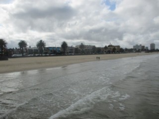
St Kilda BeachCosmopolitan St Kilda Beach is one of Melbourne's most popular attractions. The historic pier and penguins, summer sporting and music events, kite boarding, cafes and restaurants, nightlife and multi use promenade, provi(03)St Kilda Beach
20 Jacka Boulevard,
St Kilda Pier Beach (West St Kilda Beach)St Kilda Pier Beach (West St Kilda Beach)

St Kilda Pier Beach is a wide sheltered beach. In lee of the 1 km long St Kilda Pier and breakwater is the protected beach. The beach has built out over 100 m in lee of the breakwater, at the expense of the southern sect ..


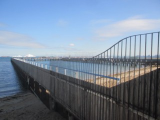
St Kilda Pier Beach (West St Kilda Beach)St Kilda Pier Beach is a wide sheltered beach. In lee of the 1 km long St Kilda Pier and breakwater is the protected beach. The beach has built out over 100 m in lee of the breakwater, at the expense of the southern sect(03)St Kilda Pier Beach (West St Kilda Beach)
Pier Road,
Station Pier Beach (Port Melbourne)Station Pier Beach (Port Melbourne)

Station Pier Beach is a heavily modified beach surrounded by structures. Wedged in between the Port Melbourne Yacht Club and the large Station Pier, and backed by busy Beach Street, is a 700 m long beach. The eastern ..


Station Pier Beach (Port Melbourne)Station Pier Beach is a heavily modified beach surrounded by structures. Wedged in between the Port Melbourne Yacht Club and the large Station Pier, and backed by busy Beach Street, is a 700 m long beach. The eastern (03)Station Pier Beach (Port Melbourne)
65 Beach Street,
Sullivan Bay Beach (Sorrento)Sullivan Bay Beach (Sorrento)

Sullivan Bay beach is set in an attractive bay just off the Highway but bypassed by many. The eastern point of Sullivan Bay is the site of Victoria's first white settlement back in 1803. The headlands that border the ..


Sullivan Bay Beach (Sorrento)Sullivan Bay beach is set in an attractive bay just off the Highway but bypassed by many. The eastern point of Sullivan Bay is the site of Victoria's first white settlement back in 1803. The headlands that border the (03)Sullivan Bay Beach (Sorrento)
3099 Point Nepean Road,
Summerlands Peninsula Beaches (Phillip Island)Summerlands Peninsula Beaches (Phillip Island)

Surfers are spoilt for choice along the Summerlands Peninsula, with a number of beaches featuring great waves for beginners and experienced surfers. These beaches are popular for surfing, beach walkers and fishing. Gener ..


Summerlands Peninsula Beaches (Phillip Island)Surfers are spoilt for choice along the Summerlands Peninsula, with a number of beaches featuring great waves for beginners and experienced surfers. These beaches are popular for surfing, beach walkers and fishing. Gener(03)Summerlands Peninsula Beaches (Phillip Island)
Ventnor Road,
Sunderland Bay Beach (Phillip Island)Sunderland Bay Beach (Phillip Island)

Sunderland Bay is a secluded spot with a rocky platform and boulders. There is a 200 m wide gap in the basalt bluffs, into which waves break over extensive reefs and rocks and around a sea stack. This has produced a 300m ..


Sunderland Bay Beach (Phillip Island)Sunderland Bay is a secluded spot with a rocky platform and boulders. There is a 200 m wide gap in the basalt bluffs, into which waves break over extensive reefs and rocks and around a sea stack. This has produced a 300m(03)Sunderland Bay Beach (Phillip Island)
Cnr The Esplanade and Ozone Court,
Sunnyside Beach (Mount Eliza)Sunnyside Beach (Mount Eliza)

Sunnyside beach is dominated by sandstone rocks, reefs and bluffs. Access - Limited to street parking on the bluffs behind Sunnyside. Note: Sunnyside North beach is only accessible on foot around the rocks and is an ..


Sunnyside Beach (Mount Eliza)Sunnyside beach is dominated by sandstone rocks, reefs and bluffs. Access - Limited to street parking on the bluffs behind Sunnyside. Note: Sunnyside North beach is only accessible on foot around the rocks and is an (03)Sunnyside Beach (Mount Eliza)
1 Sunnyside Road,
Surf Beach (Phillip Island)Surf Beach (Phillip Island)

Surf Beach has big swells from Bass Strait. Surf Beach and its surrounding beaches are popular with experienced surfers, and are ideal for pro surfers looking to catch some waves. It does, however, have strong rips and c ..


Surf Beach (Phillip Island)Surf Beach has big swells from Bass Strait. Surf Beach and its surrounding beaches are popular with experienced surfers, and are ideal for pro surfers looking to catch some waves. It does, however, have strong rips and c(03)Surf Beach (Phillip Island)
Cnr The Esplanade and Dunvegan Crescent,
Ventnor Beach (Phillip Island)Ventnor Beach (Phillip Island)

Ventnor Beach is a long, narrow beach with reef flats on low tide and a nice swimming beach on high tide. It is ideal for families wanting to spend the day at the beach. You'll also find stunning coastal views of Phillip ..


Ventnor Beach (Phillip Island)Ventnor Beach is a long, narrow beach with reef flats on low tide and a nice swimming beach on high tide. It is ideal for families wanting to spend the day at the beach. You'll also find stunning coastal views of Phillip(03)Ventnor Beach (Phillip Island)
2 Grossard Point Road,
Weeroona Bay Beach (Portsea)Weeroona Bay Beach (Portsea)

Weroona Bay is the Portsea bay beach and one of the more popular bayside beaches, with most people content to walk out on the pier, or in summer swim at the beach. The more adventurous can go out on the dive boats from t ..


Weeroona Bay Beach (Portsea)Weroona Bay is the Portsea bay beach and one of the more popular bayside beaches, with most people content to walk out on the pier, or in summer swim at the beach. The more adventurous can go out on the dive boats from t(03)Weeroona Bay Beach (Portsea)
3782 Point Nepean Road,
Werribee South BeachWerribee South Beach

Beach Road runs on the low bluffs behind the beach, and the beach curves around into the river mouth, where there is a park, picnic area, boat ramp and jetties. The 1.2 km long beach is narrow and fronted by 200 to 30 ..


Werribee South BeachBeach Road runs on the low bluffs behind the beach, and the beach curves around into the river mouth, where there is a park, picnic area, boat ramp and jetties. The 1.2 km long beach is narrow and fronted by 200 to 30(03)Werribee South Beach
97 Beach Road,
Williamstown BeachWilliamstown Beach

The Williamstown beach is 550 m long and runs between Thompson Street and Bayview Street Williamstown. The beach is accessed from Williamstown Beach train station. There's a wide range of facilities and services, incl ..


Williamstown BeachThe Williamstown beach is 550 m long and runs between Thompson Street and Bayview Street Williamstown. The beach is accessed from Williamstown Beach train station. There's a wide range of facilities and services, incl(03)Williamstown Beach
88 Esplanade,