Rosebud Beach


The entire 9 km long Rosebud Beach is backed by a 100 m wide foreshore reserve. The reserve contains numerous facilities including the 300 m long Rosebud Jetty, a boat ramp, swimming pool and camping area. The beach faces north-west, exposing it to westerly winds and waves, making it more suitable under easterly or calm conditions.
The beach is 10 to 20 m wide, with a moderate slope to the shoreline. Irregular, shallow sand flats extend for up to 1 km off the beach.
Periodic wind waves have built a highly rhythmic beach, fronted by a 60 m wide inner bar. Currents are only present when waves are breaking on the bar. Seaward of the shallow inner bar is a 1 km wide, deeper sand flat, that only drops off into deeper bay water at its outer edge. There is a low seawall along the car park and in front of the lifesaving club.
Swimming - A safe beach under low waves and calm conditions, apart from the change in water depth associated with the shoreline protrusions. Keep a watch on young children, particularly at high tide. Waves greater than 0.5 m will generate currents in the rip holes and gutters.
Rosebud beach has a General Beach Hazard Rating of 1/10 (Least hazardous). It is patrolled by the Rosebud & McCrae Life Saving Club which is located 2 km east of the Rosebud Pier.
Review:
Overall the beach is quite narrow and backed by Camping Grounds. For a general member of the public, the best place to swim would be near the Rosebud & McCrae Life Saving Club where the beach is quite wide. Take the time to stop at the old lighthouse and Rosebud Pier.
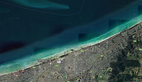
The Rosebud beach is very long and extends across McCrae and Rosebud with the eastern point at Anthonys Nose.
Just back from the beach the Bay Trail, a shared use path, extends all the way along the length of the beach.
At the east end there is a section near McCrae which is a long straight stretch with fairly narrow beach backed by grassy area and Banksia trees on the foreshore. There are wooden groynes (barriers to protect against beach erosion) every 100m.
Opposite Beverley Road there is a playground with a lighthouse. Behind the playground is the Rosebud & McCrae Life Saving Club. Next to the club house there are about 25 beach huts and the beach opens out to a fairly big sandy area. It then narrows again to the west. Take a look at the McCrae lighthouse which was established in 1883 and decommissioned in 1994 following modernisation of other navigational aids in Port Phillip Bay. In this area there is free parking, toilets and shops. From this point Anthony's Nose is 1.5 km to the east.
Immediately to the west is McCrae Yacht Club and Rosebud Beach Foreshore camping area. In front of the camping area the beach is narrow with flat dunes. You go past the basic Tom Salt Park playground and get to Rosebud pier. At this point there are long sand flats with shallow water. There are two wooden groynes and a drain pipe which leads into the water. There's quite a lot of seaweed in this area and not a lot of sandy area.
Rosebud Jetty has been renovated and is used for fishing or a walk to check out what is in the water. Dangle your feet over end and watch the ships sail past. At low tide, the water recedes so that there is little water along a lot of its length. Keep an eye open for sting rays gliding below you in the water. Also be aware of any people fishing if they are casting lines so that you don't get hooked by a fish hook. At night time the pier is lit up and looks nice.
A great new playground has been built on the foreshore near Rosebud pier.
There is a car park with toilets at the Foreshore and access to the shared walking /bicycle track (Bay Trail). Close by are places that sells fish and chips and ice creams.
Jillian Fishing Trips operates two trips daily departing the Rosebud and Rye piers. The Rosebud Foreshore play space is being built near the pier.
The narrow beach which continues west of the pier is backed by flat dunes and the water is shallow with sand flats. The foreshore camping area extends to Rosebud skatepark and Rotary Park playground. This area of them has a lot of kiteboarders. There are also toilets and BBQ. The beach is narrow and there is a pipe drain into the water with a lot of sea-weed. This is not a good spot to swim. Be careful around kiteboarders because the kites can hit the beach with a lot of force.
There is a long section of the foreshore camping and you eventually reach Beachcombers Boat Hire at 14 Rosebud Foreshore West, Rosebud and Capel Sound Camping Reserve.
Access for Dogs:
Dogs are permitted on the Bay Trail at all times. Dogs are prohibited on the beach between 9am and 7pm during Daylight Savings Period. At other times of the day (7pm - 9am), dogs are permitted leash free. Dogs must immediately be brought under effective control if it threatens or annoys any person or animal. The "leash-free" beach does NOT include vegetated parts of the foreshore reserve.
Map:
Photos:
Location
Cnr Point Nepean Road and Beverley Road, Rosebud 3939 View Map
Web Links
→ Rosebud Beach (BeachSafe)
→ McCrae Yacht Club
→ Bay Trail (Dromama - Sorrento) (PDF)


")