Frankston Beach and Waterfront


Frankston Beach forms the southern end of a 9 km long beach that runs north to the Patterson River mouth at Carrum. The Frankston section is 2.5 km long and begins at the southern boat launching area. It includes the 500 m long Frankston Pier, Kananook Creek mouth and the beach to the north.
Stretches of clear, shallow water and soft sand provide a safe swimming beach for all ages.
Near the beach is the Frankston Waterfront, pier, extensive raised timber boardwalk which starts at the bottom of Olivers Hill, arched bridge at the mouth of Kananook Creek, restaurants, boat launching facilities, picnic tables and BBQs, nice adventure playground and public artworks.
Frankston Beach houses the lifesaving club. Parking is available at the boat ramp, pier and lifesaving club. There is a large public carpark at the mouth of the Kananook Creek.
Swimming - Relatively safe on the inner bar and in the patrolled area. Watch children as deeper troughs and holes are common. Strong winds will rapidly increase the wave height and generate rip currents in the troughs. Warning: Do not jump off the pier, as the outer bars are shallow and this practice has been known to result in serious injuries.
Frankston Beach has a General Beach Hazard Rating of 3/10 (Least hazardous)
The Frankston Visitor Information Centre is situated within the carpark area.
Teams of international artists sculpt tonnes of sand into creations which are displayed from Boxing day until April.
Review:
There are a range of parking areas, some of which are free and some are paid parking. We parked at the end of Davey Street near the bridge which crosses Kananook Creek which has 2 hour free parking. It is about 1 km from Frankston train station.
For the architecturally minded, the Zoetrope Bridge which crosses Kananook Creek at the end of Davey Street has some interesting metal sculptured sides. The original plain bridge was dressed up to blur the transition as you cross from the natural environment on the beach side to the urban environment. Rolled steel balustrade was used to create a sense of movement and flow along the bridge.
To the left, along the creek is Frankston Boat Hire where you can hire boats which don't require a license.
After you cross the creek there is a grassy area dotted with trees which has some unshaded tables. As you head a little further north there is an area with four tables and two BBQs. This is close to a free parking area (Long Island Drive) and next to a boardwalk which tracks along the foreshore.
Keep heading north along the boardwalk to reach the Frankston Life Saving Club where the "Waves on the Beach" upmarket restaurant and the Waves cafe facing the beach is located. This area has public toilets, unshaded seating and water tap. Parking in this area is ticketed.
The lovely sandy beach stretches to the north and south and is quite wide here. This section of the beach is patrolled by the Frankston Life Saving Club. The beach is typically patrolled between mid November and mid April on Saturday, Sunday and public holidays in the afternoon.
You can continue to the north along the Bay trail or head back along the beach or boardwalk to the south pass the Frankston Yacht Club. You then reach the lovely arched bridge at the mouth of the Kananook Creek. After crossing the creek, there is a grassy area with a big shelter with curved roofs under which there are five tables, three BBQs and water taps. There are also toilets and lovely outdoor sculptures dot the area. Search them out because they are delightful. There are some seats stationed along the sides of the creek.
On Frankston Pier, artist Louise Lavarack has created the sculptural installation "Sight Line". The light effects and semaphore flags of this kinetic piece are triggered by tidal surges and wind.
South of this area is the Frankston Pier (no jumping or diving off the pier) and the Visitor Information Centre which has a lot of brochures about activities in the area. Continue another 100m along the boardwalk to reach a lovely playground which has shelters with tables, water tap and BBQs.
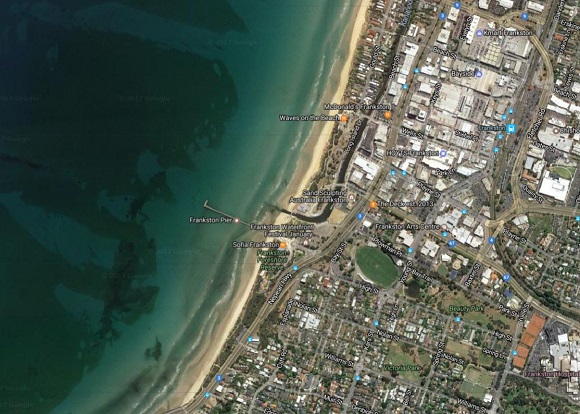
Map:
Photos:
Location
Long Island Drive, Frankston 3199 Map
Web Links
→ Frankston Beach (BeachSafe)
→ Frankston Life Saving Club
→ Frankston Life Saving Club Inc. on Facebook
→ Waves on the Beach Restaurant
→ Frankston Yacht Club
")


")