Bridge Creek - Mount Samaria State Park


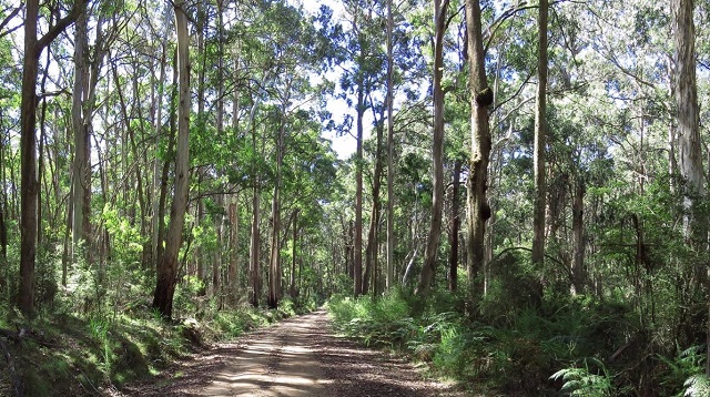
Set in tall, shady eucalypt forest, Mount Samaria State Park offers a cool and quiet retreat for beautiful walks, camping and picnicking. The Mount Samaria range incorporates a variety of scenery with spectacular vistas over the Victorian Alps, granite outcrops, high waterfalls and historic remains. Explore the park by foot, mountain bike or scenic drive and discover its tranquility and beauty.
Things to see and do
Camping and picnicking
Spring Creek Sawmill and Samaria Well offer camping and picnicking facilities. Walk-in campsites are at Wild Dog Falls Creek and Camphora and all sites have toilets and fireplaces. Creek water is available at most sites, but supply may be limited during drier periods. Supply your own drinking water.
Walking
The park features a range of walking tracks to experience the semi-remote nature of the park. Walks (one way distances) include:
Wild Dog Falls & Lookout (1.5km)
From Mt. Samaria Road the track leads to the top of the waterfalls where you can enjoy views over Lake Nillahcootie and the Strathbogie Ranges.
Back Creek Falls (1.5 km)
A gently cascading waterfall, accessible from the start of the Wileman Track off Mt Samaria Road.
Mt Samaria Summit (2.5km or 4.8 km)
At a height of 953m, the summit offers 360 degree views across the Alps and lowlands.
- 4.8km (from Sawmill site) (Moderate to Steep)
- 2.5km circuit (from Mt. Samaria Rd) (Steep)
Tramway walk (3.8 km)
Begin near the Spring Creek Sawmill site and follow the old timber tramway down to the remains of the Braking Station.
Wileman Track (7km)
Links Back Creek and Wild Dog Creek Falls. Leave vehicle at the gates at each end or return along the main road.
Lookouts
Experience spectacular views from Mt Samaria Summit, Rocky Point Lookout and Wild Dog Creek Falls.
Wildflowers
During spring and early summer the forest is alive with brilliant displays of wildflowers.
History
The Samaria ranges were a source of food for the local Aboriginal community. During the European squatting era in the 1840s, much of the area was heavily grazed.
Blessed with magnificent stands of mature trees, the Samaria range came under the scrutiny of timber cutters, and in the 1920s saw a large scale timber industry in operation. By 1928, failing yields led to the closure of the mills and logging became intermittent until an area of about 7000 hectares was declared as State Park in 1979.
Spring Creek Sawmill ruins, including kilns and mounds of sawdust, can still be found.
Access for Dogs:
Dogs and other pets are not permitted.
How to get there
Mount Samaria State Park is 130kms north-east of Melbourne, 28kms south of Benalla on the Samaria Road via Swanpool, and 14kms north of Mansfield via the Whitfield Road. A gravel road traverses the range from north to south and, although steep and rocky in places, is open all year to most vehicles.
Note: Photos from Parks Victoria
Location
Mount Samaria Road, Bridge Creek 3723 Map
Web Links
→ Mount Samaria State Park (Parks Victoria)
→ Mount Samaria State Park - Park note (PDF)
→ Exploring Mt. Samaria (Every Road)
")


")