Hattah - Hattah-Kulkyne National Park


Hattah-Kulkyne National Park lies in typical mallee country with extensive low scrub and open native pine woodland. Superbly adapted birds, animals and vegetation thrive in the poor, sandy soils and searing summers.
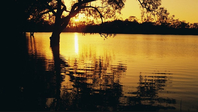
The freshwater Hattah Lakes is seasonally filled by creeks connected to the Murray, providing food and shelter for waterbirds and fish. These lakes can remain full for up to ten years without flooding, but flooding generally occurs once every two years.
Camping, walking, bike riding and canoeing are popular here and in the adjoining Murray-Kulkyne Park.
Things to See and Do
Lake Hattah
Enjoy picnicking or camping at Lake Hattah. There are pit toilets, tables and fireplaces. Lake Hattah is a good spot for cycling. There are suitable tracks around Lake Hattah and along the river. Most of the other tracks are too sandy.
When the water levels are suitable the lake is excellent for canoeing. During flood times the water can extend many kilometres from the lakes.
Walking
There are a range of walks available throughout the park, from easy family walks to longer hikes.
Hattah Nature Walk - 40 mins, 1.2km (return)
This gentle walk begins from the carpark near the park entrance off the Hattah-Robinvale Road. Interpretative signs highlight Mallee ecosystem.
Warepil Lookout Walk - 30 mins, 0.6kms (return)
Start from the Old Calder Highway carpark and take a short stroll up the steady incline to the lookout tower. You will be rewarded with great views of the surrounding Mallee Region. Look north-west and see the vast Murray Sunset National Park. This is a great place to witness the magnificent Mallee sunsets.
Woodlands Walk - 1hr, 2.5km (one way)
This walk starts at the Hattah- Kulkyne National Park Visitor Centre carpark and connects to the Camel Pad Track. It allows you to walk the 8km to Lake Mournpall Campground avoiding the car traffic on Mournpall Track.
Mournpall Lake Loop Track - 3-4hrs, 9.5km
This loop walk with interpretive signs follows the northern edge of Lake Mournpall before circling north around Lake Konardin passing through Red Gum flood plains and Mallee dunes. The walk showcases the dramatic changes in vegetation, as you get closer and further away from water. Keep an eye also for the abundant wildlife. Kangaroos and emus can frequently be spotted, as well as a variety of birds, including wedge-tailed eagles, whitebellied sea eagles and whistling kites.
Camel Pad Track - 3.5 hours, 10 km (one way)
Camels were used to transport salt from the Sunset Country to the Murray River along this track 100 years ago. Led by Afghan team masters, the camel teams carried cargoes of salt from Spectacle Lakes to the Murray River, where the salt was loaded onto paddle steamers that returned with precious fresh water and supplies.
Walk through a constantly changing landscape, with typical Mallee scrub of eucalypt and Porcupine Grass giving way to different vegetation as the track passes through open woodlands, over sand dunes, and beside a large salt pan.
Wildlife is abundant, with kangaroos and emus grazing in the open areas or resting in the shade. Hattah-Kulkyne National Park is paradise for birdwatchers, as the dry country and lakes offer habitat for over 200 species. Colourful galahs, parrots and Major Mitchell Cockatoos are often seen, while waterbirds such as pelicans, swans, ducks and grebes frequent Lake Mournpall at the end of the trail.
Start: Hattah General Store
Finish: Lake Mournpall camping ground
Best time: Winter, spring
Bugle Ridge Track - 3.5 hours return, 10 km - Beginning at the dam wall between Lake Hattah and Lake Little Hattah, the trail heads east along Bugle Ridge and over the northern shores of Lake Bulla and Lake Brockie. Follow the track between Lake Brockie and Lake Tullamook, then head for home below Lake Arawak along the nature drive that fringes magnificent Lake Hattah.
As you return to the camping ground and visitors centre, stop to inspect the old pump house that early this century was used to refill the boilers of steam trains at Hattah railway station. Later, it was used to supply water to Hattah township. Keep an eye out along the track for the region's famous wildlife, including pelicans, wedge-tailed eagles, spoonbills, herons, goannas and kangaroos (red, western grey and eastern grey).
Track condition: Good/sand
Start and Finish: Lake Hattah camping ground
Best time: Winter and spring.
Camping
There are two designated campgrounds in the park with basic facilities, including non-flush toilets, fireplaces and picnic tables. They are at Lake Mournpall and Lake Hattah. Advance bookings and payment are required year round for camping at these sights.
Other river camping areas without facilities are available at Ki Bend, Firemans Bend and Jinkers Bend. No booking or fees are required for these sites.
Canoeing
When the water levels are suitable the lake system offers excellent opportunities for canoeing. During flood times, the water can extend many kilometres from the lakes.
Cycling
There are suitable tracks for cycling around Lake Hattah and along the river. Most of the other tracks are too sandy. (Don't forget your puncture kit!).
Birdwatching
The park has a rich variety of birdlife ranging from wetland species such as Pelicans, Ducks and Spoonbills to dry mallee specialists such as Malleefowl and Emu Wrens. The Hattah Lakes are part of Australia's significant wetlands, recognised under an international agreement (the Ramsar Convention) for the protection of wetlands.
Fishing
Murray Cod, Golden Perch (Yellowbelly) and English Perch (Redfin) provide good sport for anglers. Unfortunately, European Carp are present in large numbers. In season, Yabbies and Murray Crayfish may also be found in the creeks, lakes and rivers of the Murray.
A Victorian recreational fishing licence is required for fishing and yabbying in the lakes and creeks of the park and a NSW licence for the Murray River. These can be purchased at the Hattah, Colignan and Wemen Stores.
Scenic drives
Most tracks in the park can be driven in 2WD vehicles, but some are sandy and may become slippery or impassable after rain. Check track conditions online, at the Visitor Centre or call 13 1963 before you leave.
The self-guided Hattah Lakes Nature Discovery Trail gives a great introduction to the park, while the Kulkyne Loop Drive provides a great overview of the park.
Hattah Lakes Nature Discovery Trail
This pleasant 6.5km trail is designed as a short drive but can also be walked or explored on a pushbike. As you travel around you will visit the homes of many animals, even though you may not see them. Even the logs and dead branches scattered on the ground provide important habitat and a link in the food chain for a wide range of insects, invertebrates, reptiles, birds and small ground-dwelling mammals.
Getting There
The Hattah-Kulkyne National Park is about 450km from Melbourne off the Calder Highway, between Ouyen and Mildura. It is 35km north of Ouyen and 74km south of Mildura. Murray-Kulkyne Park adjoins Hattah-Kulkyne National Park in the south-east.
Note: Photos from Parks Victoria
Location
Hattah-Robinvale Road, Hattah 3501 Map
Web Links
→ Hattah - Kulkyne National Park (Parks Victoria)
→ Birds of the Mallee Parks (PDF)
→ Hattah-Kulkyne NP Park Note - Hattah Lakes Nature Discovery (PDF)
→ Hattah-Kulkyne NP and Murray-Kulkyne Park - Park Note (PDF)
→ Hattah-Kulkyne NP and Murray-Kulkyne Park - Visitor Guide (PDF)


