Chewton - Castlemaine Diggings National Heritage Park


The Castlemaine Diggings National Heritage Park harbours fascinating tales of the golden past and retains much of its gold-rush character. From the evocative remains of house sites and puddling machines to the gold mines and gullies that yielded up fortunes.
There are many wonderful walking tracks in each of these parks but the most popular is the Great Dividing Trail. This trail, which runs between Bendigo and Ballarat via Daylesford, traverses 61 km through the Diggings areas. It covers a wide variety of walking terrains and offers spectacular views and historical relics. There are several entry and exit points at places like Mount Alexander, Chewton and Vaughan.
Castlemaine Diggings National Heritage Park is popular for bushwalking, scenic drives, cycling, picnics, exploring the mining relics and gold prospecting.
Things to Do and See
- At the site of the 22 m Garfield Water Wheel there is a walking track that explains the links between the mine, the stamping battery and the water wheel.
- Spring Gully and Eureka Reef are great areas to visit and view as they represent the many mining relics scattered throughout the Reserve. These relics can also be appreciated by following the Mount Alexander Diggings routes. There are also the ruins of an old Welsh Village, other ruined house sites and mineral springs at Vaughan.
- Camping at Vaughan Springs provides easy access for regular size caravans and a grassed tent area for those walking the Great Dividing Trail or those after a more basic camping experience. The popular site has a rich cultural history and natural beauty and camping offers visitors the chance to enjoy an extended stay.
- In spring, a sharp eye will spot many beautiful wildflowers ranging from wattles to orchids.
- Scenic driving, bushwalking, cycling, guided tours and gold fossicking are some of the popular activities in this area.
- Picnic facilities are located at Kalimna, Vaughan Springs, Garfield Waterwheel, Spring Gully Junction and Eureka Reef. Vaughan Springs also has toilets and mineral springs.
- Fishing for trout, redfin, tench and blackfish is also a popular activity along the Loddon River. A Victorian Recreational Fishing Licence is required unless the person is under 16 years of age or an old aged/disability benefits pensioner.
Mount Alexander Diggings Trail
Visit 19 heritage sites in and around the park on a journey through one of the most remarkable periods of Australian history. Self guided and guided tours are available through the Castlemaine Visitor Information Centre.
Interesting places
Garfield Wheel - This site contains the stone foundations of one of the world's largest water wheels. The 24-metre diameter water wheel had 220 wrought-iron buckets and revolved once every 55 seconds. It was constructed in 1887.
Pennyweight Cemetery is Victoria's most intact and evocative gold rush cemetery containing the marked graves of children and adults, including Chinese migrants who died in the early gold rush period.
Spring Gully Junction Mine is the entry point for one of Victoria's most intact collections of historic quartz mines. The area contains five mines, with well preserved foundations and mullock heaps.
Vaughan Mineral Springs was formerly a large gold rush township called 'The Junction' and became a favoured alluvial gold and market gardening locality for Chinese miners. Today, it is a good place to sample the mineral water and for a stroll along the Loddon River.
Eureka Reef boasts some of the earliest quartz mining relics in Victoria including a massive exposed quartz reef, foundations of Cornish crushing batteries and a mining village. Aboriginal rock wells are also present. A pleasant 1.8km walk takes you through 140 years of mining history. See the forest through the eyes of the Jaara people, alluvial gold diggers and quartz reef miners. In winter and spring there are many native wildflowers in the Eureka Reef forest.
Specimen Gully - The discovery of gold in this narrow valley started the great gold rush. There is a monument marking the discovery site and the remains of old gold workings pepper the sides of the narrow valley.
Kalimna is a good example of the Box-Ironbark forest, hard and dry in summer, it provides a diverse habitat including 28 types of orchids and two rare species of butterflies - the Eltham Copper butterfly and Satin Azure butterfly. It is a popular spot for locals to walk, located on a prominent ridgeline east of Castlemaine.
Expedition Pass Reservoir sits below the pass named by Major Mitchell when he led his expedition through the hills in 1836. The reservoir was built in 1868 and was fed from the Malmsbury-Bendigo water race - a feat of engineering in its day. No longer used as a water supply it is a popular fishing, canoeing, swimming, bushwalking, birdwatching and picnicking spot. There is an unofficial path around the lake.
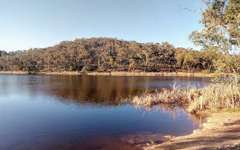
There is a small beach next to the road. The shallow area is quite small and the water depth drops quickly away to be very deep. The reservoir has reeds around the shoreline and requires some walking to find alternative swimming places. There are no facilities such as picnic tables or toilets.
Forest Creek Gold Diggings - Discover how generations of miners won gold from the rich alluvial ground along Forest Creek. Pan for gold in the ancient riverbed that diggers once called "The bank-till free to all". See one of Victoria's unique mining gems - a massive Ruston and Hornsby gas engine.
Shicers Gully, in the southwest corner of the park near Guildford, has a fine pure stand of Ironbarks. Their dark rough trunks create a particularly Australian landscape.
Monster Meeting site - It was here on 15 December 1851, on what was called the Forest Creek diggings, that 15,000 gold diggers attended a protest meeting - The Monster Meeting. This was the first such public protest in Australia. The diggers met to defy the Victorian Government's unfair Gold License - and in doing so they set a path for democracy in Australia.
Caution: Keep to the tracks to avoid old mine workings such as shafts and tunnels. It can be cold and wet in winter and very hot and dry in summer so be prepared for adverse weather conditions.
How to get there
Castlemaine Diggings National Heritage Park is about 120km north of Melbourne. Turn off the Calder Highway at Elphinstone and travel 13km through Chewton to Castlemaine. The Park can also be accessed via the Pyrenees and Midland Highways. A regular rail service runs between Melbourne and Bendigo stopping at Castlemaine.
History
Castlemaine Diggings National Heritage Park lies at the heart of the central Victorian goldfields. The park is a rare place where you can see authentic traces of the great Victorian gold rushes of the 1850s. Sites and relics harbour secrets and tell stories about how life really was on the diggings.
Despite the widespread impact of gold mining, the park contains many significant Aboriginal sites. The park lies within the country of Jaara people.
The discovery of gold in July 1851 lured tens of thousands of migrants. By 1852, the population on the Castlemaine Diggings was 40-60,000. When the diggers arrived they entered a forest of towering ironbarks, with trunks commonly over a metre in diameter.
The diggers uprooted the country, giving the place the appearance, as one newcomer remarked, of 'a great cemetery in which all the graves had been opened and emptied of their contents'.
Almost every gully, flat and hill in the park was named in the gold rush. Many of the names offer insights into the ethnic and regional backgrounds of the gold seekers.
Podcast
Eureka Reef Heritage Walk Podcast
Length: 1 kilometre
Walk: 1 hour
Start: Eureka Reef car park
Finish: Eureka Reef car park
Stops: 20
Nearby: Castlemaine
This short walk around the Mt Alexander Diggings provides a fascinating insight into the miners' struggles, and the different methods used to extract the hard-won prize of gold.
In 1851 thousands of hopeful gold miners from all over the world rushed to this quiet forested valley in the Mt Alexander area, determined to share in the fabulous wealth of what became the richest shallow alluvial diggings of all time. The frenzied activity continued into the next century, with intensive mining of the gold-rich quartz reefs taking over as the surface deposits became exhausted.
Wander through Poverty Gully, past the site of the original Eureka quartz reef and the remains of mine shafts, puddling machines, water races and the tall chimneys of old boiler houses. Evidence of much earlier occupation is here too, in the small rock wells used by the Dja Dja Wurrung people to collect life-sustaining rainwater.
Download the audio files and map using the links below and discover what life was like on an 1850s goldfield.
Access for Dogs:
Dogs are not permitted in the park.
Note: Photos from Parks Victoria
Location
North Road, Chewton 3451 Map
Web Links
→ Parks Victoria - Castlemaine Diggings National Heritage Park
→ YouTube - Castlemaine Diggings National Heritage Park
→ Eureka Reef Heritage Walk Podcast (55 MB)
→ Eureka Reef Heritage Walk Podcast Map (PDF)
→ Castlemaine Diggings National Heritage Park - Park note (PDF)
→ Friends of Mount Alexander Diggings (FOMAD)
")


")