Kororoit Creek Trail (Ardeer - Sunshine West)

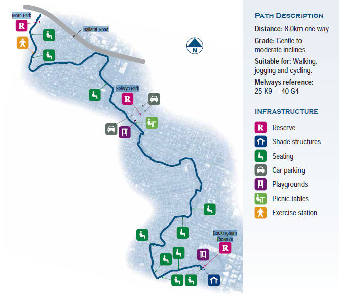
The Kororoit Creek Walking Track starts at More Park and travels along Kororoit Creek, through Ardeer and Albion to Selwyn Park, where you can discover Brimbank's historic swimming hole. Follow the trail further past attractive rocky outcrops to Buckingham Reserve in Sunshine West where your journey ends.
This area is of geological interest as a classical example of creek formation over a basalt plain. It is also home to a variety of animal and plants species that are sure to catch your eye as you pass Brimbank's unique natural land formations.
The Kororoit Creek stretches for over 80 km through the north west and western parts of Melbourne. It starts north west of Sunbury as runoff from Mount Aitken and flows south through the farmland across the Western Plains. The creek enters the Melbourne metropolitan area at Caroline Springs, north of Ballarat Road, flows over the volcanic lava plain of western Melbourne and reaches Port Phillip Bay at Altona Coastal Park.
The name Kororooit is thought to have been derived from an Aboriginal word meaning make kangaroo.
Location
Esmond Street, Ardeer 3022 View Map
Web Links
→ The Friends of Kororoit Creek
→ Friends of Lower Kororoit Creek


")