Longford - Holey Plains State Park


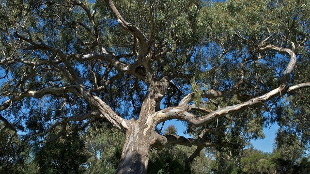
Holey Plains State Park covers an area of 10,638 hectares of mostly Banksia and Eucalypt open-forest and woodlands growing in a series of low sandy ridges. The park, proclaimed in 1977, protects an extremely high diversity of native flora and abundant wildlife, while providing for bushwalking, picnicking, camping and other activities.
Things to See and Do
Picnicking
Holey Hill is the highest point in the park at 218m. Picnic facilities including a toilet are provided here. Other picnic facilities can be found at Harrier Swamp, Merriman Creek and Clear Water Lake. There are no toilets at Merriman Creek picnic area.
Walking
Banksia Forest Walking Track (1km, 20 minutes)
Located near the picnic area at Holey Hill leads around the northern slopes of the hill.
Long Swamp Walking Track (3.2km, 1.5hours return)
Starts near the tower and leads to the largest swamp in the park.
Harrier Swamp (1km, 20 minutes)
A short walking track around Harrier Swamp provides another interesting walk and a good opportunity to listen to frogs and observe life in the swamp.
Many of the tracks off Rosedale-Stradbroke Road also provide easy walking through some beautiful wildflower areas, particularly in spring.
Scenic Drives
A scenic drive can be taken along West Boundary, Long Ridge and Wildflower tracks. Grasstrees grow adjacent to another scenic drive along Jacks Track, South Boundary Track and Merriman Creek. Most tracks are narrow and winding, please drive slowly and use only sign posted tracks.
Camping
Camping areas and toilets are provided at Holey Hill and Harrier Swamp. Campers will need to bring their own water and fires should only be lit in the fireplaces provided in the adjacent picnic areas. Camping is not permitted at Merriman Creek or Clear Water Lake picnic areas.
History
The park was formerly part of a squatting run taken up in the 1840s by the Crooke family, whose homestead is to the north of the park. The property was named 'Holey Plains' because the alluvial land along the Latrobe River has many crab holes, unlike the sandy country that makes up the park.
Access for Dogs:
Dogs, cats and other pets are not permitted in the park.
Location and Access
The park is situated south of the Princes Highway between Rosedale and Sale. The main access is from Rosedale, via the Willung Rosedale Road, then Rosedale-Stradbroke Road (see attached map). A network of sandy roads and tracks provides access within the park. Visitors should note that pine plantations in the area are private property.
Location
Holey Hill Track, Longford 3851 Map
Web Links
→ Holey Plains State Park (Parks Victoria)
→ Holey Plains State Park - Park Note (PDF)


