Euroa - Seven Creeks Walking Track


The Seven Creeks Walking Track, which was established in 1988 by the Euroa Apex Club as a Bicentennial project, is a multipurpose track offering nature's delights to enjoy.
The walking track encompasses the Seven Creeks passing through Floodplain Riparian Woodlands. The track surface ranges from well-maintained asphalt, grassed areas and loose gravel.
The Balmattum Hill Walking Track can be accessed via the southern end of the Seven Creeks Walking Track.
The Seven Creeks Reserve is situated on a natural floodplain and is largely made up of two types of vegetation communities, Floodplain Riparian Woodland and Plains Grassy Woodland. The dominant trees are River Red Gum (Eucalyptus camaldulensis) providing hollows and canopy for habitat. Silver Wattle and Blackwood providing nectar when in flower and there is a ground cover of grasses, herbs (non-woody small plants), fallen branches, twigs and leaves.
The variety of habitats attract a range of fauna, such as microbats, possums, gliders, koalas, echidnas, snakes, blue tonged lizards, geckos and skinks. Regular bird surveys have been conducted recording over ninety different bird species.
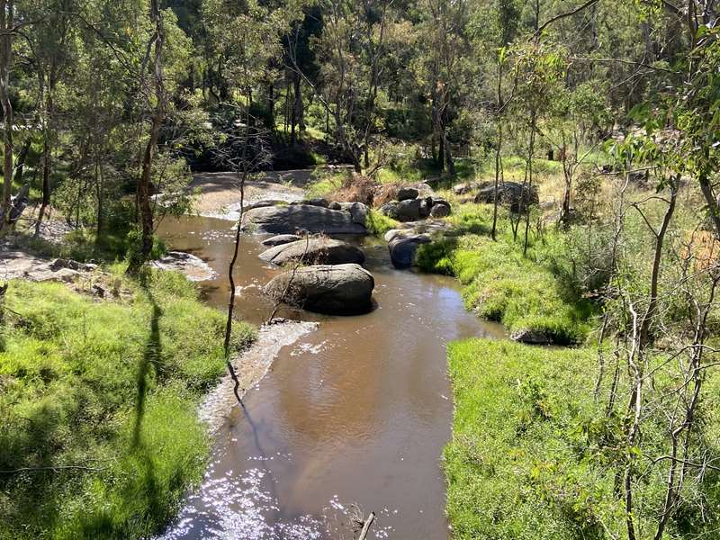
Granite boulders can be found along the creek towards the southern section of the reserve. The creek bed can change as a result of soil from the banks eroding due to fluctuating water levels and water flow velocity creating backwater billabongs and deposits of sediments forming sand bars and sand slugs. The creek supports habitat for aquatic species such as native and exotic fish, water rats, platypus, and frogs.
Seven Creeks Reserve is both culturally and historically significant. Long-term residents have memories and stories of the area that describe mining and gypsy camps, humpies, Chinese market gardens, old river crossings and deep swimming pools.
Location
East end of Bury Street, near the BBQ, rotunda and public toilet buildings next to the Euroa Museum. You can also choose to start the walk anywhere along the Sevens Creek.
Map of Walk Route
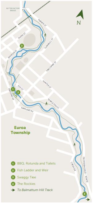
Points on map:
1. BBQ, Rotunda and Toilets - good place to start and finish your walk with ample amenities and parking overlooking the Seven Creeks
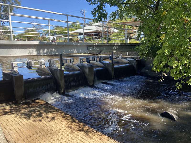
2. Fish Ladder and Weir - A fish ladder is installed, adjacent to the weir, enabling fish to swim up and down the stream for breeding as part of their natural life cycle. The weir created the perfect swimming hole for locals and until the 1970's was the town's main swimming area, complete with pavilion, changing rooms, diving boards and learner pools.
3. The Swaggy Tree - is a large River Red Gum and is a local natural icon. During the Depression of the 1930s it is believed those in need took shelter here.
4. Rockies Bridge - cross the creek at this point. The cross over at the Northern end is at the Butter Factory Bridge.
The Seven Creeks Walking Track is set in the Euroa Seven Creeks Reserve which supports passive and active recreation pursuits. The majority of the formal sporting facilities utilised by the Euroa community and visitors are located within the reserve.
Interactive Map
Access for Dogs:
Dogs are permitted on leash.
Location
Cnr Bury Street and Kirkland Avenue, Euroa 3666 Map
Web Links
→ Walk Notes - Seven Creeks Walking Track (PDF)
→ Seven Creeks Apex Walk, Euroa (Walking Maps)
")


")